
Map accompanying oen of the first 100 commemorative half dollar coins featuring York County, Maine.
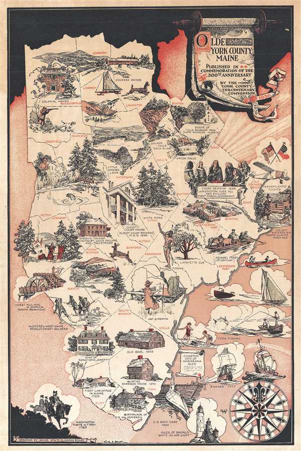
Olde York County Maine.
sold
- Digital Map Information
- Suitable for large format printing
- Full resolution TIFF file
- ICC color profile embedded
- Delivered instantly via download link
This is a scarce 1939 map of York County, Maine issued by the York County Tercentenary Commission and is published in commemoration of the 300th anniversary of York County. It depicts the county of York, the first county in Maine, established in 1636. This ... (more details)
Remarkable view of Benjamin Waterhouse Hawkins' vision for a Palaeozoic Museum in Central Park. These statues were subsequently destroyed by thugs in the employ of 'Boss' Tweed.

Palaeozoic Museum. Showing the Rehabilitated Forms of Ancient Animal Life in America. Now being constructed in Central Park.
sold
- Digital Map Information
- Suitable for large format printing
- Full resolution TIFF file
- ICC color profile embedded
- Delivered instantly via download link
A wonderful 1870 view of the intended interior of the Central Park Palaeozoic Museum – a precursor of the modern day Natural History Museum. Following the success of Benjamin Waterhouse Hawkins' life-sized concrete dinosaur models created for England's ... (more details)
Pocket map of Massachusetts, Connecticut and Rhode Island based on Mitchell's first atlas.
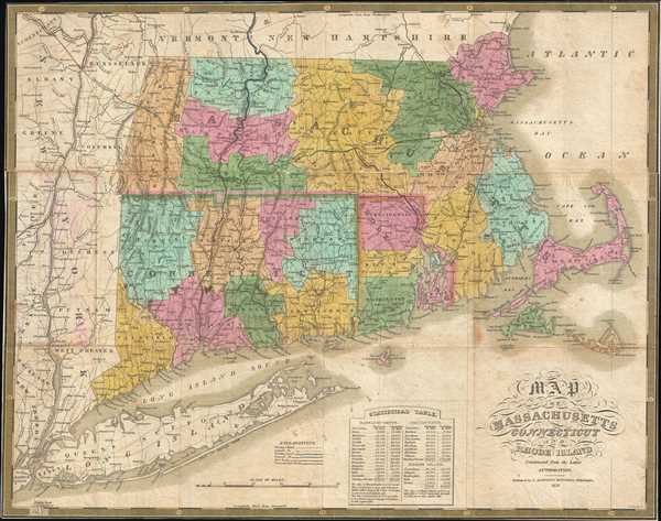
Map Of Massachusetts Connecticut And Rhode Island Constructed From the Latest Authorities.
sold
- Digital Map Information
- Suitable for large format printing
- Full resolution TIFF file
- ICC color profile embedded
- Delivered instantly via download link
This is a beautiful pocket map edition of Mitchell’s 1831 map of Massachusetts, Connecticut and Rhode Island. It covers the New England states in their entirety, with color-coding according to counties. Notes several important towns, cities, roads, ... (more details)
Detailed plan of the city of Montreal, Quebec, Canada.
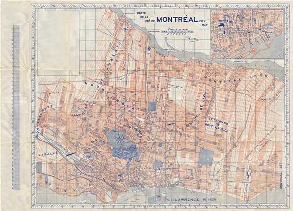
Carte de la Cite de Montreal City Map.
sold
- Digital Map Information
- Suitable for large format printing
- Full resolution TIFF file
- ICC color profile embedded
- Delivered instantly via download link
This is an attractive map or plan of the city of Montreal by Charles F. Furse published in c.1939. This plan covers Montreal from Montreal-West and La Salle north to Montreal East. Identifies several important landmarks, individual streets, parks, ... (more details)
Rare early Qing Dynasty map of Beijing, China.

Qing Dynasty full map of Beijing, with map of Tianjin's Bai He River and Purple Bamboo Forest. / 清國北京城全圖, 附天津白河及紫竹林之圖 / TQīng Guó Bě Jīng Chéng Quán Tú, Fù Tiān Jīn Bái Hé Jí Zǐ Zhú Lín Zhī Tú
sold
- Digital Map Information
- Suitable for large format printing
- Full resolution TIFF file
- ICC color profile embedded
- Delivered instantly via download link
An important early map of Beijing or Peking, China, dating to 1885. This map was issued at the end of the Sino-French War (1884 – 1885). It covers all of Beijing as well as some of the surrounding countryside. Supplementary maps above and to ... (more details)
Important highly decorative map from the first specific Atlas of Italy.
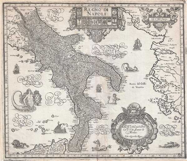
Regno di Napoli.
sold
- Digital Map Information
- Suitable for large format printing
- Full resolution TIFF file
- ICC color profile embedded
- Delivered instantly via download link
A beautifully engraved 1620 map of southern Italy or the Kingdom of Naples by Giovanni Antonio Magini. Centered on the Gulf of Taranto, this magnificent decorative map covers from Rome northern Sicily and from Rome to Albania, inclusive of al of ... (more details)
Dramatic view of the fire that destroyed the Saint-Germain Fair in Paris in 1762.

Vue de la Porte de la Treille de l'Incendie de la Foire St. Germain a Paris arrive la nuit du 16 au 17 Mars 1762.
sold
- Digital Map Information
- Suitable for large format printing
- Full resolution TIFF file
- ICC color profile embedded
- Delivered instantly via download link
This dramatic view of the fire at the Saint Germain Fair in Paris, France was published by Jacques Chereau in 1762. The view depicts the fairgrounds ablaze in the background while townsfolk attempt to douse the raging flames using buckets and ... (more details)
Pictorial Map depicting Chicago at the time of its incorporation in 1833.
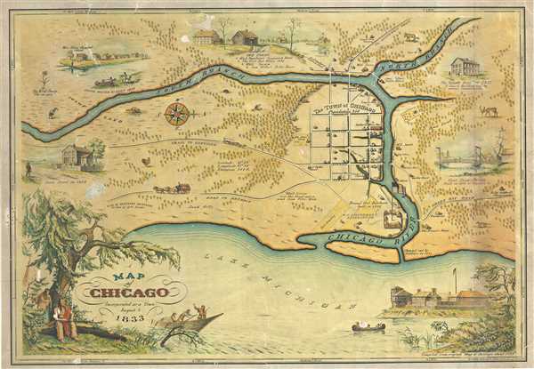
A Map of Chicago Incorporated as a Town August 5 1833.
sold
- Digital Map Information
- Suitable for large format printing
- Full resolution TIFF file
- ICC color profile embedded
- Delivered instantly via download link
This is a beautiful 1933 pictorial map of Chicago issued by Walter Conley and O. E. Stelzer to commemorate the centennial of the founding of Chicago in 1833. Oriented with north to the right, it depicts Chicago at the time of its ... (more details)
Uncommon map featuring the city of Richmond, Virginia.
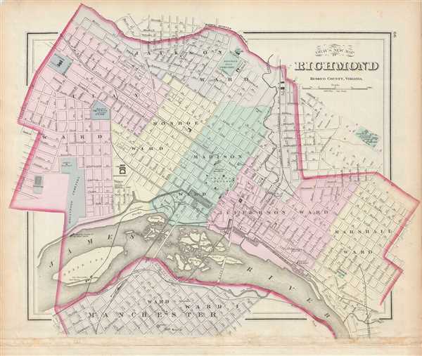
Gray's New Map of Richmond Henrico County, Virginia.
sold
- Digital Map Information
- Suitable for large format printing
- Full resolution TIFF file
- ICC color profile embedded
- Delivered instantly via download link
This is an uncommon map of the city of Richmond, Virginia by Ormando Gray issued in 1878. It covers the city from Manchester (now Old Town Manchester), past the James River and downtown Richmond north as far as Jackson Ward and ... (more details)
Early plan of San Francisco City, California.
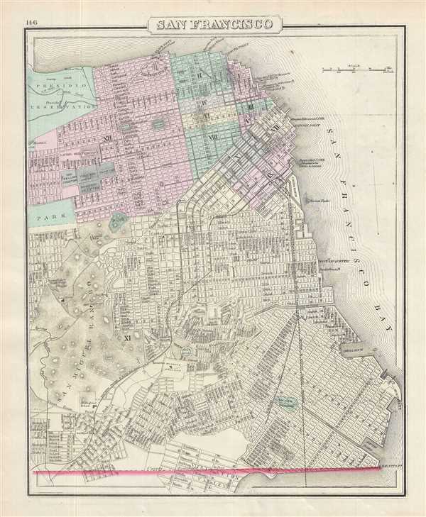
San Francisco.
sold
- Digital Map Information
- Suitable for large format printing
- Full resolution TIFF file
- ICC color profile embedded
- Delivered instantly via download link
This is a beautiful 1878 Gray map or plan of the city of San Francisco, California. It covers the entire city from Visitation Valley north to Presidio Park. The map is extremely detailed, showing individual streets, important ... (more details)
Decorative map of Central Asia.

Independent Tartary.
sold
- Digital Map Information
- Suitable for large format printing
- DPI: 300
- File Size: 4.75 MB
- File Type: ZIP / TIFF
- ICC color profile embedded
- Delivered instantly via download link
This is a highly decorative 1851 map of Independent Tartary by John Tallis and John Rapkin. It covers the regions between the Caspian Sea and Lake Bakquash and between Russia and Afghanistan. These include the ancient Silk ... (more details)
Map of the Crimean Peninsula by little known American Publisher.
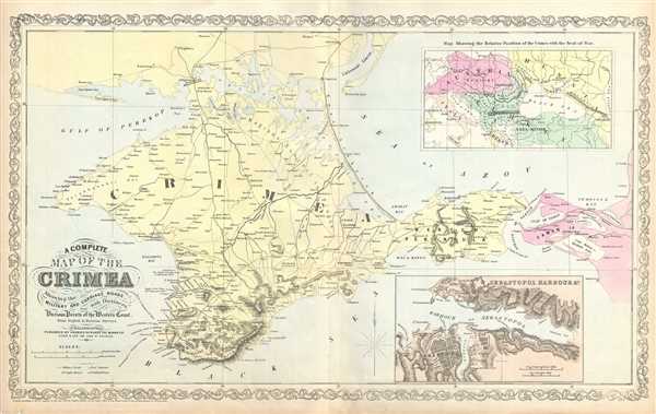
A Complete Map of the Crimea Showing the Military and Carriage Roads with Distances from Various Points of the Western Coast.
sold
- Digital Map Information
- Suitable for large format printing
- Full resolution TIFF file
- ICC color profile embedded
- Delivered instantly via download link
This is a scarce map of the Crimean Peninsula by little known American map publisher Charles Desilver. It depicts the Crimean Peninsula during the Crimean War. This highly detailed map notes military and carriage roads ... (more details)
Exceptional early map of Tsingtao China.
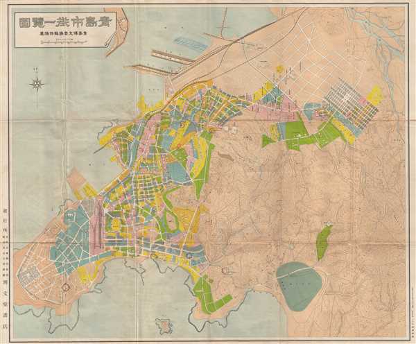
Qīng Dǎo Shì Jiē Yī Lǎn Tú / 青島市街一覽圖 / A View of Qingdao's Streets at A Glance
sold
- Digital Map Information
- Suitable for large format printing
- File Size: 31.58 MB
- File Type: ZIP / TIFF
- ICC color profile embedded
- Delivered instantly via download link
An impressive large format c. 1920 street plan or map of Tsingtao or Qingdao (青岛), Shandong, China. This map was issued by Bo Wen Hall (博文堂), a Japanese operated printing house active in Tsingtao. It was ... (more details)
Unique manuscript survey map of the Commodore Berry Park area, near Flatbush Avenue and the Brooklyn Navy Yard.
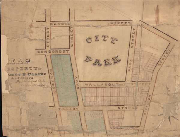
Map of the Property of James B. Clarke and Others by B. Tolford City Surveyor Brooklyn, May 1836.
sold
- Digital Map Information
- Suitable for large format printing
- Full resolution TIFF file
- ICC color profile embedded
- Delivered instantly via download link
This is a one-of-a-kind manuscript survey map of parts of Brooklyn, New York, located near Commodore Barry Park and the Brooklyn Navy Yard. The map covers land surrounding the park from Jackson Street to Division ... (more details)
Scarce manuscript survey map of one of the most beautiful parts of Cobble Hill, Brooklyn.

Partition Map of Land in the Sixth Ward of the City of Brooklyn belonging the Heirs of John Greacen decd.
sold
- Digital Map Information
- Suitable for large format printing
- Full resolution TIFF file
- ICC color profile embedded
- Delivered instantly via download link
A one-of-a-kind and historically important 1853 early manuscript (hand drawn) survey map of parts of Cobble Hill, Brooklyn. The map covers the square roughly defined by Congress Street on the north, Warren Street ... (more details)
Possibly the first published map of Prospect Park.

Design for Prospect Park as Proposed to be Laid Out for The City of Brooklyn.
sold
- Digital Map Information
- Suitable for large format printing
- File Size: 4.71 MB
- File Type: ZIP / TIFF
- ICC color profile embedded
- Delivered instantly via download link
A rare 1868 first edition of Vaux and Olmsted's map of Prospect Park, Brooklyn. Issued just months after its October 1867 completion, this is one of the first published maps to depict the design of Prospect Park. ... (more details)
The rare propaganda-ish 'Farm Animal' variant on the Visscher-Jansson Series map of New York, Virginia, and New England.

Novi Belgii Novaeque Angliae Nec Non Pennsylvaniae et Partis Virginiae Tabula multis in locis emendata.
sold
- Digital Map Information
- Suitable for large format printing
- Full resolution TIFF file
- ICC color profile embedded
- Delivered instantly via download link
An attractive old color example of Justus Danckerts' 1684 Novi Belgii or map of New York, New England, Pennsylvania, and Virginia. Some call this the 'farm animal map' for its novel incorporation of farm animals, ... (more details)
Scarce map of Taiwan issued at the end of the First Sino-Japanese War.

Actual Survey Map of Taiwan (Taiwan Shi Ce Di Tu)
sold
- Digital Map Information
- Suitable for large format printing
- File Size: 4.45 MB
- File Type: ZIP / TIFF
- ICC color profile embedded
- Delivered instantly via download link
An extremely scarce and important map of Taiwan or Formosa drawn shortly after the island was sized by Japanese forces at the beginning of the First Sino-Japanese War (August 1, 1894 – April 17, 1895). ... (more details)
Unusual pictorial map of Indiana and Illinois.
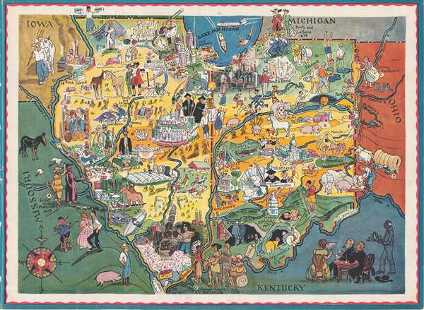
[Illinois, Indiana].
sold
- Digital Map Information
- Suitable for large format printing
- Full resolution TIFF file
- ICC color profile embedded
- Delivered instantly via download link
This is a c.1950 charming pictorial map of the states of Indiana and Illinois. It covers the two states in their entirety with countless illustrations throughout referencing history, topography and ... (more details)
Political satire following the burning of the Palace of Westminster in 1834.

Something Like a Flare Up!
sold
- Digital Map Information
- Suitable for large format printing
- Full resolution TIFF file
- ICC color profile embedded
- Delivered instantly via download link
This is an uncommon 1834 political cartoon based on the fire that destroyed much of the Palace of Westminster on October 16, 1834. This satirical caricature uses fire and fire extinguishers to show ... (more details)