
An iconic surrealist embodiment of the golden age of air travel by Lucian Boucher.

Air France.
sold
- Digital Map Information
- Suitable for large format printing
- File Size: 95.27 MB
- File Type: ZIP / TIFF
- ICC color profile embedded
- Delivered instantly via download link
The finest of Lucien Bucher's iconic comic maps drawn for Air France, here in a scarce large format edition. Boucher's work for Air France is considered an embodiment of the golden age of air travel. This map, presented as a double hemisphere celestial, was drawn ... (more details)
Beautiful powder horn used during the American Revolutionary War.

Abner Dunn IX PA Rgt. 1779.
sold
This is a beautifully carved powder horn dating to 1779. The horn is beautifully carved with the owner’s name and date of 1779 carved around the wide base of the horn. Images of a windmill, two ships, and several images of buildings are carved throughout. ... (more details)
The last edition of Melish's iconic 'Manifest Destiny' map of the United State to be published in his lifetime.
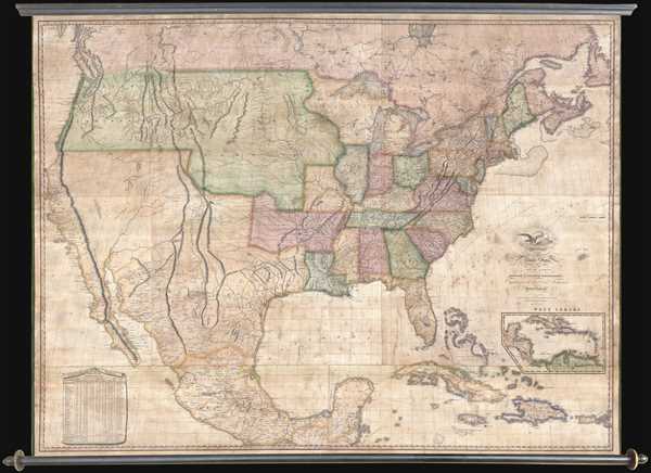
Map of the United States with the Contiguous British & Spanish Possessions Compiled from the latest & best authorities by John Melish . . . Improved to 1822.
sold
- Digital Map Information
- Suitable for large format printing
- DPI: 300
- File Size: 92.78 MB
- File Type: ZIP / TIFF
- ICC color profile embedded
- Delivered instantly via download link
An example of John Melish's important 1822 map of the United States. Melish's map is considered the most influential map of American published in the 19th century and is rivaled only by John Mitchell's 1755 map of North America as the single most influential ... (more details)
Rare independent issue of Upham's important map of Salem during the 1692 Salem Witchcraft Trials. Features manuscript annotations and a manuscript dedication by Upham.
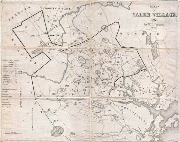
Map of Salem Village, 1692.
sold
- Digital Map Information
- Suitable for large format printing
- File Size: 4.3 MB
- File Type: ZIP / TIFF
- ICC color profile embedded
- Delivered instantly via download link
A scarce example of Salem Village, Massachusetts, in 1692, at the height of the infamous Salem Witchcraft Trails by William Phineas Upham. William Phineas Upham prepared this map in 1866 as the frontispiece for his father Charles Wentworth Upham's two-volume ... (more details)
Beautiful map of the West Indies backed on linen.

West Indien.
sold
- Digital Map Information
- Suitable for large format printing
- Full resolution TIFF file
- ICC color profile embedded
- Delivered instantly via download link
This is a scarce separate-issue 1825 map of the West Indies by C. F. Weiland. It covers from the southern part of Florida and the Bahamas south through the Caribbean Islands of Cuba and Hispaniola, to the northern part of South America and east to the ... (more details)
Map of Greece during the declining Ottoman Empire.
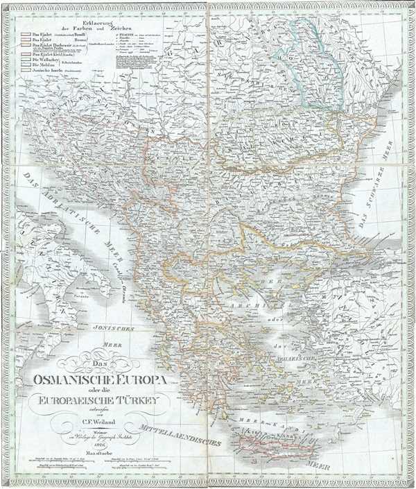
Das Osmanische Europa oder die Europaeische Turkey.
sold
- Digital Map Information
- Suitable for large format printing
- Full resolution TIFF file
- ICC color profile embedded
- Delivered instantly via download link
This is a scarce separate-issue 1826 map of European Turkey by C. F. Weiland. It covers Greece and the Balkans from Romania to Crete and includes the modern day nations of Greece, Macedonia, Albania, Croatia, Bosnia, Serbia, Bulgaria and Moldova. It ... (more details)
Beautiful early 19th century map of Asia.
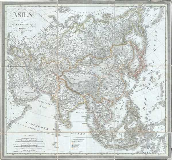
Asien.
sold
- Digital Map Information
- Suitable for large format printing
- Full resolution TIFF file
- ICC color profile embedded
- Delivered instantly via download link
This is a scarce separate-issue 1828 map of Asia by C. F. Weiland. It covers the entire Asian continent from the Arctic Ocean to the Indian Ocean and from the Red Sea to New Guinea. Important cities, rivers, mountains, deserts, islands and various ... (more details)
Early 19th century map of Australia and Polynesia

Australien.
sold
- Digital Map Information
- Suitable for large format printing
- Full resolution TIFF file
- ICC color profile embedded
- Delivered instantly via download link
This is a scarce separate-issue 1826 map of Australia, New Zealand and Polynesia by C. F. Weiland. It covers from Southeast Asia eastward as far as Baja California and includes much of the East Indies, Polynesia, Australia and New Zealand. The map ... (more details)
Early map of Africa depicting the speculative Mountains of the Moon.
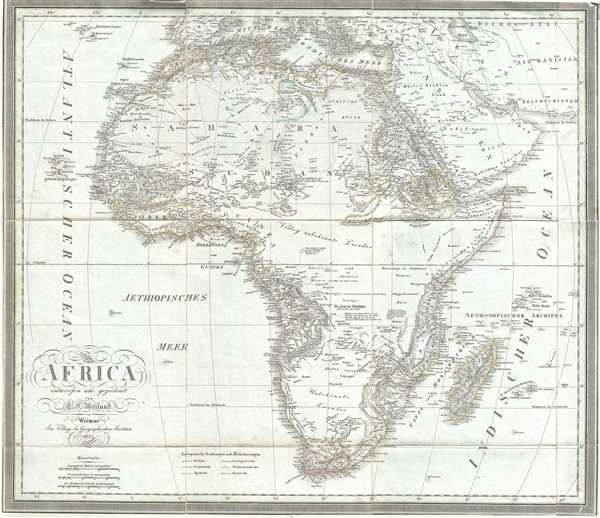
Africa.
sold
- Digital Map Information
- Suitable for large format printing
- Full resolution TIFF file
- ICC color profile embedded
- Delivered instantly via download link
This is a scarce separate-issue example of C. F. Weiland’s 1827 map of Africa. This uncommon map predates the explosion of African exploration that occurred in the mid-19th century. Much of the interior remains unknown. The Ptolemaic Mountains ... (more details)
19th century map of Scandinavia.

Schweden und Norwegen.
sold
- Digital Map Information
- Suitable for large format printing
- Full resolution TIFF file
- ICC color profile embedded
- Delivered instantly via download link
This is a scarce separate-issue example of the 1827 C. F. Weiland map of Sweden and Norway. The map covers from the Arctic Sea south to Denmark and east as far as the Gulf of Finland. Various important rivers, islands, cities and other ... (more details)
Beautiful map depicting the territories of the Austro-Hungarian Empire.
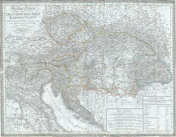
General Charte des Oestreichischen Kaiserstaats nach seiner gegenwaertigen Begraenzung und neuesten innern Eintheilung.
sold
- Digital Map Information
- Suitable for large format printing
- Full resolution TIFF file
- ICC color profile embedded
- Delivered instantly via download link
This is a scarce separate-issue example of the 1826 C. F. Weiland map of Austria. The map covers the territory of the Austro-Hungarian Empire, inclusive of all of Austria, the Italian provinces of Lombardy, Tyrol, Venice, Dalmatia, ... (more details)
Stunning Japanese chromolithograph Sugoroku gameboard.

Tetsudō kyōsō Sugoroku [Railway Race Sugoroku].
sold
- Digital Map Information
- Suitable for large format printing
- File Size: 5.32 MB
- File Type: ZIP / TIFF
- ICC color profile embedded
- Delivered instantly via download link
A scarce and dramatically produced c. 1925 (Taisho 14) board for the Japanese game known as sugoroku . The board depicts the islands of Japan oriented in a northwesterly direction - as was common in railway maps of the period. The ... (more details)
Wonderful early map of the Hamptons featuring landowner names.
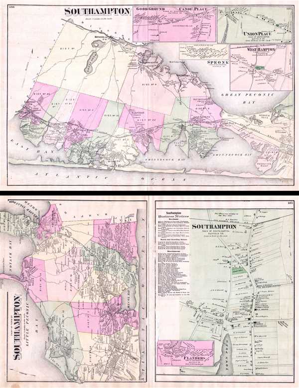
Southampton.
sold
- Digital Map Information
- Suitable for large format printing
- File Size: 4.78 MB
- File Type: ZIP / TIFF
- ICC color profile embedded
- Delivered instantly via download link
A scarce exmaple of Fredrick W. Beers’ Map of Southampton, Long Island, New York. Published in 1873, this magnificent map covers from Eastport eastward to through West Hampton to Bridgehampton and Sag Harbor. Includes the resort ... (more details)
Decorative view of the 1893 Chicago World's Fairgrounds turned into a fan.

World's Columbian Exposition Fan.
sold
- Digital Map Information
- Suitable for large format printing
- File Size: 0.86 MB
- File Type: ZIP / TIFF
- ICC color profile embedded
- Delivered instantly via download link
A stunning 1893 fan with a view of Chicago and the grounds of the 1893 Chicago World's Fair or, as it is more commonly known, the Columbian Exposition. The fair was situated along the Chicago waterfront in what is today Jackson ... (more details)
Humerous pictorial map of Manhattan intended as a gentleman's guide to New York City.

A Sight-Seers' Map of Manhattan prepared by Paul Savitt under the direction of the editors of True, the Man's Magazine.
sold
- Digital Map Information
- Suitable for large format printing
- File Size: 9.99 MB
- File Type: ZIP / TIFF
- ICC color profile embedded
- Delivered instantly via download link
A charming 1946 pictorial map of New York City, or more specifically Manhattan, drawn by Paul Savitt for True, the Man's Magazine . The map humorously illustrates all of the fun a savvy gentleman can have visiting New York City ... (more details)
Rare American Revolutionary Era Battle Plan of the Battle on Bunker Hill.
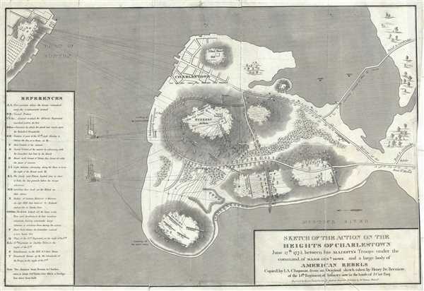
Sketch of the Action on the Heights of Charlestown June 17th 1775 between his Majesty's Troops under the command of Major Genl. Howe, and a Large Body of American Rebels.
sold
- Digital Map Information
- Suitable for large format printing
- Full resolution TIFF file
- ICC color profile embedded
- Delivered instantly via download link
This is an important 1818 map of the Battle of Bunker Hill, Charlestown, Massachusetts, by I. A. Charles. Copied from the original manuscript sketch by Henry De Berniere, which was apparently discovered in a trunk, it depicts ... (more details)
Early Land Office map showing important gold and silver deposits.
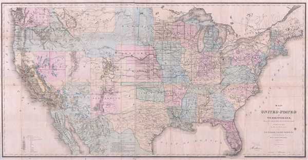
Map of the United States and Territories, Showing the extend of Public Surveys and other details.
sold
- Digital Map Information
- Suitable for large format printing
- Full resolution TIFF file
- ICC color profile embedded
- Delivered instantly via download link
This is an extremely interesting 1867 U.S. Land Office map of United States. It covers the entire country on a rectangular projection, illustrating the extant of the land surveys as it worked its way westward. This map notes ... (more details)
Early 20th century promotional real estate map of Denver, Colorado.

The Latest Map of the City of Denver Showing the New Street Names.
sold
- Digital Map Information
- Suitable for large format printing
- Full resolution TIFF file
- ICC color profile embedded
- Delivered instantly via download link
This is a 1904 map or plan of the city of Denver, Colorado, by E. M. Beeler. This promotional map issued by Bennett and Myers, covers the city of Denver from Elyria south to the University of Denver and from Sloans Lake east ... (more details)
A particularly beautiful example of this important nautical chart.

Preliminary Chart of Charleston Harbor and its Approaches.
sold
- Digital Map Information
- Suitable for large format printing
- Full resolution TIFF file
- ICC color profile embedded
- Delivered instantly via download link
This is a highly desirable and uncommon 1856 U.S. Coast Survey chart or map of Charleston Harbor, South Carolina. It covers from Charleston south to Folly Island and east as far as Long island. Offers stunning inland detail ... (more details)
Large Maritime Map of San Francisco Bay.

Preliminary Chart of Entrance to San Francisco Bay California.
sold
- Digital Map Information
- Suitable for large format printing
- Full resolution TIFF file
- ICC color profile embedded
- Delivered instantly via download link
This is a beautiful example of the 1856 U. S. Coast Survey nautical chart or maritime map of the entrance to San Francisco Bay and San Francisco itself. Centered on the City of San Francisco, the map covers the Golden Gate ... (more details)