
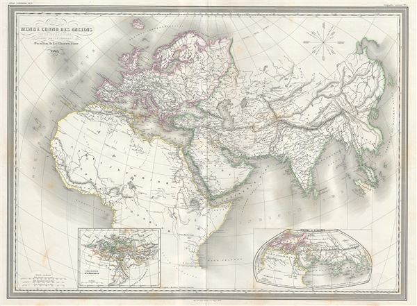
Monde Connu des Anciens.
sold
- Digital Map Information
- Suitable for large format printing
- Full resolution TIFF file
- ICC color profile embedded
- Delivered instantly via download link
This is an uncommon and attractive large 1859 elephant folio map of the Ancient World, including Asia, Europe and Africa by A. H. Dufour. The map shows the World during the time of the Ancient Roman Empire from the Atlantic Ocean to Burma in Asia and from the ... (more details)
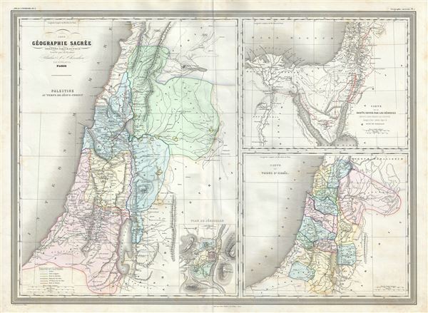
Palestine au temps de Jesus-Christ. Carte de la route suivie par les Hebreux : Depuis Leur Depart de l'Egypte Jusqua leur entree dans le Pays de Chanaam. Carte des Tribus d'Israel.
sold
- Digital Map Information
- Suitable for large format printing
- Full resolution TIFF file
- ICC color profile embedded
- Delivered instantly via download link
This is a beautiful large 1860 elephant folio map by A. H. Dufour. Essentially three maps on a single sheet, the large map on the left depicts Palestine or Israel or the Holy Land during the time of Jesus Christ. The map in the top right quadrant features the ... (more details)
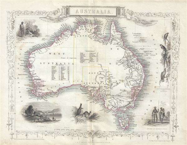
Australia.
sold
- Digital Map Information
- Suitable for large format printing
- Full resolution TIFF file
- ICC color profile embedded
- Delivered instantly via download link
This is a beautiful 1851 example of John Tallis and John Rapkin's 1851 map of Australia. It covers the entire continent of Australia along with Tasmania or as it was known at the time, Van Diemen's Island. An interesting map issued just as most of the ... (more details)
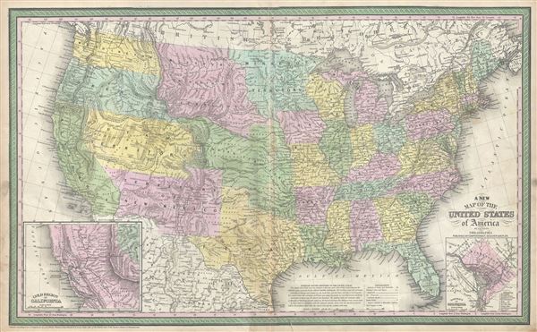
A New Map of the United States of America.
sold
- Digital Map Information
- Suitable for large format printing
- Full resolution TIFF file
- ICC color profile embedded
- Delivered instantly via download link
This is a fine example of S. A. Mitchell's 1854 map of the United States. Issued shortly following the California Gold rush, this map covers the United States from coast to coast, extending as far north as the Canadian border and as far south as ... (more details)
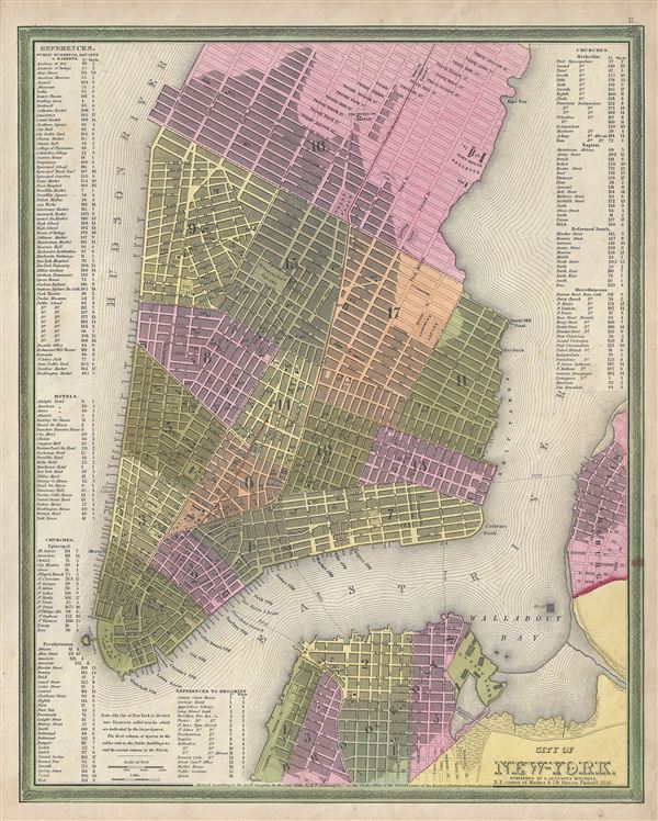
City of New York.
sold
- Digital Map Information
- Suitable for large format printing
- DPI: 300
- File Size: 8.78 MB
- File Type: ZIP / TIFF
- ICC color profile embedded
- Delivered instantly via download link
This is a beautiful example of S. A. Mitchell Junior's 1846 map of New York City. The map depicts southern Manhattan from 37th street (Kips Bay) south to Battery Park and Brooklyn from Williamsburg to Columbia St. Mitchell offers wonderful ... (more details)
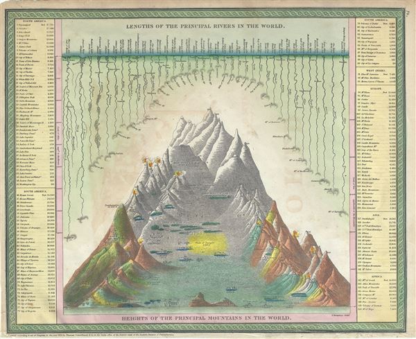
Lengths of the Principal Rivers in the World. / Heights of the Principal Mountains in the World.
sold
- Digital Map Information
- Suitable for large format printing
- Full resolution TIFF file
- ICC color profile embedded
- Delivered instantly via download link
This is an attractive example of Mitchells 1854 Comparative Mountains and Rivers Charts. Mitchell based his Mountains and Rivers Chart on a nearly identical map first prepared by the American engraver H. S. Tanner in 1836. This stunning ... (more details)

January February March. April May June. July August September. October November December.
sold
- Digital Map Information
- Suitable for large format printing
- Full resolution TIFF file
- ICC color profile embedded
- Delivered instantly via download link
This is a beautifully hand colored set of four maps depicting the night sky in the twelve months of the year, by Elijah Burritt. Each sheet features the stars and constellation in the night sky over a quarter. On each of the charts, the ... (more details)
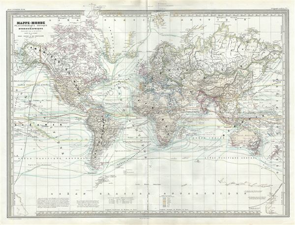
Mappe-Monde Planispherique Physique et Hydrographique.
sold
- Digital Map Information
- Suitable for large format printing
- Full resolution TIFF file
- ICC color profile embedded
- Delivered instantly via download link
This is an unusual 1860 elephant folio map of the world exhibiting its planispheric, physical and hydrographic features. The map shows extraordinary detail throughout noting European possessions around the world, cities, islands, rivers, ... (more details)
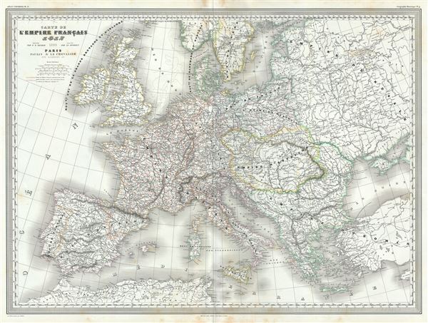
Carte de l'Empire Francais 1812.
sold
- Digital Map Information
- Suitable for large format printing
- Full resolution TIFF file
- ICC color profile embedded
- Delivered instantly via download link
This is a scarce and beautiful 1860 elephant folio map of the Europe depicting the French Empire, issued by A. H. Dufour. The map covers the entire European continent from Ireland and southern Scandinavia south the Mediterranean Sea and ... (more details)
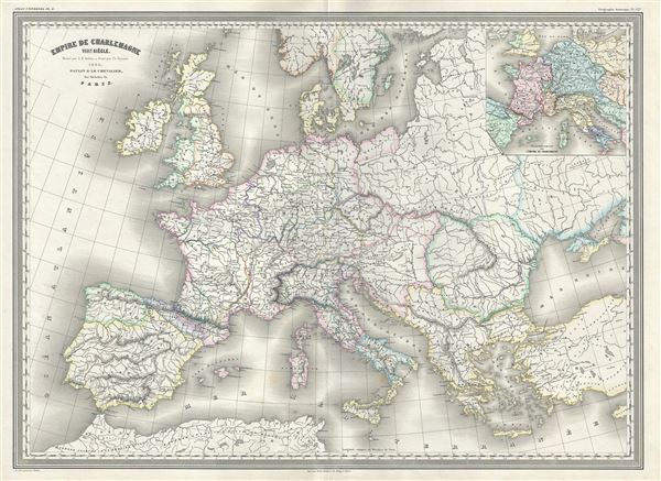
Empire de Charlemagne VIIIe. Siecle.
$225.00
Acquire
- Digital Map Information
- Suitable for large format printing
- Full resolution TIFF file
- ICC color profile embedded
- Delivered instantly via download link
This is an uncommon 1860 elephant folio map of the Europe during the Empire of Charlemagne issued by A. H. Dufour. The map covers Europe and the European Empire of Charles the Great from southern Sweden and Norway to Italy and Spain. ... (more details)

A New Map of Georgia with its Roads & Distances.
sold
- Digital Map Information
- Suitable for large format printing
- Full resolution TIFF file
- ICC color profile embedded
- Delivered instantly via download link
This is a fine example of S. A. Mitchell's 1854 map of Georgia. Through its elegant design, this map of Georgia centers our attention on the roads and railroads that crisscross the state. Steamboat routes and mileages are presented ... (more details)

A New Map of Nth. Carolina with its Canals, Roads and Distances from place to place, along the Stage and Steam Boat Routes.
sold
- Digital Map Information
- Suitable for large format printing
- Full resolution TIFF file
- ICC color profile embedded
- Delivered instantly via download link
A fine example of Samuel Augustus Mitchell's important 1854 map of North Carolina. This map shows cities, topographical features, railways, ferries and roads with color coding at the county level. In addition to cartographic ... (more details)

A New Map of Virginia with its Canals, Roads and Distances from place to place, along the Stage and Steam Boat Routes.
sold
- Digital Map Information
- Suitable for large format printing
- Full resolution TIFF file
- ICC color profile embedded
- Delivered instantly via download link
This is a fine example of S. A. Mitchell's 1854 map of Virginia. This map predates the 1862 separation of Virginia and West Virginia, and so contains both modern states in full as well as parts of adjacent Kentucky, Ohio, ... (more details)

City of Washington
sold
- Digital Map Information
- Suitable for large format printing
- Full resolution TIFF file
- ICC color profile embedded
- Delivered instantly via download link
This is a fine example of S. A. Mitchell and Thomas Cowperthwait's 1854 map or plan of Washington D.C. Given that most of Washington D.C. was under construction when this map was drawn, Mitchell's plan is a remarkable ... (more details)
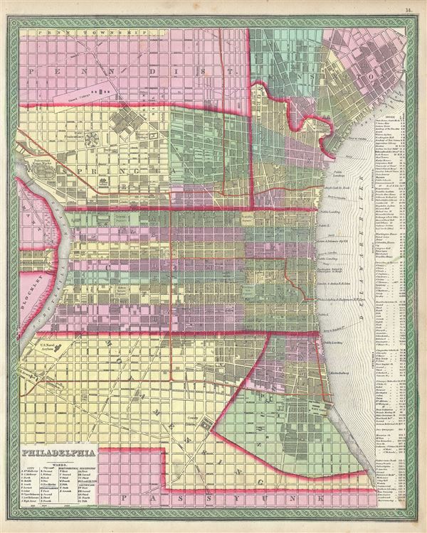
Philadelphia.
sold
- Digital Map Information
- Suitable for large format printing
- Full resolution TIFF file
- ICC color profile embedded
- Delivered instantly via download link
This is a beautiful example of S. A. Mitchell Jr.'s 1854 map of Philadelphia, Pennsylvania. Depicts the city of Philadelphia along with parts Camden. Offers wonderful detail at the street level including references to ... (more details)

A New Map of Pennsylvania with its Canals, Rail-Roads etc.
sold
- Digital Map Information
- Suitable for large format printing
- Full resolution TIFF file
- ICC color profile embedded
- Delivered instantly via download link
This carefully defined piece of S. A. Mitchell's 1854 map of Pennsylvania features the state's cities, towns, roads, canals, and railroads in great detail. This map covers from Lake Erie eastward to Delaware and New ... (more details)

Map of New Jersey Compiled From the latest authorities.
sold
- Digital Map Information
- Suitable for large format printing
- DPI: 300
- File Size: 7.6 MB
- File Type: ZIP / TIFF
- ICC color profile embedded
- Delivered instantly via download link
This is a beautifully detailed version of S. A. Mitchell's 1854 map of New Jersey. Extending vertically northward from Delaware Bay and Cape Bay, it depicts railroads, canals, rivers, State Parks, and bays to reach ... (more details)
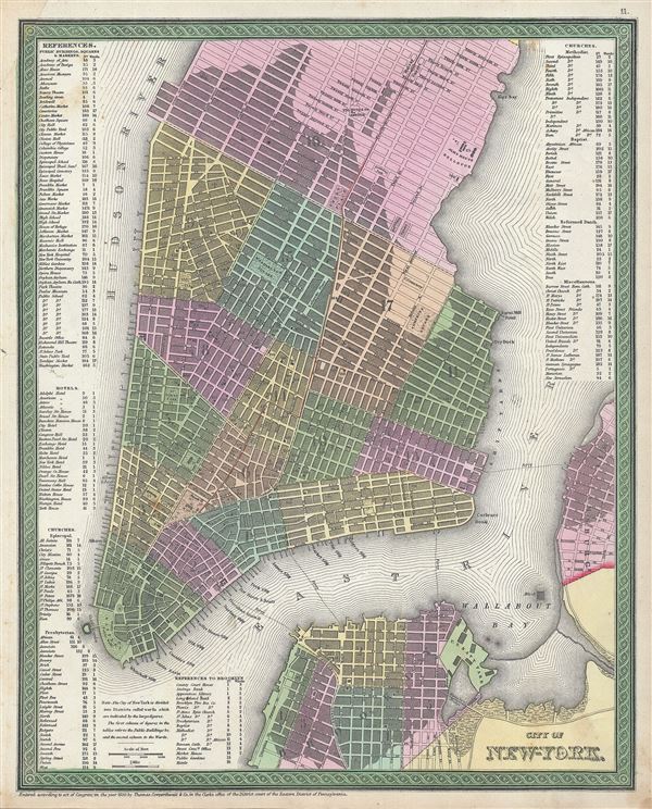
City of New York.
sold
- Digital Map Information
- Suitable for large format printing
- Full resolution TIFF file
- ICC color profile embedded
- Delivered instantly via download link
This is a beautiful example of S. A. Mitchell Junior's 1846 map of New York City. The map depicts southern Manhattan from 37th street (Kips Bay) south to Battery Park and Brooklyn from Williamsburg to Columbia St. ... (more details)
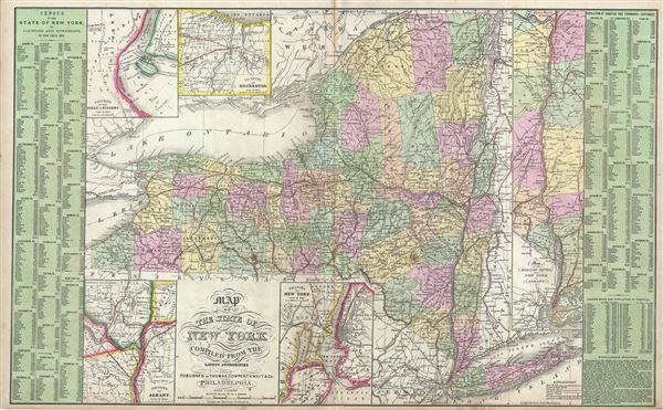
Map of the State of New York Compiled from the Latest Authorities.
sold
- Digital Map Information
- Suitable for large format printing
- Full resolution TIFF file
- ICC color profile embedded
- Delivered instantly via download link
A fine example of Thomas Cowperthwait and S. A. Mitchell's 1854 map of New York State. The fact that this is one of only two double page maps in Mitchell's New Universal Atlas testifies to the importance of New ... (more details)
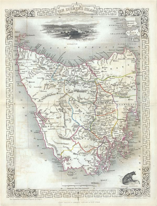
Van Diemen's Island or Tasmania.
sold
- Digital Map Information
- Suitable for large format printing
- Full resolution TIFF file
- ICC color profile embedded
- Delivered instantly via download link
This is an impressive 1851 Tallis map of Van Diemen's Island or Tasmania. The map covers the entire island of Tasmania in considerable detail noting towns, lakes, mountain ranges and other topographical ... (more details)