
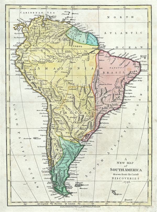
A New Map of South America drawn from the latest Discoveries.
sold
- Digital Map Information
- Suitable for large format printing
- Full resolution TIFF file
- ICC color profile embedded
- Delivered instantly via download link
This is a lovely 1793 map of the South America by Robert Wilkinson. Wilkinson's map covers the entire continent from Panama and the Caribbean to Tierra del Fuego and the Falklands Islands, inclusive of South Georgia Islands and a few other minor Antarctic islands. ... (more details)
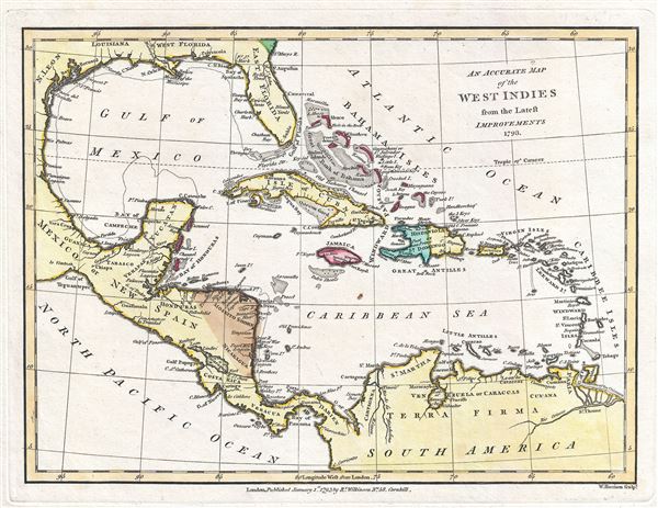
An Accurate Map of the West Indies from the Latest Improvements.
sold
- Digital Map Information
- Suitable for large format printing
- Full resolution TIFF file
- ICC color profile embedded
- Delivered instantly via download link
This is a fine 1793 map of the West Indies and the Caribbean by Robert Wilkinson. Wilkinson's map covers the West Indies, from the Mexican Coast to the Windward Islands, inclusive of the Gulf of Mexico, the Caribbean, Central America, Florida, the Spanish Main, ... (more details)
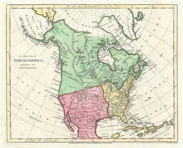
A New Map of North America agreeable to the Latest Discoveries.
sold
- Digital Map Information
- Suitable for large format printing
- Full resolution TIFF file
- ICC color profile embedded
- Delivered instantly via download link
This is a scarce 1793 map of North America by Robert Wilkinson. Wilkinson's map covers the entire continent of North America from the Arctic Sea to Mexico and from the Atlantic to the Pacific. This map bears the signature of three monumental events that ... (more details)
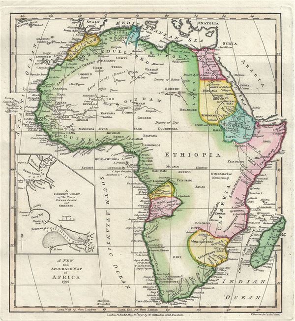
A New and Accurate Map of Africa.
sold
- Digital Map Information
- Suitable for large format printing
- Full resolution TIFF file
- ICC color profile embedded
- Delivered instantly via download link
This is a beautiful 1792 map of Africa by Robert Wilkinson. Wilkinson's map covers the entire continent of Africa inclusive of the island of Madagascar and adjacent parts of Europe and Arabia. Africa was as this time only tenuously explored beyond the ... (more details)
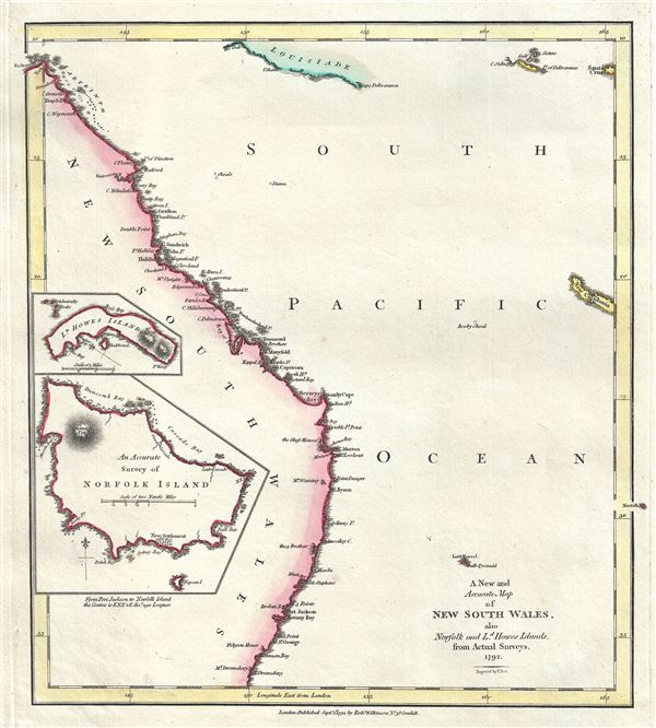
A New and Accurate Map of New South Wales, also Norfolk and Ld. Howes Islands, from Actual Surveys.
sold
- Digital Map Information
- Suitable for large format printing
- Full resolution TIFF file
- ICC color profile embedded
- Delivered instantly via download link
This is a rare 1792 map of the New South Wales, Australia, by Robert Wilkinson. One of the first maps to detail the British colonization of Australia, Wilkinson's map covers eastern Australia from the endeavors Straits south as far as Cape Dromedary, ... (more details)
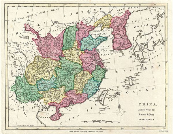
China, Drawn from the Latest and Best Authorities.
sold
- Digital Map Information
- Suitable for large format printing
- Full resolution TIFF file
- ICC color profile embedded
- Delivered instantly via download link
This is a lovely 1792 map of China and Korea by Robert Wilkinson. Wilkinson's map covers China in full as well as Korea, Formosa (Taiwan), and parts of adjacent Japan, Tibet, Vietnam (Tonkin), and Tartary (Mongolia). Color coding divides China into ... (more details)
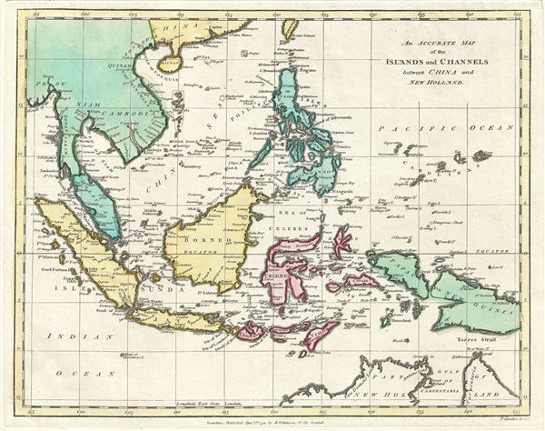
An Accurate Map of the Islands and Channels between China and New Holland.
sold
- Digital Map Information
- Suitable for large format printing
- Full resolution TIFF file
- ICC color profile embedded
- Delivered instantly via download link
This is a fine 1791 map of the East Indies and Southeast Asia by Robert Wilkinson. Wilkinson's map covers the region from Burma or Myanmar to northern Australia and from Sumatra to New Guinea, inclusive of Borneo, Malay, Singapore, Siam (Thailand), ... (more details)
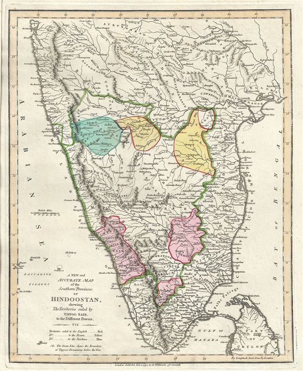
A New and Accurate Map of the Southern Provinces of Hindoostan, shewing The Territories ceded by Tipoo Saib, to the Different Powers.
sold
- Digital Map Information
- Suitable for large format printing
- Full resolution TIFF file
- ICC color profile embedded
- Delivered instantly via download link
This is a scarce and beautiful 1791 map of southern India by Robert Wilkinson. It covers from Bombay or Mumbai to Cape Comorin. This exquisite map is absolutely invaluable for those interested in colonial or Indian history, as it shows the ... (more details)
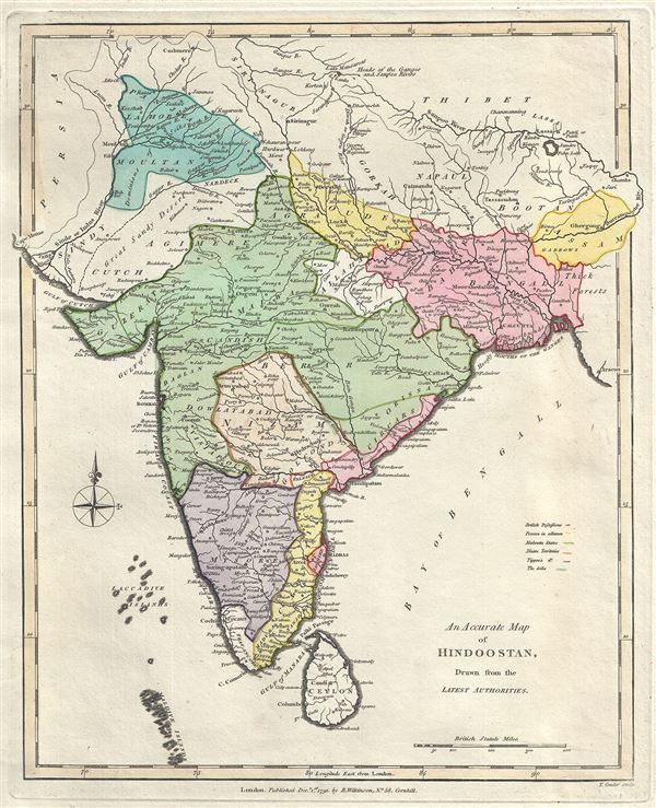
An Accurate Map of Hindoostan, Drawn from the Latest Authorities.
sold
- Digital Map Information
- Suitable for large format printing
- Full resolution TIFF file
- ICC color profile embedded
- Delivered instantly via download link
This is a lovely 1791 map of India by Robert Wilkinson. Wilkinson's map covers from Kabul and Persia in the northwest, to Cape Comorin, Ceylon and the Maldive Islands in the south, and from 'Thibet' in the northeast to Cape Negrais in what ... (more details)

New Map of Asia drawn from the latest Discoveries.
sold
- Digital Map Information
- Suitable for large format printing
- Full resolution TIFF file
- ICC color profile embedded
- Delivered instantly via download link
This is a finely detailed first edition 1794 map of Asia and Australia by Robert Wilkinson. Wilkinson's map covers from the Russian Arctic to the Indian Ocean and from Madagascar to New South Wales and New Guinea. Here Asia is divided into ... (more details)
The world's first cane map - a rare novelty from the 1893 Columbian Exposition showing Buffalo Bill's Wild West Show.

Columbian Novelty Company.
sold
- Digital Map Information
- Suitable for large format printing
- File Size: 5.74 MB
- File Type: ZIP / TIFF
- ICC color profile embedded
- Delivered instantly via download link
An extremely rare and unusual map prepared in 1893 for the Chicago World's Fair or, as it is better known, the 1893 Columbian Exposition. Although separated from the cane (not present) in the current example, this is the earliest known ... (more details)
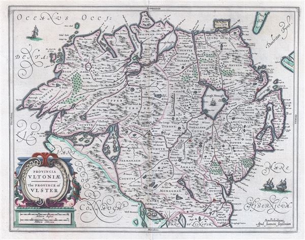
Provencia Ultoniae. The Province of Uslter.
sold
- Digital Map Information
- Suitable for large format printing
- Full resolution TIFF file
- ICC color profile embedded
- Delivered instantly via download link
An attractive c. 1650 map of Ulster province, Northern Ireland, by the Dutch cartographer Johannes Jansson (Janssonius). The map covers from the Atlantic to the Irish Sea and from Cardonagh to Connaught and Leinster. Includes Belfast. ... (more details)
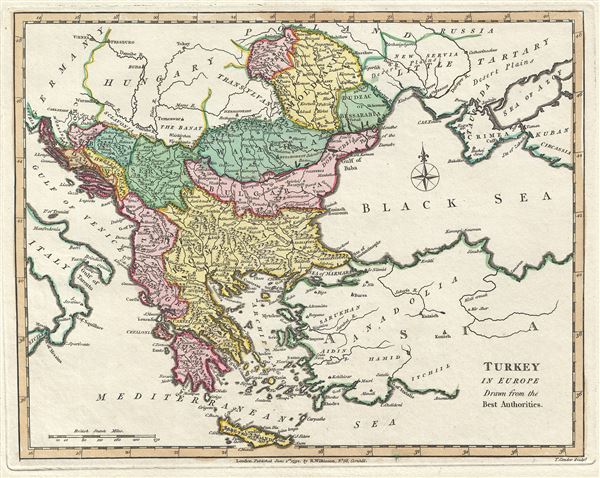
Turkey in Europe Drawn from the Best Authorities.
sold
- Digital Map Information
- Suitable for large format printing
- Full resolution TIFF file
- ICC color profile embedded
- Delivered instantly via download link
This is a fine 1792 map of Greece, the Balkans and Turkey in Europe by Robert Wilkinson. Wilkinson's map covers from Germany to the eastern Black Sea and surrounding areas, inclusive of the modern day countries of Greece, Albania, ... (more details)

Naples and Sicily, Drawn from the Best Authorities.
sold
- Digital Map Information
- Suitable for large format printing
- Full resolution TIFF file
- ICC color profile embedded
- Delivered instantly via download link
This is a lovely 1793 map of southern Italy by Robert Wilkinson. Wilkinson's map covers the territory claimed by the Kingdom of Naples, which extended from the Papal States south to include all of Sicily. Shortly after this map ... (more details)

The Middle Part of Italy, Drawn from The best Authorities.
sold
- Digital Map Information
- Suitable for large format printing
- Full resolution TIFF file
- ICC color profile embedded
- Delivered instantly via download link
This is a beautifully detailed 1794 map of Tuscany and the Papal States by Robert Wilkinson. Wilkinson's map covers from the island of Elba to the Gulf of Venice and from Modena to Naples, inclusive of the Duchy of Tuscany and ... (more details)

Italy, with the Islands of Sicily, Sardinia, and Corsica, Drawn from the Best Authorities.
sold
- Digital Map Information
- Suitable for large format printing
- Full resolution TIFF file
- ICC color profile embedded
- Delivered instantly via download link
This is an exquisitely detailed 1793 map of Italy by Robert Wilkinson. It covers the entire peninsula of Italy as well as Piedmont, the Venetian States, the Dalmatian Coast, and the islands of Sardinia, Corsica, and Sicily. ... (more details)
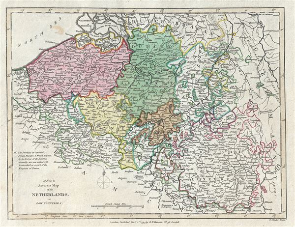
A New and Accurate Map of the Netherlands, or Low Countries.
sold
- Digital Map Information
- Suitable for large format printing
- Full resolution TIFF file
- ICC color profile embedded
- Delivered instantly via download link
This is Robert Wilkinson's lovely 1793 map depicting the area now covered by the southern Netherlands, Belgium and Luxembourg. It covers from Breda, south as far as Montmedy and from Dunkirk east as far as Cologne. When ... (more details)

The Seven United Provinces from the best Authorities 1793.
sold
- Digital Map Information
- Suitable for large format printing
- Full resolution TIFF file
- ICC color profile embedded
- Delivered instantly via download link
This is a fine example of Robert Wilkinson's 1793 map of what is now the northern Netherlands. It covers from Borkum (Bosch) south as far as Antwerp and east as far as Munster. The 'Republic of the United Provinces' was ... (more details)
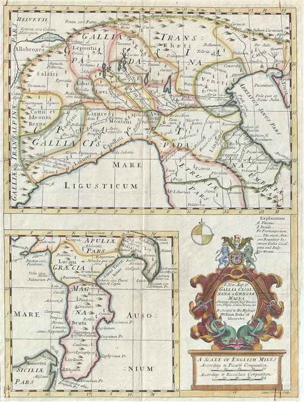
A New Map of Gallia Cisalpina and Graecia Magna Shewing their Chief Divisions, Peoples, Cities, Towns etc.
sold
- Digital Map Information
- Suitable for large format printing
- Full resolution TIFF file
- ICC color profile embedded
- Delivered instantly via download link
This is a charming 1712 map of the northern Italy and southern Italy in antiquity by Edward Wells of Oxford. Essentially two maps on a single sheet, the top map depicts the northern part of Italy from Lake Geneva (Lake ... (more details)
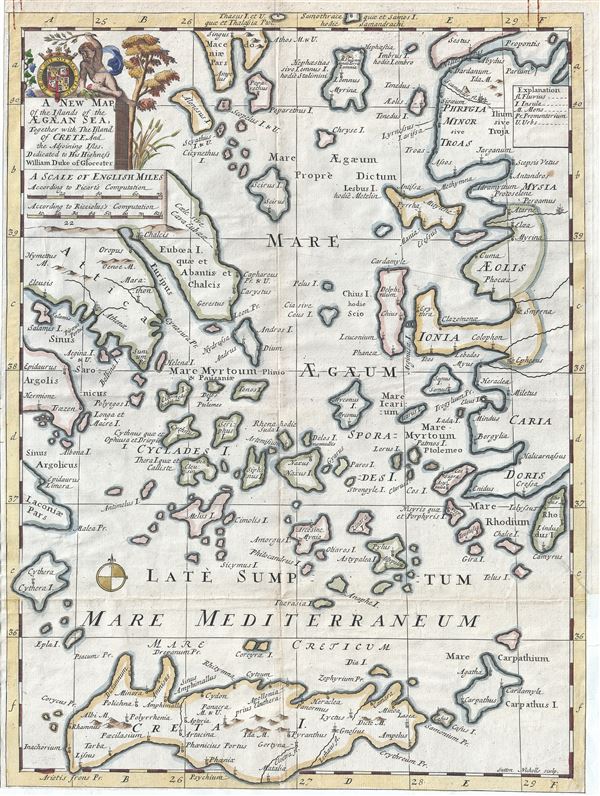
A New Map of the Islands of the Aegaean Sea, Together with The Island of Crete And the Adjoining Isles.
sold
- Digital Map Information
- Suitable for large format printing
- Full resolution TIFF file
- ICC color profile embedded
- Delivered instantly via download link
This is a beautiful 1712 map of the Islands of the Aegean Sea by Edward Wells of Oxford. The map covers the Greek Isles or the Islands of the Aegean Sea from Myrina south to include Crete and from Cythera east as far ... (more details)