
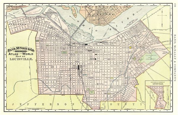
Map of Louisville.
sold
- Digital Map Information
- Suitable for large format printing
- File Size: 7.69 MB
- File Type: ZIP / TIFF
- ICC color profile embedded
- Delivered instantly via download link
This is a fine example of the 1892 Rand McNally and Company map or plan of the city of Louisville, Kentucky. It cover the city from Portland east as far as Cave Hill Cemetery and from Jeffersonville in Indiana, across the Ohio River south as far as the House of ... (more details)
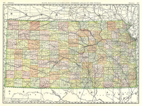
Kansas.
sold
- Digital Map Information
- Suitable for large format printing
- File Size: 18.35 MB
- File Type: ZIP / TIFF
- ICC color profile embedded
- Delivered instantly via download link
A fine 1888 map of Kansas by Rand McNally and Company. It covers the state of Kansas along with part of neighboring states. The map is color coded according to counties and notes major towns, cities, rives, railroads, and other topographical features. ... (more details)

Wyoming.
sold
- Digital Map Information
- Suitable for large format printing
- File Size: 10.82 MB
- File Type: ZIP / TIFF
- ICC color profile embedded
- Delivered instantly via download link
This is an attractive 1891 Rand McNally map of Wyoming. It covers the state of Wyoming in its entirety, noting towns, rivers, mountains, lakes, rivers, railroads and other important topographical features. Indian reservations are also noted. The map ... (more details)

Idaho.
sold
- Digital Map Information
- Suitable for large format printing
- File Size: 7.78 MB
- File Type: ZIP / TIFF
- ICC color profile embedded
- Delivered instantly via download link
A beautiful 1892 map of Idaho by Rand McNally and Company. It covers the state of Idaho and part of neighboring Montana. Several towns, cities, railroads, mountains, rivers, lava beds, and other topographical features are noted throughout. The map ... (more details)

Alaska.
sold
- Digital Map Information
- Suitable for large format printing
- File Size: 6.17 MB
- File Type: ZIP / TIFF
- ICC color profile embedded
- Delivered instantly via download link
A fine example of Rand McNally and Company's 1892 map of Alaska. It covers the state in detail, noting capes, rivers, mountains, bays and various other topographical features. Elevation is rendered by hachures. A small inset in the upper right ... (more details)

South Dakota.
sold
- Digital Map Information
- Suitable for large format printing
- File Size: 9.27 MB
- File Type: ZIP / TIFF
- ICC color profile embedded
- Delivered instantly via download link
An appealing 1891 map of South Dakota issued by Rand McNally and Company. It covers the state just two years after the treaty of 1889 in great detail, noting towns, rivers, mountains, railroads and other topographical features. The region ... (more details)

Nebraska.
sold
- Digital Map Information
- Suitable for large format printing
- File Size: 15.03 MB
- File Type: ZIP / TIFF
- ICC color profile embedded
- Delivered instantly via download link
This is a beautiful 1888 Rand McNally and Company map of Nebraska. The map covers the state of Nebraska along with parts of neighboring states. It notes major towns, rivers, railroads, roads, and various other topographical features. The ... (more details)

Arizona.
sold
- Digital Map Information
- Suitable for large format printing
- File Size: 10.04 MB
- File Type: ZIP / TIFF
- ICC color profile embedded
- Delivered instantly via download link
A fine example of Rand McNally and Company's 1888 map of Arizona. Covering the state of Arizona in its entirety, the map identifies several important towns, railroads, cities, peaks, and other topographical features. Elevation is rendered ... (more details)

California.
sold
- Digital Map Information
- Suitable for large format printing
- File Size: 17.87 MB
- File Type: ZIP / TIFF
- ICC color profile embedded
- Delivered instantly via download link
An attractive 1892 map of California by Rand McNally and Company. It covers the entire state of California in extraordinary detail, noting major towns, cities, mountains, rivers, lakes and other topographical features. An inset map of San ... (more details)

The Eastern Hemisphere.
sold
- Digital Map Information
- Suitable for large format printing
- DPI: 300
- File Size: 7.09 MB
- File Type: ZIP / TIFF
- ICC color profile embedded
- Delivered instantly via download link
A fascinating 1852 map of the Eastern Hemisphere issued by George Frederick Cruchley. It offers a fascinating snapshot of the world during a period of rapid globalization and discovery, and includes entirety of Asia, Europe and Africa as ... (more details)
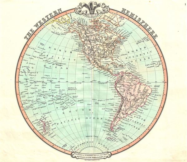
The Western Hemisphere.
sold
- Digital Map Information
- Suitable for large format printing
- DPI: 300
- File Size: 6.4 MB
- File Type: ZIP / TIFF
- ICC color profile embedded
- Delivered instantly via download link
A beautiful 1852 George Frederick Cruchley map of the Western Hemisphere. It offers a fascinating snapshot of the world during a period of rapid globalization and discovery, and includes North America, South America and most of ... (more details)
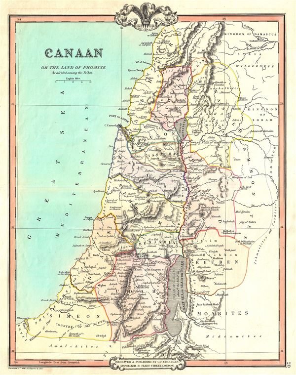
Canaan or the Land of Promise As divided among the Tribes.
sold
- Digital Map Information
- Suitable for large format printing
- DPI: 300
- File Size: 7.34 MB
- File Type: ZIP / TIFF
- ICC color profile embedded
- Delivered instantly via download link
This is a fascinating 1850 map of Canaan (Israel or Palestine) by George Frederick Cruchley. It covers the region as it existed in Biblical times with divisions for each of the Tribes of Israel and includes the modern day ... (more details)

Palestine, In the Time of our Saviour Illustrating the Acts of the Apostles etc.
sold
- Digital Map Information
- Suitable for large format printing
- DPI: 300
- File Size: 6.46 MB
- File Type: ZIP / TIFF
- ICC color profile embedded
- Delivered instantly via download link
This is a fine example of George Frederick Cruchley's 1850 map of Palestine, Israel or the Holy Land in Biblical times. Centered on the Jordan River, the map covers the regions between modern day Israel and Lebanon along ... (more details)
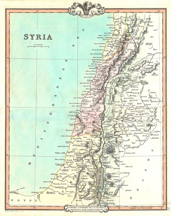
Syria.
sold
- Digital Map Information
- Suitable for large format printing
- DPI: 300
- File Size: 6.27 MB
- File Type: ZIP / TIFF
- ICC color profile embedded
- Delivered instantly via download link
This is an appealing 1853 map of Syria issued by George Frederick Cruchley. It covers from Tripoli to the Dead Sea and includes the modern day countries of Lebanon, Israel, Jordan and Syria. The sites of numerous ... (more details)
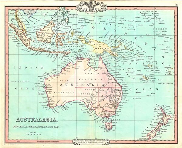
Australasia, New Zealand, East India Islands, etc. etc.
sold
- Digital Map Information
- Suitable for large format printing
- DPI: 300
- File Size: 6.55 MB
- File Type: ZIP / TIFF
- ICC color profile embedded
- Delivered instantly via download link
This is a fine example of George Frederick Cruchley's 1852 map of Australia, New Zealand and the East India Islands. It covers from the Malay Peninsula to New Zealand, including Australia, Malaysia, Indonesia, ... (more details)

Egypt.
sold
- Digital Map Information
- Suitable for large format printing
- DPI: 300
- File Size: 5.7 MB
- File Type: ZIP / TIFF
- ICC color profile embedded
- Delivered instantly via download link
This is an attractive 1853 map of Egypt issued by George Frederick Cruchley. Centered on the Nile Valley, Cruchley's map covers Egypt from the Mediterranean to Nubia. The map is color coded and divides Egypt ... (more details)
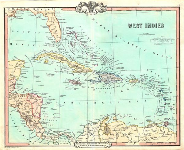
West Indies.
sold
- Digital Map Information
- Suitable for large format printing
- DPI: 300
- File Size: 6.58 MB
- File Type: ZIP / TIFF
- ICC color profile embedded
- Delivered instantly via download link
This is a beautiful 1852 map of the West Indies by George Frederick Cruchley. Centered on Haiti or San Domingo (Hispaniola), the map covers the Caribbean from Florida to Venezuela and from Yucatan to the ... (more details)
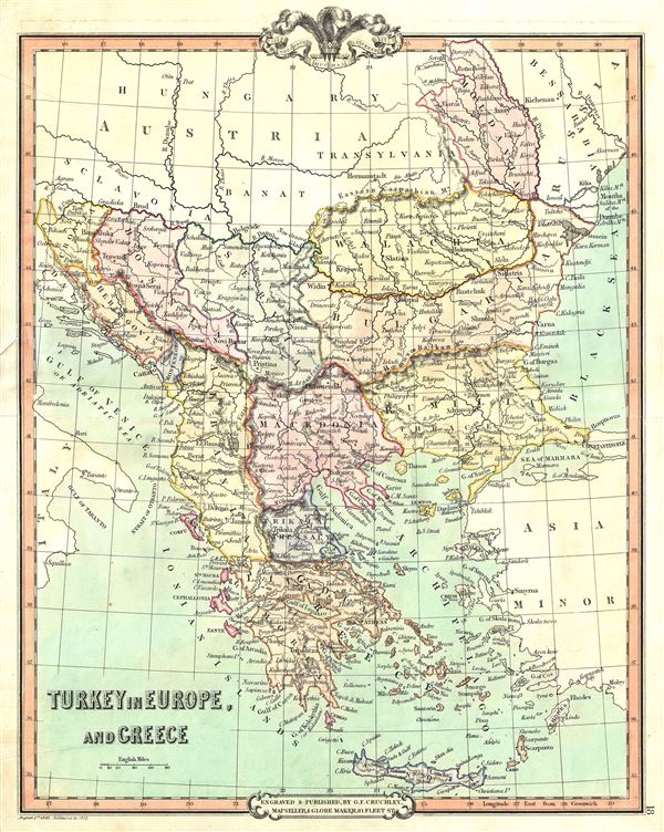
Turkey in Europe, and Greece.
sold
- Digital Map Information
- Suitable for large format printing
- DPI: 300
- File Size: 7.45 MB
- File Type: ZIP / TIFF
- ICC color profile embedded
- Delivered instantly via download link
This is a beautiful 1852 map of Greece, the Balkans and the European part of Turkey by George Frederick Cruchley. It covers from Moldavia to Candia and from the Gulf of Venice or the Adriatic Sea to the ... (more details)
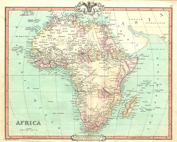
Africa.
sold
- Digital Map Information
- Suitable for large format printing
- DPI: 300
- File Size: 8.04 MB
- File Type: ZIP / TIFF
- ICC color profile embedded
- Delivered instantly via download link
This is a beautiful 1852 map of Africa issued by George Frederick Cruchley. It details the continent of Africa, including Madagascar, on the cusp of the great exploratory expeditions of the mid-19th ... (more details)

China.
sold
- Digital Map Information
- Suitable for large format printing
- DPI: 300
- File Size: 7.81 MB
- File Type: ZIP / TIFF
- ICC color profile embedded
- Delivered instantly via download link
A lovely 1852 map of China by George Frederick Cruchley. It covers the traditional provinces of mainland China, as well as adjacent Corea (Korea) and Formosa (Taiwan). Hong Kong Island and Macao ... (more details)