
Jewish-American immigrant patriotism in WWI.

[Food will win the war!] / שפייז וועט געווינען דיא קריעג!
sold
- Digital Map Information
- Suitable for large format printing
- File Size: 64.86 MB
- File Type: ZIP / TIFF
- ICC color profile embedded
- Delivered instantly via download link
A significant 1917 World War I propaganda poster in Yiddish illustrated by Charles Edward Chambers and published by the United States Food Administration. The poster appeals to Jewish immigrants to save food, particularly wheat, for the Allied war effort by suggesting that the European war was a threat to their hard-won freedom. (more details)
Educating for national identity.

明細大日本切圖九州之部 / [Detailed Sectional Map of Japan - Kyushu].
sold
- Digital Map Information
- Suitable for large format printing
- File Size: 74.37 MB
- File Type: ZIP / TIFF
- ICC color profile embedded
- Delivered instantly via download link
An impressive 1877 Kobayashi Kanetaka map of the island of Kyushu and several smaller neighboring islands in Japan, published by Aoki Sukekiyo of Dōmeisha. It was part of a series of highly detailed maps of Japan's regions, and the involvement of Aoki and Dōmeisha strongly suggest that it was intended for educational purposes. (more details)
Pony Express.
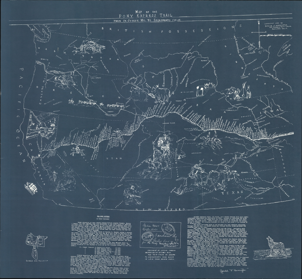
Map of the Pony Express Trail from St. Joseph Mo. to Sacramento Calif.
sold
- Digital Map Information
- Suitable for large format printing
- File Size: 1672.5 MB
- File Type: ZIP / TIFF
- ICC color profile embedded
- Delivered instantly via download link
This is Gerald F. Harrington's 1935 cyanotype map illustrating the route of the Pony Express. Gerald was a noted Pony Express expert, and this map and his research are widely cited by Pony Express historians. (more details)
Striking view of Narragansett Bay by Providence's most prosperous printer.

A Bird's-Eye View of Narraganset Bay.
sold
- Digital Map Information
- Suitable for large format printing
- File Size: 92.01 MB
- File Type: ZIP / TIFF
- ICC color profile embedded
- Delivered instantly via download link
A striking 1888 bird's-eye view and map of Narragansett Bay, Rhode Island, published in Providence by J. A. and R. A. Reid. This is the only known view of Narragansett Bay published in Providence. (more details)
Italia Viva.

Italia.
sold
A vibrant c. 1970 pictorial map of Italy produced in the postwar period, drawn by Vsevolode Nicouline and published by Giovanni De Agostini. Its intricate drawings bring to life Italian culture, economy, and history. (more details)
Der Beste Der Welt.

Costa Rica Kaffee Der Beste Der Welt Bildkarte von Costa Rica.
sold
A whimsical 1968 German-language pictorial view of Costa Rica, drawn by an artist named Ruiz and printed by the Casa Grafica for Costa Rica's Oficina del Café, a government body with representatives in Europe. It was designed to promote Costa Rican coffee to German investors and coffee sellers. (more details)
L.A.'s Bohemian Beachfront Community.

Venice California 75 Years - 1905 - 1980.
sold
A 1979 pictorial view of Venice, California, a beachfront neighborhood of Los Angeles, edited by Jeffrey Stanton and illustrated by C. June Barton and R. Freenway Frager. Celebrating 75 years since the town's founding (annexed by L.A. in 1926), the view and accompanying verso text praise the neighborhood's diversity and distinctiveness but cast a wary tone about its future in the face of gentrification. (more details)
Italian wine!

Vini d'Italia.
sold
This is a 1976 Yanez Oski pictorial wine map of Italy. The map celebrates Italy's rich viticultural tradition. (more details)
America's most famous national parks.
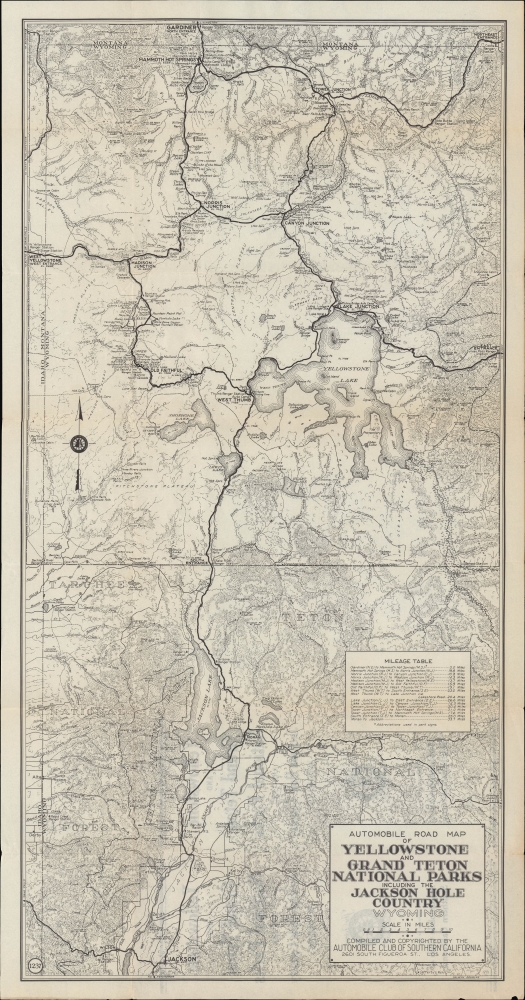
Automobile Road Map of Yellowstone and Grand Teton National Parks Including the Jackson Hole Country Wyoming.
sold
- Digital Map Information
- Suitable for large format printing
- Full resolution TIFF file
- ICC color profile embedded
- Delivered instantly via download link
A c. 1930 Automobile Club of Southern California road map of Yellowstone and Grand Teton National Parks. It provides extensive and helpful detail to the motorist, reflecting the growing popularity of automobiles as a means of reaching and exploring the parks. (more details)
'The Greatest Interurban System in the World'

Special Sightseeing Map of Los Angeles and Vicinity.
sold
- Digital Map Information
- Suitable for large format printing
- Full resolution TIFF file
- ICC color profile embedded
- Delivered instantly via download link
A charming c. 1930 pictorial bird's-eye view of Los Angeles drawn by W. Calkins for Tanner Motor Tours, the Pacific Electric Railway, and the Catalina Island Company. Geared towards tourists, it displays the region in the era before highways, when it was more a group of somewhat disconnected cities strung together by rail lines than the massive span of unbroken urban sprawl of today. (more details)
Stunning archipelago in Washington.
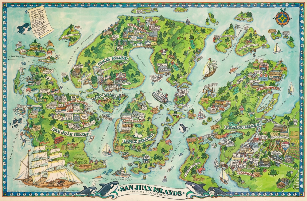
San Juan Islands, Washington.
sold
This is a 1988 Sharon Schumacher pictorial map of the San Juan Islands, Washington. The San Juan Islands are an enchanting archipelago of some 400 islands nestled between the mainland and Vancouver Island, British Columbia. (more details)
Visit Manhattan and stay at the Hotel Taft!

A Map of Part of Manhattan Around the Hotel Taft Seventh Avenue at 50th St.
sold
- Digital Map Information
- Suitable for large format printing
- Full resolution TIFF file
- ICC color profile embedded
- Delivered instantly via download link
This is a c. 1935 Hotel Taft pictorial tourist map of Manhattan, New York City. Created to promote the Hotel Taft and complete with a detachable mail-in reservation card, the map highlights sites around Manhattan that might interest visitors during their stay. (more details)
40th Anniversary of the D-Day Landings.

A L'aube du mardi 6 Juin 1944 135000 hommes debarqués.
sold
This is a 1984 Europe Marketing Concept pictorial tourist map of Normandy illustrating the World War II, June 6, 1944, D-Day landings.It combines historical information, remembrance, and practical information for tourists. (more details)
Explore Copenhagen!

Pictorial Map of Copenhagen Old Town.
sold
This is a 1955 Politiken pictorial map of central Copenhagen, Denmark. The map pictorially highlights Copenhagen's most iconic historic buildings. (more details)
Hotels in the Heyday of the Florida Land Boom

Stop at Melbourne Hotel Miami Miramar Hotel.
sold
- Digital Map Information
- Suitable for large format printing
- Full resolution TIFF file
- ICC color profile embedded
- Delivered instantly via download link
This c. 1928 bookmark issued by the Miami Miramar Hotel incorporating a strip map of eastern Florida. From the heyday of the Florida Land Boom, it highlights U.S. Highway 1 and the Tamiami Trail linking Miami with Tampa. (more details)
One of the most desirable maps of any part of the world, ever printed.

Islandia.
sold
- Digital Map Information
- Suitable for large format printing
- Full resolution TIFF file
- ICC color profile embedded
- Delivered instantly via download link
This is a handsome example of Abraham Ortelius' 1587 map of Iceland, in its 1612 Italian text edition. Ortelius' Islandia is arguably the most famous decorative map, being the 'monster map' par excellence, as it presents a menagerie of sea monsters typically found on early maps. The map is geographically important as well. Beyond strongly evoking Iceland's astonishing terrain with its vigorously engraved mountains, it is remarkably accurate since it is the first map of Iceland derived from the work of an Icelander, Gudbrandur Thorlaksson (Guðbrandur Þorláksson; c. 1542 - 1627). (more details)
Unique survivor from the First Hawaii Territory Survey.
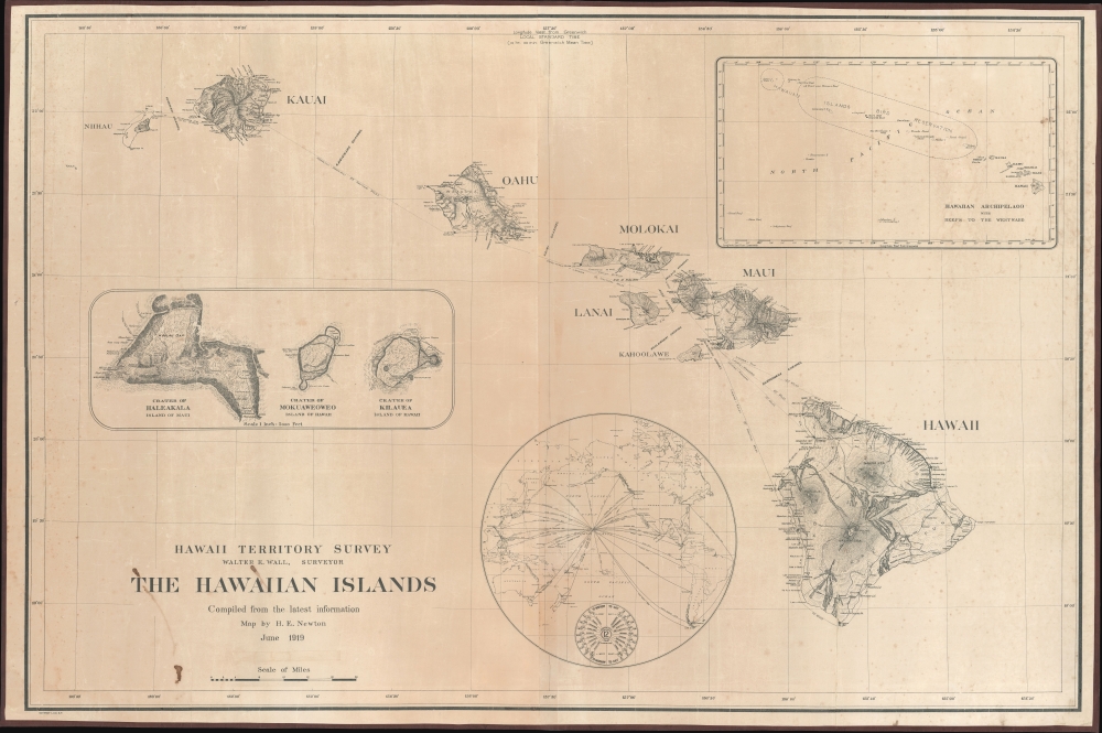
Hawaii Territory Survey. The Hawaiian Islands Compiled from the latest information Map by H. E. Newton June 1919.
sold
- Digital Map Information
- Suitable for large format printing
- File Size: 109.11 MB
- File Type: ZIP / TIFF
- ICC color profile embedded
- Delivered instantly via download link
A singular survivor from the first Hawaiian Territorial Survey, this is Henry E. Newton's 1919 map of the Hawaiian Islands, here in a previously unknown double-sized presentation issue. This is the most important map of Hawaii issued during the territorial period and the foundation for most subsequent maps of the archipelago into the late 20th century. (more details)
Propaganda from both sides of the Vietnam War.

[Vietnam War Propaganda Archive.]
sold
This is an extraordinary archive of Vietnam War (1955 - 1975) propaganda from the estate of Major General Ira A. Hunt Jr. It is a comprehensive retrospective on the propaganda produced by both sides of the long and nuanced war. The collection includes 41 items ranging from Viet Cong produced anti-American pieces to propaganda distributed among the Viet Cong by American Psychological Operations (PSYOPS). (more details)
Stalin's Genocide against the Ukrainian Kulak.

КАРТА РАЗМЕЩЕНИЯ СОВХОЗОВ И М.Т.С. ПО КРЫМСКОЙ АССР. / LOCATION MAP OF STATE FARMS AND M.T.S. ACCORDING TO THE CRIMEA ASSR.
sold
- Digital Map Information
- Suitable for large format printing
- File Size: 40.83 MB
- File Type: ZIP / TIFF
- ICC color profile embedded
- Delivered instantly via download link
This is a c. 1936 Tipo-Lithografia map of Crimea, Ukraine, highlighting collective farms and machine tractor stations - a key element of Stalin's 'Dekulakization', Stalin's 'genocide' against the Ukrainian Kulak (prosperous farmer) class. (more details)
An Epic Late 19th Century Wall Map of Japan.

大日本國海陸精圖 / [Map of the Lands and Seas of Japan].
sold
- Digital Map Information
- Suitable for large format printing
- File Size: 173.91 MB
- File Type: ZIP / TIFF
- ICC color profile embedded
- Delivered instantly via download link
An enormous 1892 first-edition wall map of Japan, edited by Senmasu Genzō and published by Morimoto Sensuke. Its impressive size allows for tremendous detail, presenting Japan during the height of the Meiji Era, on the eve of its imperial expansion into Taiwan and Korea. (more details)