

Good Natured Map of 1936 Shrine Playground.
sold
- Digital Map Information
- Suitable for large format printing
- DPI: 300
- File Size: 34.33 MB
- File Type: ZIP / TIFF
- ICC color profile embedded
- Delivered instantly via download link
This is a beautiful example of the vibrantly colored 1936 pictorial Shriners map of the Pacific Northwest. This map was created to commemorate the 62nd Imperial Council Session of the A.A.O.N.M.S. (Ancient Arabic Order of the Nobles of the Mystic Shrine) held in ... (more details)
A fine decorative map depicting colonial America during the Spanish War of Succession.
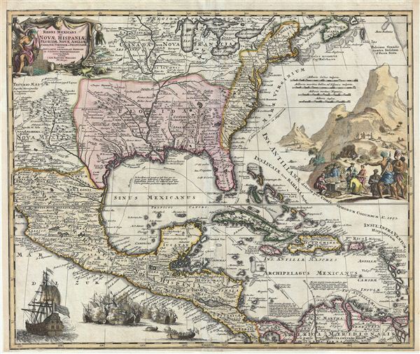
Regni Mexicani seu Novae Hispaniae, Floridae, Novae Angliae, Carolinae, Virginiae et Pensylvaniae, nec non Insularum, Archipelagi Mexicani in America Septentrionali.
sold
- Digital Map Information
- Suitable for large format printing
- DPI: 300
- File Size: 19.94 MB
- File Type: ZIP / TIFF
- ICC color profile embedded
- Delivered instantly via download link
A fine first state example of J. B. Homann's decorative 1712 map of Mexico, Florida, New england, the West Indies, and the Mississippi Valley (Louisiana). Centered on the Mississippi River Valley, Homann's map covers from Sinaloa (Mexico) eastwards to the ... (more details)
The first published map of the northwest coast to show Vancouver Island, the Puget Sound, and the Columbia River.
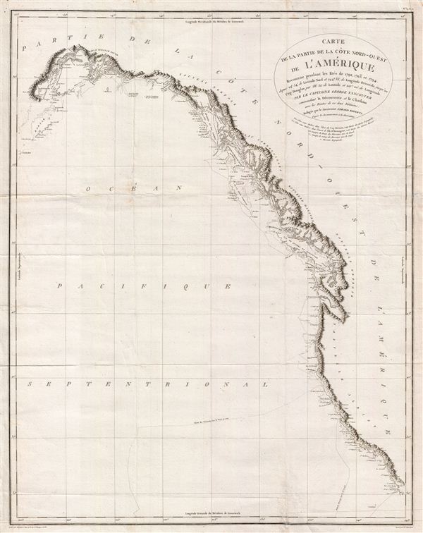
Carte de la Partie de la Cote Nord-Ouest de L'Amerique Reconnue pendant Etes de 1792, 1793, et 1794
sold
- Digital Map Information
- Suitable for large format printing
- DPI: 300
- File Size: 20.9 MB
- File Type: ZIP / TIFF
- ICC color profile embedded
- Delivered instantly via download link
One of the great navigator George Vancouver's most important and influential maps, this is the 1799 general reconnaissance of the west coast of America from San Diego to Kodiak Island, Alaska. At last the west coast of America, particular the Pacific ... (more details)
One of the most beautiful atlas maps of Poland to emerge in the early 18th century.
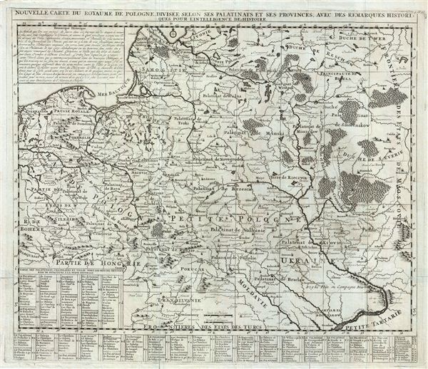
Nouvelle Carte du Royaume de Pologne Divisee Selon ses Palatinats et ses Provinces, avec des Remarques Historiques pour L'Intelligence de l'Histoire.
sold
- Digital Map Information
- Suitable for large format printing
- DPI: 300
- File Size: 20.18 MB
- File Type: ZIP / TIFF
- ICC color profile embedded
- Delivered instantly via download link
An extraordinary map of Poland issued c. 1710 by Henri Chatelain. Centered on 'Petite Pologne,' the map covers from the Baltic Sea to Transylvania and from Glatz to the border with Moscovie (Russia). Like most of Chatelain's work it is beautifully ... (more details)
One of the finest large format maps of Africa to appear in the 18th century.
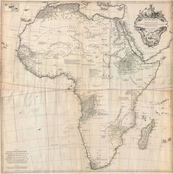
Afrique Publiee sous les Auspices de Monseigneur le Duc D'Orleans Premier Prince du Sang.
sold
- Digital Map Information
- Suitable for large format printing
- DPI: 300
- File Size: 43.33 MB
- File Type: ZIP / TIFF
- ICC color profile embedded
- Delivered instantly via download link
This is one of the largest and most influential maps of Africa to appear in the mid-18th century. Anville's map covers the entire continent of Africa from the Mediterranean to the Cape of Good Hope and from the Cape Verde Islands to Madagascar. ... (more details)
Fascinating Chronological Chart of the Bible following Bishop Ussher's schemata.
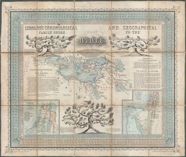
Leonard's Chronological and Geographical Family Guide to the Holy Bible.
sold
- Digital Map Information
- Suitable for large format printing
- DPI: 300
- File Size: 27.13 MB
- File Type: ZIP / TIFF
- ICC color profile embedded
- Delivered instantly via download link
A charming c. 1850 map, chart, and chronological guide to the Holy Land issued by C. W. Leonard. Following the schemata devised by Bishop Ussher of Ireland this chart illustrates the history of the Bible from October 23, 4004 BC, the supposed ... (more details)
Spectacular 19th century hand drawn Celestial map.

[Celestial Map] Untitled.
sold
- Digital Map Information
- Suitable for large format printing
- DPI: 300
- File Size: 8.71 MB
- File Type: ZIP / TIFF
- ICC color profile embedded
- Delivered instantly via download link
One of the most spectacular and whimsical manuscript celestial maps we have ever seen, this is a c. 1823 map of the constellations or northern night sky. Centered the star Polaris, or Northern Star, this map includes countless finely rendered ... (more details)
Striking 19th century manuscript school-girl map of Asia Minor in Antiquity.

Asia Minor.
sold
- Digital Map Information
- Suitable for large format printing
- DPI: 300
- File Size: 7.76 MB
- File Type: ZIP / TIFF
- ICC color profile embedded
- Delivered instantly via download link
An unusual and beautiful 1823 manuscript map of Asia Minor or what is today Turkey. The map generally follows the historical atlas work of the english cartographer James Wyld however is a fully independent and unique hand rendered production. ... (more details)
Striking 19th century manuscript school-girl map of the Ancient World.
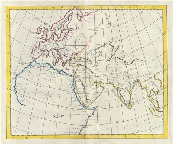
[World as known to the Ancients] Untitled.
$500.00
Acquire
- Digital Map Information
- Suitable for large format printing
- DPI: 300
- File Size: 8.49 MB
- File Type: ZIP / TIFF
- ICC color profile embedded
- Delivered instantly via download link
An unusual and beautiful 1823 manuscript map of The Ancient World, including Asia, europe and Africa. The map generally follows the historical atlas work of the english cartographer James Wyld however is a fully independent and unique hand ... (more details)
Striking 19th century manuscript school-girl map of Ancient Greece.

[Greece] Untitled.
sold
- Digital Map Information
- Suitable for large format printing
- DPI: 300
- File Size: 8.97 MB
- File Type: ZIP / TIFF
- ICC color profile embedded
- Delivered instantly via download link
An unusual and beautiful 1823 manuscript map of Ancient Greece. The map generally follows the historical atlas work of the english cartographer James Wyld however is a fully independent and unique hand rendered production. The manuscript ... (more details)
Striking semi-manuscript school-girl map of America.

[America] Untitled.
sold
- Digital Map Information
- Suitable for large format printing
- DPI: 300
- File Size: 7.91 MB
- File Type: ZIP / TIFF
- ICC color profile embedded
- Delivered instantly via download link
An unusual and beautiful semi-manuscript map of the Western Hemisphere dating to 1823. The printed portions of this map follow the cartography of James Wyld and include the basic outlines of the continents, latitude and longitude lines, ... (more details)
Striking semi-manuscript school-girl map of Asia.
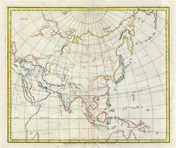
Asia.
sold
- Digital Map Information
- Suitable for large format printing
- DPI: 300
- File Size: 9.54 MB
- File Type: ZIP / TIFF
- ICC color profile embedded
- Delivered instantly via download link
An unusual and beautiful semi-manuscript map of the Asia dating to 1823. The printed portions of this map follow the cartography of James Wyld and include the basic outlines of the countries, latitude and longitude lines, the Arctic ... (more details)
Striking semi-manuscript school-girl map of the Western Hemisphere.

Western Hemisphere.
sold
- Digital Map Information
- Suitable for large format printing
- DPI: 300
- File Size: 8.55 MB
- File Type: ZIP / TIFF
- ICC color profile embedded
- Delivered instantly via download link
An unusual and beautiful semi-manuscript map of the Western Hemisphere dating to 1823. The printed portions of this map follow the cartography of James Wyld and include the basic outlines of the continents, latitude and longitude ... (more details)
Striking semi-manuscript school-girl map of the Eastern Hemisphere.

Eastern Hemisphere.
sold
- Digital Map Information
- Suitable for large format printing
- DPI: 300
- File Size: 7.63 MB
- File Type: ZIP / TIFF
- ICC color profile embedded
- Delivered instantly via download link
An unusual and beautiful semi-manuscript map of the eastern Hemisphere dating to 1823. The printed portions of this map follow the cartography of James Wyld and include the basic outlines of the continents, latitude and longitude ... (more details)
Extremely scarce early nautical chart of the East Indies and Singapore.
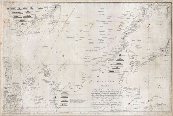
China Sea Sheet 1. To Capt. D. Ross and His Assistants Lieut. P. Maugham, J. Crawford, and J. Houghton, of the Bombay Marine; Who under the auspices of the Honble East India Company, having performed with Arduous Zeal a difficult and dangerous Exploration of the China Sea, so Essential to the safety of Navigation, This Chart Although with an extension of Limits being Chiefly Construction from Their Valuable Surveys, is now Inscribed as a Tribute due to Those Laudable Exertions By their Sincerely Obliged Friend, James Horsburgh.
sold
- Digital Map Information
- Suitable for large format printing
- DPI: 300
- File Size: 41.26 MB
- File Type: ZIP / TIFF
- ICC color profile embedded
- Delivered instantly via download link
An extremely scarce 1842 James Horsburgh nautical chart of parts of the east Indies and Southeast Asia, including Singapore, Malay, Borneo and Cambodia. Centered on northern Borneo, this chart covers from Malay and Singapore to ... (more details)

Folklore and Legends of Our Country.
sold
- Digital Map Information
- Suitable for large format printing
- File Size: 35.1 MB
- File Type: ZIP / TIFF
- ICC color profile embedded
- Delivered instantly via download link
An appealing and colorful pictorial map of the United States illustrated with our national folklore and legends. Recognizable figures include Paul Bunyan and his great Blue Ox, Long Jon Silver, Moby Dick, Jonny Appleseed, the ... (more details)
A fine Tokugawa Period map of Edo or Tokyo, Japan.
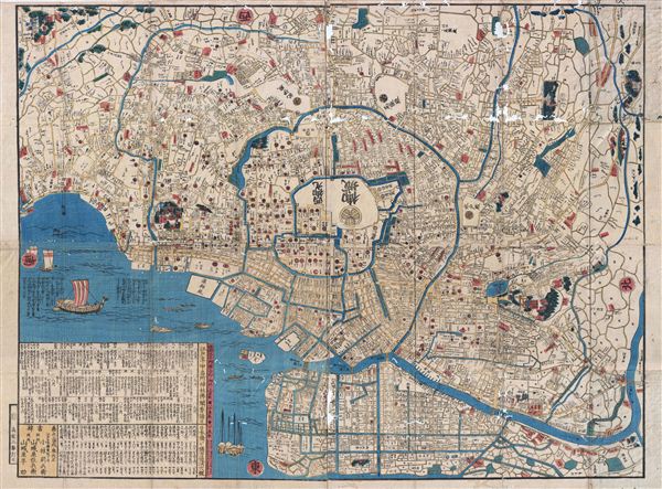
Edo.
sold
- Digital Map Information
- Suitable for large format printing
- DPI: 300
- File Size: 49.19 MB
- File Type: ZIP / TIFF
- ICC color profile embedded
- Delivered instantly via download link
This extraordinary item is a hand colored Tokugawa Period woodcut map of edo, or Tokyo, Japan by Sanyu Takashiba. Impressive size and detail, this map is oriented to the east. The map shows the land tenures of various daimyo ... (more details)
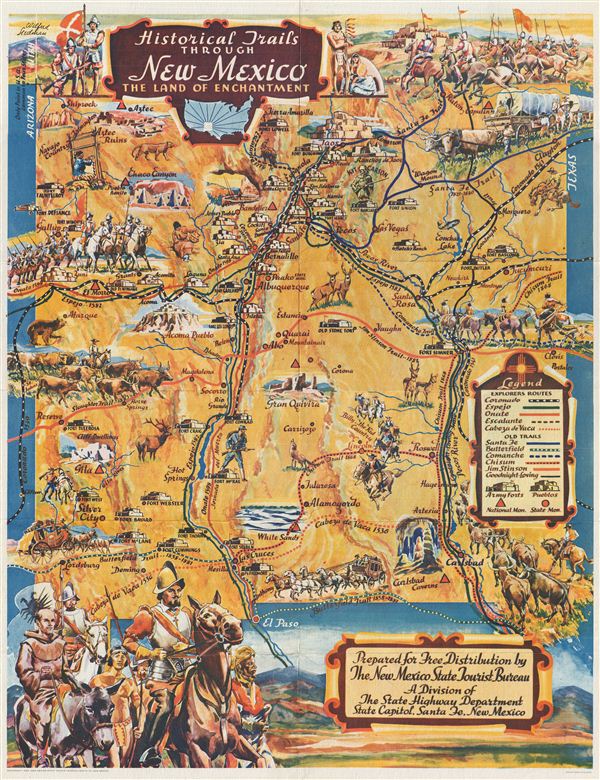
Historical Trails Through New Mexico The Land of Enchantment.
sold
- Digital Map Information
- Suitable for large format printing
- File Size: 17.95 MB
- File Type: ZIP / TIFF
- ICC color profile embedded
- Delivered instantly via download link
An extraordinary example of Wilfred Stedman's beautifully illustrated 1940 map of the historical trails through New Mexico. The map covers New Mexico from Shiprock to el Paso. Notes the only point in the United States ... (more details)
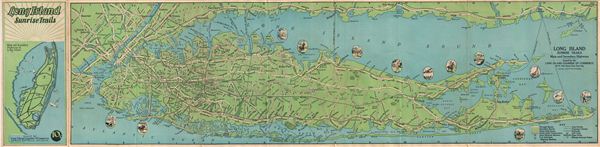
Long Island Sunrise Trails.
sold
- Digital Map Information
- Suitable for large format printing
- File Size: 10.7 MB
- File Type: ZIP / TIFF
- ICC color profile embedded
- Delivered instantly via download link
A beautiful example of Rand McNally's 1928 map of the Long Island Sunrise Trails. This folding map coves Long Island from Staten Island to Montauk Point in Long Island and includes Manhattan, and parts of adjacent ... (more details)
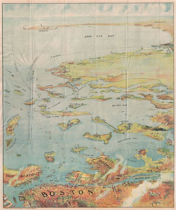
Bird's Eye View of Boston Harbor and South Shore to Provincetown Showing Steamboat Routes.
sold
- Digital Map Information
- Suitable for large format printing
- File Size: 14.08 MB
- File Type: ZIP / TIFF
- ICC color profile embedded
- Delivered instantly via download link
A remarkable chromolithograph map and view of Boston Harbor from Boston to Provincetown. Includes all of Cape Cod Bay, Quincy Bay and Dorchester Bay with the communities of Boston, east Boston, South Boston, ... (more details)