

British Provinces Western Portion (Canada). British Provinces Eastern Portion (Canada).
sold
- Digital Map Information
- Suitable for large format printing
- File Size: 6.39 MB
- File Type: ZIP / TIFF
- ICC color profile embedded
- Delivered instantly via download link
A rare example of Colton's 1858 map of the western and eastern portions of the British Provinces (Canada). Divided into two maps, the upper map covers Canada West and part of Canada east including the Great Lakes of Superior, Huron, Michigan, erie and Ontario. ... (more details)
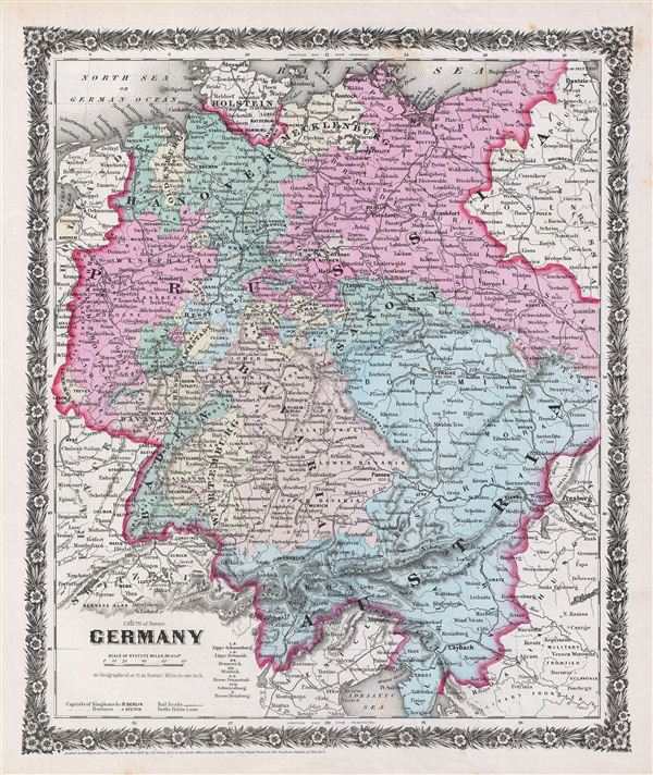
Germany.
sold
- Digital Map Information
- Suitable for large format printing
- File Size: 6.65 MB
- File Type: ZIP / TIFF
- ICC color profile embedded
- Delivered instantly via download link
A rare example of Colton's 1858 map of the Germany. The map covers Germany from the Baltic Sea to the Adriatic Sea and includes Hanover, Mecklenburg, Prussia, Baden, Bavaria, Wurtemburg, Saxony and Austria. This beautiful hand colored map is a copper plate ... (more details)

Europe.
sold
- Digital Map Information
- Suitable for large format printing
- File Size: 5.73 MB
- File Type: ZIP / TIFF
- ICC color profile embedded
- Delivered instantly via download link
A rare example of Colton's 1858 map of the europe. The map covers the continent in its entirety from the Atlantic to the Caspian Sea and from the Arctic Ocean to the Mediterranean Sea. It also details Iceland and parts of Turkey in Asia. Shows the Austrian ... (more details)
1858 Colton Map of the World Showing the Geographical Distribution of the Animal Kingdom and Illustr

The World Showing the Geographical Distribution & Range of the Principal members of the Animal Kingdom. The World Illustrating the Productive Industry of Various Countries, & Exhibiting the Principal Features of Commerce and Navigation.
sold
- Digital Map Information
- Suitable for large format printing
- File Size: 5.35 MB
- File Type: ZIP / TIFF
- ICC color profile embedded
- Delivered instantly via download link
A rare example of Colton's 1858 map of the world, divided into two parts. The upper map shows the geographical distribution and range of the principal members of the animal kingdom, with an inset of a bird map. The lower map illustrates the productive ... (more details)

Illinois, Iowa and Missouri.
sold
- Digital Map Information
- Suitable for large format printing
- File Size: 5.9 MB
- File Type: ZIP / TIFF
- ICC color profile embedded
- Delivered instantly via download link
A rare example of Colton's 1858 map of Illinois, Iowa and Missouri. The map covers the entire states of Illinois, Iowa and Missouri showing parts of Minnesota, Nebraska, Kansas is detail. The map also shows parts of Arkansas, Tennessee, Kentucky, ... (more details)
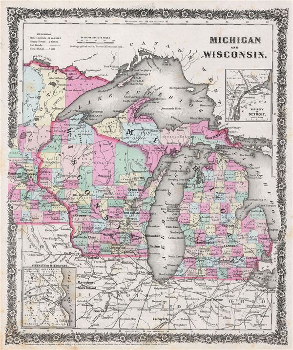
Michigan and Wisconsin.
sold
- Digital Map Information
- Suitable for large format printing
- File Size: 6.59 MB
- File Type: ZIP / TIFF
- ICC color profile embedded
- Delivered instantly via download link
A rare example of Colton's 1858 map of Michigan and Wisconsin. Centered on Lake Michigan, the map covers the states of Michigan and Wisconsin showing parts of Minnesota, Iowa, Illinois, Indiana and Ohio. Also shows Lake Superior, Lake Michigan, ... (more details)

Southern Syria, or the countries watered by the Jordan.
sold
- Digital Map Information
- Suitable for large format printing
- DPI: 300
- File Size: 4.83 MB
- File Type: ZIP / TIFF
- ICC color profile embedded
- Delivered instantly via download link
This is a rare example of Aaron Arrowsmith's 1828 map of Southern Syria and the countries watered by the River Jordan. Centered on the River Jordan, the map covers the course of the river from Lake Hula to the Dead Sea and shows the Ottoman ... (more details)

Central Italy.
sold
- Digital Map Information
- Suitable for large format printing
- DPI: 300
- File Size: 4.27 MB
- File Type: ZIP / TIFF
- ICC color profile embedded
- Delivered instantly via download link
This is a rare example of Aaron Arrowsmith's 1828 map of Central Italy. The map covers the central part of the Italy which includes parts of Tuscany, State of the Church and the Kingdom of Naples. The regional boundaries are colored and ... (more details)
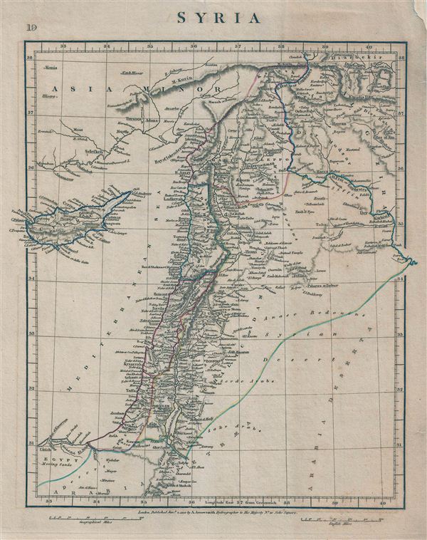
Syria.
sold
- Digital Map Information
- Suitable for large format printing
- DPI: 300
- File Size: 4.95 MB
- File Type: ZIP / TIFF
- ICC color profile embedded
- Delivered instantly via download link
This is a rare example of Aaron Arrowsmith's 1828 map of Syria. Centered on Syria, covers from Asia Minor to Egypt and Cyprus. During this time in history, Syria was part of the Ottoman Empire and was largely ignored by world affairs. ... (more details)
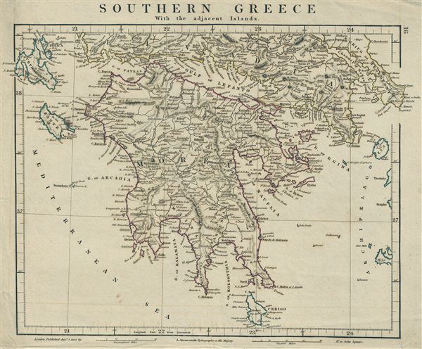
Southern Greece With the adjacent Islands.
sold
- Digital Map Information
- Suitable for large format printing
- DPI: 300
- File Size: 4.79 MB
- File Type: ZIP / TIFF
- ICC color profile embedded
- Delivered instantly via download link
This is a rare example of Aaron Arrowsmith's 1828 map of Southern Greece and adjacent Islands. The map covers the entire Peloponnese peninsula (known as 'Morea' in the Ottoman era) including the Islands of Cerigo, Zante, Ceppalonia and ... (more details)
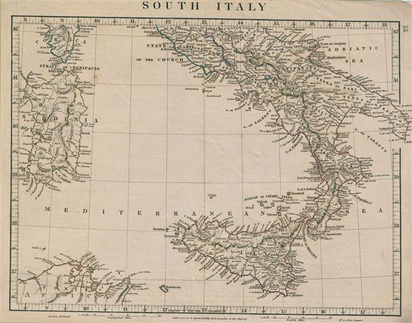
South Italy.
sold
- Digital Map Information
- Suitable for large format printing
- DPI: 300
- File Size: 4.3 MB
- File Type: ZIP / TIFF
- ICC color profile embedded
- Delivered instantly via download link
This is a rare example of Aaron Arrowsmith's 1828 map of Southern Italy. The map covers the Kingdom of Naples (a common reference for the 'Kingdom of the Two Sicilies'), which extended from the Papal States south to include all of ... (more details)
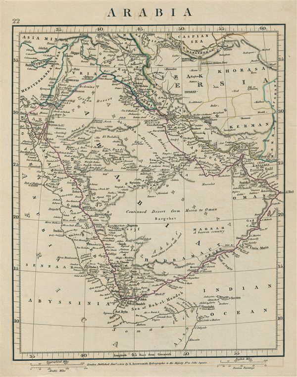
Arabia.
sold
- Digital Map Information
- Suitable for large format printing
- DPI: 300
- File Size: 4.34 MB
- File Type: ZIP / TIFF
- ICC color profile embedded
- Delivered instantly via download link
This is a rare example of Aaron Arrowsmith's 1828 map of Arabia. Centered on the Arabian Desert, the map covers from Caspian Sea and Syria to the Indian Ocean and Somalia. It shows Arabia and Parts of Persia, Syria and ... (more details)

North Italy.
sold
- Digital Map Information
- Suitable for large format printing
- DPI: 300
- File Size: 4.87 MB
- File Type: ZIP / TIFF
- ICC color profile embedded
- Delivered instantly via download link
This is a rare example of Aaron Arrowsmith's 1828 map of Northern Italy. The map covers the island of Corsica and Northern Italy, depicting the territories of Tuscany, Modena, Parma, Kingdom of Sardinia, Lombardy, Venice ... (more details)

Asia Minor.
sold
- Digital Map Information
- Suitable for large format printing
- DPI: 300
- File Size: 4.86 MB
- File Type: ZIP / TIFF
- ICC color profile embedded
- Delivered instantly via download link
This is a rare example of Aaron Arrowsmith's 1828 map of Asia Minor. This map covers from the Grecian Archipelago to Syria and from the Black Sea to the Mediterranean Sea and Cyprus. The map shows many colonies under ... (more details)

Clason's Guide Map of Arizona.
sold
- Digital Map Information
- Suitable for large format printing
- File Size: 13.89 MB
- File Type: ZIP / TIFF
- ICC color profile embedded
- Delivered instantly via download link
This is a fine example of the Guide Map of Arizona by G. S. Clason. Issued to accompany Clason's Arizona Green Guide , this folding map covers the entire state of Arizona. A legend near the bottom of the map shows the ... (more details)
Monumental map of Paris in nine panels.
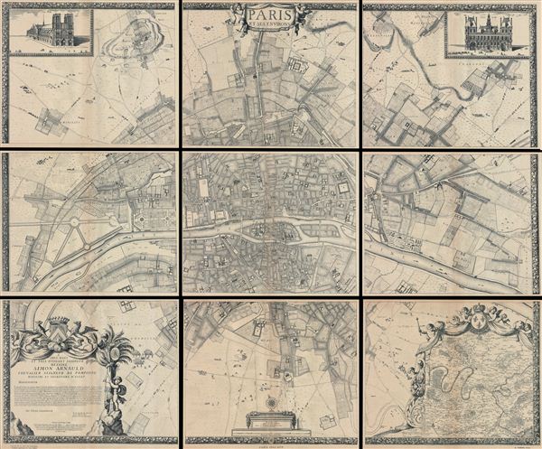
Paris et ses Environs.
sold
- Digital Map Information
- Suitable for large format printing
- File Size: 13.02 MB
- File Type: ZIP / TIFF
- ICC color profile embedded
- Delivered instantly via download link
A rare example of the c. 1900 reissue of Albert Jouvin de Rochefort's monumental 1675 nine panel map of Paris. Rochefort's plan of Paris was influential due to its illustration of the rapidly expanding urban center ... (more details)
The most important and influential 18th century Colonial Era map of New England.

A Map of the most Inhabited part of New England containing the Provinces of Massachusets Bay and New Hampshire, with the Colonies of Connecticut and Rhode Island, divided into Counties and Townships: The whole composed form Actual Surveys and its Situation adjusted by Astronomical Observations.
sold
- Digital Map Information
- Suitable for large format printing
- Full resolution TIFF file
- ICC color profile embedded
- Delivered instantly via download link
A highly significant map, this is the 1774 'Jefferys' Map' of the Most Inhabited Part of New england . Centered on the Massachusetts Bay Colony, this map covers from Long Island to Lake Champlain and from the Hudson ... (more details)
Offers ancient place names.

Johnson's Roman Empire, Imperium Romanorum Latissime Patens.
sold
- Digital Map Information
- Suitable for large format printing
- File Size: 12.12 MB
- File Type: ZIP / TIFF
- ICC color profile embedded
- Delivered instantly via download link
An attractive example of A. J. Johnson and Ross C. Browning's 1861 map of the Roman empire. Covers all of europe as well as much of the Middle east, Persia and parts of North Africa. Presents the Roman empire ... (more details)
One of the earliest American maps to depict Lake Victoria at the source of the White Nile.

Johnson's Africa.
sold
- Digital Map Information
- Suitable for large format printing
- File Size: 16.71 MB
- File Type: ZIP / TIFF
- ICC color profile embedded
- Delivered instantly via download link
An attractive example of A. J. Johnson and Ross C. Browning's 1862 map of Africa. This rare map appeared only in the earliest three editions of Johnson's Atlas, 1861-63. Includes all of Africa as well as ... (more details)
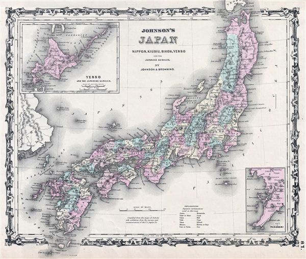
Johnson's Japan Nippon, Kiusiu, Sikok, Yesso and the Kuriles.
sold
- Digital Map Information
- Suitable for large format printing
- File Size: 8.86 MB
- File Type: ZIP / TIFF
- ICC color profile embedded
- Delivered instantly via download link
A very nice first edition example of A. J. Johnson and Ross C. Browning's 1861 map of Japan. Covers the Japanese Islands from Kyushu north to Yesso (Hokkaido). Offers considerable detail with color ... (more details)