
1971 Abdullah / De Agostini Arabic Wall Map of Abu Dhabi


This item has been sold.
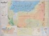
أبوظبي خريطة طبيعية / [Abu Dhabi Physical Map].
أقدم خريطة لأبو ظبي بعد الاستقلال.
أقدم خريطة لأبو ظبي بعد الاستقلال.
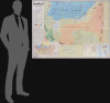
هذه خريطة كبيرة الحجم باللغة العربية لأبوظبي وضواحيها، أعدها محمد مرسي عبد الله، تعود إلى عام ١٩٧١ تقريبًا. تُعدّ هذه الخريطة أقدم خريطة رسمية لأبوظبي ككيان مستقل بعد الاستعمار، وكعاصمة لدولة الإمارات العربية المتحدة.نظرة عن قرب
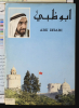
تغطي الخريطة الملونة أبوظبي (مظللة باللون الأحمر، أعلى اليمين) ومعظم الإمارات العربية المتحدة، من قطر غربًا إلى الشارقة شرقًا. في الخليج العربي، يشير التظليل الأرجواني إلى مناطق صيد اللؤلؤ، وهي الصناعة الرئيسية في هذه المنطقة قبل اكتشاف النفط. ويُستخدم تظليل إضافي للإشارة إلى الارتفاعات والواحات (الأخضر). يقدم شرحٌ شامل على اليسار شرحًا لتمثيل التضاريس والممرات المائية ومعالم مثل المستوطنات والطرق والموانئ والمطارات وحقول النفط وخطوط الأنابيب. كما أُشير إلى المواقع الأثرية، التي اهتم بها عبد الله بشكل خاص.أسفل الشرح يوجد قسم من النص بعنوان "النفط في أبو ظبي" (النفط في أبو ظبي) يقدم تاريخًا لاستكشاف النفط واستغلاله في المنطقة، من الجهود الأولى في أواخر الثلاثينيات إلى عمليات الحفر التي بدأت في فبراير 1970 من قبل شركة الشرق الأوسط للنفط، وهي اتحاد ياباني بقيادة مجموعة ميتسوبيشي. يقدم شريط نصي آخر على طول الجانب الأيمن من الخريطة تفاصيل جغرافية عن أبو ظبي ومنطقتها وجزرها المكونة وسكانها والعائلة المالكة وما إلى ذلك. تظهر أربع خرائط مدمجة في الأسفل، تركز على امتيازات النفط (مظللة بالألوان حسب الشركة) وقرى واحات ليوا والعين وضواحيها وجزيرة/مدينة أبو ظبي نفسها. يتضمن الغلاف صورة للشيخ زايد بن سلطان آل نهيان (1918-2004)، حاكم أبو ظبي وأول رئيس لدولة الإمارات العربية المتحدة.
أبو ظبي وتأسيس دولة الإمارات العربية المتحدة
في منتصف القرن العشرين، كانت أبوظبي واحدة من عدة إمارات متصالحة على طول ساحل الخليج العربي تحت الحماية البريطانية، وهي حالة تعود إلى أوائل القرن التاسع عشر عندما سعت بريطانيا إلى تأمين الطرق البحرية إلى الهند (من الناحية الفنية، كانت الولايات جزءًا من إقامة شركة الهند الشرقية في الخليج العربي ثم الراج، وكانت الروبية الهندية هي العملة الفعلية بين الأقاليم). حوّل اكتشاف النفط في عام 1959 أبوظبي من مجتمع فقير يعتمد على صيد اللؤلؤ والتجارة إلى دولة ذات أهمية اقتصادية وسياسية متزايدة. في عام 1968، عندما أعلنت بريطانيا عن نيتها الانسحاب من "شرق السويس" بحلول عام 1971، تولى حاكم أبوظبي، الشيخ زايد، زمام المبادرة في تنظيم إطار سياسي جديد لضمان الاستقرار بعد انتهاء الإشراف البريطاني. دخل زايد في مفاوضات مع حكام الإمارات المتصالحة الأخرى، بالإضافة إلى البحرين وقطر، لتشكيل اتحاد يوازن بين الحكم الذاتي المحلي والأمن الجماعي والتنمية.تُوجت هذه الجهود بإنشاء دولة الإمارات العربية المتحدة في 2 ديسمبر 1971، بعد يوم واحد من الاستقلال الرسمي عن بريطانيا، عندما اتحدت أبوظبي وخمس إمارات أخرى (دبي والشارقة وعجمان وأم القيوين والفجيرة) رسميًا، مع انضمام رأس الخيمة في أوائل عام 1972. أصبحت أبوظبي، أكبر وأغنى إمارة، عاصمة الاتحاد الجديد، واختير الشيخ زايد أول رئيس له. أسس دستور الإمارات العربية المتحدة نظامًا اتحاديًا حافظ على سيادة كل إمارة مع تركيز المجالات الرئيسية مثل الدفاع والسياسة الخارجية والتنسيق الاقتصادي. وفرت ثروة أبوظبي النفطية وقيادة زايد الأساس المالي والسياسي لاستقرار الاتحاد المبكر وتحديثه السريع.
تاريخ النشر والتعداد
أعد هذه الخريطة محمد مرسي عبد الله، مستفيدًا من عمل سابق قام به فيديريكو دي أغوستيني، من عائلة أغوستيني لرسامي الخرائط وناشريها. هذه الخريطة غير مؤرخة، وفي قوائم الكتالوج، يرجع تاريخها إلى أي مكان بين عامي 1969 و1973. تشير سيرة عبد الله الذاتية إلى أن الخريطة أُعدت على مدار عدة أشهر، ومن المرجح أنها صدرت بالتزامن مع استقلال أبوظبي وتأسيس دولة الإمارات العربية المتحدة في أوائل ديسمبر 1971. هذه النسخة العربية من الخريطة نادرة للغاية، حيث لا تُدرج إلا ضمن مقتنيات مكتبة الكونجرس وجامعة كاليفورنيا، بيركلي، وجامعة إكستر (ويُفترض أن المكتبة الوطنية والأرشيف في الإمارات العربية المتحدة تحتفظ أيضًا بمثال)، بينما النسخة الإنجليزية ("خريطة أبوظبي المادية"، OCLC 5569784) أكثر انتشارًا.Cartographers
Mohamed Morsi Abdullah (December 18, 1929 - October 4, 2005; محمد مرسي عبد الله) was an Egyptian-Emirati historian and cartographer who was one of the earliest social scientists in the United Arab Emirates. He was born in Beni Suef, Egypt to a middle-class family, with his father serving as a police officer and later a government administrator and his mother coming from an esteemed family that was descended from the Prophet Mohammed (thus Abdullah was sometimes known as Sharif Mohamed Morsi Abdullah). Abdullah enrolled at Cairo University as an engineer, but soon switched to the liberal arts, focusing on history. After graduation, he worked in the tourism sector and as a teacher in several countries, eventually becoming a high school principal in Doha, Qatar. Abdullah became convinced that Arabs needed to write their own history rather than leave the task to Western historians, and thus he earned a master's degree in at the University of Cairo in 1965 with a thesis on Saudi-Omani relations, utilizing British, French, and Ottoman archives. Due to his expertise on international relations on the Arabian Peninsula, he was recruited to work in a Documents and Research Bureau (مكتب الوثائق والدراسات, forerunner to the U.A.E. National Archives), where he prepared the first official maps of Abu Dhabi and the United Arab Emirates. Abdullah was encouraged by Zayed bin Sultan Al Nahyan, the ruled of Abu Dhabi and the first President of the United Arab Emirates, to pursue a doctoral degree at the University of Cambridge, which he completed in 1975. Soon before completing his degree, Abdullah was appointed the Director General of the Documents and Research Bureau, a position he held until 1999. Abdullah was an active historian who published several books on the history and foreign relations of the United Arab Emirates and Abu Dhabi specifically. Further Details...
Giovanni De Agostini (August 23, 1863 - November 21, 1941) was an Italian cartographer and publisher. In 1901, he founded the Istituto Geografico Italiano del dott. G. De Agostini and C. in Rome. In addition to school atlases, the group published the Calendario Atlante de Agostini, a compact yearbook, calendar, and atlas, which was highly successful. In 1908, the company moved to Novara in Piemonte, in large part to be closer to Germany, from where they sourced their equipment. In 1919, the company was acquired by Marco Boroli and Cesare Rossi and began to expand more rapidly, including the installation of Italy's first rotogravure printing press and the publication of the esteemed Grande Atlante Geografico, though it retained its name and identity. After De Agostini's death, the Istituto geografico and publishing house he had founded continued to use his name. His younger brother, Alberto Maria de Agostini (1883 - 1960) was a Salesian priest and polymath who lived most of his life in Tierra del Fuego and Patagonia, contributing greatly to the geographic and ethnographic knowledge of the region. Giovanni's son, Federico De Agostini (1905 - 1960), began working at the firm in 1927 and was known for his own discoveries in South America as well as several important maps, textbooks, encyclopedias, and murals, including some in Arabic. Another of Agostini's sons, Giovanni De Agostini, Jr., became especially adept at speaking and reading Arabic and was an expert on the history of Islam. In the years after the Second World War, the company retained the name Agostini but was fully taken over by the Boroli family. It diversified into publishing school textbooks, books on art, children's books, encyclopedias, and more. In subsequent decades, it became one of the best known Italian publishing houses and expanded throughout Europe to become a multifaceted international holding company with publishing, cartographic, arts, media, gaming, and asset management subsidiaries. Further Details...
Condition
Very good. Slight wear at a few old fold intersections, with slight loss at a couple. A few very minor closed spits, stabilized on verso with archival tissue.
References
OCLC 5569783, 1088540361.