
1968 Brown / Jackson Bilingual Map of the Southern Hijaz, incl. Mecca and Jeddah


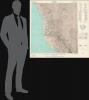
Geographic Map of the Southern Hijaz Quadrangle, Kingdom of Saudi Arabia Miscellaneous Geologic Investigations Map I-210B. / [خريطة جغرافية للوحة الحجاز الجنوبي بالمملكة العربية السعودية ابحاث جيولوجية مختلفة ؛ خريطة رقم I 210B].
واحدة من أنجح الشراكات في التاريخ.
واحدة من أنجح الشراكات في التاريخ.
خريطة مميزة للجزء الجنوبي من الحجاز، المملكة العربية السعودية، بما في ذلك مكة المكرمة. أعد هذه الخريطة جلين ف. براون وروي أو. جاكسون من هيئة المساحة الجيولوجية الأمريكية عام ١٩٥٨ لصالح شركة أرامكو السعودية للنفط، ثم حُدِّثت بمعلومات حتى عام ١٩٦٨. تُمثل هذه الخريطة جزءًا من شراكة مميزة بين هيئة المساحة الجيولوجية الأمريكية وأرامكو، ساهمت في جعل الأخيرة من أكبر الشركات وأكثرها ربحية في العالم.نظرة عن قرب
تشمل التغطية الجزء الجنوبي من الحجاز من منطقة جنوب المدينة المنورة (المسافات المشار إليها على طول الهامش العلوي) جنوبًا إلى مدينة الليث الساحلية والمنطقة الجبلية حول الحجرة، بما في ذلك مدينة مكة المكرمة ومدينتي جدة والطائف (المعروفة بالعاصمة الصيفية غير الرسمية للمملكة). تبرز جبال الحجاز بشكل بارز، حيث تمتد من الشمال إلى الجنوب موازية لساحل البحر الأحمر. كل شيء على الخريطة مطبوع باللغتين العربية والإنجليزية، بما في ذلك اسمي جاكسون وبراون (وضعها جلين براون وروي جاكسون). يوفر أسطورة موسعة في أعلى اليمين معلومات عن الطرق من مختلف الأنواع والجودة (بما في ذلك الطرق "المشكوك في ديمومتها") ومسارات الجمال والآبار ومصادر المياه الأخرى والمناجم وأنواع مختلفة من التضاريس (المشار إليها بالأرقام الرومانية) والآثار والمزيد.هيئة المسح الجيولوجي الأمريكية وأرامكو السعودية
منذ عشرينيات القرن العشرين فصاعدًا، لعب الجيولوجيون الأمريكيون دورًا مهمًا في استكشاف النفط في شبه الجزيرة العربية. مُنحت شركة ستاندرد أويل أوف كاليفورنيا (شيفرون حاليًا) امتيازًا من الحكومة السعودية (التي كانت لا تزال في طور توحيد البلاد) للبحث عن احتياطيات النفط تحت شركة تابعة، وهي شركة كاليفورنيا العربية القياسية للزيت (CASOC)، والتي وظفت جيولوجيين أمريكيين، بمن فيهم قدامى المحاربين في هيئة المسح الجيولوجي الأمريكية. بعد سنوات من البحث دون نجاح يُذكر، وصلت الشركة أخيرًا إلى هدفها في الظهران عام 1938، وهو حدث غيّر تاريخ شبه الجزيرة العربية والعالم بشكل جذري. في عام 1944، غيرت CASOC اسمها إلى شركة الزيت العربية الأمريكية (أو أرامكو)، وازدهرت في فترة ما بعد الحرب. أدى نزاع مع الملك عبد العزيز عام 1950 إلى تقاسم الشركة للأرباح مع الحكومة السعودية. وعلى الرغم من أن اتحاد شركات النفط الأميركية كان يمتلك في البداية شركة أرامكو، فإن ترتيب تقاسم الأرباح حفز كل من الحكومة السعودية والحكومة الأميركية، اللتين تتطلعان إلى دعم الشركات الأميركية وتوفير النفط الرخيص للمستهلكين الأميركيين، على البحث بشكل مستمر عن احتياطيات إضافية واستغلالها.من هذه النقطة، أصبحت هيئة المسح الجيولوجي الأمريكية أكثر مشاركة بشكل مباشر، مستخدمة أحدث التقنيات ومطورة أول خرائط مسح جيولوجي حقيقية لشبه الجزيرة العربية. بين عامي 1950 و1958، أجرى جيولوجيو هيئة المسح الجيولوجي الأمريكية، بالتعاون مع أرامكو والمديرية العامة لشؤون البترول والمعادن السعودية، مسوحات أسفرت عن سلسلة من 42 خريطة ثنائية اللغة للمملكة بمقياس 1:500000، والتي تعد هذه الخريطة واحدة منها. يوجد دليل رئيسي مطبوع على اليمين، يوضح أن كل خريطة طُبعت في نسختين، واحدة بالمعلومات الجغرافية فقط والأخرى بالمعلومات الجغرافية والجيولوجية. وعلى الرغم من أن الدافع الرئيسي كان البحث عن النفط في المقام الأول، إلا أن الخرائط قدمت أيضًا ثروة من المعلومات ومستوى هائل من التفاصيل حول موارد المياه والمعادن، والتي أثبتت أيضًا قيمتها في تطوير الاقتصاد والمجتمع السعودي. وبعد ذلك، وحتى الوقت الحاضر، واصلت هيئة المسح الجيولوجي الأمريكية إجراء أعمال المسح والبحث الحيوية في شبه الجزيرة العربية، بما في ذلك المساعدة في إنشاء هيئة المساحة الجيولوجية السعودية (هيئة المساحة الجغرافية السعودية) في عام 1999.
تاريخ النشر والتعداد
أعد هذه الخريطة جلين ف. براون وروي أو. جاكسون من هيئة المسح الجيولوجي الأمريكية عام ١٩٥٨، وهذه الخريطة هي طبعة ثانية مُحدثة طُبعت عام ١٩٦٨. (صدرت طبعة ثالثة عام ١٩٦٩). تُمثل الخريطة، بطبعاتها المختلفة، تمثيلاً جيداً في المجموعات المؤسسية. تحتفظ سبع مؤسسات في مكتبة OCLC بالطبعة الحالية، لكنها نادرة جداً في السوق.Cartographers
Glen Francis Brown (December 14, 1911 - February 27, 2001) was an American geologist at the U.S. Geological Survey who is best known for leading a years-long USGS effort to survey the geology, hydrology, and mineral resources of the Kingdom of Saudi Arabia, concurrent with most of the Arabian Peninsula. Brown was born in Graysville, Indiana and attended college at New Mexico School of Mines before receiving a master's degree and doctorate at Northwestern University. He began working with the USGS in 1938 and was posted to projects in different parts of the U.S. before being selected to explore water resources on the Arabian Peninsula, the result of a request by King Abdulaziz to the USGS. He undertook further explorations in Saudi Arabia on agricultural possibilities and geologic formations before completing his doctorate and being posted to Thailand for a geological and mineral reconnaissance. But in 1950, Brown was requested by King Abdulaziz to return to Saudi Arabia to lead an ambitious project, in conjunction with the Arabian-American Oil Company (Aramco), to survey the water and mineral resources of the entire kingdom. These maps would play a key role in the future economic and infrastructural development of the kingdom. Brown remained in Saudi Arabia for most of the following twenty years, leading the joint USGS-Saudi project until 1969, and remained a consultant residing in Jeddah until returning to the U.S. in 1972 and retiring, though remaining a key expert on Saudi Arabia's geology, geography, and tectonics. Further Details...
The United States Geological Survey (March 3, 1879 - present), commonly abbreviated USGS, is an American federal scientific bureau and civilian mapping agency within the Department of the Interior, established in Washington, D.C., and subsequently headquartered in Reston, Virginia. Congress created the Survey to classify public lands and investigate the geological structure, mineral resources, and products of the national domain, replacing separate western investigations with a permanent scientific organization. Its first director, Clarence King (1842 - 1901), organized geological investigations and recruited experienced scientists and topographers from earlier federal surveys. Under his successor, John Wesley Powell (1834 - 1902), director from 1881 to 1894, topographic mapping expanded from support for individual geological investigations into a nationwide undertaking. Congressional authorization in 1882 to continue preparation of a geological map of the United States extended the Survey's work into the eastern states, while systematic topographic mapping received authorization in 1884. Henry Gannett (1846 - 1914), the Survey's chief geographer, helped establish enduring methods and standards for this work. Its topographic quadrangles represented terrain through contour lines alongside drainage, settlements, roads, and other features, furnishing a common geographic foundation for scientific investigation and practical land use. During the 20th century, the Survey's mapping evolved from field surveying and compilation toward aerial photography, photogrammetry, and digital geographic information systems. A formal program begun in 1947 to map the conterminous United States at 1:24,000 scale culminated in nationwide coverage in 1992, comprising more than 55,000 maps. The Survey also produced geological and thematic maps and assembled national geographic information. In 2009 it introduced US Topo, a digitally generated successor to its traditional topographic quadrangles. Its continuing cartographic work includes The National Map, digital topographic products, and public access to historical quadrangles, alongside broader investigations of water, ecosystems, mineral and energy resources, and natural hazards. Further Details...
Arabian American Oil Company (Aramco; predecessor established 1933; name used 1944 - 1988) was an American-owned petroleum exploration and production company operating in Saudi Arabia, headquartered in Dhahran from 1952, whose survey departments made substantial contributions to the geographic and geological mapping of the Arabian Peninsula during the mid-20th century. Its origins lay in the petroleum concession granted to Standard Oil Company of California in 1933 and administered through its subsidiary, California Arabian Standard Oil Company. Commercial oil production began at Dammam No. 7 in 1938, and the company adopted the Arabian American Oil Company name in 1944. Standard Oil Company of New Jersey and Socony-Vacuum acquired interests in 1948, broadening its American ownership; its headquarters moved from New York to Dhahran in 1952. Cartographic work developed alongside geological exploration, combining ground reconnaissance, astronomical observations, triangulation, leveling, and aerial photography. Beginning in 1949, aerial mapping supplied the photographic foundation for increasingly systematic geographic coverage, while company surveyors established horizontal and vertical control. Aramco's Arabian Affairs Division also evaluated place names, consulting Saudi informants and working toward consistent Arabic and English nomenclature. In the mid-1950s, Aramco joined the United States Geological Survey in a cooperative mapping program sponsored by the Saudi government and the United States Department of State. The program provided for 21 quadrangles at 1:500,000, with separate geographic and geological versions and bilingual nomenclature. Aramco assumed responsibility for compiling the sedimentary regions, while the Geological Survey principally covered the western Arabian Shield. Geographic sheets appeared from 1956 to 1962 and geological sheets from 1956 to early 1964; the collaboration also produced a preliminary peninsula-wide geographic map in 1958, a revised edition in 1963, and the Geologic Map of the Arabian Peninsula at 1:2,000,000 in 1963. These publications made extensive company exploration data available for scientific and economic use beyond petroleum operations. Saudi government participation in Aramco began in 1973 and reached complete ownership in 1980. In 1988, the newly established Saudi Arabian Oil Company, known as Saudi Aramco, succeeded to Aramco's responsibilities. Further Details...
Condition
Fine. Original folds. Accompanied by original binder.
References
OCLC 78555923.