
Russian Maps (sold)
Russian Cold War plans for a nuclear attack on Phoenix.
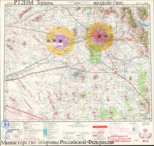
ГЕНЕРАЛЬНЫЙ ШТАБ ФИНИКС. РТ2ПМ Тополь. Воздействие. / GENERAL HEADQUARTERS PHOENIX. RT-2PM-Topol. Impact.
sold
A chilling and thought-provoking 1982 Soviet Cold War map of Phoenix, Arizona, illustrating Russian plans for a nuclear ICBM attack. Two impacts targets are illustrated in manuscript: downtown Phoenix and the Palo Verde Generating Station, one of the largest nuclear power plants in the United States. The map bears the signature of Viktor Chebrikov (Виктор Михайлович Че́бриков; 1923 - 1999), then head of the KGB, as well as stamps showing that it was obtained and translated by American intelligence. (more details)
The most magnificent pictorial map of China ever produced.
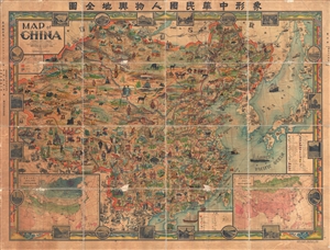
A Map of China. / 象形中華民國人物輿地全圖 / Xiàngxíng Zhōnghuá Mínguó Rénwù Yúdì Quántú (Pictorial Full Map of the People and Geography of the Republic of China.)
sold
- Digital Map Information
- Suitable for large format printing
- File Size: 177.27 MB
- File Type: ZIP / TIFF
- ICC color profile embedded
- Delivered instantly via download link
The most extraordinary pictorial map we have seen to date. A masterpiece, this scarce and enormous lavishly pictorial map of China was compiled in 1931 by John A. Diakoff and drawn by G. Primakoff. The map covers all of China from Kashgar and Yarken to Korea and ... (more details)
Most magnificent pictorial map of China.
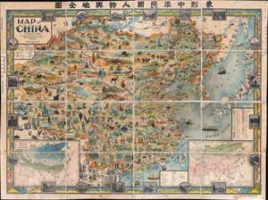
A Map of China. / 象形中華民國人物輿地全圖 / Xiàngxíng Zhōnghuá Mínguó Rénwù Yúdì Quántú (Pictorial Full Map of the People and Geography of the Republic of China.)
sold
- Digital Map Information
- Suitable for large format printing
- Full resolution TIFF file
- ICC color profile embedded
- Delivered instantly via download link
The most extraordinary pictorial map we have seen and the best specifically of China, a masterpiece. This enormous and lavish chromolithograph pictorial map of China was compiled in 1931 by John A. Diakoff, drawn by G. Primakoff, and printed by Yao-Hsiun. The map covers China from Kashgar to Taiwan, including neighboring Korea, Japan, Mongolia, and Nepal. All lands within China are rich in color and detail with countless vignettes illustrating a diversity of plant and animal life, human cultures, architectures, and resources. Text and annotations throughout are in both English and Chinese. Regions outside of China, like Japan, Korea, and India, are also heavily illustrated with vignettes, but are not in color. (more details)
Previously unknown Japanese serio-comic map.
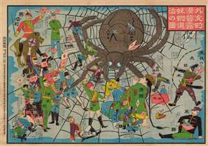
外交的滑稽露蜘蛛退治の圖 / [Image of the Diplomatic Hilarity of Exterminating the Spider].
sold
- Digital Map Information
- Suitable for large format printing
- File Size: 125.97 MB
- File Type: ZIP / TIFF
- ICC color profile embedded
- Delivered instantly via download link
This is a 1904 serio-comic tour de force, with vivid colors and rich symbolism, made by Enomoto Matsunosuke, satirizing the geopolitics of the day in the opening phase of the Russo-Japanese War. While cheering on Japan in the conflict, Enomoto is also having a laugh at the alliances and efforts required to exterminate the 'spider' of Tsarist Russia. This comic was part of an outpouring of popular patriotic images, poetry, songs, and other cultural production in Japan after the start of the war. Enomoto was prescient in his portrayal of the Russian Empire as tottering, beset by domestic unrest and surrounded by unfriendly powers. (more details)
One of the most important maps of Siberia made in Tsarist times.
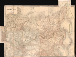
Карта Азіятской Россіи с прилегающими к ней владѣниями / [Map of Asian Russia, with Adjacent Possessions].
sold
- Digital Map Information
- Suitable for large format printing
- Full resolution TIFF file
- ICC color profile embedded
- Delivered instantly via download link
This is an rare and important 1884 Russian-language map of the Russian Empire, focusing on Siberia and the Russian Far East, produced by the Military Topographic Department of the Imperial Army's General Staff. It represents a major advance in detailed geographical and cartographic knowledge of Siberia at a time, when the Tsarist government was increasingly interested in settling colonists and exploiting the resources of the vast region. (more details)
Highpoint of Russian Harbin.
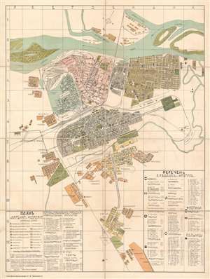
ПЛАНЬ г. ХАРБИНА и ФУДАДЯНА. / Plan of Harbin and Fudadyan.
sold
- Digital Map Information
- Suitable for large format printing
- File Size: 61.88 MB
- File Type: ZIP / TIFF
- ICC color profile embedded
- Delivered instantly via download link
This is a c. 1916 Lev Markovich Abramovich large-scale administrative city plan or map of Harbin (哈尔滨 / Харби́н), China. Composed in art nouveau styled Cyrillic, the map depicts China's most 'Russian' city during the ephemeral period of Russian control between the Russo-Japanese War (1904 - 1905) and Bolshevik Revolution (1917 - 1923). As evidenced by the map's authorship, this was also the highpoint of Judaism in Harbin, then known as the 'Jerusalem of the East'. Harbin Jews, like the mapmaker here, Abramovich, were exiled from Russia, but became influential in Harbin. Orientation is to the northeast, with the Songhua River at top, employing color coding to highlight neighborhoods and an icon system for significant sites, including breweries, banks, consulates, theaters, wells, and government buildings. The all-important railroad lines are illustrated throughout. Although undated, the map can only have been made between 1915 and 1919, reflecting the development of city at that time, as well as the need for a large-scale administrative plan in Russian - as by 1920, Chinese officials had taken over most positions of power and influence and any administrative map would have been in Chinese. (more details)
Soviet Exceptionalism: Denouncing Hunger Abroad, Ignoring Hunger at Home.
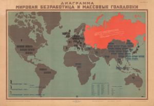
Диаграмма Мировая Безработица и Массовые Голодовки / [Chart of Global Unemployment and Mass Famines].
sold
- Digital Map Information
- Suitable for large format printing
- File Size: 62.35 MB
- File Type: ZIP / TIFF
- ICC color profile embedded
- Delivered instantly via download link
A unique survivor, this is the only known example of this 1931 IZOSTAT Soviet Exceptionalism propaganda poster map of the world presenting the Soviet Union as an exception in a world beset by hunger and unemployment. Produced during the Great Depression (1929 - 1939), it was meant to tout the benefits of Stalin's intensive collectivization and industrialization drive (First Five-Year Plan, 1928-1932), which itself caused widespread famine, particularly in Ukraine. The producer, IZOSTAT was a propaganda arm of the U.S.S.R. government focused powerful persuasive infographics. (more details)
Early detailed Russian map of Asia, including Maritime Southeast Asia.
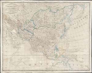
генеральная карта Азіи : изданная По новейшим известиям / [General Map of Asia: Published according to the Latest News].
sold
- Digital Map Information
- Suitable for large format printing
- DPI: 600
- File Size: 115.83 MB
- File Type: ZIP / TIFF
- ICC color profile embedded
- Delivered instantly via download link
This is a unique 1833 Russian-language map of Asia, most likely produced by the Russian Military Topographic Depot (Военно-топографическом депо). It represents an important advance in Russian geographic knowledge, particularly of Maritime Southeast Asia and Australia. (more details)
Cosmopolitan geographical eduction for Russian youth.
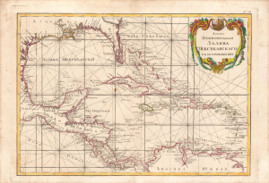
Карта Земноводная Залива Мексиканского / [Terrestrial and Maritime Map of the Gulf of Mexico].
sold
- Digital Map Information
- Suitable for large format printing
- DPI: 600
- File Size: 33.79 MB
- File Type: ZIP / TIFF
- ICC color profile embedded
- Delivered instantly via download link
This is a fascinating 1793 Russian-language map of the West Indies, Gulf of Mexico, Florida, and the Caribbean produced for the 'New Atlas' (Novyy Atlas / Новый атлас), an important work that made the latest French cartography available to a Russian audience. It depicts the Caribbean with portions of North, Central, and South America, and also incorporates notation typical of nautical charts. (more details)
Cold War secrecy, espionage, and the Olympics.
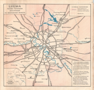
Схема режима разъездов иностранцев по Московской области / [Plan of the Travel Regime for Foreigners in Moscow Oblast].
sold
A remarkable 'classified' map illustrating the logistics surrounding the 1980 Moscow Summer Olympic Games, and showcasing fear of the espionage and general secrecy that marked Cold War foreign relations. This map indicates areas of Greater Moscow (including portions of Moscow Oblast) designated as restricted to foreigners. It was almost certainly produced by the Central Taxi Control Room, which oversaw state-owned taxi companies operating in and around Moscow. (more details)
50th anniversary of the Russian Revolution.
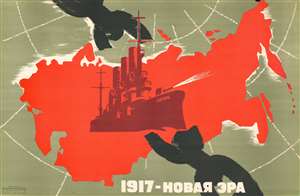
This is a c. 1967 Vorobyov Soviet propaganda broadside map of the Soviet Union created to celebrate the 50th anniversary of the Russian Revolution (1917 - 1923). Superimposed upon a red (Soviet) map of Russia, the Cruiser Aurora (АВРОРА) takes center stage as it blasts through through a massive black chain representing the repressive Tzarist Old Regime. Text along the bottom declares '1917 - New Era'. (more details)
Soviet Map of the U.S. Capital.
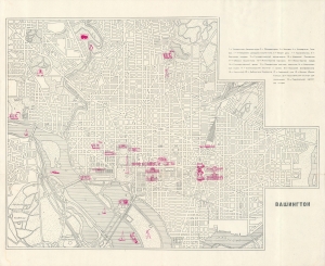
An intriguing c. 1960 Russian-language map of Washington, D.C. The origin of the map is unclear, but it may have been produced to coincide with Nikita Khrushchev's visit to the United States in September 1959, which began with a sojourn in the nation's capital. (more details)
Soviets Tour New York.
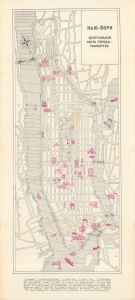
Нью-Йорк, центральная часть города - Манхэттен / [New York, Central Part of the City - Manhattan].
sold
A mysterious c. 1960 Russian-language map of Manhattan, New York City. The origin of the map is unclear, but it may have been produced to coincide with Nikita Khrushchev's visit to the United States, including a stop in New York, in September 1959. (more details)
Russian map of North American issued at the height of the Cold War.
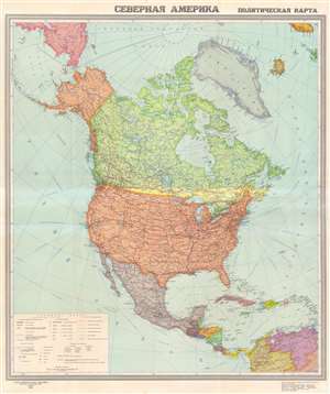
СЕВЕРНАЯ АМЕРИКА ПОЛИТИЧЕСКАЯ КАРТА. / [North America Political Map].
sold
- Digital Map Information
- Suitable for large format printing
- File Size: 89.16 MB
- File Type: ZIP / TIFF
- ICC color profile embedded
- Delivered instantly via download link
This is a 1952 USSR Directorate of Geodesy and Cartography map of North America, in Russian. published in Moscow at the height the Cold War (1947 - 1989). Coverage extends from the North Pole to northern South America including the West Indies. States and provinces throughout the United States, Mexico, and Canada are labeled with major cities identified. Red lines trace major railways and solid blue lines mark 'navigable channels', many of which are large rivers, including the Mississippi. Blue dashed lines follow shipping routes, which are identified by the two ports on either end with distances in both kilometers and miles provided. (more details)
Changing Times in the Ancient City.
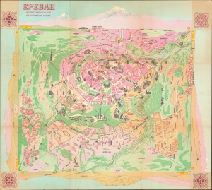
Ереван Иллюстрированная панорамная схема / Ереван туристская схема. [Yerevan Illustrated Panoramic Map / Yerevan Tourist Map].
sold
An impressive and scarce pictorial view of Yerevan, Armenia, published by the Main Administration of Geodesy and Cartography (GUGK) of the Soviet Union in 1985. Though designed for tourists, the map boasts interesting aesthetic qualities while also reflecting changing Soviet policies on national identity and religion in the 1980s. (more details)
Tsar's Palace Precinct at St. Petersburg.
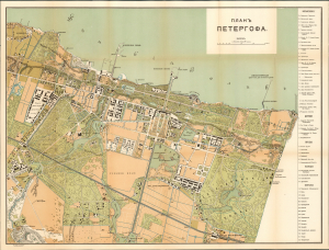
Plan of Peterhof (Планъ Петергофа).
sold
- Digital Map Information
- Suitable for large format printing
- File Size: 31.2 MB
- File Type: ZIP / TIFF
- ICC color profile embedded
- Delivered instantly via download link
This is a 1909, R. Golike Map of the Peterhof, (Петергофа), the opulent imperial residence near St. Petersburg on the Gulf of Finland. The table to the right of the plan lists, in Cyrillic, the names of the Peterhof’s nine palaces, four churches, five ponds, and seventeen fountains. (more details)