
Russian Maps
Cold War Era Soviet Plan to Repel an American Arctic Invasion.

Организация и ведение противодесантной операции на морском побережье во взаимодействии с военно-морским флотом / [Organization and Conduct of an Anti-Amphibious Operation on the Seacoast in Coordination with the Navy].
$7,500.00
Acquire
This is a one-of-a-kind 1952 Cold War Era top-secret report with maps, prepared for the Operations Directorate of the Northern Military District of the Armed Forces of the Soviet Union. The booklet discusses detailed plans to repel a much-feared 'Anglo-American imperialist' invasion of the Soviet Union from the Arctic. It offers unique insight into the Soviet perspective and defensive planning at the height of the Cold War (1947 - 1991). (more details)
Mansucript record of a multinational Survey the Himalayas on the Eve of the Great War.
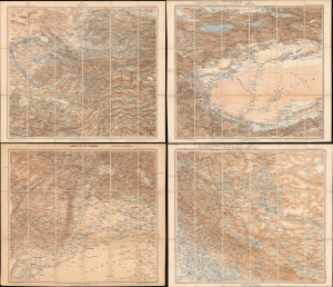
Карта южной пограничной полосы азиатской россіи XIX. ТАШКЕНТЪ ; XX. КАШГАРЪ ; КАБУЛЪ (XXVII) ПЕШАВАРЪ ; XXVIII ЛЕ, СИМЛА, ДЕЛИ/ [Map of the Southern Border Zone of Asiatic Russia XIX. Tashkent ; XX. Kashgar ; Kabul (XVII) Peshawar ; XXVIII Leh, Shimla, Delhi].
$5,000.00
Acquire
- Digital Map Information
- Suitable for large format printing
- Full resolution TIFF file
- ICC color profile embedded
- Delivered instantly via download link
This unique set of four Russian military topographic maps of Central and Inner Asia (each measuring 22.25 x 26.25 in.) bears English-language manuscript notes recording Filippo De Filippi's scientific expedition of 1913 - 1914. The expedition greatly improved scientific mapping of the Karakoram Pass, an ancient caravan route through the Himalayas connecting India and China (more specifically, Leh and Tibet), and attempted to trace the Yarkand River's origins. Though billed as an Italian expedition, it was in fact a multinational team that drew on the expertise of earlier Russian and British explorers, Filippi's own previous surveys in the region, and local Survey of India workers deeply familiar with the region's landscape, languages, and climate. This scientific cosmopolitanism is especially notable given the recent 'Great Game' tensions between Britain and Russia, ameliorated by the early 20th century, and when set against the backdrop of World War I (1914 - 1918), which broke out while the expedition was in the field. The map's annotations, most likely made by Major Henry Wood of the Survey of India, connect Srinagar, Skardu, Leh, the eastern Karakoram, and Kashgar, identifying successive bases for exploration, illustrating the expedition unfolding in situ. (more details)
Russian Interest in the Americas.
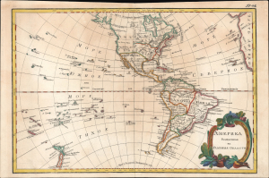
Америка раздѣленная на главныя области / [America Divided into Its Main Regions].
$2,800.00
Acquire
- Digital Map Information
- Suitable for large format printing
- File Size: 11.78 MB
- File Type: ZIP / TIFF
- ICC color profile embedded
- Delivered instantly via download link
This is a 1793 Russian-language map of the Americas produced for the 'New Atlas' (Novyy Atlas / Новый атлас), an important work that made the latest French cartography available to a Russian audience. (more details)
Catch up and overtake America!
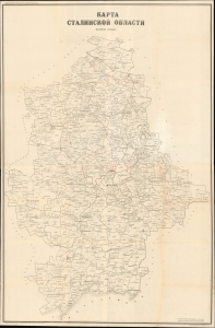
A remarkable find, this is an unrecorded 1958 very large-format (5' x 3') map of Stalino Oblast (Donetsk Oblast) of Soviet Ukraine, produced by the Soviet Ministry of Agriculture. It presents the region during the height of Nikita Khruschev's agricultural modernization and production drive of the late 1950s. Today, this region is contested in an ongoing Russo-Ukrainian War (2014 - present). (more details)
Venice of the North.
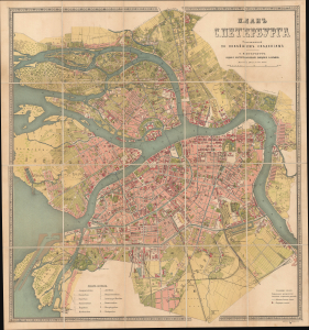
Планъ С. Петербурга составленный по новѣйшимъ свѣденіямъ [План С. Петербурга составленный по новейшим сведениям] / [Plan of St. Petersburg, Compiled Based on the Latest Information].
sold
- Digital Map Information
- Suitable for large format printing
- Full resolution TIFF file
- ICC color profile embedded
- Delivered instantly via download link
This is a c. 1885 chromolithographed folding Russian-language city plan of St. Petersburg, Russia, published by the prolific cartographic establishment of Alexey Ilyin. It captures the imperial capital as it underwent a rebirth, growing into the fifth-largest city in Europe, with modern infrastructure, amenities, and industries. (more details)
Defiance and Development in Warsaw.
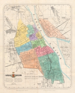
Warszawa Варшава / [Warsaw].
$1,450.00
Acquire
- Digital Map Information
- Suitable for large format printing
- Full resolution TIFF file
- ICC color profile embedded
- Delivered instantly via download link
A scarce 1876 hand-colored lithograph city plan of Warsaw, Poland, in both Polish and Russian, prepared by Feliks Kasprzykiewicz. It is an early edition, likely the first, of Kasprzykiewicz's map of Warsaw, which was revised and reissued in multiple editions into the early 20th century. (more details)
Siberia Revealed: An Empire Mapped at Monumental Scale.
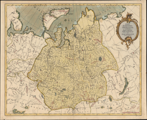
Mappa Gubernii Sibiriensis, continens procincias Toboliensem et Jenisejensem.
$900.00
Acquire
- Digital Map Information
- Suitable for large format printing
- Full resolution TIFF file
- ICC color profile embedded
- Delivered instantly via download link
This is a c. 1775 Ivan Treskot map of the Siberia Governorate, one of the great achievements of 18th-century Russian imperial cartography. Produced as part of the ambitious 1770 - 1776 project undertaken by Treskot and Jacob Friedrich Schmidt to remap Siberia, it synthesizes Russia's rapidly expanding regional geographical knowledge. Stretching from the Arctic Ocean to the Central Asian steppe and from European Russia nearly to Lake Baikal, the map reveals Siberia not as an empty wilderness, but as an increasingly organized imperial landscape structured around immense river systems, fortified settlements, and expanding networks of Russian administration. (more details)
One the most brutal sieges in modern history.
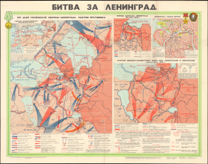
This is a dramatic 1973 wall map recounting the World War II Battle of Leningrad, issued by the Soviet Main Administration of Geodesy and Cartography (GUGK). Presented as a historical map, it is also persuasive, designed to glorify the Russian sacrifices during World War II (1939 - 1945), a major component of Soviet Brezhnev Era propaganda. (more details)
Halting the German Advance into Belgium.
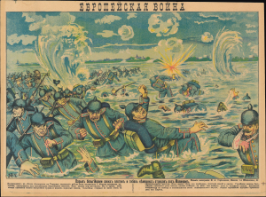
Европейская война Взрыв бельгийцами своих плотин и гибель немецких отрядов под Малином / [European War The Belgians exploding their dams and the death of German troops near Malines.]
$750.00
Acquire
- Digital Map Information
- Suitable for large format printing
- Full resolution TIFF file
- ICC color profile embedded
- Delivered instantly via download link
A dramatic piece of wartime propaganda, this c. 1914 Russian-language lubok illustration celebrates a rare Belgian victory in the opening phase of World War I (1914 - 1818). It was printed by M. A. Streltsova and was the 7th in a series of such propaganda broadsides titled 'European War.' (more details)
Africa as a field of Cold War contention.
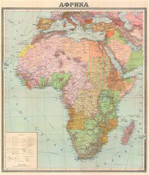
АФРИКА. / [Africa].
$400.00
Acquire
- Digital Map Information
- Suitable for large format printing
- File Size: 85.92 MB
- File Type: ZIP / TIFF
- ICC color profile embedded
- Delivered instantly via download link
This is a c. 1952 Russian Cold War-era wall map of Africa. Dating from the beginning of the age of decolonization, color explain complex colonial claims. Pink marks French territory in West Africa and Madagascar, while green illustrates British territory. Anglo-Egyptian Sudan is filled with green and tan stripes, underlining the 'power-sharing' agreement in then effect. A golden color highlights Portuguese holdings in modern-day Angola and Mozambique. Black dashed lines mark railroads and bright red lines trace highways. (more details)
Commemorating Stalingrad in the Twilight Years of the USSR.
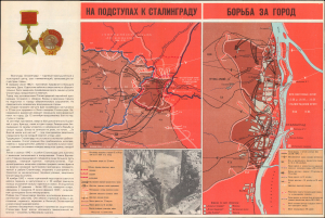
Города - герои Великой Отечественной войны Карты : Волгоград / [Maps of the Hero Cities of the Great Patriotic War : Volgograd]
$250.00
Acquire
This is a 1989 historical map of Volgograd, formerly known as Stalingrad, prepared by the Main Administration of Geodesy and Cartography of the U.S.S.R., better known by the abbreviation of its Russian name as G.U.G.K. It celebrates the costly but heroic Soviet victory over Nazi Germany at the Battle of Stalingrad, the turning point of the war on the Eastern Front and of the entire European theater of World War II (1939-1945). It was also produced at a time when Gorbachev's reforms had allowed for more critical discussion of the war, including the crimes of Stalin and the overwhelming, and in many cases unnecessary, losses suffered by the Soviet people. (more details)