
Cellarius, Andreas (sold)

Andreas Cellarius (1596 - 1665) was a Dutch-German cartographer, mathematician, and astronomer. He was born in Neuhausen (now a part of Worms), and was educated in Heidelberg. Cellarius, being Protestant, may have left Heidelberg in 1618, at the onset of the Thirty Years' War, or slightly later, in 1622, when the city fell to Catholics. His activities are unclear at this time but based on his later works it is conjectured he spent time in Poland where he may have taken work as a military engineer. In 1625. he married Catharina Eltemans in Amsterdam, where he taught Latin. After a brief stay in The Hague, the family moved to Hoorn. From 1637 until his death he was rector of the Hoorn Latin School. Today Cellarius is best known for his Harmonia Macrocosmica of 1660, a major celestial atlas, published in Amsterdam by Johannes Janssonius.
The wheel of the Zodiac in a beautiful example.
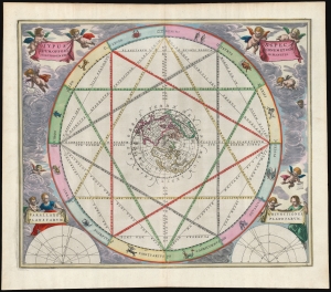
Typus Aspectuum Oppositionum et Conjunctionum Etz In Planetis.
sold
- Digital Map Information
- Suitable for large format printing
- Full resolution TIFF file
- ICC color profile embedded
- Delivered instantly via download link
This beautiful work is Andreas Cellarius' 1660 astrological chart, in its second 1661 edition with beautiful original color. The work illustrates how planetary positions affect the 'humors', and thus human behavior. (more details)
Visualizing the Celestial Sphere.
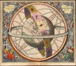
Situs Terrae Circulis Coelestibus Circundatae.
sold
- Digital Map Information
- Suitable for large format printing
- File Size: 24.78 MB
- File Type: ZIP / TIFF
- ICC color profile embedded
- Delivered instantly via download link
This beautiful work is Andreas Cellarius' celestial chart, in its 1661 second state with sumptuous original color, illustrating the position of the Earth within the celestial sphere divided into its circles. Its lush, baroque presentation - filled with clouds, putti, and muses - frames a useful visual glossary illustrating terminology important to the astronomer and the geographer. (more details)
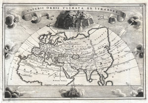
Veteris Orbis Climata ex Strabo
sold
- Digital Map Information
- Suitable for large format printing
- DPI: 300
- File Size: 3.3 MB
- File Type: ZIP / TIFF
- ICC color profile embedded
- Delivered instantly via download link
A rare and beautifully engraved map of the old world divided into seven climatic zones according to the Ancient Greek geographer Strabo. Depicts Europe, Asia, and northern Africa. Surrounded by seven wind heads. At the northern polar caps is a wonderful ... (more details)
Presenting the obsolete, geocentric, model of the universe
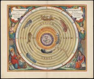
Planisphaerium Ptolemaicum, sive Machina Orbium Mundi Ex Hypothesi Ptolemaica in Plano Disposita.
sold
- Digital Map Information
- Suitable for large format printing
- File Size: 28.06 MB
- File Type: ZIP / TIFF
- ICC color profile embedded
- Delivered instantly via download link
This beautiful work is Andreas Cellarius' celestial chart, in its 1708 Valk and Schenk edition, illustrating the geocentric solar system imagined by Claudius Ptolemy in the 2nd century, and which remained the standard model of the universe until the 16th century and the discoveries of Nicolas Copernicus. It is among the most beautiful depictions of the Earth-centered solar system produced in the 17th century. (more details)
Ptolemy's Earth-Centered Universe.
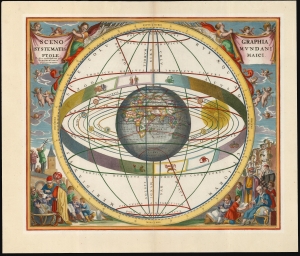
Scenographia Systematis Mundani Ptolemaici.
sold
- Digital Map Information
- Suitable for large format printing
- File Size: 22.18 MB
- File Type: ZIP / TIFF
- ICC color profile embedded
- Delivered instantly via download link
This beautiful work is Andreas Cellarius' celestial chart, in its 1708 Valk and Schenk edition, illustrating the geocentric solar system theorized by the 2nd-century astronomer Claudius Ptolemy. One of Cellarius' most visually engaging celestial charts, it centers on a beautifully engraved hemisphere and depicts the orbits around it of the Moon, Mercury, Venus, the Sun, Mars, Jupiter, and Saturn. Surrounding the orbiting planets is the celestial sphere, divided into circles. Cellarius' lush, baroque presentation frames the chart with a sky filled with putti while on the ground, scholars, astronomers, and their students measure the sky and confer over books and globes. (more details)
Lavishly illustrated celestial chart.
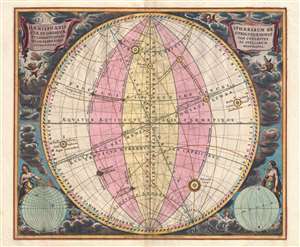
Haemisphaeria Sphaerarum Rectae Et Obliquae Utriusque Motus Et Longitudines Tam Coelestes Quam Terrestres Ac Stellarum Affectiones Monstrantia.
sold
- Digital Map Information
- Suitable for large format printing
- DPI: 300
- File Size: 10 MB
- File Type: ZIP / TIFF
- ICC color profile embedded
- Delivered instantly via download link
A fine 1708 Andreas Cellarius celestial chart illustrating the motions of the upright (the Equatorial Coordinate System) and oblique spheres (the Ecliptic Coordinate System), the Celestial and Terrestrial Longitudes, and the influence of the stars. The surround is lavishly decorated with finely engraved and colored images of clouds, putti, and two sub-diagrams. It is of note that this is a beautifully colored example with giltwork incorporated into the color. (more details)
The lunar theories of Claudius Ptolemy in stunning old color.
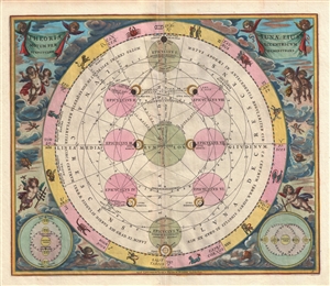
Theoria Lunae, eius Motum per Eccentricum et Epicyclum Demonstrans.
sold
- Digital Map Information
- Suitable for large format printing
- DPI: 300
- File Size: 9.22 MB
- File Type: ZIP / TIFF
- ICC color profile embedded
- Delivered instantly via download link
A fine 1708 Andreas Cellarius celestial chart illustrating the Claudius Ptolemy model of lunar motion. The chart illustrates the lunar epicycles as the moon revolves along various orbits. The central chart is bordered zodiacal iconography. The ... (more details)