
Dower, John Crane (sold)

John Crane Dower (1791 - February 20, 1847) was an English engraver, map publisher, and printer active in northern London during the first half of the 19th century. Dower had his office at 6 Cumming Place, Pentonville, London. He was most active as an engraver from 1820 to 1847, where he produced work for John Greenwood, William Fowler, Henry Teesdale, Thomas Moule, Geroge Bradshaw, and others. Dower passed his business on two his two sons, John James Downer, and Fredreric Jamesd Dower.
Independent Greece.
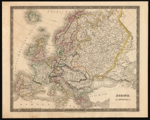
Europe.
sold
- Digital Map Information
- Suitable for large format printing
- DPI: 600
- File Size: 38.17 MB
- File Type: ZIP / TIFF
- ICC color profile embedded
- Delivered instantly via download link
This is an 1831 Henry Teesdale and John Crane Dower map of Europe, inclusive of Iceland and reaching as far east as the Ural mountains. Political borders, highlighted with original outline color, reflect an up-to-date presentation of the European international scene. (more details)
Detailed, Elegant 19th Century Map of World.
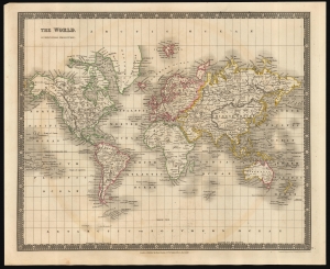
The World, On Mercators Projection.
sold
- Digital Map Information
- Suitable for large format printing
- DPI: 600
- File Size: 30.91 MB
- File Type: ZIP / TIFF
- ICC color profile embedded
- Delivered instantly via download link
This is an 1831 Henry Teesdale and John Crane Dower map of the world. It covers the explored world on a Mercator projection: the Americas, Europe, Asia, Africa, Australia and Oceania are presented clearly. The Arctic and Antarctic regions, as yet unpenetrated by explorers, are bare of detail. (more details)
Unusual center weighted comparative mountains and rivers chart declaring the Amazon to be the longest river in the world.
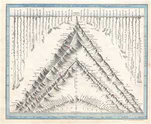
A View of the Comparative Lengths of the Principal Rivers, and Heights of the Principal Mountains in the World.
sold
- Digital Map Information
- Suitable for large format printing
- DPI: 300
- File Size: 2.35 MB
- File Type: ZIP / TIFF
- ICC color profile embedded
- Delivered instantly via download link
This is a c. 1844 John Crane Dower comparative map or chart of the world's mountains and rivers. Charts of this kind were first introduced in England around 1823 and became a common feature in atlases throughout the 19th century. The chart comparing the heights of ... (more details)
A remarkable heavily annotated wall format map of the world showing Texas as a Republic.
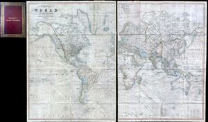
A New Chart of the World On Mercator's Projection With The Tracks Of The Most Celebrated and Recent Navigators.
sold
- Digital Map Information
- Suitable for large format printing
- Full resolution TIFF file
- ICC color profile embedded
- Delivered instantly via download link
This is an impressive 1844 large format map of the world by Henry Teesdale. The map covers the entire world on a Mercator projection with copious notes and annotations throughout. The map is thorough, but predictably presented an highly Anglo-centric perspective ... (more details)
A remarkable heavily annotatioed wall format map of the world showing Texas as a Republic.
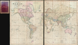
A New Chart of the World On Mercator's Projection With The Tracks Of The Most Celebrated and Recent Navigators.
sold
- Digital Map Information
- Suitable for large format printing
- Full resolution TIFF file
- ICC color profile embedded
- Delivered instantly via download link
This is an impressive 1844 large format map of the world by Henry Teesdale. The map covers the entire world on a Mercator projection with copious notes and annotations throughout. The map is thorough, but predictably presented a highly Anglo-centric perspective ... (more details)
One of only a few English maps to recognize the Republic of Texas. / The first map to show a fully explored Northwest Passage.
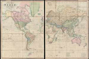
A New Chart of the World On Mercator's Projection With The Tracks Of The Most Celebrated and Recent Navigators.
sold
- Digital Map Information
- Suitable for large format printing
- Full resolution TIFF file
- ICC color profile embedded
- Delivered instantly via download link
This is an impressive 1845 large format map of the world by Henry Teesdale. The map covers the entire world on a Mercator projection with copious notes and annotations throughout. It is significant for many reasons, but chief among them is that it is one of the few English maps to recognize the Republic of Texas (as England itself did not) - and depict its most ambitious boundary configuration. It is also the first map to show a complete northwest passage following the Deese-Simpson Expedition. The map is thorough, including the most up to date political events and discoveries, but also tends to be biased, although not always towards Anglo-centric interests. For example, the map agrees with British claims to British Columbia relating to the 54/40 Oregon Question, and ignores the discoveries of Charles Wilkes (1798 - 1877) and the U.S. Exploring Expedition (1838 - 1842), no doubt to bolster the competing exploratory claims of Englishman John Ross (1777 - 1856). Teesdale's map is beautifully presented in two sections, each of which have been dissected into sixteen panels and laid on linen. The whole folds into a beautifully tooled leather binder with marbled endpapers. (more details)
A remarkable heavily annotated wall format map of the world showing Texas as a Republic.
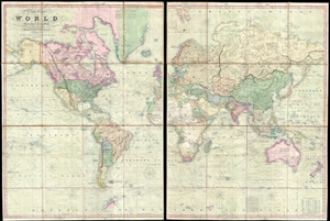
A New Chart of the World On Mercator's Projection With The Tracks Of The Most Celebrated and Recent Navigators.
sold
- Digital Map Information
- Suitable for large format printing
- DPI: 300
- File Size: 81.91 MB
- File Type: ZIP / TIFF
- ICC color profile embedded
- Delivered instantly via download link
This is an impressive 1845 large format map of the world by Henry Teesdale. The map covers the entire world on a Mercator projection with copious notes and annotations throughout. It is significant for many reasons, but chief among them is that it is one of the few English maps to recognize the Republic of Texas (as England itself did not) - and depict its most ambitious boundary configuration. It is also the first map to show a complete northwest passage following the Deese-Simpson Expedition. The map is thorough, including the most up to date political events and discoveries, but also tends to be biased, although not always towards Anglo-centric interests. For example, the map agrees with British claims to British Columbia relating to the 54/40 Oregon Question, and ignores the discoveries of Charles Wilkes (1798 - 1877) and the U.S. Exploring Expedition (1838 - 1842), no doubt to bolster the competing exploratory claims of Englishman John Ross (1777 - 1856). Teesdale's map is beautifully presented in two sections, each of which have been dissected into sixteen panels and laid on linen. The whole folds into a beautifully tooled leather binder with marbled endpapers. (more details)