
Edwards, Bryan (sold)
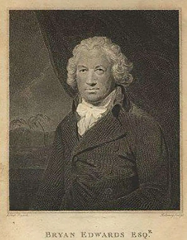
Bryan Edwards (May 21, 1743 - July 15 or 16, 1800) was a British politician and colonial administrator active in the later part of the 18th century. Born in Westbury, England, Edwards lost his father at 13 years of age. His education was subsequently taken over by his uncle, Zachary Bayly, a wealthy merchant based in Jamaica. This would turn out to have a profound influence on Edwards. When Bayly died in the 1770s, Edwards inherited his uncle's substantial wealth and quickly rose to a position of prominence in the Colonial Assembly of Jamaica. Raised in the plantation culture of Jamaica, Edwards used his wealth and influence to advocate for the continuation of the slave trade. Despite being politically misguided, Edwards was regarded with respect by both his colleagues and opponents. During his long tenure in the West Indies, Edwards wrote a number of histories and administrative studies, many of which featured important cartographic works and offered an illuminating view of the British colonies in the region. He is also known to have returned to England on several occasions where he repeatedly attempted and failed to acquire a seat in Parliament. Eventually, he was elected to represent the Cornish borough of Grampond, though the election itself may have been corrupt. Edwards was also secretary of the Association of Promoting the Discovery of the Interior Parts of Africa. In this capacity, he wrote of the first known account of the travels of Mungo Park in Africa.
Published only a few years after Admiral Nelson's tour of duty in the West Indies.
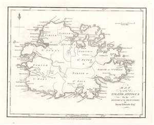
Map of the Island Antigua.
sold
- Digital Map Information
- Suitable for large format printing
- DPI: 600
- File Size: 2.86 MB
- File Type: ZIP / TIFF
- ICC color profile embedded
- Delivered instantly via download link
This is a 1794 Bryan Edwards map of Antigua. Published after Horatio Nelson's tour of duty in the West Indies, Antigua's many forts and coastal batteries underscore the tense situation in the Caribbean. Nelson was in the region enforcing the Navigation Acts, which prohibited trade between British subjects and the newly independent United States of America. Antigua held a prominent place in the Caribbean sugar trade, and Antiguan merchants loathed Nelson and the Navigation Acts for hindering their access to critical American markets. St. John's, the capital of modern-day Antigua and Barbuda, is clearly labeled, and several other settlements occupy coastal land. Bays, points, and other coastal features are also identified, as are many smaller islands. (more details)
Marks plantations and sugar works on the most heavily fortified island in the Caribbean.
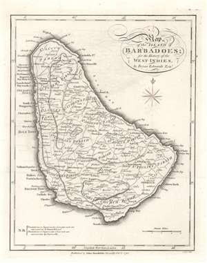
Map of the Island of Barbadoes.
sold
- Digital Map Information
- Suitable for large format printing
- DPI: 600
- File Size: 3.62 MB
- File Type: ZIP / TIFF
- ICC color profile embedded
- Delivered instantly via download link
This is a 1794 Bryan Edwards and John Stockdale map of Barbados, which was then the most heavily fortified island in the Caribbean. (more details)
A map of Grenada long before the 1983 U.S. invasion.
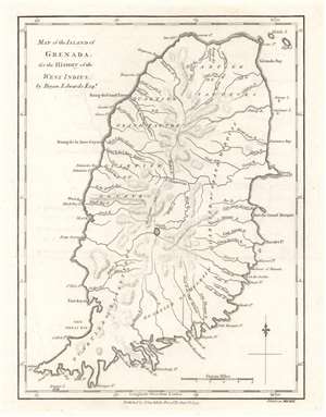
Map of the Island of Grenada.
sold
- Digital Map Information
- Suitable for large format printing
- DPI: 600
- File Size: 2.98 MB
- File Type: ZIP / TIFF
- ICC color profile embedded
- Delivered instantly via download link
This is a 1794 Bryan Edwards and John Stockdale map of Grenada. Grenada was a British colony in 1794 and today is a member of the British Commonwealth. Here, Fort Royal takes the place of the modern-day capital, St. George's. The island's six quartiers are labeled, along with rivers, bays, and points. In American memory, Grenada evokes the U.S. invasion in 1983, when American troops landed on the island to remove a Communist government that was supposedly sympathetic to Cuba and the Soviet Union. (more details)
A member of the British Commonwealth of Nations.
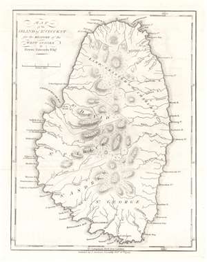
Map of the Island of St. Vincent.
sold
- Digital Map Information
- Suitable for large format printing
- DPI: 600
- File Size: 3.01 MB
- File Type: ZIP / TIFF
- ICC color profile embedded
- Delivered instantly via download link
This is a 1794 Bryan Edwards and John Stockdale map of Saint Vincent. Part of the Winward Islands, Saint Vincent is the largest island in the modern-day country 'Saint Vincent and the Grenadines'. Kingstown, the island's capital, is labeled. Bays and points are marked along the coast, and the island's parishes are identified. The northernmost portion of the island is labeled 'land granted to the Charibs in 1773'. The Caribs are St. Vincent's native peoples, and they repeatedly revolted against British rule in the 18th century. Calm was only restored after a treaty was signed in 1796. Saint Vincent gained its independence in 1979 and is part of the British Commonwealth of Nations to this day. (more details)
Illustrates the Jamaican sugar industry.
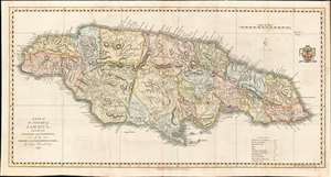
A Map of the Island of Jamaica, Divided into Counties and Parishes, for the History of the British West Indies.
sold
- Digital Map Information
- Suitable for large format printing
- DPI: 600
- File Size: 16.31 MB
- File Type: ZIP / TIFF
- ICC color profile embedded
- Delivered instantly via download link
This is a 1794 Bryan Edwards map of Jamaica. Edwards illustrates and labels all major settlements on Jamaica, including Kingston and Montego Bay. Edwards employs small circles to indicate the many lucrative sugar plantations operating throughout the island. Churches, barracks, forts, ports, and even Bryan Edwards' home are marked. Parishes are shaded to allow for easy differentiation, and a legend explaining the various notations used is included along the bottom border. (more details)
Labels Spiritu Santo Bay - Tampa Bay.
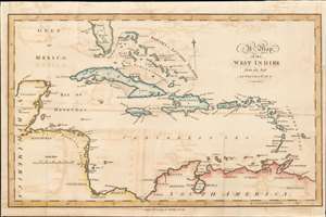
A Map of the West Indies.
sold
- Digital Map Information
- Suitable for large format printing
- DPI: 600
- File Size: 6.19 MB
- File Type: ZIP / TIFF
- ICC color profile embedded
- Delivered instantly via download link
This is a 1799 Bryan Edwards map of the West Indies. Depicting from Florida to northern South America, islands throughout the Caribbean Sea are labeled, including many of the Bahama and the Leeward Islands. Cozumel is identified off the Yucatan coast, and coastal lagoons, islands, and gulfs are named throughout. Very little detail is present in Florida, apart from labeling Martyr's Reef and Spiritu Santo Bay, today's Tampa. (more details)
Extremely scarce large scale map of Hispaniola.
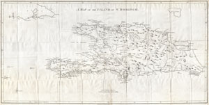
A Map of the Island of St. Domingo.
sold
- Digital Map Information
- Suitable for large format printing
- DPI: 300
- File Size: 15.35 MB
- File Type: ZIP / TIFF
- ICC color profile embedded
- Delivered instantly via download link
A dramatic and important map of the island of St. Domingo (Santo Domingo) or Hispaniola prepared by Bryan Edwards and published by John Stockdale in 1800. Covers the island in full offering significant detail throughout. Edwards includes notations of the ... (more details)