
Emory, William Hemsley (sold)
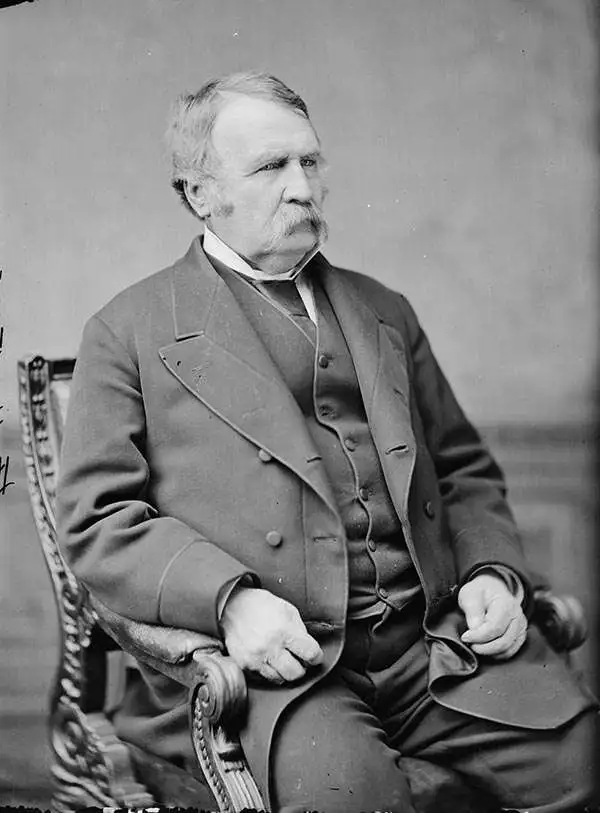
William Hemsley Emory (September 7, 1811 - December 1, 1887) was an American surveyor, civil engineer, and Army officer. Born in Queen Anne's County, Maryland, Emory graduated from the United States Military Academy at West Point in 1831, was assigned to the Fourth Artillery, and resigned from service in 1836 to pursue civil engineering. He returned to the army in 1838 to serve in the newly-formed Army Corps of Topographical Engineers. During the Mexican-American War, Emory served in the Army of the West under the command command of Stephen Watts Kearny. While serving with Kearny, he kept a detailed journal that was then published as Notes of a Military Reconnaissance from Fort Leavenworth to San Diego and soon became an important guidebook for the route to Southern California. After the war, Emory served as part of the team that surveyed the United States-Mexican border. When the American Civil War started, Emory was stationed in Indian Territory and immediately realized the likelihood that Confederates would capture him and his men. To avoid this, Emory quickly secured the services of Black Beaver, the famous Lenape warrior, to guide them out of the territory. Emory and his troops, on their way from Fort Washita to Fort Leavenworth, captured a number of their Confederate pursuers, which were the first prisoners taken during the war. Emory then served in the Army of the Potomac, in the Western Theater, and in the Shenandoah Valley Campaign of 1854. After the war, Emory held the post of commander of the Department of the Gulf during Reconstruction and, in September 1874, President Ulysses S. Grant ordered Emory to New Orleans, where he successfully negotiated a peace with the white supremacist paramilitary organization the White League, which led to the White League being disbanded. Emory married Matilda Wilkins Bache on May 29, 1838 in Philadelphia, with whom he had two sons, both of which served in the United States armed forces. Matilda Bache was Alexander D. Bache's sister. Alexander Bache was one of the most influential superintendents of the United States Coast Survey.
The first scientific mapping of the entire region based on actual observation. - Martin and Martin
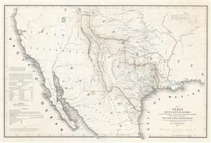
Map of Texas and the Countries Adjacent: Compiled in the Bureau of the Corps of Topographical Engineers; From The Best Authorities, for the State Department, Under the Direction of Colonel J. J. Abert, Chief of the Corps; by W. H. Emory, 1St. Lieut. T.E.
sold
- Digital Map Information
- Suitable for large format printing
- DPI: 600
- File Size: 28.42 MB
- File Type: ZIP / TIFF
- ICC color profile embedded
- Delivered instantly via download link
A seminal production, this 1844 large-format edition map of the Republic of Texas by the U.S. Topographical Engineer, W. H. Emory, is the most important pre-war map of Texas. Centered on the vast claims of the Republic of Texas, Emory's map offers expansive coverages extending from the Pacific to west Florida and from South Pass (modern day Wyoming) to Tampico, Mexico. This map is significant on a number of levels. First, it is the first scientifically surveyed map of the Texas region. Second, it serves as the official U.S. acknowledgement of the full territorial claims of the Republic of Texas. Third, it is a vital reconnaissance of the Texas region in anticipation of the breakout of the Mexican-American War (1846 - 1848). Fourth, it establishes the Texas claims that would be fought over during the Mexican-American War. Fifth and finally, it lays down the Texas borders that would later be copied by Disturnell in his 'Treaty Map' of 1847, formalizing the U.S-Mexican border. (more details)
The first scientific mapping of the entire region
based on actual observation. - Martin and Martin
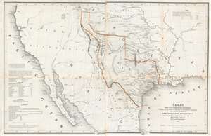
Map of Texas and the Countries Adjacent: Compiled in the Bureau of the Corps of Topographical Engineers; From The Best Authorities, for the State Department, Under the Direction of Colonel J. J. Albert, Chief of the Corps; by W. H. Emory, 1St. Lieut. T.E.
sold
- Digital Map Information
- Suitable for large format printing
- DPI: 600
- File Size: 29.71 MB
- File Type: ZIP / TIFF
- ICC color profile embedded
- Delivered instantly via download link
A seminal production, this 1844 large-format edition map of the Republic of Texas by the U.S. Topographical Engineer, W. H. Emory, is the most important pre-war map of Texas. Centered on the vast claims of the Republic of Texas, Emory's map offers expansive coverage extending from the Pacific to west Florida and from South Pass (modern day Wyoming) to Tampico, Mexico. This map is significant on a number of levels. First, it is the first scientifically surveyed map of the Texas region. Second, it serves as the official U.S. acknowledgement of the full territorial claims of the Republic of Texas. Third, it is a vital reconnaissance of the Texas region in anticipation of the breakout of the Mexican-American War (1846 - 1848). Fourth, it establishes the Texas claims that would be fought over during the Mexican-American War. Fifth and finally, it lays down the Texas borders that would later be copied by Disturnell in his 'Treaty Map' of 1847, formalizing the U.S-Mexican border. (more details)
The final battle between Colonel Sterling Price's force and the insurgents leadint the Taos Revolt.
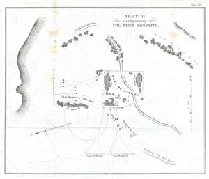
Sketch accompanying Col. Price Despatch.
sold
- Digital Map Information
- Suitable for large format printing
- DPI: 300
- File Size: 1.18 MB
- File Type: ZIP / TIFF
- ICC color profile embedded
- Delivered instantly via download link
This is an 1847 William Hemsley Emory map of the Siege of the Pueblo de Taos, a modern-day National Historic Landmark and UNESCO World Heritage site located one mile north of the modern city of Taos, New Mexico. Centered on the pueblo with the Red Willow Creek running through it, the map illustrates the deployment of Colonel Sterling Price's men as he laid siege to the Pueblo de Taos, the final stronghold of the insurrectionists that started the Taos Revolt only a few weeks prior to the siege with the murder of Territorial Governor Charles Bent. (more details)
A map of a Mexican-American War battle that took place in Pasadena.
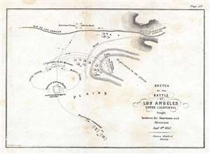
Sketch of the Battle of Los Angeles Upper California, fought between the Americans and Mexicans January 9th, 1847.
sold
- Digital Map Information
- Suitable for large format printing
- DPI: 300
- File Size: 1.04 MB
- File Type: ZIP / TIFF
- ICC color profile embedded
- Delivered instantly via download link
This is an 1847 William Hemsley Emory map of the Battle of Los Angeles, California, which occurred on January 9, 1847. The map depicts the American contingent led by Commodore Robert F. Stockton in the final day before the force reached 'Pueblo de Los Angeles'. Although only a sketch, the map details the last engagement between Stockton's contingent and the Californians under the command of Jose Maria Flores. (more details)
A controversial battle near San Diego, California fought during the Mexican-American War of which the victor is still debated.
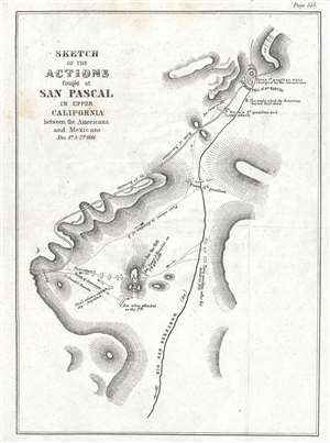
Sketch of the Actions fought at San Pascal in Upper California between the Americans and Mexicans Dec. 6th and 7th, 1846.
sold
- Digital Map Information
- Suitable for large format printing
- DPI: 300
- File Size: 2.06 MB
- File Type: ZIP / TIFF
- ICC color profile embedded
- Delivered instantly via download link
This is an 1847 William Hemsley Emory map of the battle of San Pasqual during the Mexican-American War. Located in what is today the San Pasqual Valley area of the city of San Diego, California, the map depicts the actions of an American military force led by General Stephen Watts Kearny against a group of insurgents under the leadership of Andres Pico, the younger brother of Mexican Governor Pio Pico. Printed lines trace the actions of both Kearny and Pico's forces, illustrating (and labeling) rather well the progression of the engagement. Several positions are labeled and dated, allowing the viewer some understanding of how events unfolded. (more details)
Took place in the modern-day cities Whittier, Pico Rivera, and Montebello, CA about ten miles south of downtown Los Angeles.
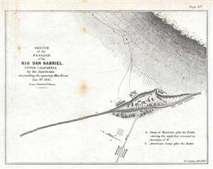
Sketch of the Passage of the Rio San Gabriel, Upper California, by the Americans, - discomfiting the opposing Mex. Forces, Jan. 8th 1847.
sold
- Digital Map Information
- Suitable for large format printing
- DPI: 300
- File Size: 1.21 MB
- File Type: ZIP / TIFF
- ICC color profile embedded
- Delivered instantly via download link
This is an 1847 William Hemsley Emory map of the Battle of Rio San Gabriel during the Mexican-American War, which took place in parts of modern-day Whittier, Pico Rivera, and Montebello, California, about ten miles south of downtown Los Angeles. The Rio San Gabriel (San Gabriel River) bisects the map and was the focus of this engagement between the American force led by Commodore Robert Stockton and the Californian contingent under the command of José María Flores. The American force had set out from San Diego on December 29th, with the goal of reaching a besieged American force in Los Angeles. On January 8th, at two-thirty in the afternoon after marching eleven- and one-half miles, Stockton and his men reached the Rio San Gabriel. As the American approached the river, they formed into a square, believing this to be the most effective defense against a mounted enemy. An advance group from the Californian force began harassing them even trying (unsuccessfully) to drive a group of wild mares into the Americans. The Mexican artillery occupied the high ground on the far side of the river, which did not provide the best fire for the Mexicans, even though they held the high ground. The Americans successfully forded the river and brought their own artillery to bear against the Mexicans, who, faced with superior firepower, withdrew to the north, closer to Los Angeles. (more details)
The first battle in the Taos Revolt of 1847 between U.S. forces and Hispano and Puebloan insurgents.
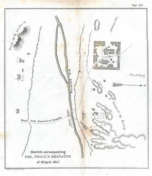
Sketch accompanying Col. Price's Despatch of 18 April 1847.
sold
- Digital Map Information
- Suitable for large format printing
- DPI: 300
- File Size: 1.08 MB
- File Type: ZIP / TIFF
- ICC color profile embedded
- Delivered instantly via download link
This is an 1847 William Hemsley Emory map of the Battle of Cañada one of the battles during the Taos Revolt in and near Taos, New Mexico, which was part of the Mexican-American War. Oriented to the west, the map is bisected by the Rio Chicito, with the road from Santa Fe to Cañada illustrated by two dashed lines. Cañada itself is on the north side of the river and several buildings are noted, though none are labeled. Numerous buildings are illustrated throughout the countryside, along with the region's topography, allowing the viewer to have some understanding of the terrain where the battle occurred. (more details)
'General Map' of the U.S.-Mexico Boundary Survey.
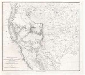
Map of the United States and their territories between the Mississippi and the Pacific Ocean and part of Mexico...
sold
- Digital Map Information
- Suitable for large format printing
- File Size: 57.47 MB
- File Type: ZIP / TIFF
- ICC color profile embedded
- Delivered instantly via download link
This is Emory and Michler's critically important 1857 map of the American West produced following the Treaty of Guadeloupe-Hidalgo and the Gadsden Purchase. The product of years of labor, delays, and frustrations, it appeared in Emory's monumental Report on the United States and Mexican Boundary Survey and was by far the most complete map of the American West at the time. (more details)