
Schièble, Georges Erhard (sold)
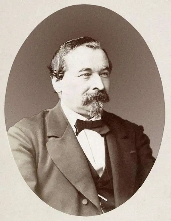
Georges Erhard Schièble (1823 – November 23, 1880) was a German printer active in Paris during the middle to late 19th century. Erhard was born in Forchheim, Baden-Württemberg, and relocated to Paris in his 16th year, where he apprenticed under his cousin, an engraver and mapmaker. In 1852, after 6 years with the Royal Printing Office, he started his own business. Around this time, he also became a naturalized French citizen. From his offices on Rue Bonaparte, he produced several important maps, and a detailed topography of Gaul for Napoleon III's History of Julius Caesar. In 1865 he took on larger offices expanding his operations to include a lithographic press. He was among the first to introduce printed color maps and pioneered photo-reduction, including the process known as Erhard reproduction. After Erhard's death in 1880, the firm was taken over by his sons and run under the imprint of 'Erhard Frères' until 1911.
The first printed example of a Babinet / Mollweide Projection?
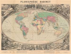
Planisphère Babinet Physique et Politique.
sold
- Digital Map Information
- Suitable for large format printing
- File Size: 192.9 MB
- File Type: ZIP / TIFF
- ICC color profile embedded
- Delivered instantly via download link
A stunning c. 1860 wall-sized map of the world on a Mollweide or Babinet Projection surrounded by elaborate allegorical imagery. Our research suggests this is one of the earliest, if not the earliest, published example of a Mollweide Projection. The map is centered on Europe and is, indeed, Eurocentric, with color coding intended to represent colonial claims around the world. Tracks at sea illustrate popular maritime routes across the Atlantic and to various points, around Africa, and to Australia, China, and the East Indies. Text at bottom center by Victor Adolphe Malte-Brun (1816 - 1889) and Hermann Berghaus (1828 - 1890), the preeminent geographers of the day, praise the usefulness and practicality of the Mollweide / Babinet projection. (more details)
Building the Suez Canal.
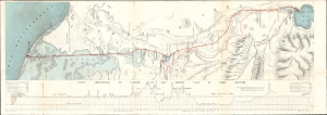
Percement de L'Isthme de Suez. / [Suez Canal.]
sold
- Digital Map Information
- Suitable for large format printing
- File Size: 17.77 MB
- File Type: ZIP / TIFF
- ICC color profile embedded
- Delivered instantly via download link
This is a dramatic large map of the Suez Canal, Egypt, issued in 1868, a year before the canal opened to commercial traffic. The map accompanies a scarce publication by L. Barreau, a French civil engineer based in Alexandria, describing the monumental undertaking. (more details)
Rare Geological map of Guatemala!
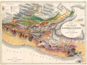
Esquisse d'une Carte Géologique d'une partie des Républiques de Guatemala et de Salvador (Amérique Centrale).
sold
- Digital Map Information
- Suitable for large format printing
- File Size: 70.29 MB
- File Type: ZIP / TIFF
- ICC color profile embedded
- Delivered instantly via download link
A stunning 1868 large format geological map of Guatemala and El Salvador by Auguste Dollfus and Eugène de Montserrat. The map covers from the Bay of Honduras to the Pacific and from roughly modern-day Port Chiapas, to the Gulf of Fonseca. Color coding illustrates geographical features with an emphasis on volcanic activity (red), and drainage systems (yellow). This is the most comprehensive study of Central American geology of the 19th century. It was compiled in conjunction with the Commission Scientifique du Mexique, the scientific arm of the Napoleon III's French Intervention in Mexico (1862 - 1867). (more details)
Costa Rica's trans-continental railroad.
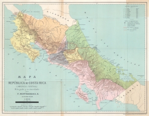
Mapa de la República de Costa-Rica (America Central).
sold
- Digital Map Information
- Suitable for large format printing
- File Size: 15.57 MB
- File Type: ZIP / TIFF
- ICC color profile embedded
- Delivered instantly via download link
This is a rare 1889 Faustino Montes De Oca Ramírez map of Costa Rica illustrating plans for that country's first (and only) railroad. (more details)
The Bordeaux 'Cru' system.
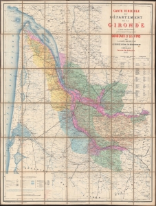
Carte Vinicole du Département de la Gironde.
sold
- Digital Map Information
- Suitable for large format printing
- Full resolution TIFF file
- ICC color profile embedded
- Delivered instantly via download link
This is an 1893 Féret et Fils viticultural map of the Gironde, France, highlighting Bordeaux wine varietals and the Cru system. The Gironde is the heart of Bordeaux wine country with over 110,000 hectares of vineyards producing some of the world's most prestigious wines. (more details)
The Sahara's 'City of Gold' revealed.
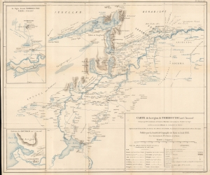
Carte de la région de Tombouctou au 1/500.000e.
sold
- Digital Map Information
- Suitable for large format printing
- File Size: 21.49 MB
- File Type: ZIP / TIFF
- ICC color profile embedded
- Delivered instantly via download link
This highly detailed map of the Niger River, Timbuktu, and environs - one of the first to offer the European audience any real information on the fabled desert 'city of gold'. It was prepared by Lieutenants Hourst and Bluzet and published in the 1895 Bulletin de la Société de Géographie. Hourst was the leader of an ambitious French expedition to descend along the Niger River from Timbuktu to the Atlantic Ocean, (more details)
Map and broadsheet invitation to the reception at the Paris Geographcal Society following the rescue of the Fridtjof Nansen 'Fram Expedition' to the North Pole. One of only two known examples.
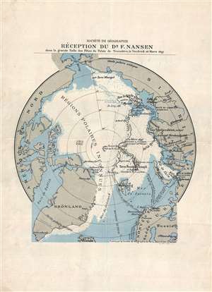
Sociéte de Géographie Réception du Dr F. Nansen dans la Grande Salle des Fétes du Trocadéro, le Vendredi 26 Mars 1897.
sold
- Digital Map Information
- Suitable for large format printing
- File Size: 4.81 MB
- File Type: ZIP / TIFF
- ICC color profile embedded
- Delivered instantly via download link
A truly remarkable bit of ephemera, this is the broadside initiation to the March 26, 1897 reception for the Norwegian Arctic explorer Fridtjof Nansen at the Paris Société de Géographie. The invitation consists of a map illustrating Nansen's 1893 – 1896 ... (more details)