
Geographischen Institutes Weimar (sold)

Geographisches Institut, Weimar (fl. 1804 - c. 1903) was a German map and globe publishing house and geographical research institute based in Weimar. The organization primarily focused on republishing and improving upon the works of earlier cartographers, including Kitchin, Jefferys, Carey, and others. In general, its publications are known for their fine engraving, attention to detail, historical accuracy, and overall high quality. The firm was founded in 1804 by Friedrich Justin Bertuch (???? - c. 1845) and, on his death, passed to his son Robert Froreip (???? - 1855), then to Louis Denicks of Luneberg, then in 1859 to Voigt & Günther, in 1883 to F. Arnd, from 1890 - 1893 to Julius Kettler, and in 1903 to Max Wedekind. During the institute's height in the early 19th century, most of its cartographic publication was overseen by Carl Ferdinand Weiland (1782 - 1847). The firm also employed the cartographers Franz Xaver von Zach, Adam Christian Gaspari, Heinrich Kiepert, Karl (or Carl) and Adolf Graef, Julius Kettler, Carl Riemer and Karl Christian Bruhns. Weimar was a logical place for a collective like the Geographisches Institut to arise; it was a cultural mecca in the German-speaking world in the late 18th and 19th centuries because of its liberal atmosphere and associations with figures like Schiller, Herder, and, above all, Goethe, who spent most of his adult life in the city.
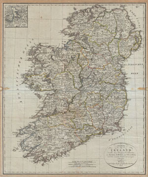
Charte von Ireland Nach den Original-Charten von Kitchin, Jefferys, und Beaufort, und den neuesten Ortsbestimmungen entworfen.
sold
- Digital Map Information
- Suitable for large format printing
- DPI: 300
- File Size: 19.79 MB
- File Type: ZIP / TIFF
- ICC color profile embedded
- Delivered instantly via download link
An uncommon map of Ireland dating to 1804. Though published by the German Geographical Institute, this map references the earlier work of Thomas Kitchin, Thomas Jefferys, and Daniel Beaufort. Covers the entirety of Ireland with exceptional detail throughout. ... (more details)
Ephemeral state of Franklin!
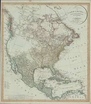
Charte von Nord America nach en neuesten Bestimmungen und Entdeckungen.
sold
- Digital Map Information
- Suitable for large format printing
- DPI: 600
- File Size: 31.76 MB
- File Type: ZIP / TIFF
- ICC color profile embedded
- Delivered instantly via download link
A fascinating 1804 map of North America by C. G. Reichard including the ephemeral 'lost state' of Franklin. The map embraces all of North America from Baffin Bay and Cook's Inlet (Alaska) to Panama and the Spanish Main, including all of the modern day United States, Canada, Mexico, West Indies, and Central America. (more details)
Ephemeral state of Franklin!
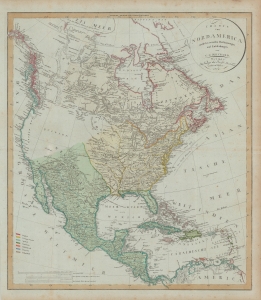
Charte von Nord America nach en neuesten Bestimmungen und Entdeckungen.
sold
- Digital Map Information
- Suitable for large format printing
- DPI: 600
- File Size: 78.19 MB
- File Type: ZIP / TIFF
- ICC color profile embedded
- Delivered instantly via download link
A fascinating 1804 map of North America by C. G. Reichard that includes the ephemeral 'lost state' of Franklin. The map embraces all of North America from Baffin Bay and Cook's Inlet (Alaska) to Panama and the Spanish Main, including all of the modern-day United States, Canada, Mexico, West Indies, and Central America. (more details)
One of the earliest obtainable plains of Sydney, Australia.
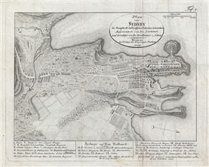
Plan von Sydney der Hauptstadt der Englischen Colonien in Australien. Aufgenommen von Hrn. Lesueur; und berichtigt von Hrn Boullanger i. J. 1802
sold
- Digital Map Information
- Suitable for large format printing
- DPI: 300
- File Size: 2.91 MB
- File Type: ZIP / TIFF
- ICC color profile embedded
- Delivered instantly via download link
One of the earliest obtainable maps of the city of Sydney, Australia, this is an 1808 German edition of an 1802 manuscript Map by Charles-Alexandre Lesueur's. The map covers from Darling Harbour to Dawes Batter and from Woolloomooloo to Brickfields. At the ... (more details)
One of the few specific maps of Puerto Rico from the early 19th century.
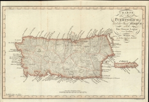
Charte der Insel Puerto Rico und der Bieque nach Don Thomas Lopez von Ledru.
sold
- Digital Map Information
- Suitable for large format printing
- File Size: 6.43 MB
- File Type: ZIP / TIFF
- ICC color profile embedded
- Delivered instantly via download link
This is a rare 1814 Thomas Lopez and Andree Pierre Ledru map of Puerto Rico, one of the few specific maps of this island dating to the early 19th century. (more details)
French mapping of a major British port during the Napoleonic Wars.
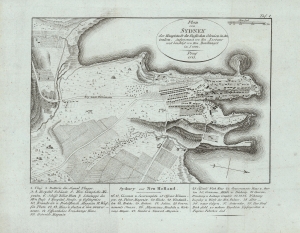
Plan von Sydney der Hauptstadt der Englischen Colonien in Australien. Aufgenommen von Hrn. Lesueur; und berichtigt von Hrn Boullanger i. J. 1802.
sold
- Digital Map Information
- Suitable for large format printing
- DPI: 600
- File Size: 12.06 MB
- File Type: ZIP / TIFF
- ICC color profile embedded
- Delivered instantly via download link
One of the earliest obtainable maps of the city of Sydney, Australia, this is an 1815 German edition of an 1802 manuscript map by Charles-Alexandre Lesueur. The map covers from Darling Harbour to Dawes Batter and from Woolloomooloo to Brickfields. At the bottom of the plan there is a numbered index identifying thirty-eight important buildings. In addition, the map note roads, buildings, windmills, gardens, orchards, gallows, brickfields, and the cemetery. (more details)
A 360-degree view from the top of the Großer Inselsberg in the Thuringian Forest in Germany.
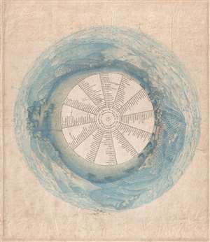
Panorama des Inselsberges.
sold
- Digital Map Information
- Suitable for large format printing
- DPI: 300
- File Size: 10.96 MB
- File Type: ZIP / TIFF
- ICC color profile embedded
- Delivered instantly via download link
This is an 1823 C.A. Kaiser panorama view from the top of the Grosser Inselsberg, the highest mountain in German's Thuringian Forest. A fully 360-degree view colored a brilliant blue, 228 different locations are numerically identified within the view and ... (more details)
Beautiful map of the West Indies backed on linen.
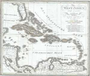
West Indien.
sold
- Digital Map Information
- Suitable for large format printing
- Full resolution TIFF file
- ICC color profile embedded
- Delivered instantly via download link
This is a scarce separate-issue 1825 map of the West Indies by C. F. Weiland. It covers from the southern part of Florida and the Bahamas south through the Caribbean Islands of Cuba and Hispaniola, to the northern part of South America and east to the ... (more details)
Early 19th century map of Australia and Polynesia
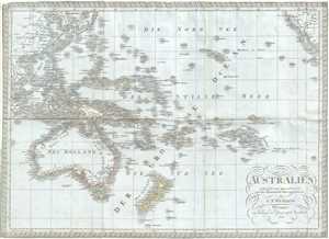
Australien.
sold
- Digital Map Information
- Suitable for large format printing
- Full resolution TIFF file
- ICC color profile embedded
- Delivered instantly via download link
This is a scarce separate-issue 1826 map of Australia, New Zealand and Polynesia by C. F. Weiland. It covers from Southeast Asia eastward as far as Baja California and includes much of the East Indies, Polynesia, Australia and New Zealand. The map ... (more details)
Map of Greece during the declining Ottoman Empire.
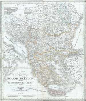
Das Osmanische Europa oder die Europaeische Turkey.
sold
- Digital Map Information
- Suitable for large format printing
- Full resolution TIFF file
- ICC color profile embedded
- Delivered instantly via download link
This is a scarce separate-issue 1826 map of European Turkey by C. F. Weiland. It covers Greece and the Balkans from Romania to Crete and includes the modern day nations of Greece, Macedonia, Albania, Croatia, Bosnia, Serbia, Bulgaria and Moldova. ... (more details)
Early 19th century map of Netherlands, Belgium and Luxemboug.
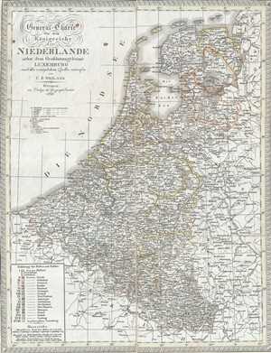
General-Charte von dem Koonigreiche der Niederlande nebst dem Grossherzogthume Luxemburg.
sold
- Digital Map Information
- Suitable for large format printing
- Full resolution TIFF file
- ICC color profile embedded
- Delivered instantly via download link
This is a scarce separate-issue 1826 map of Holland (the Netherlands), Belgium and Luxembourg by C. F. Weiland. It covers all of Belgium and Holland from the North Sea south to France, Luxembourg. Identifies various towns, cities, rivers, roads, ... (more details)
Beautiful map depicting the territories of the Austro-Hungarian Empire.
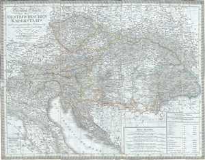
General Charte des Oestreichischen Kaiserstaats nach seiner gegenwaertigen Begraenzung und neuesten innern Eintheilung.
sold
- Digital Map Information
- Suitable for large format printing
- Full resolution TIFF file
- ICC color profile embedded
- Delivered instantly via download link
This is a scarce separate-issue example of the 1826 C. F. Weiland map of Austria. The map covers the territory of the Austro-Hungarian Empire, inclusive of all of Austria, the Italian provinces of Lombardy, Tyrol, Venice, Dalmatia, Hungary, ... (more details)
Early map of Africa depicting the speculative Mountains of the Moon.
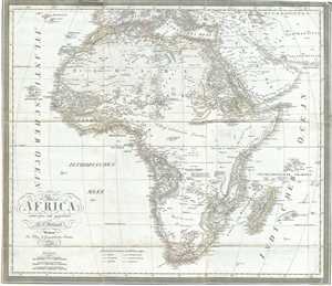
Africa.
sold
- Digital Map Information
- Suitable for large format printing
- Full resolution TIFF file
- ICC color profile embedded
- Delivered instantly via download link
This is a scarce separate-issue example of C. F. Weiland’s 1827 map of Africa. This uncommon map predates the explosion of African exploration that occurred in the mid-19th century. Much of the interior remains unknown. The Ptolemaic ... (more details)
19th century map of Scandinavia.
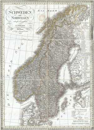
Schweden und Norwegen.
sold
- Digital Map Information
- Suitable for large format printing
- Full resolution TIFF file
- ICC color profile embedded
- Delivered instantly via download link
This is a scarce separate-issue example of the 1827 C. F. Weiland map of Sweden and Norway. The map covers from the Arctic Sea south to Denmark and east as far as the Gulf of Finland. Various important rivers, islands, cities and other ... (more details)
Beautiful early 19th century map of Asia.
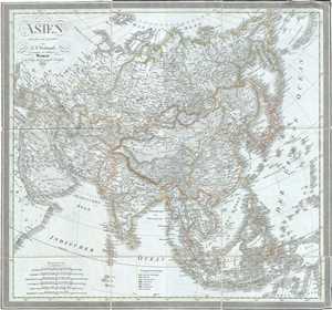
Asien.
sold
- Digital Map Information
- Suitable for large format printing
- Full resolution TIFF file
- ICC color profile embedded
- Delivered instantly via download link
This is a scarce separate-issue 1828 map of Asia by C. F. Weiland. It covers the entire Asian continent from the Arctic Ocean to the Indian Ocean and from the Red Sea to New Guinea. Important cities, rivers, mountains, deserts, islands ... (more details)
One of the earliest maps to name Kuwait (El Koueit ox Grane), Dubai (Debai) and Abu Dhabi (Abuthubbi).
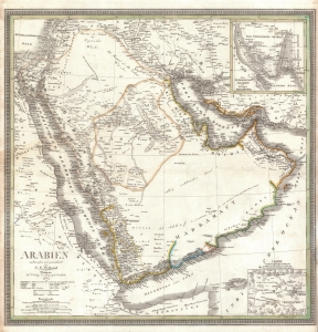
Arabien.
sold
- Digital Map Information
- Suitable for large format printing
- DPI: 600
- File Size: 28.2 MB
- File Type: ZIP / TIFF
- ICC color profile embedded
- Delivered instantly via download link
This is an 1841 Carl Ferdinand Weiland map of Arabia - considered one of the earliest modern scientific mappings of the Arabian Peninsula and one of the earliest maps to name Kuwait (El Koueit ox Grane), Dubai (Dubai), and Abu Dhabi (Abuthubbi). (more details)
German-made map of Central America.
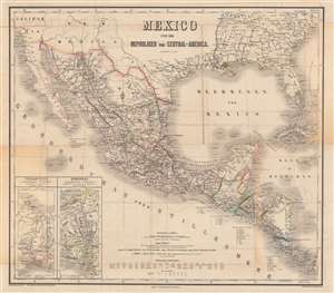
Mexico und die Republiken von Central-America.
sold
- Digital Map Information
- Suitable for large format printing
- Full resolution TIFF file
- ICC color profile embedded
- Delivered instantly via download link
This is a beautifully engraved and colored c. 1879 map of Mexico and Central America, edited by Carl Gräf and published by the Weimar Geographisches Institut. It shows the Mexico region stretching from the southern United States to Panama and includes a wealth of information on geography, administrative divisions, and infrastructure. (more details)