
NEW ACQUISITIONS
Heart of the White Mountains.
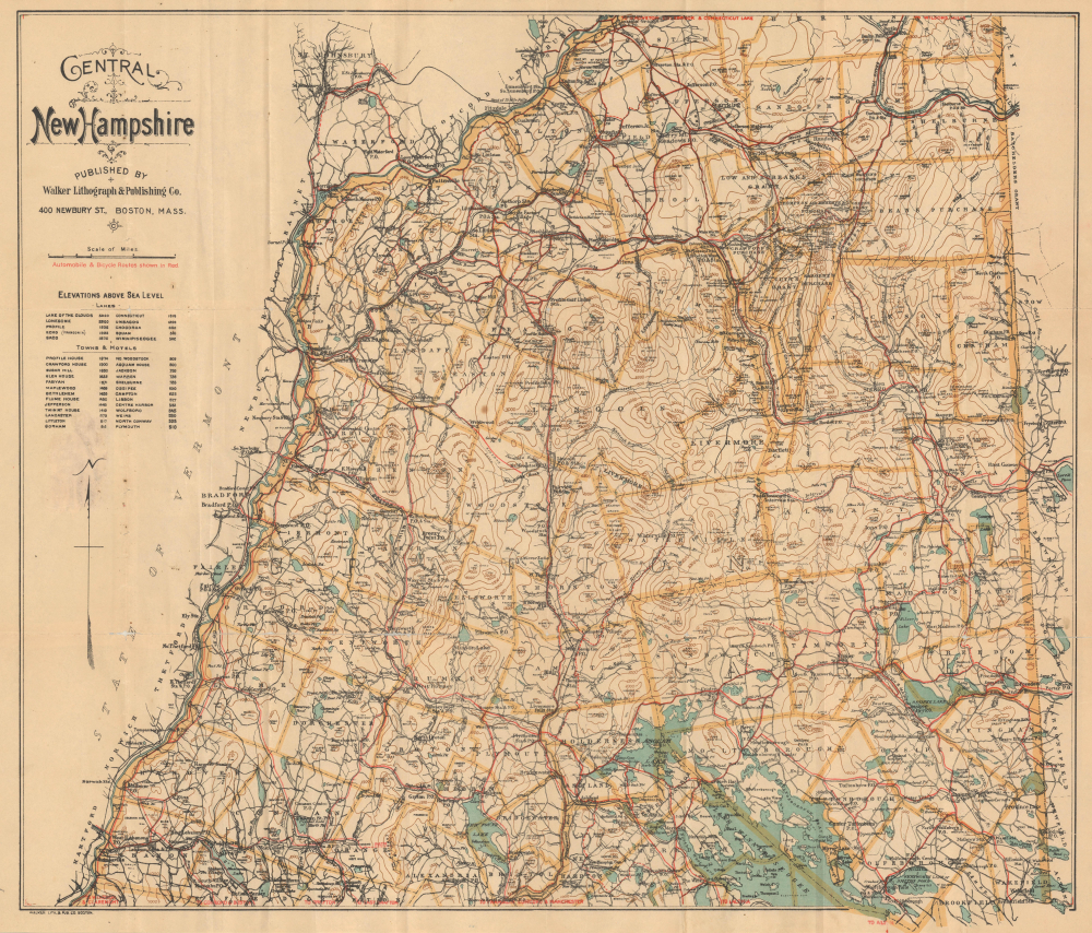
Central New Hampshire / Central New Hampshire including the White Mountain District.
$500.00
Acquire
- Digital Map Information
- Suitable for large format printing
- Full resolution TIFF file
- ICC color profile embedded
- Delivered instantly via download link
This is a rare c. 1907 George Walker pocket map of central New Hampshire, covering the heart of the White Mountains, including the Presidential Range, and the northern part of New Hampshire's Lakes Region. It was published at the height of the turn-of-the-century White Mountains tourism boom. (more details)
Stunning pictorial map of Quebec City, Quebec.

The City of Quebec with Historical Notes.
$400.00
Acquire
- Digital Map Information
- Suitable for large format printing
- File Size: 51.81 MB
- File Type: ZIP / TIFF
- ICC color profile embedded
- Delivered instantly via download link
This is an exceptional 1932 Samuel Herbert Maw pictorial map of the city of Quebec, Canada. The map beautifully captures the old city of Quebec in exceptional detail, surrounded by the St. Lawrence River. (more details)
New Hampshire's Lakes Region.

Map of New Hampshire Southern Part / Latest Map of Southern New Hampshire.
$400.00
Acquire
- Digital Map Information
- Suitable for large format printing
- Full resolution TIFF file
- ICC color profile embedded
- Delivered instantly via download link
This is a scarce c. 1907 George Walker pocket map of southern New Hampshire, including much of the state's gorgeous Lakes Region. It was produced during a period of heightened tourism to the Lakes Region and the White Mountains, facilitated by the development of railroads and the expansion of the state's tourism economy. (more details)
One of the great National Parks.

Union Pacific System Map of Rocky Mountain National (Estes) Park Denver Mountain Parks.
$400.00
Acquire
- Digital Map Information
- Suitable for large format printing
- File Size: 49.35 MB
- File Type: ZIP / TIFF
- ICC color profile embedded
- Delivered instantly via download link
An uncommon 1922 map of Estes Park and the Rocky Mountain region west of Denver and Fort Collins issued by Poole Brothers on behalf of the Union Pacific Railroad. The map promotes travel to Denver on the Union Pacific with car excursions to Rocky Mountain National Park (Estes Park). Red overprinting illustrates potential auto routes past noteworthy towns and natural wonders. (more details)
World War II in France in November 1944.

France the Battleground.
$375.00
Acquire
- Digital Map Information
- Suitable for large format printing
- Full resolution TIFF file
- ICC color profile embedded
- Delivered instantly via download link
This is a 1944 Edwin Sundberg map of France, illustrating the Allied progress since the successful D-Day landings in Normandy on June 6, 1944. The map provides an overview of the fighting in France during the autumn of 1944, noting the dates when major cities were liberated. (more details)
Strahlenberg's stolen 1715 map of Asiatic Russia and the Tatar Empire.
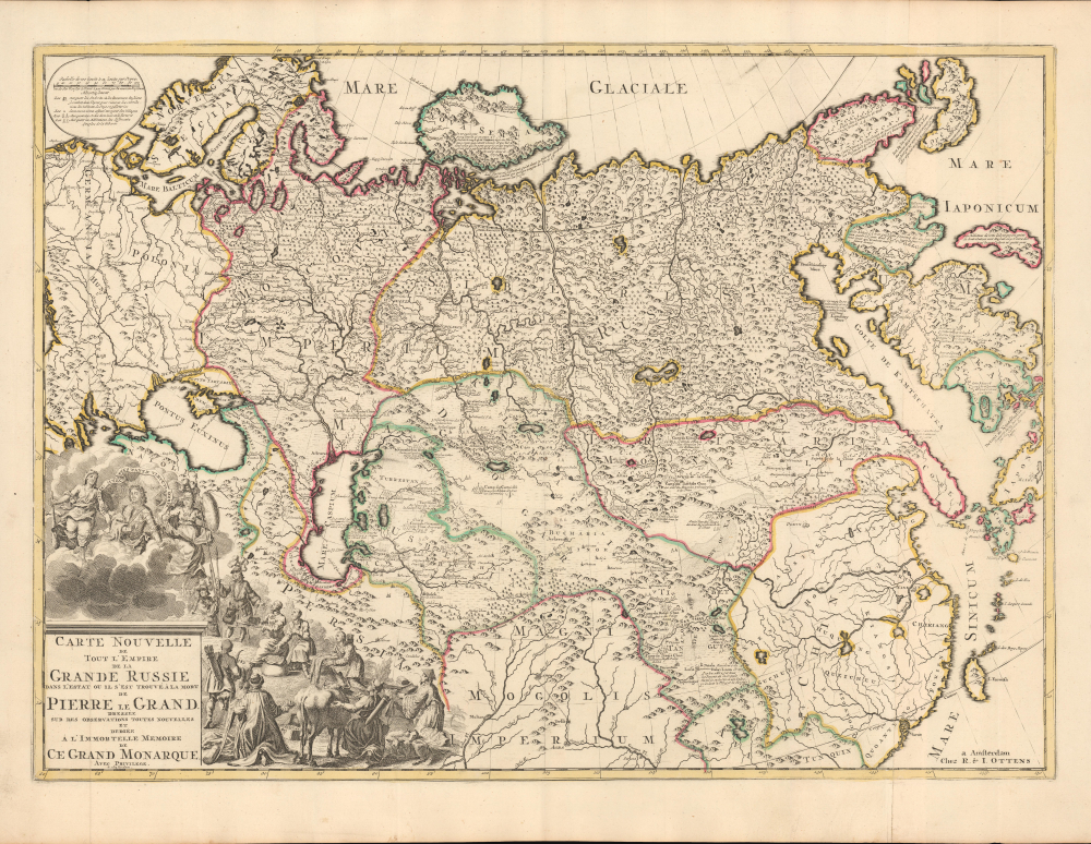
Carte nouvelle de tout l'Empire de la Grande Russie dans l'estat ou il s'est trouvé à la mort de Pierre le Grand. Dressée sur des observations toutes nouvelles et dedoée à l'immortelle memoire de ce Grand Monarque Avec Privilege à Amsterdam.
$3,500.00
Acquire
- Digital Map Information
- Suitable for large format printing
- DPI: 600
- File Size: 29.44 MB
- File Type: ZIP / TIFF
- ICC color profile embedded
- Delivered instantly via download link
This rare, separately issued map of the Russian Empire was printed by Renier and Josua Ottens c. 1730, but the map is based on the work of Philipp Johann von Strahlenberg. It is that mapmaker's first map of Russia and Siberia, stolen from him in 1715. Strahlenberg (1677 - 1747) would rebound to produce his superb 1730 Tattariae Magnae, one of the largest, most groundbreaking, and unique maps of Russia to appear in the first half of the 18th century. This beautiful engraving represents the first complete expression of Strahlenberg's efforts at his seminal mapping of Siberia and the Russian Arctic. (more details)
Estates of New York's 'Aristocracy'.

Map of Dutchess Co. New York from Actual Surveys.
$3,500.00
Acquire
- Digital Map Information
- Suitable for large format printing
- DPI: 600
- File Size: 205.94 MB
- File Type: ZIP / TIFF
- ICC color profile embedded
- Delivered instantly via download link
This is John Gillette's 1858 very large-format case map of Dutchess County, New York. It is notable, among other features, for including the estates of the leading families of New York, including the father and grandfather of future president Franklin D. Roosevelt. (more details)
Some of the Most Expensive Real Estate in New York City.
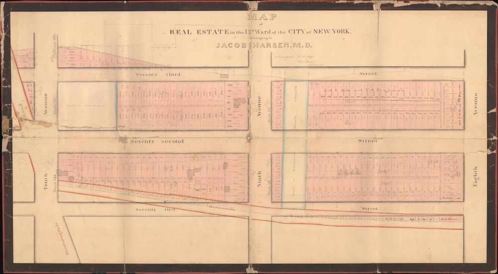
Map of Real Estate in the 12th Ward of the City of New York Belonging to Jacob Harsen, M.D.
$3,500.00
Acquire
- Digital Map Information
- Suitable for large format printing
- DPI: 600
- File Size: 60.42 MB
- File Type: ZIP / TIFF
- ICC color profile embedded
- Delivered instantly via download link
This is an 1848 John J. Serrell large-format manuscript plat map of a portion of the Upper West Side of Manhattan between 71st and 73rd Streets. Among other features, the map demonstrates the degree to which Manhattan's familiar grid pattern was misaligned with earlier properties in this portion of the island. (more details)
Coronelli's most focused map of the Hong Kong / Macao - Fujian - Manila circuit.
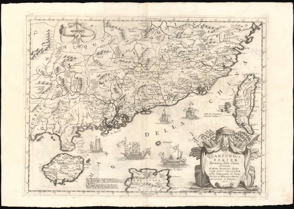
Quantung, e Fokien, Provincie della China, Dedicate Al Motlo Reverendo Padre Carlo Trigona, dell Compagnia di Gesu, Teologo diu Monsignor Illustriss. Arciuescovo di Palermo, etc.
$3,000.00
Acquire
- Digital Map Information
- Suitable for large format printing
- DPI: 600
- File Size: 73.55 MB
- File Type: ZIP / TIFF
- ICC color profile embedded
- Delivered instantly via download link
This is Vincenzo Coronelli's 1696 map of Guangdong and Fujian, China, including the islands of Hainan and Taiwan, the South China Sea, and part of Luzon in the Philippines. Of Coronelli's maps, it is the most focused on Hong Kong, the Pearl River Delta, and Macau, and is among the most detailed depictions of Taiwan of the 17th century. (more details)
Early Map of the Pearl River Delta published in Canton.
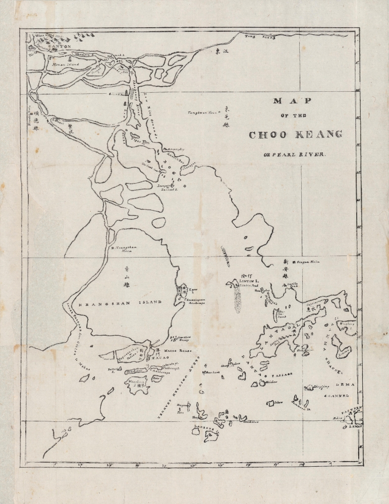
Map of the Choo Keang or Pearl River. / Chinese Repository (volume III)
$2,800.00
Acquire
- Digital Map Information
- Suitable for large format printing
- Full resolution TIFF file
- ICC color profile embedded
- Delivered instantly via download link
This is a rare 1835 map of the Pearl River, Canton, and Hong Kong, published in Canton (Guangzhou). It was issued for the 1835 The Chinese Repository (vol III), the first American journal of Sinology and the first American missionary publication in China. It reflects the increasing American interest in China, originating with 'the China Trade' and expanding into religious and cultural exchange in the early 19th century. (more details)
Cyanotype World War II route map!
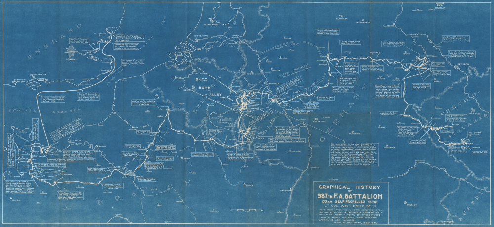
Graphical History of the 987th F.A. Battalion 155 MM Self Propelled Guns. Lt. Col. Wm. C. Smith, BN CO.
$2,500.00
Acquire
- Digital Map Information
- Suitable for large format printing
- DPI: 600
- File Size: 42.67 MB
- File Type: ZIP / TIFF
- ICC color profile embedded
- Delivered instantly via download link
This is a rare 1946 cyanotype World War II route map of the 987th Field Artillery Battalion in Europe, drawn by the battalion's commanding officer, Lieutenant Colonel William C. Smith. The map highlights moments throughout the 987th's campaign across Europe and provides snippets of the battalion's experiences in the war. This map is the only cyanotype route map we have encountered. Due to restrictions imposed by the cyanotyping process, this map was likely produced in a very small print run. (more details)
Roots of Riverside Park.
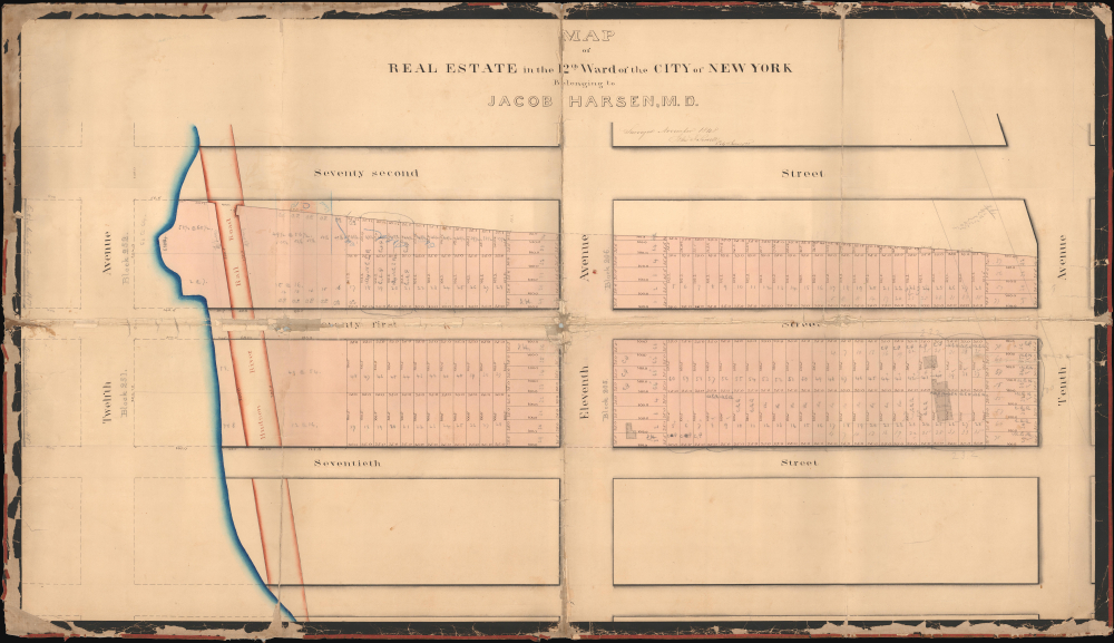
Map of Real Estate in the 12th Ward of the City of New York Belonging to Jacob Harsen, M.D.
$2,500.00
Acquire
- Digital Map Information
- Suitable for large format printing
- DPI: 600
- File Size: 60.66 MB
- File Type: ZIP / TIFF
- ICC color profile embedded
- Delivered instantly via download link
This is a 1848 John J. Serrell large-format manuscript plat map of a portion of the Upper West Side of Manhattan between 70th and 72nd Streets. The map heralds the wholesale transformation of this area in the following decades, from a collection of farms to one of the most desirable residential neighborhoods in New York City. (more details)
Boston's First Modern System of Piped Water.
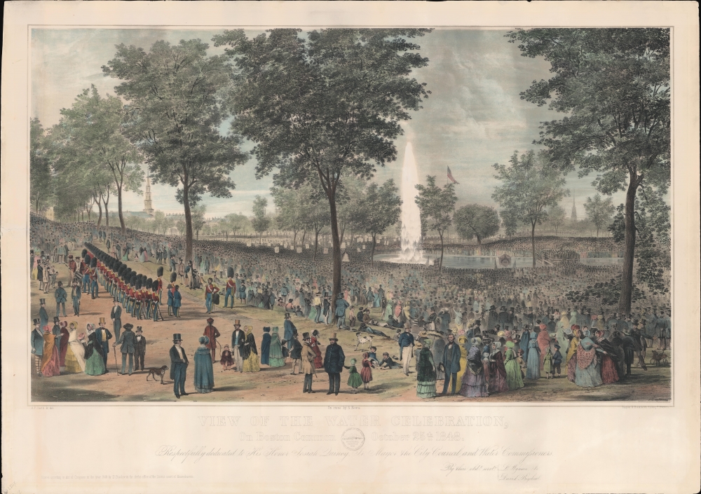
View of the Water Celebration, On Boston Common, October 25th 1848.
$2,000.00
Acquire
- Digital Map Information
- Suitable for large format printing
- DPI: 600
- File Size: 55.98 MB
- File Type: ZIP / TIFF
- ICC color profile embedded
- Delivered instantly via download link
A striking hand-tinted 1848 lithograph view depicting Boston Common during a ceremony to celebrate the opening of a publicly-administered city water supply system. The introduction of a public water system transformed Boston and, despite much debate, inaugurated an age of large-scale civil infrastructure projects that transformed Boston and other American cities. (more details)
Shanghai's French Concession amidst War.

Plan de la Concession française Changhai.
$2,000.00
Acquire
- Digital Map Information
- Suitable for large format printing
- Full resolution TIFF file
- ICC color profile embedded
- Delivered instantly via download link
This is a large-format diazotype proof map of the Shanghai French Concession, produced by the Concession's administration in 1937, a period defined by the Battle of Shanghai (August 13 - November 26, 1937) and a refugee crisis. The verso is equally intriguing, though perhaps unrelated, and bears the handwritten Order of Battle of a German infantry division in French. (more details)
Mid-Century Modern Advertising Splendor.
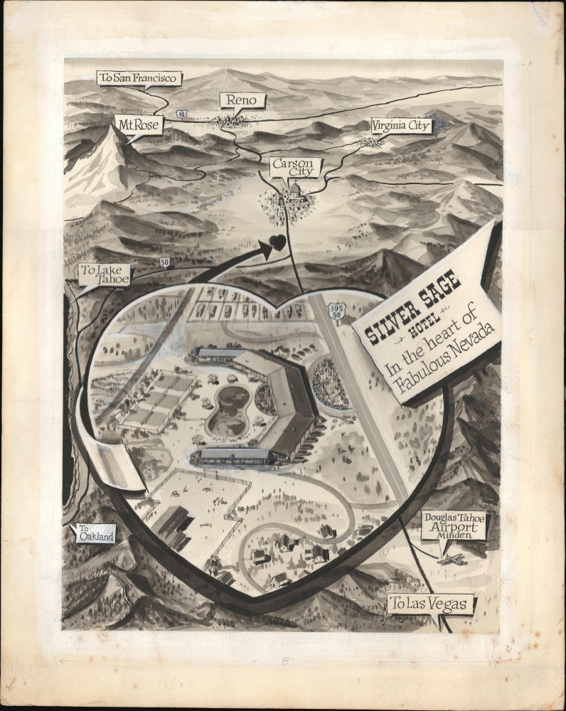
Silver Sage Hotel In the Heart of Fabulous Nevada.
$1,400.00
Acquire
This is an undated and unattributed c. 1955 manuscript pictorial promotional view of western Nevada prepared as a promotional piece for the Silver Sage Hotel. The piece is emblematic of graphic design and illustration of the era, which also saw a tourism boom to Nevada and Lake Tahoe. (more details)
Forgotten Austro-Turkish War of 1737-39.
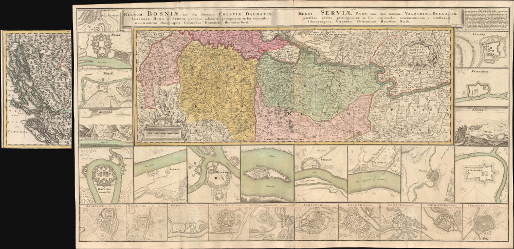
Theatrum belli inter imperat. Carol VI et sult. Achmet IV in partibus regnorum Serviae et Bosniae ex authenticis subsidys delineatum a Ioh. Fr. Ottingero. / Regnum Bosniae, una cum finitimis Croatiae, Damatiae, Slavoniae, Hung et Servia partibus… / Regni Servia una cum finitimis Valachiae et Bulgariae partibus…
$1,000.00
Acquire
- Digital Map Information
- Suitable for large format printing
- DPI: 600
- File Size: 83.1 MB
- File Type: ZIP / TIFF
- ICC color profile embedded
- Delivered instantly via download link
This is an uncommon large-format c. 1739 Homann Heirs map of the Balkans drawn by the royal military engineer Johann Friedrich (Franz) Ottinger (fl. c. 1736 - 1765). It is superbly detailed and includes two dozen insets of cities and fortifications, illustrating the events of the Austro-Turkish War of 1737 - 1739. (more details)
In the year the Grand Coulee Dam started producing electricity.
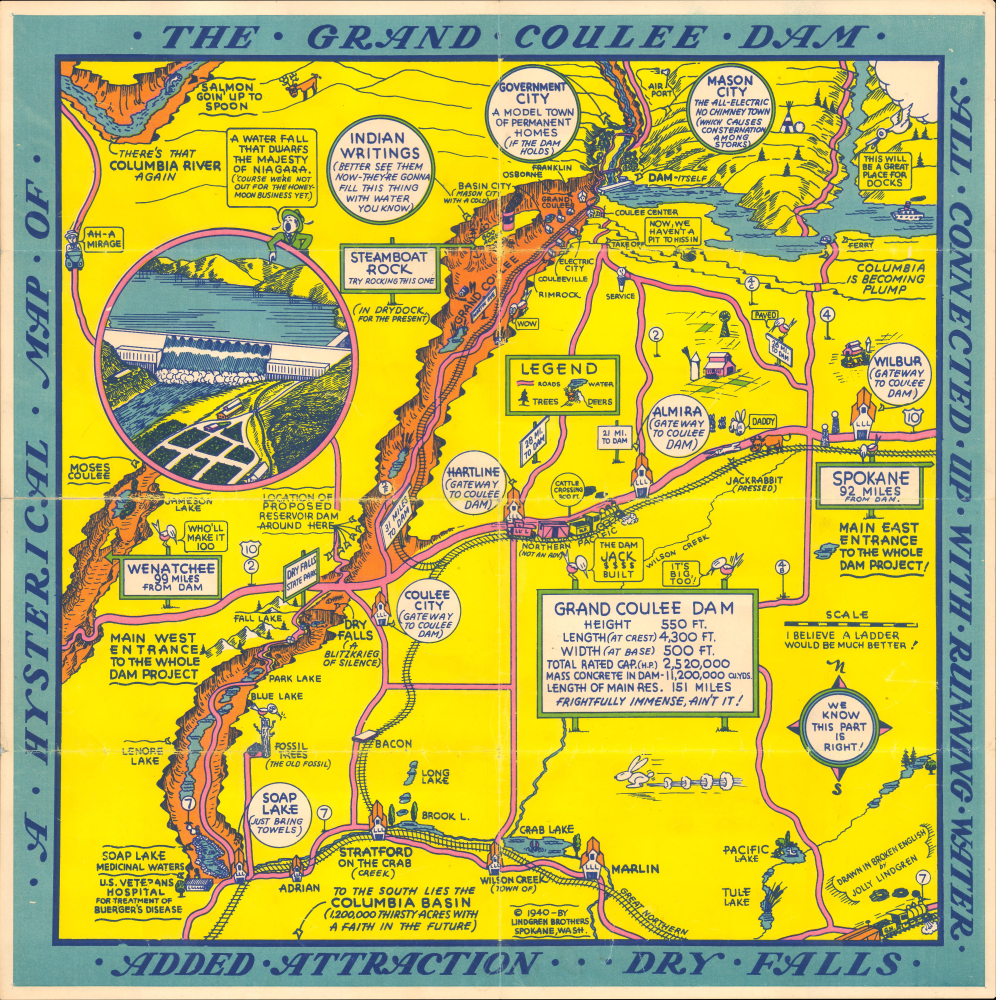
A Hysterical Map of the Grand Coulee Dam all Connected up with Running Water Added Attraction, Dry Falls
$650.00
Acquire
- Digital Map Information
- Suitable for large format printing
- DPI: 600
- File Size: 14.43 MB
- File Type: ZIP / TIFF
- ICC color profile embedded
- Delivered instantly via download link
This is Joly Lindgren's 1940 pictorial map of the Grand Coulee Dam on the Columbia River, Washington. This is a scarce silkscreened example. It is the second of Lindgren's two maps of the Grand Coulee Dam. That Lindgren reissued this map in 1940 is no mistake, for it was that year when the dam began operating and generating electricity, transforming not only the physical landscape but also the economic outlook of the entire region. Lindgren hints at this optimism in his humor, 'To the south lies the Columbia Basin 1,200,000 thirsty acres with a faith in the future'. (more details)
Celebrating Brooklyn!
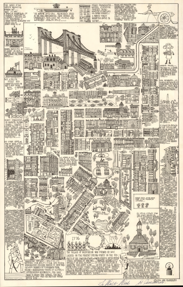
[Brooklyn] The Village of Breuckelen was formed in 1645 Located on the Present Fulton Street in the vicinity of ...
$550.00
Acquire
This is an unrecorded 1976 artist-signed pictorial map of Brooklyn, New York, drawn in July of 1975 by Joseph Gammarato for the Brooklyn Bicentennial Commission. The map celebrates all things Brooklyn and was issued to highlight Brooklyn's contributions to the American Revolutionary War (1775 - 1783). (more details)
Babylon for the Ba'athists.

خارطة العراق السياحية / [Iraq Tourist Map].
$550.00
Acquire
This is a c. 1972 Arabic-language tourism map of Iraq, prepared by the country's tourist administration. It is notable for its celebration of ancient cultures of the region, an important element in the ideology of the Ba'athist Party. (more details)
Victorian London.
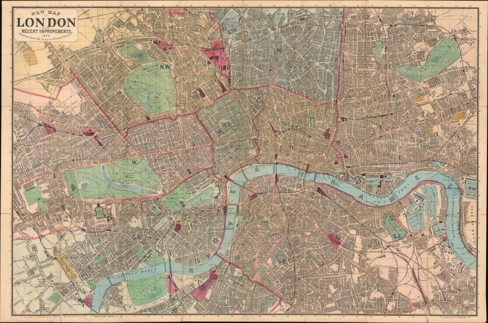
New Map of London with the Recent Improvements, 1874.
$500.00
Acquire
- Digital Map Information
- Suitable for large format printing
- Full resolution TIFF file
- ICC color profile embedded
- Delivered instantly via download link
This is a 1874 James Reynolds folding pocket city map or plan of London. It presents the city at the height of the Victorian era, when its infrastructure, including early underground railways, was developing rapidly to match its ballooning population. (more details)