
Noguera, Juan (sold)

Juan Noguera (fl. c. 1835 – 1870) was a Spanish draftsman and engraver based in Madrid during the middle part of the 19th century. Noguera drafted and engraved maps for Francisco Coello, Direccion de Hidrografia, and others. Juan Noguera should not be confused with Clemente Noguera, who was also a senior line-engraver at the Direccion de Hidrografia. The two engravers may or may not be related. Clemente was significantly older than Juan, and may have been an older relative.
Spanish issue nautical chart of Florida and the Bahamas.
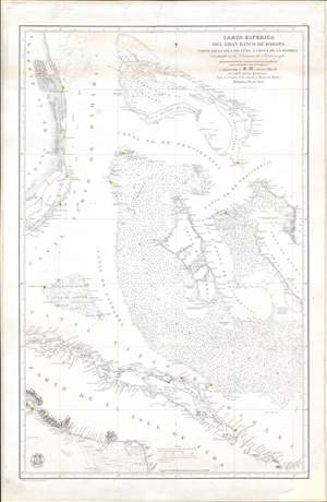
Carta Esférica del Gran Banco de Bahama parte de la Isla de Cuba y Costa de la Florida.
sold
- Digital Map Information
- Suitable for large format printing
- File Size: 33.52 MB
- File Type: ZIP / TIFF
- ICC color profile embedded
- Delivered instantly via download link
A scarce, large, and highly detailed 1858 nautical chart or maritime map of the Bahamas by the Spanish Direccion de Hidrografia. Within 3 years, this and similar maps would become a hot commodity for enterprising smugglers and blockade-runners supplying the Confederacy from bases in the Bahamas and Matazas, Cuba. Centered on Andros Island, the largest of the Bahama archipelagic state, the map depicts from Grand Bahama to Cuba and from Florida to Exuma. Cartographically and hydrographically, it is a compilation of Spanish and English surveys artfully combined. The Florida coast is illustrated in meticulous detail from, roughly, modern day Vero Beach to Matecumbe Key. Fort Jupiter, Boca Raton, the Miami River, Fort Lauderdale, and Fort Dallas are all noted. The Bahama Bank itself is dense with thousands of soundings - underscoring just how dangerous navigating these low-lying waters could be. The Cuba coast, is also illustrated with exceptional detail, as one would expect from a Spanish chart. (more details)
Highly detailed Spanish issue nautical chart of Florida and the Bahamas.
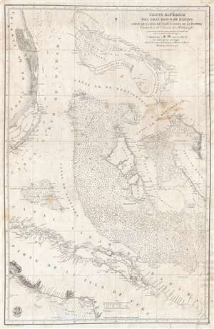
Carta Esférica del Gran Banco de Bahama parte de la Isla de Cuba y Costa de la Florida.
sold
- Digital Map Information
- Suitable for large format printing
- File Size: 20.42 MB
- File Type: ZIP / TIFF
- ICC color profile embedded
- Delivered instantly via download link
A scarce, large, and highly detailed 1858 nautical chart or maritime map of the Bahamas by the Spanish Direccion de Hidrografia . Centered on Andros Island, the largest of the Bahama family, the map covers from Grand Bahama to Cuba and from Florida to Exuma. ... (more details)
Includes the city of Iloilo, the third most active port in the Philippines.
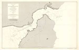
Archipiélago Filipino. Plano del Estrecho de Ilo - Ilo.
sold
- Digital Map Information
- Suitable for large format printing
- File Size: 53.29 MB
- File Type: ZIP / TIFF
- ICC color profile embedded
- Delivered instantly via download link
This is an 1875 Direccion de Hidrografia and D. Claudio Montero nautical chart or maritime map of the Iloilo Strait in the Philippines. The Iloilo Strait separates Panay Island from Guimaras Island and connects the Panay Gulf with the Guimaras Strait. Depth soundings are indicated throughout, as are banks and shoals. Points along the coast are labeled, as is the port city of Iloilo, which is today the third busiest port in the Philippines with regard to number of ships. A manuscript anchor in drawn near Iloilo, indicating the presence of a safe harbor. (more details)
Philippine-American War reissue of a Spanish Map of the Philippines.
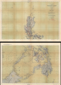
Carta General (en dos hojas) del Archipiélago Filipino.
sold
- Digital Map Information
- Suitable for large format printing
- Full resolution TIFF file
- ICC color profile embedded
- Delivered instantly via download link
This is a 1901 U.S. War Department map of the Philippines. Published during the Philippine-American War (1899 - 1902), the War Department repurposed a Spanish Direccion Hidrografia map originally published in 1870. (more details)