
Owen, William Fitzwilliam (sold)
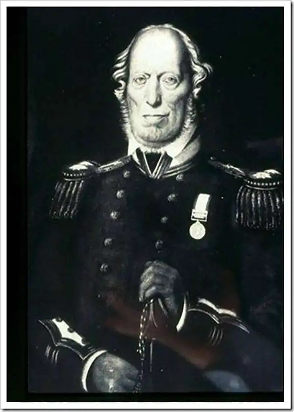
William Fitzwilliam Owen (September 17, 1774 - November 3, 1857) was an officer in the British navy and a renowned explorer. He embarked on the HMS Culloden as a midshipman at the age of 13 and began his life in the navy. He served under Lord Nelson during the first years of the Napoleonic Wars. In 1803, when war with France resumed, he was given command of the 16-gun brig HMS Safflower and sent to the East Indies, where he would spend the next few years. He explored the Maldives in 1806 and discovered the Seaflower Channel, which is between the islands of Siberut and Sipora off the west coast of Sumatra, that same year. In 1808 he was captured by the French and imprisoned in Mauritius for two years. he returned to England in 1813 and spent from 1815 to 1816 surveying the Canadian Great Lakes.
Between 1821 and 1826, Owen mapped the entire east coast of Africa from the Cape of Good Hope to the Horn of Africa in the sloop Leven. He returned in 1826 with 300 new charts which covered 30,000 miles of coastline, but over half of the original crew had died of tropical diseases. In the mid-1830s, nearing the end of his career, Owen moved his family to New Brunswick, where he became involved in local politics and even served as a justice of the peace. In the final action of his career in the Navy, Owen conducted the definitive survey of the Bay of Fundy between September 1842 and December 1847. Some charts in use today are based on his work.
Between 1821 and 1826, Owen mapped the entire east coast of Africa from the Cape of Good Hope to the Horn of Africa in the sloop Leven. He returned in 1826 with 300 new charts which covered 30,000 miles of coastline, but over half of the original crew had died of tropical diseases. In the mid-1830s, nearing the end of his career, Owen moved his family to New Brunswick, where he became involved in local politics and even served as a justice of the peace. In the final action of his career in the Navy, Owen conducted the definitive survey of the Bay of Fundy between September 1842 and December 1847. Some charts in use today are based on his work.
The earliest functional chart of the Maldives.
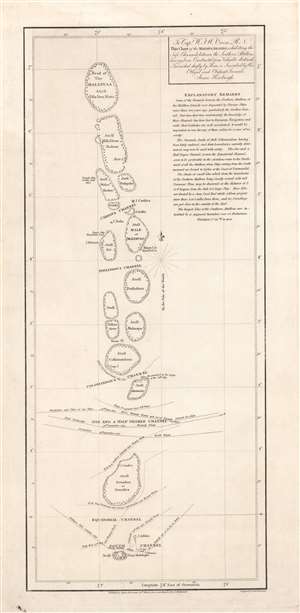
To Capt. W.F.W. Owen R.N. this chart of the Maldiva Islands, exhibiting the safe channels between the southern attollons.
sold
- Digital Map Information
- Suitable for large format printing
- DPI: 600
- File Size: 8.24 MB
- File Type: ZIP / TIFF
- ICC color profile embedded
- Delivered instantly via download link
This is a rare 1814 James Horsburgh nautical map of the central part of the Maldives or Maldivian Archipelago around Malé. Although seemingly simplistic, Horsburgh's chart marks a major advance in Europeans' geographical and hydrological knowledge of the archipelago. The dangerous, near impassible reefs, had long served as the archipelago's most effective and only line of defense against foreign imperialistic interests. This chart partially opened the islands to foreign navigation and marked the beginning of a long period of European influence. This Horsburgh chart served as the definitive mapping of the Maldives until the Robert Moresby surveys of 1834 - 1836. (more details)
With outstanding whaling annotations in manuscript.
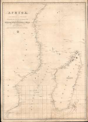
Africa Sheet V from Cape Correntes to Juba Islands including Madagascar, Comoro, Zanzibar Ids. And c.
sold
- Digital Map Information
- Suitable for large format printing
- DPI: 600
- File Size: 27.99 MB
- File Type: ZIP / TIFF
- ICC color profile embedded
- Delivered instantly via download link
An exceptional British Admiralty / William Fitzwilliam Owen 1828 nautical chart of Madagascar, Southeast Africa, and the Mozambique Channel, with unique manuscript annotations relating to a series of c. 1852 - 1856 whaling voyages in the south Indian Ocean. The annotations including charmingly illustrated whale tails recording whale sightings and takings, some of which are dated, others of which appear to relate to a numeric key, now lost. (more details)
With outstanding whaling annotations in manuscript.
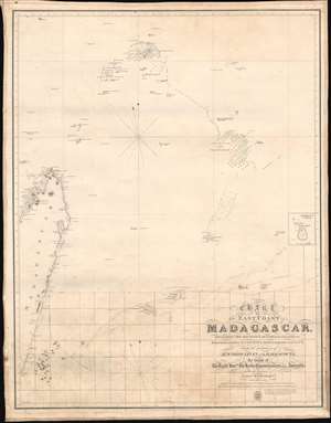
Chart of the East Coast of Madagascar, including the Mauritius, Seychelle Islands and c.
sold
- Digital Map Information
- Suitable for large format printing
- DPI: 600
- File Size: 20.05 MB
- File Type: ZIP / TIFF
- ICC color profile embedded
- Delivered instantly via download link
An exceptional British Admiralty / William Fitzwilliam Owen 1846 nautical chart of northeast Madagascar, Mauritius, and the Seychelles Archipelago with unique manuscript annotations relating to a series of c. 1852 - 1856 whaling voyages in the south Indian Ocean. The annotations including charmingly illustrated whale tails recording whale sightings and takings, some of which are dated, others of which appear to relate to a numeric key, now lost. (more details)
Updated example of a chart from the first survey of the east coast of Africa - depicting Zanzibar at the height of its influence in the slave trade.
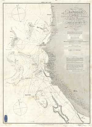
Zanzibar, S.W. Coast and Harbour, Surveyed by Capt. A.T.E. Vidal and Lieut. T. Boteler of H. M. Sloop Barracouta and Lieut. R. Owen of H. M. S. Leven. Assisted by the junior officers under the direction of Capt. W. F. W. Owen.
sold
- Digital Map Information
- Suitable for large format printing
- File Size: 12.57 MB
- File Type: ZIP / TIFF
- ICC color profile embedded
- Delivered instantly via download link
This is an 1873 William Fitzwilliam Owen map or chart of the west coast of Zanzibar, Tanzania. The map depicts a portion of the coast of Zanzibar and the Zanzibar Strait including Zanzibar City (Stone Town, Zanzibar or Shangany). The hydrography for this map was ... (more details)