
Pease, Richard H. (sold)
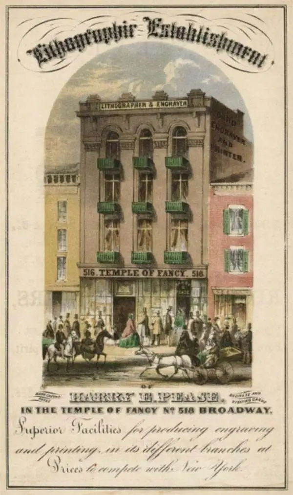
Richard H. Pease (1813 - 1869) was an American merchant and lithographer active in Albany, New York, during the middle part of the 19th century. Pease is best recognized for his publication of America's first Christmas card for the 1849 -1850 holiday season. He also played a role in populating the American version of Santa Claus and tying it to consumerism in the holiday advertisements his produced for his 'Temple of Fancy or Pease's Great Variety Store.' Pease operated the Great Variety Store in tandem with his lithography business until he passed the store on to his son, Harry E. Pease, in 1855. The store was located at 516 Broadway, Albany. Pease also published hand-colored lithographs of fruit for Ebenezer Emmons’s book Agriculture of New York State, published between 1846 and 1854. From 1856 to 1867 he worked with the lithography firm of Hoffman, Knickerbocker and Co.
Early history of the Hudson Valley.
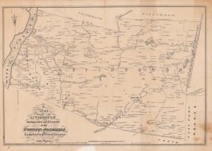
A Map of the Towns of Livingston Germantown and Clermont in the County of Columbia.
sold
- Digital Map Information
- Suitable for large format printing
- Full resolution TIFF file
- ICC color profile embedded
- Delivered instantly via download link
A fine example of David Vaughan's 1850 reissue of John Wigram's 1798 ornate map of the towns of Livingston, Germantown, and Clermont in Columbia County, New York. It was produced for The Documentary History of the State of New-York, an important reference work for the early history of the state. (more details)
New York under the Iroquois.
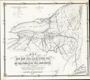
Map of Ho-De'-No-Sau-Nee-Ga or the Territories of the People of the Long House in 1720. Exhibiting the Home Country of the Iroquois with the Aboriginal Names of their Villages, Lakes, River, Streams and Ancient Localities, and the courses of their principal Trails.
sold
- Digital Map Information
- Suitable for large format printing
- DPI: 600
- File Size: 462.83 MB
- File Type: ZIP / TIFF
- ICC color profile embedded
- Delivered instantly via download link
This is the rare 1851 first edition of 'Father of American Anthropology' Lewis Henry Morgan and Seneca Sachem Ely S. Parker's map of New York as it existed under the Iroquois League c. 1720. This novel work is one of the few maps published in the 19th century to directly detail American Indian lands, routes of travel, and language. It is considered the first scientific representation of an American Indian Tribe on a map. (more details)
New York under the Iroquois.

Map of Ho-De'-No-Sau-Nee-Ga or the Territories of the People of the Long House in 1720. Exhibiting the Home Country of the Iroquois with the Aboriginal Names of their Villages, Lakes, River, Streams and Ancient Localities, and the courses of their principal Trails.
sold
- Digital Map Information
- Suitable for large format printing
- DPI: 600
- File Size: 478.64 MB
- File Type: ZIP / TIFF
- ICC color profile embedded
- Delivered instantly via download link
This is the rare 1851 first edition of 'Father of American Anthropology' Lewis Henry Morgan and Seneca Sachem Ely S. Parker's map of New York as it existed under the Iroquois League c. 1720. This novel work is one of the few maps published in the 19th century to directly detail American Indian lands, routes of travel, and language. It is considered the first scientific representation of an American Indian Tribe on a map. (more details)
Historically intriguing map overlaying French and English land grants along Lake Champlain.
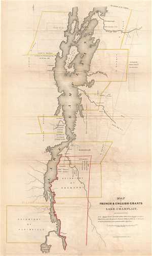
Map of French and English Grants on Lake Champlain.
sold
- Digital Map Information
- Suitable for large format printing
- DPI: 300
- File Size: 4.9 MB
- File Type: ZIP / TIFF
- ICC color profile embedded
- Delivered instantly via download link
This is an 1851 Richard H. Pease map of Lake Champlain. The map depicts Lake Champlain from the extreme northern end of Lake George to 45° 0' latitude and a certain amount of land on either side of the lake. French and English land grants surrounding the lake are ... (more details)
Historically intriguing map overlaying French and English land grants along Lake Champlain.
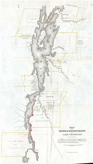
Map of French and English Grants on Lake Champlain.
sold
- Digital Map Information
- Suitable for large format printing
- DPI: 300
- File Size: 3.78 MB
- File Type: ZIP / TIFF
- ICC color profile embedded
- Delivered instantly via download link
This is an 1851 Richard H. Pease map of Lake Champlain. The map depicts Lake Champlain from the extreme northern end of Lake George to 45° 0' latitude and a certain amount of land on either side of the lake. French and English land grants surrounding the lake are ... (more details)
French and English land grants along Lake Champlain.
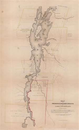
Map of French and English Grants on Lake Champlain.
sold
- Digital Map Information
- Suitable for large format printing
- Full resolution TIFF file
- ICC color profile embedded
- Delivered instantly via download link
This is an 1851 Richard H. Pease map of Lake Champlain illustrating French and English land grants. French grants are illustrated in yellow and English grants in black. However, the grant to Dominic Dellius in 1696 is different, as the northern part of the Dellius grant is presented using red lines. Apart from the depiction of the grants, very little detail is included. Depth in Lake Champlain is shown by hachure, and a few rivers are illustrated running into the lake. Both Grand Isle and Long Island are named. (more details)
French and English land grants along Lake Champlain.
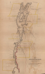
Map of French and English Grants on Lake Champlain.
sold
- Digital Map Information
- Suitable for large format printing
- File Size: 16.86 MB
- File Type: ZIP / TIFF
- ICC color profile embedded
- Delivered instantly via download link
This is an 1851 Richard H. Pease map of Lake Champlain illustrating French and English land grants. These grants were key to both French and English attempts to establish control over the strategically and commercially signficant lake. (more details)
Real Estate on Martha's Vineyard.
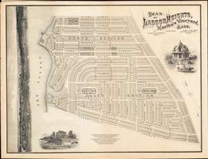
PLAN OF LAGOON HEIGHTS, Martha’s Vineyard, MASS.
sold
- Digital Map Information
- Suitable for large format printing
- File Size: 59.7 MB
- File Type: ZIP / TIFF
- ICC color profile embedded
- Delivered instantly via download link
A beautiful 1873 promotional map of Lagoon Height, present-day Oak Bluffs, Martha's Vineyard, Massachusetts. The map consists of a detailed street plan with housing lots and parks, as well as wonderful vignettes of exceptionally elegant Victorian era summer homes. Along the left is a dramatic panoramic advertising the spectacular view potential home buyers might enjoy. A promotional imprint at the bottom center directs interested buyers to the attention of J. and W. R. Wing of New Bedford Massachusetts. (more details)