
Pharoah, J. B.

J. B. Pharoah (fl. c. 1838 – 1869) was a Madras, India, based bookseller and publisher of educational books and maps active in the middle of the 19th century. He maintained a bookshop on Mount Road. The form of which was a general emporium for European published work. They also published a weekly English language newspaper called The Athenaeum and Statesman (in 1864 renamed, The Athenaeum and Daily News). They also published the The Madras Quarterly Medical Journal and The Madras Journal of Literature and Science.
Map of the Ganjam District, part of British India's Madras Presidency.
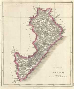
District of Ganjam.
$250.00
Acquire
- Digital Map Information
- Suitable for large format printing
- DPI: 300
- File Size: 2.95 MB
- File Type: ZIP / TIFF
- ICC color profile embedded
- Delivered instantly via download link
This is an unusual 1854 map of the Ganjam District (modern day Ganjam District and Srikakulam District in Odisha and Andhra Pradesh), India. It extends from the Chilika Lake south to Srikakulam or Chicacole. The map notes important towns, rivers, roads, and ... (more details)
Map of the North-Arcot district notes the town of Tirupati, one of the holiest sites in the Hindu religion.
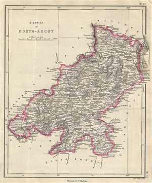
District of North-Arcot.
$250.00
Acquire
- Digital Map Information
- Suitable for large format printing
- DPI: 300
- File Size: 2.97 MB
- File Type: ZIP / TIFF
- ICC color profile embedded
- Delivered instantly via download link
This is an 1854 map of the district of North Arcot in Tamil Nadu, India. Issued by Pharoah and Company, it covers from Vandavasi north to Mettu and the Swarnamukhi River in the modern day state of Andhra Pradesh. Includes important towns, roads, lakes, ... (more details)
Map of the Trichinopoly district in British India.
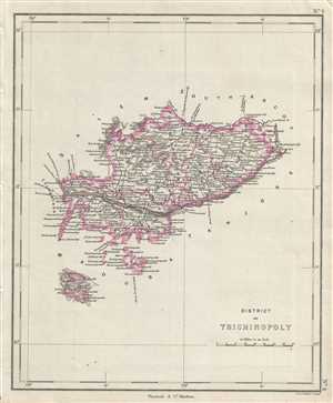
District of Trichinopoly.
$250.00
Acquire
- Digital Map Information
- Suitable for large format printing
- DPI: 300
- File Size: 2.3 MB
- File Type: ZIP / TIFF
- ICC color profile embedded
- Delivered instantly via download link
This is a nice example of the 1854 map of the District of Trichinopoly in the modern day state of Tamil Nadu, India, issued by Pharoah and Company. It covers from Karur east to Chidambaram. Includes important towns, roads, lakes, rivers and topography. ... (more details)
Map of the Khammam province of the princely state of Hyderabad, India.
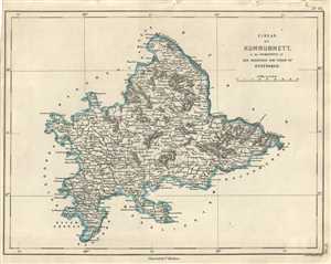
Circar of Kummummett in the Dominions of His Highness The Nizam of Hyderabad.
$250.00
Acquire
- Digital Map Information
- Suitable for large format printing
- DPI: 300
- File Size: 2.57 MB
- File Type: ZIP / TIFF
- ICC color profile embedded
- Delivered instantly via download link
This is an uncommon 1854 map of the Kummummet or Khammam Circar of the Nizam of Hyderabad. The map covers what is today the modern district of Khammam in the Indian state of Telangana from Kondapalli, Andhra Pradesh to Educberlapalle, Telangana. Notes ... (more details)
Pharoah and company map of the Kurnool district in the Indian state of Andhra Pradesh.
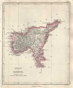
District of Kurnool.
$250.00
Acquire
- Digital Map Information
- Suitable for large format printing
- DPI: 300
- File Size: 2.24 MB
- File Type: ZIP / TIFF
- ICC color profile embedded
- Delivered instantly via download link
This is a lovely 1854 Pharoah and Company map of the Kurnool District of Andhra Pradesh, India. It extends from the Krishna River south to the Lankamalla reserved forest. Kurnool city is identified. The map notes important towns, roads, lakes, rivers, ... (more details)
Map of part of the Amravati division of Maharashtra, India under the rule of the Nizam of Hyderabad.
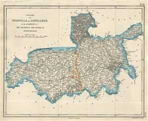
Circars of Nurnulla and Gawilghuk in the Dominions of His Highness the Nizam of Hyderabad.
$250.00
Acquire
- Digital Map Information
- Suitable for large format printing
- DPI: 300
- File Size: 2.71 MB
- File Type: ZIP / TIFF
- ICC color profile embedded
- Delivered instantly via download link
This is a good example of the 1854 Pharoah and Company map of part of the Amravati Division or the districts of Akola, Buldhana and Amravati in the Indian state of Maharashtra. It covers the circars or sarkars of Nurnulla and Gawilghur ruled by the ... (more details)
Map of the dominions of the Nizam of Hyderabad when India was under British control.
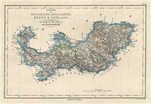
Circars of Nuldroog, Kullianee, Beder and Kowlass in the Dominions of His Highness the Nizam of Hyderabad.
$250.00
Acquire
- Digital Map Information
- Suitable for large format printing
- DPI: 300
- File Size: 3.09 MB
- File Type: ZIP / TIFF
- ICC color profile embedded
- Delivered instantly via download link
This is an attractive 1854 Pharoah and Company map of the Circars of Naldurg, Kalyani, Bidar and Kowlass under the Nizam of Hyderabad. The map extends from Dhoki Town in the modern day Osmanabad District of Maharashtra east past the Manjeera River ... (more details)
19th century map of the divisions of the princely state of Hyderabad during British rule.
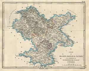
Circars of Maiker, Bassim & Patree in the Dominions of His Highness the Nizam of Hyderabad.
$250.00
Acquire
- Digital Map Information
- Suitable for large format printing
- DPI: 300
- File Size: 2.69 MB
- File Type: ZIP / TIFF
- ICC color profile embedded
- Delivered instantly via download link
This is an uncommon 1854 map of the Buldhana, Washim and Parbhani districts in the Indian state of Maharashtra. The map was issued by Pharoah and Company in 1854 and depicts the region when it was divided into the circars or sarkars of Maiker ... (more details)
Map depicting the dominions of the Nizam of Hyderabad in parts of Maharashtra and Telangana, India.
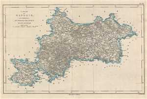
Circar of Nandair in the Dominions of His Highness the Nizam of Hyderabad.
$250.00
Acquire
- Digital Map Information
- Suitable for large format printing
- DPI: 300
- File Size: 3.72 MB
- File Type: ZIP / TIFF
- ICC color profile embedded
- Delivered instantly via download link
This is a lovely map depicting the circar of Nanded under the Nizam of Hyderabad corresponding to parts of the modern day districts of Nanded, Latur in Maharashtra and Nizamabad and Adilabad in Telangana. Issued by Pharoah and Company in ... (more details)
19th century map of the princely state of Hyderabad during British rule.
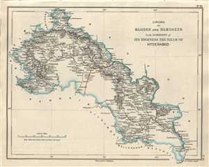
Circars of Mahoor and Ramgheer in the Dominions of His Highness the Nizam of Hyderabad.
$250.00
Acquire
- Digital Map Information
- Suitable for large format printing
- DPI: 300
- File Size: 2.58 MB
- File Type: ZIP / TIFF
- ICC color profile embedded
- Delivered instantly via download link
This is a lovely 1854 Pharoah and Company map of part of the Yavatmal and Adilabad districts in the Indian states of Maharashtra and Telangana. It covers the circars of Mahoor and Ramgheer ruled by the Nizam of Hyderabad under the ... (more details)
Pharoah map depicting part of the state of Tamil Nadu, India.
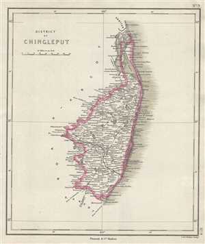
District of Chingleput.
$250.00
Acquire
- Digital Map Information
- Suitable for large format printing
- DPI: 300
- File Size: 2.3 MB
- File Type: ZIP / TIFF
- ICC color profile embedded
- Delivered instantly via download link
This is an interesting 1854 map of the District of Chingleput in the modern day state of Tamil Nadu, India, issued by Pharoah and Company. It depicts the district from the Pulicat Lake south to Marcanum (Marakkannam) near ... (more details)
Beautiful map depicting the Bellari District of Karnataka, India.
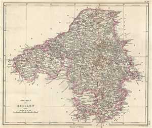
District of Bellary.
$250.00
Acquire
- Digital Map Information
- Suitable for large format printing
- DPI: 300
- File Size: 4.45 MB
- File Type: ZIP / TIFF
- ICC color profile embedded
- Delivered instantly via download link
This is an uncommon 1854 Pharoah and Company map of the district of Bellary in Karnataka, India. The map covers the district from Hyderabad south to Bangalore and from Dharwar east to Cuddapah. At the time this map was ... (more details)
Beautiful map of the Tajore district in Tamil Nadu, India, home of the Tanjore paintings.
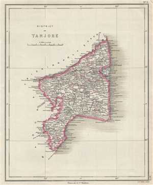
District of Tanjore.
$250.00
Acquire
- Digital Map Information
- Suitable for large format printing
- DPI: 300
- File Size: 2.55 MB
- File Type: ZIP / TIFF
- ICC color profile embedded
- Delivered instantly via download link
This is a nice example of the 1854 map of the District of Tanjore in the modern day state of Tamil Nadu, India, issued by Pharoah and Company. It covers from Mimbesel (Mimisal) north to Pazhaiyar or the entrance of the ... (more details)
19th century map of the princely state of Hyderabad during British rule.
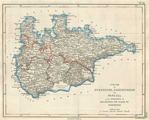
Circars of Ghunapoor, Davercondah and Pangull in the Dominion of His Highness the Nizam of Hyderabad.
$250.00
Acquire
- Digital Map Information
- Suitable for large format printing
- DPI: 300
- File Size: 2.67 MB
- File Type: ZIP / TIFF
- ICC color profile embedded
- Delivered instantly via download link
This is an uncommon 1854 Pharoah and Company map of the Circars or Sarkars of Ghunapoor, Davercondah and Pangull under the Nizam of Hyderabad. The map covers what is today part of the Districts of Nalgonda and ... (more details)
19th century map of the princely state of Hyderabad during British rule.
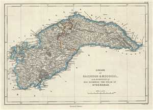
Circars of Raichoor and Moodgul in the Dominions of His Highness The Nizam of Hyderabad.
$250.00
Acquire
- Digital Map Information
- Suitable for large format printing
- DPI: 300
- File Size: 3.22 MB
- File Type: ZIP / TIFF
- ICC color profile embedded
- Delivered instantly via download link
This is a nice 1854 map of the Circars or Sarkars of Raichur and Mudgul under the Nizam of Hyderabad issued by Pharoah and Company. It covers what are today the Raichur and Koppal districts in the Indian state ... (more details)
Town plan of Samalkota in the Indian state of Andhra Pradesh.
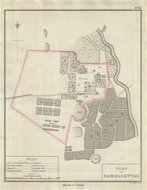
Plan of Samulcottah.
$175.00
Acquire
- Digital Map Information
- Suitable for large format printing
- DPI: 300
- File Size: 2.22 MB
- File Type: ZIP / TIFF
- ICC color profile embedded
- Delivered instantly via download link
This is a nice 1854 Pharoah and Company map of the town of Samalkota located in the East Godavari district of Andhra Pradesh, India. The map notes rivers, important roads, bazaars, tanks and military ... (more details)
Lovely depiction of the town of Eluru, India under British control.
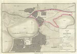
Plan of Ellore.
$200.00
Acquire
- Digital Map Information
- Suitable for large format printing
- DPI: 300
- File Size: 4.08 MB
- File Type: ZIP / TIFF
- ICC color profile embedded
- Delivered instantly via download link
This is a nice example of the 1854 Pharoah and Company map of the town of Eluru in the Indian State of Andhra Pradesh. It covers the town at the time it was a military station and part of the Madras ... (more details)