
Valentijn, Francois (sold)
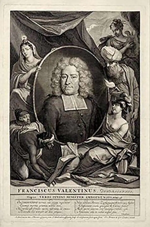
Francois Valentijn (April 17, 1666 - August 6, 1727) was a Dutch minister, naturalist, colonial administrator, and historian active in Holland and the East Indies, in the late 17th and early 18th centuries. Valentijn was born in Dordrecht, Holland and studied at the Universities and Leiden and Utrecht before, in 1685, taking a position with the Dutch East India Company (VOC). He remained in the East Indies for about 10 years before returning to Dordrecht. Unable to adjust to life in Europe, he returned to the East Indies in 1705 where he remained for another 9 years. After 19 total years in the Orient working for the VOC, Valentijn once again returned to Holland where he composed his eight volume five part masterwork Oud en Nieuw Oost-Indien. The scope and detail of this work, including over 1000 engraved images and numerous maps was unprecedented with regards to Asia. The work contained some of the finest and most detailed large scale maps of the East Indies ever published. The most important of these focus on Taiwan and Malaya. Valentijn most likely drew on secret VOC manuscript maps and documents, a fact that makes it exceptionally surprising that his works were actually published. Valentijn academic scholarship, in sharp contrast to his cartographic work, is often highly criticized as being self-aggrandizing and, more often than not, plagiarized.
Enforcers of the Dutch Spice Monopoly.
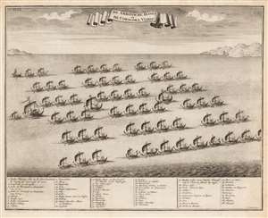
De Ambonsche Hongi of de Coracora Vloot.
sold
- Digital Map Information
- Suitable for large format printing
- DPI: 600
- File Size: 14.38 MB
- File Type: ZIP / TIFF
- ICC color profile embedded
- Delivered instantly via download link
This is a 1724 engraved illustration of the Hongi Fleet of 1702 under the command of Dutch official Balthazar Coyett (c. 1650 - 1725), Governor of the Dutch colony at Ambon. The Hung Fleet were a part Dutch, part indigenous Moluccan fleet of kora-kora shipped contracted to enforce the Hongitochten inspections of the VOC (Dutch East India Company) spice monopoly. (more details)
Ayutthaya's Golden Age.
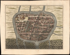
Judia, de Hoofd-Stad van Siam.
sold
- Digital Map Information
- Suitable for large format printing
- File Size: 13.8 MB
- File Type: ZIP / TIFF
- ICC color profile embedded
- Delivered instantly via download link
This is a striking 1726 Francois Valentijn view and map of Ayutthaya, capital of Siam (Thailand), under the aptly named Ayutthaya Kingdom (1351 - 1767), considered a golden age for Thailand. The map illustrates the city at its peak when it was one of the world's largest and wealthiest. At this time, few Europeans had contact with Ayutthaya, as the French and other Europeans were banned from the Kingdom in 1688, leaving only the Dutch with a tenuous presence. (more details)
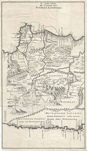
N. Vysde bestek, De Landen van Panaraga, Kadoewang.
sold
- Digital Map Information
- Suitable for large format printing
- Full resolution TIFF file
- ICC color profile embedded
- Delivered instantly via download link
This is a rare and exquisite 1726 map of central Java by Francois Valentijn. It covers from modern day Semarang (Samarang) east to Tuban (Toeban). The important cities of Madiun (Madion), Ponorogo (Panaraga) and others are noted. The map offers beautiful ... (more details)
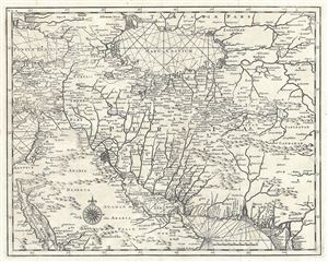
[Persia].
sold
- Digital Map Information
- Suitable for large format printing
- Full resolution TIFF file
- ICC color profile embedded
- Delivered instantly via download link
This is a rare 1726 map of Persia by Francois Valentijn. It covers from the Gulf of Suez eastward to Ahmedabad (Amadabad) in modern day western India. This map, centered on Persia, includes the Caspian Sea and part of the Arabian Peninsula. The map is ... (more details)
Dominant map of Persia and Afghanistan at the beginning of the 18th century
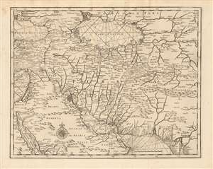
[Persia]
sold
- Digital Map Information
- Suitable for large format printing
- Full resolution TIFF file
- ICC color profile embedded
- Delivered instantly via download link
This is a rare 1726 map of Persia by Francois Valentijn. It covers from the Gulf of Suez eastward to Ahmedabad (Amadabad) in modern-day western India. This map, centered on Persia, includes the Caspian Sea and part of the Arabian Peninsula. The map is highly detailed, noting numerous rivers, towns, islands and mountains. Stippling along the coastlines indicates shallows. The detail of this elegant and scarce map, alas, reflects the cartography of the previous centuries: place names are largely consistent with those found on the 16th century maps of Giacomo Gastaldi, which were largely passed along wholesale to Blaeu, whose labors this map's maker appears to have mined. (more details)
Earliest and most desirable printed map of Taiwan / Formosa.
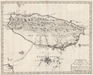
Kaart van het Eyland Formosa en de Eylanden van Piscadores.
sold
- Digital Map Information
- Suitable for large format printing
- DPI: 600
- File Size: 45.16 MB
- File Type: ZIP / TIFF
- ICC color profile embedded
- Delivered instantly via download link
Printed in 1726 by Francois Valentijn, this is the earliest and most desirable printed map of Taiwan or Formosa. It is considered the first specific printed map of Formosa. Oriented to the east, with north at the left, Valentijn's map covers the entire island was well as the nearby Pescadores, now known as the Penghu Islands, and the nautical route to the Chinese coastal province of Fujian. Soundings appear around the Pescadores, along the west coast of Taiwan, and extend to the Chinese coast. (more details)
Early map showing landholders throughout the Cape.
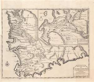
Nieuwe Kaart van Caap der Goede Hoop in hare rechte jegenwoordige staaat vertoond door Francois Valentyn.
sold
- Digital Map Information
- Suitable for large format printing
- DPI: 600
- File Size: 126.67 MB
- File Type: ZIP / TIFF
- ICC color profile embedded
- Delivered instantly via download link
A beautiful and remarkable 1726 Francois Valentijn map of the Cape of Good Hope, South Africa. This piece comprises two important maps printed on a single sheet. The primary map details the Cape of Good Hope from the Doornbosch River to the Baay van Algoa (Algoa Bay). The second map, appearing in the upper right quadrant, offers a more detailed depiction of the modern day Cape Town region from Robben Island to False Bay and east as far as Draakenstein. Both maps offer exceptional inland detail with landholders noted throughout - an exceptionally valuable resource for anyone studying the early development of the Cape. Being one of the earliest sophisticated maps of the region, Valentijn's chart was used as a model by numerous subsequent cartographers. (more details)
One of the first accurate maps of the interior of Thailand (Siam).
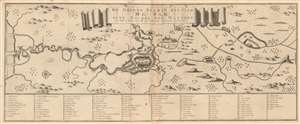
De Groote Siamse Rievier Me-Nam ofte Moeder der Wateren inharen loop met de in vallende Spruyten Verbeeld.
sold
- Digital Map Information
- Suitable for large format printing
- DPI: 600
- File Size: 19.24 MB
- File Type: ZIP / TIFF
- ICC color profile embedded
- Delivered instantly via download link
This is a rare 1726 Francois Valentijn map of the Chao Phraya River, Thailand. Roughly translated, the title reads, 'The Great Siamese River Me-Nam, or Mother of Waters, its course and its tributaries displayed.' Centered on the Siamese capital of Ayutthaya and oriented to the west, the map extends inland several hundred miles from the Gulf of Thailand to central Thailand. Bangkok, identified as 'Fortres Banckok' appears on the left side of the map as no. 12. At the mouth of the Chao Phraya, described here as the Me-nam, a Dutch flag flies from a building (no. 5), no doubt the VOC (Dutch East India Company) storehouse. This is one of the first published maps to offer accurate first-hand information on the interior of Siam. In total some 101 locations are referenced in the table below the map. The wonderful research below can be attributed to the superb research compiled by Barend J Terwiel and published as François Valentijn’s Map of 'The Great Siamese River Me-Nam'. (more details)
One of the first accurate maps of the interior of Thailand (Siam).
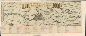
De Groote Siamse Rievier Me-Nam ofte Moeder der Wateren inharen loop met de in vallende Spruyten Verbeeld.
sold
- Digital Map Information
- Suitable for large format printing
- File Size: 21.25 MB
- File Type: ZIP / TIFF
- ICC color profile embedded
- Delivered instantly via download link
This is a rare 1726 Francois Valentijn map of the Chao Phraya River, Thailand. This is among the earliest published maps to offer first-hand information on the interior of Siam. (more details)
Exceedingly rare map of Singapore and the Straits of Malacca.
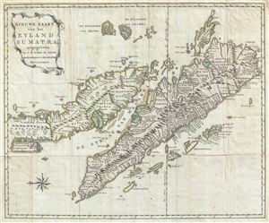
Nieuwe Kaart van het Eyland Sumatra, uitgegeeven by C. H. Bohn en Zoon, Boekverkopers te Haaarlem MDCCLXXXIII.
sold
- Digital Map Information
- Suitable for large format printing
- DPI: 300
- File Size: 15.39 MB
- File Type: ZIP / TIFF
- ICC color profile embedded
- Delivered instantly via download link
A fine engraved 1783 map of the Malay Peninsula, Singapore, the Straits of Malacca, and Sumatra by Christoph Heinrich Bohn. Oriented to the east, Bohn's map covers from the Island of Junsalan (Penang / Prince of Wales Island / Pulu Pinang) south as ... (more details)