
Vooght, Claes Jansz (sold)

Claes Jansz Vooght (1638 – 1696) was a Dutch astronomer, mathematician, teacher, surveyor and cartographer active in Amsterdam during the 17th century. Vooght described himself as a 'surveyor and teacher of mathematics and the art of navigation' and published extensively on these subjects. His is known to have been a surveyor for the Council of Holland and co-authored several books with Rembrantsz Dirck van Nierop. Though little is known of Vooght's life, his most important cartographic work appeared in conjunction with the prominent Johannes Van Keulen firm, with whom he partnered in 1680. Vooght was responsible for creating and compiling most of the maps in Van Keulen's seminal Nieuwe Lichtende Zee-Fakkel, with many early editions bearing only his name.
One of the most decorative early nautical charts of the American Southeast.
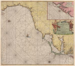
Pas Kaart van de Kust van Carolina tusschen C de Canaveral en C Henry.
sold
- Digital Map Information
- Suitable for large format printing
- DPI: 300
- File Size: 21.25 MB
- File Type: ZIP / TIFF
- ICC color profile embedded
- Delivered instantly via download link
Among the most scarce and decorative Dutch nautical charts of the American southeast, this is Johannis Van Keulen's and C. J. Vooght's 1687 maritime map of the Virginia, Carolina, Georgia and Florida coasts. Oriented to the west (with north to the right), this map ... (more details)
The earliest nautical chart to specifically detail the southeast Florida coast.
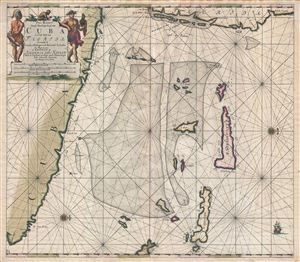
Pas Kaart Vande Noord Oost Kust van Cuba en d'Oost Kust van FLORIDA vervaatende de Canal van Bahama met de Bahaamse Eylende Door Vooght Goemetra…
sold
- Digital Map Information
- Suitable for large format printing
- DPI: 300
- File Size: 20.93 MB
- File Type: ZIP / TIFF
- ICC color profile embedded
- Delivered instantly via download link
A fine old color example of Claes Jansz Vooght and Johannes Van Keulen's 1687 nautical chart or maritime map of the approaches to the Straits of Florida. Oriented to the west, this map covers from the eastern tip of Cuba to the Bahamas and from Florida to exuma, ... (more details)
One of the first charts to name Philadelphia.
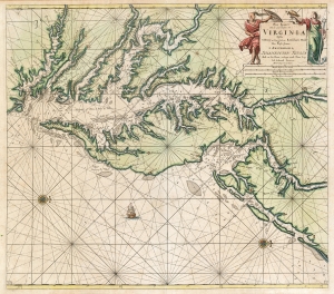
Pas kaart van de zee kusten van Virginia : tusschen C. Henry en t hooge land van Renselaars Hoek...
sold
- Digital Map Information
- Suitable for large format printing
- DPI: 600
- File Size: 27.92 MB
- File Type: ZIP / TIFF
- ICC color profile embedded
- Delivered instantly via download link
This is Van Keulen's 1695 nautical chart or maritime map of Chesapeake Bay, Delaware Bay, and the adjacent coastlines. It is one of the first charts to utilize the 1673 Hermann map as a source, making it one of the most up-to-date charts of the region - and a vast improvement on the 1675 Roggeveen, specifically because Van Keulen's chartmaker, Vooght, relied on the English Hermann map rather than Hessel Gerritz's c. 1630 chart. (more details)
The Raiding Ground of Buccaneers.
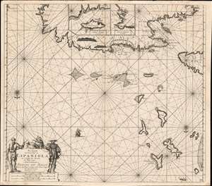
Pas kaart Van de Noord Kust van Espaniola met d Eylanden daar Benoorden.
sold
- Digital Map Information
- Suitable for large format printing
- DPI: 600
- File Size: 27.24 MB
- File Type: ZIP / TIFF
- ICC color profile embedded
- Delivered instantly via download link
A beautifully engraved 1684 nautical chart or maritime map of the north coast of Hispaniola, the east end of Cuba, the Turks and Caicos islands, and the southeastern reaches of the Bahamas. This southern-oriented chart depicts the heart of the raiding territory of the 'Brethren of the Coast', the buccaneers. (more details)
Dutch New York at the time of the British takeover.
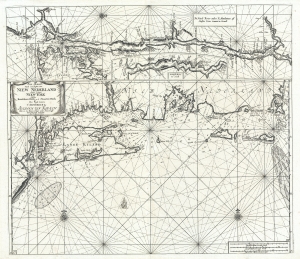
Pas-kaart vande zee kusten van Niew Nederland anders genaamt Niew York tusschen Renselaars Hock en de Staaten Hoek.
sold
- Digital Map Information
- Suitable for large format printing
- Full resolution TIFF file
- ICC color profile embedded
- Delivered instantly via download link
This is Johannes van Keulen and Claes Janszoon Vooght's 1702 map of New York, Long Island, the Hudson River, and the Connecticut River. First appearing in 1684, this is the second earliest published map to detail the coast between Long Island and Cape Cod. It also features the earliest published maps of any American River. Furthermore, many of the place names throughout make their first appearance here. As such, it may be considered the high point of Dutch knowledge about New Amsterdam before the British takeover. (more details)