
Vrients, Johannes Baptista (sold)

Johannes Baptista Vrients (1552 - 1612) was a Flemish engraver, publisher, and mapseller. Little is known of his early years, but it is to be assumed he came up as an apprentice among the mapmakers of Antwerp, where the guild named him a master in 1575. In the 1590s, he executed world maps for Plancius and Linschoten. (In 1600, after Ortelius died, he became the estate's executor and acquired the plates for the Theatrum.) He would go on to publish further editions of the Ortelius atlas between 1606 and 1612. Vrients also acquired the plates for Gerard De Jode's (1516/17 - 1591) Speculum in and around 1600, but he did not republish that work - though he would preserve the De Jode plates depicting the Electors of the Holy Roman Empire, reprinting it in his editions of the Ortelius atlas after 1603. Most likely, his purchase of the De Jode plates was a play to keep them off the market. Vrients' editions of the Theatrum were not published in Antwerp (that city having fallen during the Dutch war with Spain) but in Amsterdam.
First European map specifically of China to appear in a modern atlas.
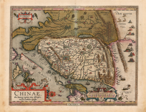
Chinae, olim Sinarum regionis, nova descriptio. auctore Ludovico Georgio.
sold
- Digital Map Information
- Suitable for large format printing
- Full resolution TIFF file
- ICC color profile embedded
- Delivered instantly via download link
This is Abraham Ortelius' 1584 map of China, the first specific map of China to appear in an atlas, here in a beautiful, original-color example of a 1602 Vrients edition. Based on reports of Portuguese missionaries, Ortelius' map was not substantially improved upon until the 1655 maps of Martino Martini (卫匡国; 1614 - 1661). The map is visually unique, with its western orientation and abundant decorative elements. (more details)
First printed map to illustrate the Chesapeake Bay.
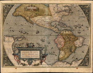
Americae Sive Novi Orbis Nova Descriptio.
sold
- Digital Map Information
- Suitable for large format printing
- Full resolution TIFF file
- ICC color profile embedded
- Delivered instantly via download link
This is Abraham Ortelius' map of the Americas in an attractive, early example of the 1587 third plate, printed in 1589. It represents the state-of-the-art mapping of the Western Hemisphere during the initial period of European Colonization. It is significant as the first printed map to illustrate the Chesapeake Bay, predating John White's 1590 map of Virginia. (more details)
One of the most desirable maps of any part of the world, ever printed.
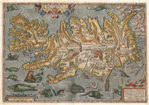
Islandia.
sold
- Digital Map Information
- Suitable for large format printing
- Full resolution TIFF file
- ICC color profile embedded
- Delivered instantly via download link
This is a beautiful example of the Vrients issue of Abraham Ortelius' 1587 map of Iceland. Ortelius' Islandia is arguably the most famous decorative map, being the 'monster map' par excellence, as it presents a menagerie of sea monsters typically found on early maps. The map is geographically important as well. It strongly evokes Iceland's astonishing terrain with its vigorously engraved mountains, and it is remarkably accurate since it is the first map of Iceland based on reports of an Icelander, Gudbrandur Thorlaksson (Guðbrandur Þorláksson; c. 1542 0 1627). (more details)
Paradisiacal Vale of Tempe, in the Coastal Mountains of Greece.
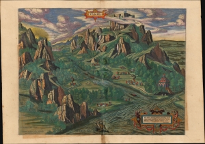
Tempe.
sold
- Digital Map Information
- Suitable for large format printing
- Full resolution TIFF file
- ICC color profile embedded
- Delivered instantly via download link
This is a lush example of Ortelius' 1590 engraving Vale of Tempe and Mount Olympus, Greece, here in a beautiful 1603 original color example. (more details)
First Printed Map to show the Chesapeake Bay.
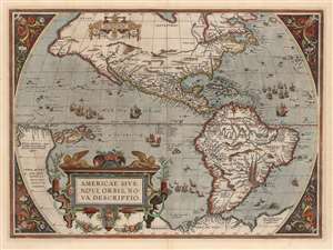
Americae Sive Novi Orbis Nova Descriptio.
sold
- Digital Map Information
- Suitable for large format printing
- DPI: 600
- File Size: 50.62 MB
- File Type: ZIP / TIFF
- ICC color profile embedded
- Delivered instantly via download link
This is Abraham Ortelius' map of the Western Hemisphere, in an attractive example of the 1587 third state. It represents the state-of-the-art mapping of the Americas during the initial period of European Colonization and the first printed map to illustrate the Chesapeake Bay. (more details)
First Atlas Map of the Caribbean, and Northwestern Mexico.
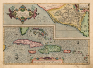
Culiacanae, America Regionis Descriptio./ Hispaniolae, Cubae, Aliarumque Insularum Circumiacentium, Delineatio./ Cum Imp. et Regio./ privilegio decennali 1579.
sold
- Digital Map Information
- Suitable for large format printing
- Full resolution TIFF file
- ICC color profile embedded
- Delivered instantly via download link
This is a beautiful, original color example of Ortelius' 1579 map of Cuba and the Caribbean, combined with his map of the Viceroyalty of Culiacan in Northwestern Mexico. Moreover, this is a Vrients edition of the map: maps from Vrients editions typically exhibit finer quality color than those printed during Ortelius' lifetime and are consequently very desirable. (more details)
One of the rarest and most beautiful Ortelius maps.
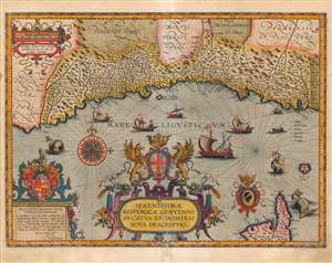
Serenissimae Reipublicae Genuensis Ducatus Et Dominii Nova Descriptio.
sold
- Digital Map Information
- Suitable for large format printing
- Full resolution TIFF file
- ICC color profile embedded
- Delivered instantly via download link
This is a beautiful example of Jan Baptista Vrients' map of the Republic of Genoa, added to Ortelius' Theatrum Orbis Terrarum in 1608. It is among the scarcest of the maps appearing in the Ortelius opus, having appeared in only the four final editions of the work. Typical of the maps thus included by Vrients, it is a tour de force of decorative cartography and stands among the most sumptuously engraved of the maps to appear in Ortelius' opus. Also, Ortelius atlases printed by Vrients enjoyed hand coloring of a very high quality, and the present map exemplifies this: the coloration on the cartouches, compass roses and ships is particularly rich. (more details)
First European map specifically of China to appear in a modern atlas.
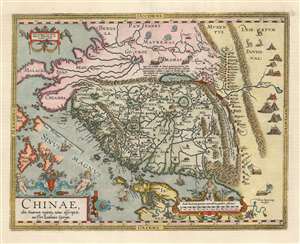
Chinae, olim Sinarum regionis, nova descriptio. auctore Ludovico Georgio.
sold
- Digital Map Information
- Suitable for large format printing
- Full resolution TIFF file
- ICC color profile embedded
- Delivered instantly via download link
This is Abraham Ortelius' 1584 map of China, the first specific map of China to appear in an atlas. Based ultimately on reports of Portuguese missionaries, it would not be substantially improved upon until Martino Martini's (卫匡国; 1614-1661) 1655 maps. The map is visually very distinctive, with its western orientation and abundant decorative elements. (more details)
Vrients color.
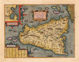
Siciliae Veteris Typus ex Conatibus geographicis Ab. Ortelij.
sold
- Digital Map Information
- Suitable for large format printing
- Full resolution TIFF file
- ICC color profile embedded
- Delivered instantly via download link
This is a superb example of Ortelius' map of Sicily as it was known in antiquity. The map is noteworthy for highlighting Ortelius' scholarship as a historian, as well as for denoting the locations of many sites from classical antiquity and mythology. This example is noteworthy as being from the Jan Bapatista Vrients (1552 - 1612) edition, which are known for exceptionally rich original colorwork. (more details)