
Wilkes, Charles (sold)
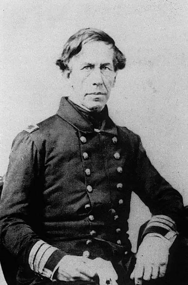
Charles Wilkes (April 3, 1798 – February 8, 1877) was an American naval officer and explorer. Wilkes was born in New York City to a prominent family. His mother died when he was just three years old. Consequently, Wilkes was raised by his aunt Elizabeth Ann Setton, the first American born woman to be canonized a saint of the Roman Catholic Church. Inspired by tales of nautical adventure, Wilkes embarked on several merchant voyages, including one to the South Pacific. Finding shipboard life unpleasant, he returned to New York City where attended Columbia College (today's Columbia University) studying various aspects of mathematics and the sciences. For a time Wilkes was a prodigy of Coast Survey Superintendent Ferdinand Hassler. Before the relationship went foul, Wilkes mastered Hassler's sophisticated techniques for navigation and nautical surveying. Though the Coast Survey at this time was underfunded, several coastal mapping expeditions were launched, one of which focused on Narragansett Bay and was headed by Wilkes. In 1833, impressed with his work on Narragansett Bay, the Navy placed Wilkes in charge of the Navy's Depot of Charts and Instruments in Washington, D.C, out of which developed the Naval Observatory and Hydrographic Office. In 1838, after years of political posturing, he was chosen to lead the U.S. Exploring Expedition (U.S. Ex. Ex.), a multidisciplinary voyage to the Pacific with the lofty goal to
collect, preserve, and arrange every thing valuable in the whole range of natural history, from the minute madrapore to the huge spermaceti, and accurately describe that which cannot be preserved.The expedition lasted from 1838 to 1842. Wilkes gained the reputation for being a harsh and dictatorial leader often at odds with his sailors and sub commanders - so much so that some suggest he was the real life inspiration for Herman Melville's characterization of Captain Ahab. Nonetheless, the U.S. Ex. Ex. was a resounding success with long term political and scientific ramifications. Under Wilkes, the expedition surveyed 1500 miles of the Antarctic continent, mapped over 280 islands, explored over 800 miles of the Pacific Northwest, and catalogued over 60,000 plant and bird specimens. Despite his scientific achievements, the end of the expedition Wilkes was court-martialed for the loss of one of his ships on the Columbia River, for the regular mistreatment of his subordinate officers, and for excessive punishment of his sailors. He was acquitted on all charges except illegally punishing the men in his squadron. During this post-expedition period he was also employed by the U.S. Coast Survey, but it was mostly an honorary position with most of his energies being focused on preparing the influential five volume expedition report. Later, during the American Civil War (1861 - 1865) Wilkes commanded a Union naval vessel in the Trent Affair, a diplomatic incident in which Wilkes intercepted the British mail packet RMS Trent and removed, as contraband of war, two Confederate diplomats, James Mason and John Slidell. Wilkes died in Washington, D. C. on February 8, 1877 at the rank of Rear Admiral. In August 1909, the United States moved his remains to Arlington National Cemetery. His gravestone reads "he discovered the Ant-arctic continent".
The first and finest scientific map of the Fiji Islands.
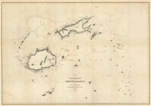
Chart of the Viti Group or Feejee Islands by the U.S. Ex. Ex.
sold
- Digital Map Information
- Suitable for large format printing
- DPI: 600
- File Size: 30 MB
- File Type: ZIP / TIFF
- ICC color profile embedded
- Delivered instantly via download link
A beautiful example of Wilkes' 1840 map of the Fiji Islands. Considered to be the first accurate scientifically produced map of the Fiji Islands, this map includes three main islands, Vanua Levu, Viti Levu, and Taveuni as well as the Yasawa Group and countless lesser islands. Topography is rendered by hachure and shoals, reefs, and other undersea dangers are indicated with shading. (more details)
The first accurate map of the Fiji Islands.
Chart of the Viti Group or Feejee Islands by the U.S. Ex. Ex.
sold
- Digital Map Information
- Suitable for large format printing
- Full resolution TIFF file
- ICC color profile embedded
- Delivered instantly via download link
A beautiful example of Wilkes' 1840 map of the Fiji Islands. Considered to be the first accurate map of the Fiji Islands, this map includes three main islands, Vanua Levu, Viti Levu, and Taveuni as well as the Yasawa Group and countless lesser islands. Topography ... (more details)
The first and finest scientific map of the Fiji Islands.
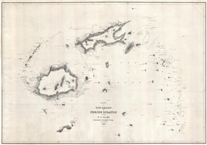
Chart of the Viti Group or Feejee Islands by the U.S. Ex. Ex.
sold
- Digital Map Information
- Suitable for large format printing
- Full resolution TIFF file
- ICC color profile embedded
- Delivered instantly via download link
A beautiful example of Wilkes' 1840 map of the Fiji Islands. Considered to be the first accurate scientifically produced map of the Fiji Islands, this map includes three main islands, Vanua Levu, Viti Levu, and Taveuni as well as the Yasawa Group and countless ... (more details)
The map that definitively established Antarctica's continental nature.
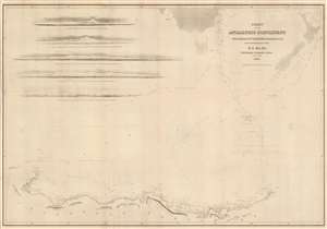
Chart of the Antarctic Continent Shewing the Icy Barrier Attached to It Discovered by the U.S. Ex. Ex.
sold
- Digital Map Information
- Suitable for large format printing
- Full resolution TIFF file
- ICC color profile embedded
- Delivered instantly via download link
This important and extraordinary production is Commodore Wilkes's 1840 U.S. exploring expedition map of Antarctica. Of extraordinary importance to Antarctica collectors, the surveying of this coast and this resulting map are the first to definitively prove Antarctica's continental nature. Among the many great achievements of the U.S. exploring expedition, and Wilkes specifically, the surveying of the Antarctic coast now known as Wilkes Land, stands out as the most significant. The chart covers that portions of Antarctica now known as Wilkes Land, located due south of New Zealand and Australia (ghosted in at the top of this chart), roughly from Cape Hordern (100°31' e) to Point Alden (142°02' e). Five profile charts in the upper left quadrant offer views of the Antarctic shoreline. (more details)
1871 Reissue of a seminal 1841 map.
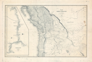
Map of the Oregon Territory by the U.S. Ex. Ex.
sold
- Digital Map Information
- Suitable for large format printing
- File Size: 113.73 MB
- File Type: ZIP / TIFF
- ICC color profile embedded
- Delivered instantly via download link
This is the 1871 U.S.H.O. reissue of Commodore Wilkes' 1841 U.S. exploring expedition map of Oregon Territory, the finest and most important map of Oregon of the 19th century. The reissue was prepared from the original copper plate and is on higher quality paper than the original 1841 report issue. (more details)
The first geometrically constructed map of any significant portion of Hawaii. - Fitzpatrick
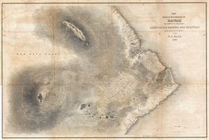
Map of Part of the Island of Hawaii Sandwich Islands Shewing the Craters and Eruption of May and June 1840.
sold
- Digital Map Information
- Suitable for large format printing
- DPI: 300
- File Size: 16.9 MB
- File Type: ZIP / TIFF
- ICC color profile embedded
- Delivered instantly via download link
This extraordinary production is Commodore Wilkes' 1841 U.S. Exploring Expedition map of the island of Hawaii. An incredibly important work, this is, according to Fitzpatrick, the 'first geometrically constructed map of any significant portion of Hawaii.' ... (more details)
The 'first geometrically constructed map of any significant portion of Hawaii.' - Fitzpatrick
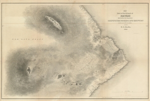
Map of Part of the Island of Hawaii Sandwich Islands Shewing the Craters and Eruption of May and June 1840.
sold
- Digital Map Information
- Suitable for large format printing
- DPI: 600
- File Size: 28.81 MB
- File Type: ZIP / TIFF
- ICC color profile embedded
- Delivered instantly via download link
This extraordinary production is Commodore Wilkes' 1841 U.S. Exploring Expedition map of the island of Hawaii. An incredibly important work, this is, according to Fitzpatrick, the 'first geometrically constructed map of any significant portion of Hawaii.' Wilkes' map covers the vicinity of the volcanoes Mauna Loa, Mauna Kea, and Kilauea as well as the Hawaiian shoreline roughly between Laupahoehoe and Kahaualea, including Hilo Bay and city. Topography is rendered in striking hachure. (more details)
Seminal Map of the Pacific Northwest.
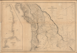
Map of the Oregon Territory by the U.S. Ex. Ex.
sold
- Digital Map Information
- Suitable for large format printing
- Full resolution TIFF file
- ICC color profile embedded
- Delivered instantly via download link
This Commodore Wilkes' rare large-format 1841 U.S. Exploring Expedition (U.S. Ex. Ex.) map of Oregon Territory, which appeared in the expedition Atlas. Wilkes' map was the finest and most detailed map of this largely unknown Oregon-Washington-Vancouver-Idaho region yet published and is considered by map historian Carl I. Wheat to be 'really quite extraordinary'. (more details)
A definitive map of the Pacific Northwest, considered by Wheat, 'really quite extraordinary.'
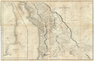
Map of the Oregon Territory by the U.S. Ex. Ex.
sold
- Digital Map Information
- Suitable for large format printing
- DPI: 300
- File Size: 29.57 MB
- File Type: ZIP / TIFF
- ICC color profile embedded
- Delivered instantly via download link
This important and extraordinary production is Commodore Wilkes' 1841 U.S. Exploring Expedition map of Oregon Territory. The map covers roughly from the 50th parallel to Mount Shasta, the upper Sacramento River, and Great Salt Lake (labeled Youta Lake) ... (more details)
A definitive map of the Pacific Northwest, considered by Wheat, 'really quite extraordinary.'
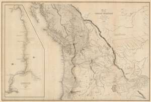
Map of the Oregon Territory by the U.S. Ex. Ex.
sold
- Digital Map Information
- Suitable for large format printing
- DPI: 600
- File Size: 59.51 MB
- File Type: ZIP / TIFF
- ICC color profile embedded
- Delivered instantly via download link
This important and extraordinary production is Commodore Wilkes' 1841 U.S. exploring expedition map of Oregon Territory, the finest and most important map of Oregon of the 19th century. The map covers roughly from the 50th parallel to Mount Shasta, the upper Sacramento River, and Great Salt Lake (Youta Lake) and from the Pacific to the Black Hills. It includes, either in part or full, modern day Washington, Oregon, British Columbia, Vancouver, Idaho, Utah, Nevada, Montana, Wyoming, and California. A large inset occupying the left quadrants focuses on the Columbia River where the United States exploring expedition lost one of its ships, the Peacock, on the infamous Columbia Bar. Topography is rendered by hachure and the engravers even made some attempt to illustrate the vast pine forests of the Pacific Northwest. (more details)
The first world map to show any significant portion of the Antarctic Coast.
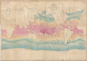
Chart of the World Shewing the tracks of the U.S. Exploring Expedition in 1838, 39, 40, 41 & 42.
sold
- Digital Map Information
- Suitable for large format printing
- DPI: 300
- File Size: 24.35 MB
- File Type: ZIP / TIFF
- ICC color profile embedded
- Delivered instantly via download link
This important and extraordinary production is Commodore Wilkes's 1840 U.S. exploring expedition map of the World. Presented on a Mercator Projection, this chart covers the globe from the high arctic to the Antarctic Coast. The map is color coded to represent isothermal lines, with variances in shading representing 5 degrees of temperature difference. In addition, Wilkes also shows currents and winds. Wilkes intended this map to present a general overview of the accomplishments of the U.S. Exploring Expedition (1838 - 1842). (more details)
First world map to show any significant portion of the Antarctic Coast.
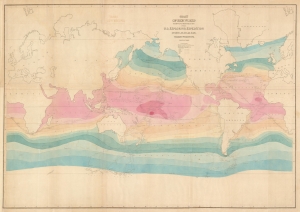
Chart of the World Shewing the tracks of the U.S. Exploring Expedition in 1838, 39, 40, 41 and 42.
sold
- Digital Map Information
- Suitable for large format printing
- DPI: 600
- File Size: 36.36 MB
- File Type: ZIP / TIFF
- ICC color profile embedded
- Delivered instantly via download link
This important production is Commodore Wilkes's 1840 U.S. Exploring Expedition map of the World. Presented on a Mercator Projection, this chart covers from the high Arctic to the Antarctic, with unique color coding illustrating isothermal lines, with variances in shading representing 5 degrees of temperature difference. In addition, Wilkes also shows currents and winds. Wilkes intended this map to present a general overview of the accomplishments of the U.S. Exploring Expedition (1838 - 1842). (more details)