
Zatta, Antonio (sold) (Antonio Zatta e figli Librai e Stampatori)
Antonio Zatta (1722 - February 16, 1804) was a Venetian printer and publisher whose illustrated books and atlases made him a leading figure in late 18th-century Italian publishing. Born in Venice into a printing family active since 1656, he attempted to relocate to Rovereto in 1752, but Venetian authorities blocked the move. The merchant Amedeo Svajer financed his early ventures. His connections with the Jesuits, including publications defending the order under false imprints (1760 - 1761), attracted controversy, although these ties weakened during the 1760s. Geography became a major undertaking: he published Anton Friedrich Büsching's Nuova geografia in 34 volumes (1773 - 1782), followed by the four-volume Atlante novissimo, illustrato ed accresciuto (1779 - 1785), comprising approximately 240 maps. Portions appeared separately, notably Le colonie unite dell'America settentr.le, an Italian adaptation of John Mitchell's 1755 map. His geographical publications also included Cook's voyages (1794 - 1795) and the map-illustrated political periodical Prospetto degli affari attuali dell'Europa (1788 - 1801). Beyond cartography, he published literature, medicine, and Buffon's natural history (1782 - 1791), cultivating collaborations with leading Venetian illustrators and engravers. His sons Giacomo and Giovanni joined the business in 1783; the printing house closed shortly after his death.
AKA: Antonio Zatta e figli Librai e Stampatori
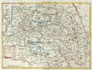
Parte settentrionale della Francia
sold
- Digital Map Information
- Suitable for large format printing
- Full resolution TIFF file
- ICC color profile embedded
- Delivered instantly via download link
This map is a hand colored depiction of central France ( the vicinity of Paris ) by an A. Zatta. Map depicts France from Chartes in the West to Langres in the Southeast to Verdun in the Northeast. Paris is central. Map is beautifully rendered in the late 18th ... (more details)
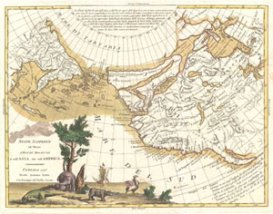
Nuove Scoperte De'Russi al Nord del Mare del Sud si nell'Asia, che nell'America
sold
- Digital Map Information
- Suitable for large format printing
- DPI: 300
- File Size: 6.68 MB
- File Type: ZIP / TIFF
- ICC color profile embedded
- Delivered instantly via download link
A stunning example of Antonio Zatta's 1776 map of the northwestern parts of America and the northeastern parts of Asia. This map is one of the most sought after and decorative 18th century pre-Cook maps of the Pacific Northwest. The map covers the region from the Hudson Bay and the Great Lakes westward as far as Siberia and Japan, north well into the Arctic, and southwards as far as Cabo San Lucas in Baja California. In this stunning map, Zatta, combining almost every 17th and 18th century myth and fact of the American west into a single map, offers up a veritable smorgasbord of speculative geography. (more details)
Smorgasbord of Speculative Cartography.
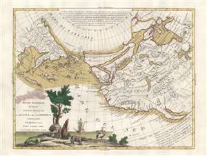
Nuove Scoperte De'Russi al Nord del Mare del Sud si nell'Asia, che nell'America.
sold
- Digital Map Information
- Suitable for large format printing
- Full resolution TIFF file
- ICC color profile embedded
- Delivered instantly via download link
A stunning example of Antonio Zatta's 1776 map of the northwestern parts of America and the northeastern parts of Asia. This map is one of the most sought after and decorative 18th century pre-Cook maps of the Pacific Northwest. The map covers the region from the Hudson Bay and the Great Lakes westward as far as Siberia and Japan, north well into the Arctic, and southwards as far as Cabo San Lucas in Baja California. In this stunning map, Zatta, combining almost every 17th and 18th century myth and fact of the American west into a single map, offers up a veritable smorgasbord of speculative geography. (more details)
Intriguing map showing speculative Chinese colony of Fusang in the Pacific northwest and De Fonte's fictional Northwest Passage.
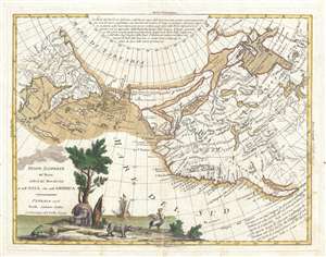
Nuove Scoperte De'Russi al Nord del Mare del Sud si nell'Asia, che nell'America
sold
- Digital Map Information
- Suitable for large format printing
- DPI: 300
- File Size: 6.11 MB
- File Type: ZIP / TIFF
- ICC color profile embedded
- Delivered instantly via download link
A stunning example of Antonio Zatta's 1776 map of the northwestern parts of America and the northeastern parts of Asia. This map is one of the most sought after and decorative 18th century pre-Cook maps of the Pacific Northwest. The map covers the region from the Hudson Bay and the Great Lakes westward as far as Siberia and Japan, north well into the Arctic, and southwards as far as Cabo San Lucas in Baja California. In this stunning map, Zatta, combining almost every 17th and 18th century myth and fact of the American west into a single map, offers up a veritable smorgasbord of speculative geography. (more details)
An Ostrich, Elephant, and Alligator walk into the Northwest Passage...
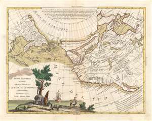
Nuove Scoperte De'Russi al Nord del Mare del Sud si nell'Asia, che nell'America.
sold
- Digital Map Information
- Suitable for large format printing
- DPI: 600
- File Size: 10.97 MB
- File Type: ZIP / TIFF
- ICC color profile embedded
- Delivered instantly via download link
A stunning example of Antonio Zatta's 1776 map of the northwestern parts of America and the northeastern parts of Asia. This map is one of the most sought after and decorative 18th century pre-Cook maps of the Pacific Northwest. The map covers the region from the Hudson Bay and the Great Lakes westward as far as Siberia and Japan, north well into the Arctic, and southwards as far as Cabo San Lucas in Baja California. In this stunning map, Zatta, combining almost every 17th and 18th century myth and fact of the American west into a single map, offers up a veritable smorgasbord of speculative geography. (more details)
An Ostrich, Elephant, and Alligator walk into the Northwest Passage...
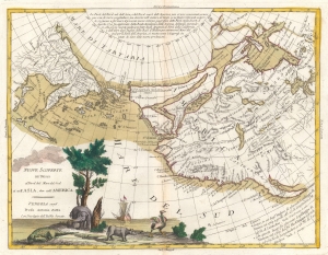
Nuove Scoperte De'Russi al Nord del Mare del Sud si nell'Asia, che nell'America.
sold
- Digital Map Information
- Suitable for large format printing
- DPI: 600
- File Size: 23.82 MB
- File Type: ZIP / TIFF
- ICC color profile embedded
- Delivered instantly via download link
A stunning example of Antonio Zatta's 1776 map of the northwestern parts of America and the northeastern parts of Asia. This map is one of the most sought after and decorative 18th century pre-Cook maps of the Pacific Northwest. (more details)
Italian edition of the Authoritative Mapping of the Southern British Colonies in North America.
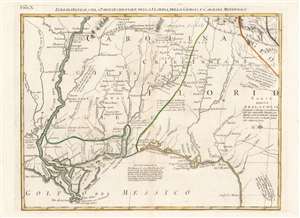
Luigiana Inglese, colla Parte Occidentale della Florida, della Giorgia, e Carolina Meridonale.
sold
- Digital Map Information
- Suitable for large format printing
- Full resolution TIFF file
- ICC color profile embedded
- Delivered instantly via download link
This is an attractive and fascinating 1778 Antonio Zatta map of the Gulf Coast from Louisiana to Florida, encompassing the region inclusive of modern-day Mississippi, Alabama and Georgia. The geography is drawn from John Mitchell's foundational 1755 A map of the British and French dominions in North America, the most important map of North America published in the 18th century. It remained so authoritative that it was used to draft the borders of the United States following Independence, and consulted for border disputes as recently as the 1980s. The present sheet hails from Zatta's Italian edition of the Mitchell, which faithfully copied the original in translation. (more details)
United Colonies: First printed map devoted to the 13 states.
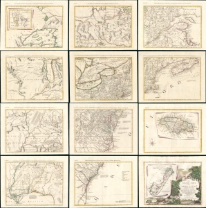
Le Colonie Unite Dell' America Settentrle. Di Nuova Projezione a S.S.E.E. Li Signori Riformatori Dello Studio Di Padovia.
sold
- Digital Map Information
- Suitable for large format printing
- File Size: 191.68 MB
- File Type: ZIP / TIFF
- ICC color profile embedded
- Delivered instantly via download link
This is a beautiful example of Antonio Zatta's 1778 12-sheet Revolutionary War era wall map of the United States - significant as the first printed map dedicated to the thirteen states, here distinguished from their former status as 'British Colonies' by the new term 'Colonies Unite' or 'United Colonies.' (more details)
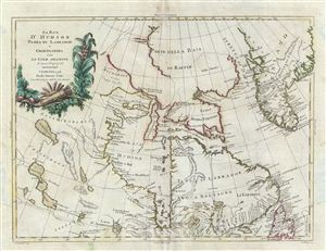
La Baja d'Hudson Terra di Labrador e Groenlandia con le Isloe Adiacenti di nuova Projezione.
sold
- Digital Map Information
- Suitable for large format printing
- DPI: 300
- File Size: 8.45 MB
- File Type: ZIP / TIFF
- ICC color profile embedded
- Delivered instantly via download link
This map is a hand colored 1778 A. Zatta map of the Hudson Bay. Centered on the Hudson Bay, it covers from Baffin Bay (North Atlantic Ocean) to James Bay. Includes the Hudson Bay, southern Greenland, Labrador and Newfoundland. The map offers excellent detail ... (more details)
Border Disputes in Pennsylvania, New York, and New Jersey.
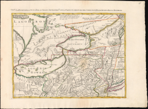
La Pensilvania, La Nuova York, Il Jersey Settentrio:le, con la Parte Occidentale del Connecticut, Massachusset-s-Bay e L' Irochesia.
sold
- Digital Map Information
- Suitable for large format printing
- File Size: 17.32 MB
- File Type: ZIP / TIFF
- ICC color profile embedded
- Delivered instantly via download link
This is Antonio Zatta's striking 1778 map of New York, Pennsylvania, and the eastern Great Lakes. While a separate issue, the map comprises sheet V of Zatta's 12-sheet Italian edition of John Mitchell's important c. 1775 map of eastern North America. Among other points of interest, the richly annotated map illustrates Pennsylvania's pre-1774 claims to what is today western New York as well as land disputes between New York and New Jersey. (more details)
Imperial frontier comprising a complex tapestry of Native American Nations.
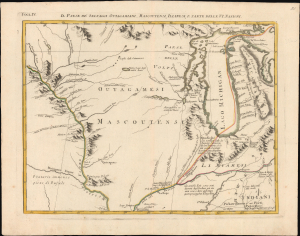
Il Paese de' Selvaggi Outagamiani, Mascoutensi, Illinesi, e Parte delle VI. Nazioni.
sold
- Digital Map Information
- Suitable for large format printing
- File Size: 12.94 MB
- File Type: ZIP / TIFF
- ICC color profile embedded
- Delivered instantly via download link
This is Antonio Zatta's striking 1778 map of Lake Michigan, Wisconsin, and Illinois, issued at the height of the American Revolutionary War (1775 - 1783). Although separately published, the sheet forms Plate IV of Zatta's 12-sheet Italian edition of John Mitchell's seminal map of eastern North America. The geography presented here corresponds to what would later become the Northwest Territory ('Old Northwest'), formally organized under the Northwest Ordinance of 1787. In 1778, however, this was still a volatile frontier world - its political future unsettled and its landscape shaped not by American institutions but by a dense and dynamic tapestry of Native nations, whose alliances, rivalries, and diplomacy defined the region on the eve of U.S. expansion. (more details)
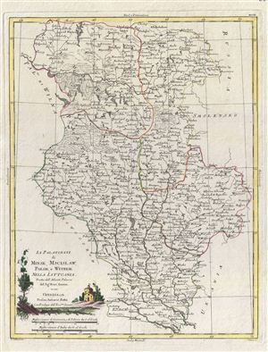
Li Palatinati di Minsk, Mscislaw, Polok, e Witebsk Nella Littuania.
sold
- Digital Map Information
- Suitable for large format printing
- DPI: 300
- File Size: 8.5 MB
- File Type: ZIP / TIFF
- ICC color profile embedded
- Delivered instantly via download link
A fine map of the Palatinates of Minsk, Mscislaw, Polok and Witebsk, Poland. This map covers from parts of Poland from Sokolnikow to Plost and from Wilna to the Russian border. Though culturally intact, by 1781 Poland had gone through two partitions. When ... (more details)
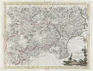
La Tartaria Chinese.
sold
- Digital Map Information
- Suitable for large format printing
- DPI: 300
- File Size: 9.72 MB
- File Type: ZIP / TIFF
- ICC color profile embedded
- Delivered instantly via download link
This map is a hand colored 1784 Antonio Zatta map of Chinese Tartary and Korea. Centered on Chinese Tartary, the map details Korea, Manchuria, Chinese Tartary and parts of adjacent Russian Tartary, Independent Tartary, Mongolia, and Japan. The map is ... (more details)
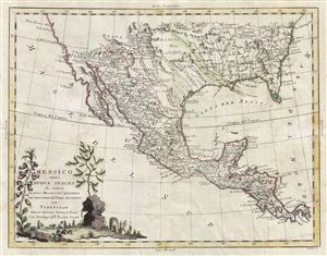
Messico ouvero Nuova Spagna che Contiene il Nuovo Messico la California con una Parte de' Paesi Adjacenti.
sold
- Digital Map Information
- Suitable for large format printing
- DPI: 300
- File Size: 8.87 MB
- File Type: ZIP / TIFF
- ICC color profile embedded
- Delivered instantly via download link
A nice example of Antonio Zatta's fascinating map of Mexico, Texas, Florida, Louisiana, and Central America. Centered on what would soon be known as Texas, this map covers from the Pacific to the Atlantic, and from the entrance to the Chesapeake Bay ... (more details)
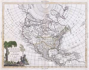
America Settentrionale divisa ne'suoi principali Stati.
sold
- Digital Map Information
- Suitable for large format printing
- Full resolution TIFF file
- ICC color profile embedded
- Delivered instantly via download link
This is an exceptionally stunning example of Antonio Zatta's 1785 map of North America. It covers the North American continent from the Pacific Ocean to the Azores Islands north well into the Arctic and southwards as far as Panama. In this stunning ... (more details)
A beautiful example with unusual detail.
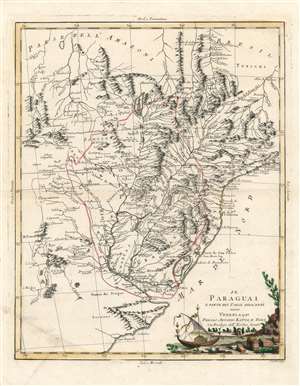
Il Paraguai E Parte Dei Paesi Adiacenti.
sold
- Digital Map Information
- Suitable for large format printing
- Full resolution TIFF file
- ICC color profile embedded
- Delivered instantly via download link
A beautiful example of Antonio Zatta's 1785 map of Paraguay. The map embraces the Rio de la Plata watershed well into Brazil and the Amazon, and includes the modern-day nations of Uruguay, Paraguay, and parts of adjacent Brazil and Argentina. Rich detail is offered throughout, naming mountains, rivers, national boundaries, cities, regions, and indigenous tribes. Identifies Asuncion, Buenos Aires, Rio de Janeiro, and numerous other important South American cities. (more details)