
Basset, André (sold) (Bassett)

André Basset (Bassett; fl. 1768 - 1784) was a well-known French publisher and engraver active on the Rue St. Jacques, Paris, during the 18th and 19th centuries. His office was located at the corner of Rue Saint Jacques and of Mathurins, à l'enseigne de Sainte Geneviève. The firm is closely aligned with the Chéreau family of printers and engravers, with whom they were connected with multiple, often incestuous, marriages and remarriages. Basset was best known for the production of low-cost optical views of European cities and events. However, the firm also produced games, maps, and other prints. The firm was taken over by Paul-André Bassett (1759 - 1829) in 1784. Paul-André Bassett himself retired in 1819, but the business continued under various family members until 1865.
AKA: Bassett
First view of New Orleans.
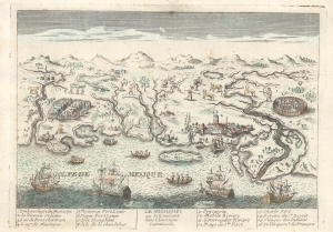
Le Mississipi ou la Louisiane dans l'Amerique Septentrionale.
sold
- Digital Map Information
- Suitable for large format printing
- File Size: 4.43 MB
- File Type: ZIP / TIFF
- ICC color profile embedded
- Delivered instantly via download link
This is a rare c. 1779 Basset / Chéreau broadside leaflet map-view of the Gulf of Mexico littoral c. 1720, just a few years after New Orleans was founded. It is likely the earliest printed view of New Orleans - though admittedly, it is not an accurate representation of the city at the time. The map was issued as a propaganda leaflet to promote New Orleans and French Louisiana. It is indeed one of the earliest maps to include a view of New Orleans and the indigenous peoples of the Gulf. The present example is the second state, issued in late 1770s by Basset to capitalize on French public interest in the American Revolutionary War (1775 - 1783). (more details)
Separate issue map illustrating the ramifications of the American Revolutionary War in the East Indies.
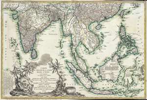
Carte du Theatre De La Guerre Dans L'inde ou se Trouvent Une Partie de La Chine, Les Iles De Sumatra, Java, Borneo, Moluques et Philippines. Dressee d'apres les Meilleures Cartes tant Francaises qu'Anglaises.
sold
- Digital Map Information
- Suitable for large format printing
- Full resolution TIFF file
- ICC color profile embedded
- Delivered instantly via download link
A rare and important 1781 separately issued map of the East Indies by Andre Basset. This map was issued to illustrate a series of conflicts in India and East Indies associated with the American Revolutionary War (1775–1783), including the Anglo-French War ... (more details)
The American Revolutionary War - in SE Asia!
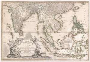
Carte du Theatre De La Guerre Dans L'inde ou se Trouvent Une Partie de La Chine, Les Iles De Sumatra, Java, Borneo, Moluques et Philippines. Dressee d'apres les Meilleures Cartes tant Francaises qu'Anglaises.
sold
- Digital Map Information
- Suitable for large format printing
- Full resolution TIFF file
- ICC color profile embedded
- Delivered instantly via download link
A rare and important 1781 separately issued map of the East Indies by Andre Basset. This map was issued to illustrate a series of conflicts in India and East Indies associated with the American Revolutionary War (1775 - 1783), including the Anglo-French War (1778 - 1783), Fourth Anglo-Dutch War (1780 - 1784), and the Second Anglo-Mysore War (1780 - 1784). The theater of war described is a vast expanse of East Asian territory centered on the Malay Peninsula, but extending from the Maldives to the Philippines and from China to Java, including all of the East Indies, the Indian Subcontinent, the Philippines, and Southeast Asia. (more details)
Remarkable early French board game.
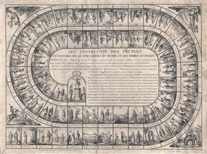
Jeu Instructif des Peuples et Costumes des Quatre Parties du Monde et des Terres Australes.
sold
- Digital Map Information
- Suitable for large format printing
- DPI: 300
- File Size: 17.65 MB
- File Type: ZIP / TIFF
- ICC color profile embedded
- Delivered instantly via download link
A scarce 1815 French geographically themed board game or jeux de l'oie (Game of Goose) produce by the French publishing house of Basset. In the spirit of snakes-and-ladders, the jeu de l'oie is a unicursal race game played with two dice and tokens. The ... (more details)
Marvelous separate issue chart with outstanding period guache color!
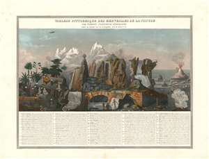
Tableau Pittoresque des Merveilles de la Nature.
sold
- Digital Map Information
- Suitable for large format printing
- DPI: 600
- File Size: 40.11 MB
- File Type: ZIP / TIFF
- ICC color profile embedded
- Delivered instantly via download link
This is a separate issue 1840 Aristide Michel Perrot and Sigismond Himely comparative chart illustrating the marvels of the nature - as they were understood in the 19th century. The present example is notable for its striking gouache color masterfully applied. The chart illustrates 58 numerically identified natural wonders, among them,
- No. 5 - the deep and picturesque Mines of Persberg, Sweden
- No. 8 - a gigantic antediluvian human skeleton fossilized.
- No. 9 - the skeleton of a wooly mammoth.
- no. 30 - the bizarre illusion of giant human beings on the side of a mountain
- no. 29 - Iceland's Mount Hekla volcano.
- No. 18 - the clifftop Corsican city of Bonifacio
- No. 12 - St. Michael's Cave in Gibraltar
Illustrates pterodactyls and plesiosaurs next to wolves, bats, and a pangolin!
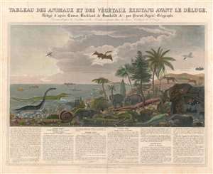
Tableau des Animaux et des Végétaux Éxistans Avant le Déluge, Rédigé d'après Cuvier, Buckland, de Humboldt etc. par Perrot, Ingénr.-Geographe. Dessiné d'après les Végétaux et les Fossiles existants dans les divers Cabinets de l'Europe.
sold
- Digital Map Information
- Suitable for large format printing
- DPI: 600
- File Size: 37.16 MB
- File Type: ZIP / TIFF
- ICC color profile embedded
- Delivered instantly via download link
Filled with strange and unfamiliar creatures, this is 1844 Aristide Michel Perrot chart of antediluvian animals. Seventy-five different animals and plants, dating from the epoch just after primordial times to the era before the last ice age, are depicted here, with Perrot having consulted fossil collections to create this stunning piece. A narrative situated below the chart traces the evolution of these creatures across five historical epochs, presenting the plants and animals illustrated above in a sort of context. Plesiosaurs, ichthyosaurs, and pterodactyls are among the dinosaurs illustrated alongside mastodons and mammoths. Some more familiar animals, such as pangolins, wolves, and bats, are also included. The juxtaposition of the dinosaurs alongside beavers, bats, and herons gives the piece an aura that is both amusing and jarring. (more details)
Illustrates and briefly explains weather phenomena like tornadoes, clouds, and thunder and lightning storms.
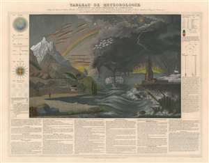
Tableau de Météorologie Représentant les Divers Phénomènes de l'Atmosphère, Tels que le Tonnere, l'Aurore Boréale, Aréolythes, l'Arc-en-ciel, les Trombes, le Feu St. Elme, les Etoiles filantes et Aréolythes, le Halo, les Parhélies, le Mirage, les Marées, etc., etc.
sold
- Digital Map Information
- Suitable for large format printing
- DPI: 600
- File Size: 41.71 MB
- File Type: ZIP / TIFF
- ICC color profile embedded
- Delivered instantly via download link
This is an 1844 Aristide Michel Perrot chart of weather phenomena. The chart combines illustrations of over two dozen different weather phenomena, including lightning, tornadoes, rainbows, the Northern Lights, and clouds. Different phenomena are identified below the central image, with the name of each phenomenon and a short explanation provided, some of which even refer to a specific part of the central image and provide the corresponding number. Various figures are included along the left and right borders, the first of which, the atmosphere, is provided as a basis for understanding of all the phenomena explained in the chart. A wind compass, snowflakes, and a lightning rod are depicted along the left side, while thermometers and the rainbow effect are explained along the right. (more details)
Terrors of mother nature!
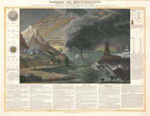
Tableau de Météorologie Représentant les Divers Phénomènes de l'Atmosphère, Tels que le Tonnere, l'Aurore Boréale, Aréolythes, l'Arc-en-ciel, les Trombes, le Feu St. Elme, les Etoiles filantes et Aréolythes, le Halo, les Parhélies, le Mirage, les Marées, etc., etc.
sold
- Digital Map Information
- Suitable for large format printing
- DPI: 600
- File Size: 33.95 MB
- File Type: ZIP / TIFF
- ICC color profile embedded
- Delivered instantly via download link
This is an 1844 Aristide Michel Perrot chart of weather phenomena. The chart combines illustrations of over two dozen different weather phenomena, including lightning, tornadoes, rainbows, the Northern Lights, and clouds. Different phenomena are identified below the central image, with the name of each phenomenon and a short explanation provided, some of which even refer to a specific part of the central image and provide the corresponding number. Various figures are included along the left and right borders, the first of which, the atmosphere, is provided as a basis for understanding of all the phenomena explained in the chart. A wind compass, snowflakes, and a lightning rod are depicted along the left side, while thermometers and the rainbow effect are explained along the right. (more details)