
Britton and Rey (sold)

Britton and Rey (1852 - 1916) was a lithographic firm based in San Francisco founded by Joseph Britton (1825 - 1901) and Jacques Joseph Rey (1820 - 1892). The leading firm in the area during the second half of the 19th century, Britton and Rey eventually earned the reputation of being the western Currier and Ives. They published both large-format and postcard views of California, as well as with stock certificates, stationery, and maps. Within the partnership, Rey was the artist and Britton the principal lithographer. Britton was also principally concerned with the business aspects of the firm. The firm also printed lithographs by other artists, including Thomas Almond Ayres (1816 - 1858), George Holbrook Baker (1824 - 1906), Charles Christian Nahl (1818 - 1878), and Frederick August Wenderoth (1819 - 1884). After Rey's death in 1892 and Britton's subsequent retirement, the firm passed to Rey's son, Valentine J. A. Rey, who ran the firm until at least the 1906 San Francisco earthquake and fire. A. Carlisle and Company, another San Francisco printer, acquired the remains of the Britton and Rey firm in 1916. For more information about Joseph Britton and Jacques Joseph Rey, please reference their individual biographies included in our cartographer database.
One of the earliest specific printed maps of Golden Gate Parrk.
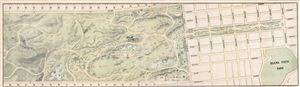
Golden Gate Park San Francisco
sold
- Digital Map Information
- Suitable for large format printing
- File Size: 9.29 MB
- File Type: ZIP / TIFF
- ICC color profile embedded
- Delivered instantly via download link
An extremely rare map and one of the earliest specific illustrations of San Francisco's Golden Gate Park. The map, issued in 1874, covers the eastern half of Golden Gate Park from 19th Avenue to Buena Vista Park and Broderick Street. San Franciscans began to ... (more details)
Not a bad plan.
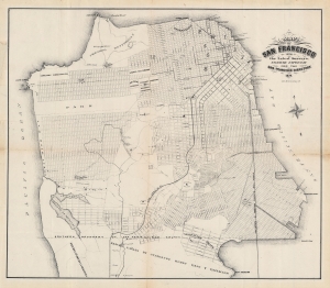
Map of San Francisco from the latest surveys. Engraved expressly for the San Francisco Directory. 1874.
sold
- Digital Map Information
- Suitable for large format printing
- File Size: 18.73 MB
- File Type: ZIP / TIFF
- ICC color profile embedded
- Delivered instantly via download link
An important map of San Francisco produced by Britton and Rey for the 1874 edition of The San Francisco Directory. Notably, it reflects efforts to plan and develop the western and southern portion of the city to accommodate its rapidly growing population. (more details)
Super rare Comstock Lode Broadsheet!
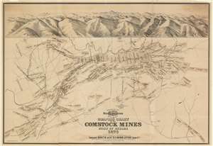
Graphic Chart of the Comstock Mines State of Nevada 1876.
sold
- Digital Map Information
- Suitable for large format printing
- Full resolution TIFF file
- ICC color profile embedded
- Delivered instantly via download link
A scarce 1876 broadsheet map and view of the Comstock Mines in Nevada by the mining engineer John B. Treadwell. Treadwell at the time was manager of the Comstock Mine. Oriented to the west and roughly centered on Virginia City, the map details the heart of the Comstock Strike, what is generally known as the Mother Lode. It identifies claims in and around Virginia City, Gold Hill, and Silver City. Surmounting the map there is a view of the silver region centered on Mount Davidson and Virginia City. At the base of the view is Dayton, Nevada, and the outlet of the Sutro Tunnel. (more details)
Yosemite by stagecoach!
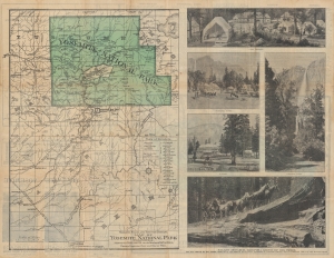
Yosemite Wawona Route via Mariposa Big Trees, Inspiration Point and Glacier Point.
sold
- Digital Map Information
- Suitable for large format printing
- Full resolution TIFF file
- ICC color profile embedded
- Delivered instantly via download link
This is a c. 1885 Yosemite Stage and Turnpike Company map of Yosemite National Park, California. (more details)
California emergence as a major economy in the late 19th century.
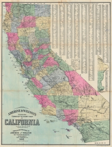
Amerine and Willson's Indexed Township and County Map of California.
sold
- Digital Map Information
- Suitable for large format printing
- Full resolution TIFF file
- ICC color profile embedded
- Delivered instantly via download link
This is the 1892 Amerine and Willson map of California. It illustrates the state during a heady period of expansion, largely driven by rapid railroad development in the second half of the 19th century that opened the way for agricultural development of the interior as well as real estate booms in Los Angeles and San Diego. (more details)
Incredible early map of Golden Gate Park - only the eastern third has been improved!

Map Showing the Golden Gate Park, the Avenue, and Buena Vista Park
sold
- Digital Map Information
- Suitable for large format printing
- File Size: 8.08 MB
- File Type: ZIP / TIFF
- ICC color profile embedded
- Delivered instantly via download link
This is an 1893 Joseph Britton and Jacques Joseph Rey map of Golden Gate Park. The map depicts Golden Gate Park from the Pacific Ocean to Baker Street and from D Street to H Street and includes both The Panhandle and Buena Vista Park. When compared with later ... (more details)
San Francisco's Late 19th Century Water System.
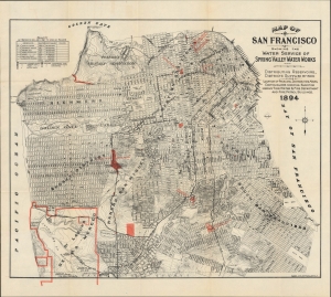
Map of San Francisco Showing the Water Service of Spring Valley Water Works.
sold
- Digital Map Information
- Suitable for large format printing
- File Size: 29.02 MB
- File Type: ZIP / TIFF
- ICC color profile embedded
- Delivered instantly via download link
A scarce and important 1894 Britton and Rey map of San Francisco highlighting the water system owned by the Spring Valley Water Works, arguably the most powerful monopoly in California at the time of publication. However, it was also facing public criticism and an insufficient supply of water for the city, prompting extremely ambitious plans in the following years. (more details)
Plotting out the City by the Bay.
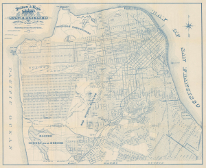
Britton and Rey's Guide Map of the City of San Francisco Compiled from the Latest Official Data.
sold
- Digital Map Information
- Suitable for large format printing
- Full resolution TIFF file
- ICC color profile embedded
- Delivered instantly via download link
This is a c. 1894 map of San Francisco prepared by local printers Britton and Rey for Richards' Official Guide and Maps of San Francisco Street Railways. The map captures San Francisco as it expanded beyond the original downtown core formed during the Gold Rush era into the western and southern sections. (more details)
Highlights the birds, deer, and bison living in Golden Gate Park.

Map showing the Golden Gate Park the Avenue and Buena Vista Park.
sold
- Digital Map Information
- Suitable for large format printing
- File Size: 33.03 MB
- File Type: ZIP / TIFF
- ICC color profile embedded
- Delivered instantly via download link
This is an 1897 Joseph Britton and Jacques Joseph Rey map of Golden Gate Park, San Francisco. The map depicts the park from the Pacific Ocean to Baker Street and from D Street to H Street and includes both the Panhandle and Buena Vista Park. Park improvements in the eastern third are illustrated in detail, with the numerous buildings, monuments, and other areas all identified. (more details)