
Chase, Ernest Dudley
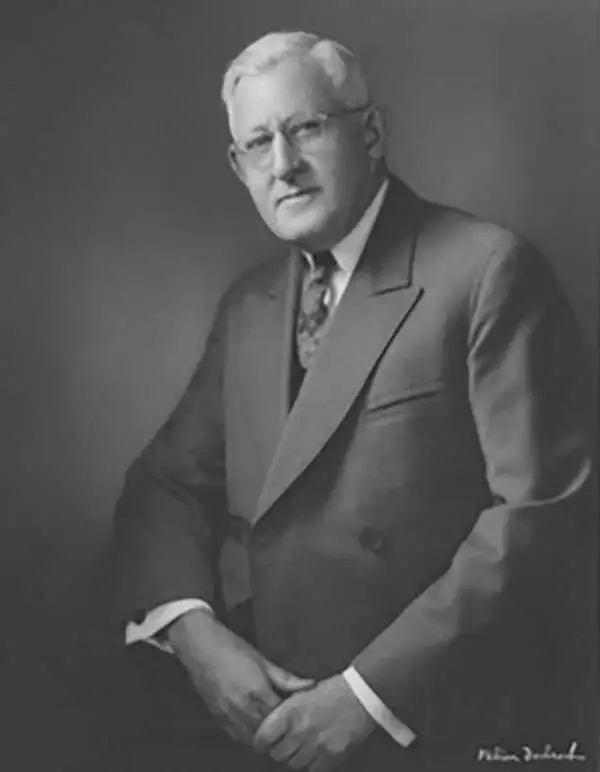
Ernest Dudley Chase (July 26, 1878 - August 25, 1966) was an American illustrator of greeting cards and pictorial maps active in the first half of the 20th century. From his studio in Winchester, Massachusetts, Chase became famous for his elaborately illustrated pictorial maps. He was born in Lowell, Massachusetts, and attended the Lowell Textile School and the Vesper George Art School. He took work with Butterfield Printing Company in 1900. In 1906, he moved to the W. T. Sheehan Printing Firm. He began producing postcards and greeting cards on his own account in 1908. This initial imprint was Des Arts Publishers, but later, he changed it to Ernest Dudley Chase Publishers. Chase is best known today for his distinctive pictorial maps, most of which he published privately, characterized by dense vignette images of important locations. The biographical pamphlet A Meticulous Maker of Maps describes Chase's attention to detail wherein, pursuing a 'passion for perfection' by stippling his images 'dot-by-dot, with tiny pens' under a magnifying glass. His impressive corpus includes nearly 50 maps focusing on various parts of the United States and Europe, as well as other international locations and novelty pieces. Most are thematic, focusing on topics such as wonders of the world, stamps, aviation, and war. Others, such as his map of The United States as viewed by California and Loveland are satirical. All, in their original editions, are coveted by a dedicated following of modern collectors.
Visual summary of the U.S.A.
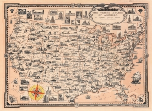
The United States of America.
$650.00
Acquire
- Digital Map Information
- Suitable for large format printing
- File Size: 65.2 MB
- File Type: ZIP / TIFF
- ICC color profile embedded
- Delivered instantly via download link
This is a 1935 Ernest Dudley Chase pictorial map of the United States. Vignettes mark cities, towns, natural wonders, and economic successes. Illustrations of capitol buildings mark state capitals. Trains, airplanes, blimps, and other modern forms of transportation zip from coast to coast. Oil derricks, factory smokestacks, and mines highlight American industry, alongside Hoover Dam. Vignettes of farms and ranches promote American agriculture. World-renowned sites, including Mesa Verde, Carlsbad Caverns, Yellowstone National Park, and the Grand Canyon are all illustrated. Views of important buildings appear above and below the map and among the highlighted sites are the Lincoln Memorial, the Field Museum in Chicago, the Statue of Liberty, and the Museum of Fine Arts in Los Angeles. (more details)
Signed. Natural and Manufactured wonders.
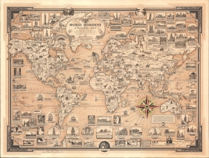
World Wonders. A Pictorial Map.
$950.00
Acquire
- Digital Map Information
- Suitable for large format printing
- File Size: 542 MB
- File Type: ZIP / TIFF
- ICC color profile embedded
- Delivered instantly via download link
This is a 1939 Ernest Dudley Chase pictorial map of the world celebrating natural and manufactured wonders, signed in the lower left. This is one of Chase's most famous and iconic maps. (more details)
A charming and vibrant pictorial map of South America.
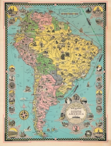
Moore-McCormack Lines pictorial map of South America.
$400.00
Acquire
- Digital Map Information
- Suitable for large format printing
- File Size: 39.94 MB
- File Type: ZIP / TIFF
- ICC color profile embedded
- Delivered instantly via download link
An attractive pictorial map of South America, produced in 1942 by Ernest Dudley Chase and printed by Rand McNally for Moore-McCormack Lines, a shipping company that ran regular passenger service between New York and South America. (more details)
Chase's popular World War II World Map.
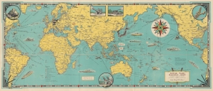
Total War Battle Map. / Invasion and Total War Victory Maps with Decorations, Illustrations and Military and Naval Insignia.
$450.00
Acquire
- Digital Map Information
- Suitable for large format printing
- Full resolution TIFF file
- ICC color profile embedded
- Delivered instantly via download link
This is a 1943 Ernest Dudley Chase pictorial map of the world during World War II (1939 - 1945). It is one of a series of maps Chase produced to illustrate the war as it developed. (more details)
One year after statehood - Hawaiian edition.
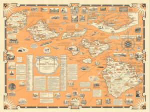
Aloha. A Pictorial Map of the Hawaiian Islands. The United States' Fiftieth State.
$1,100.00
Acquire
This is a scarce 1960 Ernest Dudley Chase pictorial map of Hawaii, a visually rich and educational celebration of the archipelago a year after statehood. This is one of the scarcer Chase maps, especially as here, in its Hawaiian Magazine Distributors edition. (more details)