
Fusazō Sugie (sold) (杉江房造)

Fusazō Sugie (杉江房造; fl. c. 1910 – 1950) was a Japanese bookseller, printer, and active in Shanghai during the final years of the Qing. Fusazō was the owner of the Nihon-do Japanese Bookstore (日本堂書店) in Shanghai, located at 155 Hong-Kou-Wen Street and 237 Woosung Road. He issued numerous guidebooks, souvenir photo books, and maps associated with Shanghai and Nanjing, many of which were bilingual and marketed to American and European tourists and servicemen. His bilingual New Map of Shanghai, published in various states and editions from 1931 well into the 1940s, is his most notable cartographic work.
AKA: 杉江房造
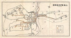
上海電車線務圖 / Shanghai Tram Map.
sold
- Digital Map Information
- Suitable for large format printing
- Full resolution TIFF file
- ICC color profile embedded
- Delivered instantly via download link
An attractive Chinese plan or map of Shanghai, China, dating to about 1927. Streets, parks, and districts are identified. All text in ... (more details)
Issued in the wake of the April 1927 anti-Communist Shanghai Massacre.
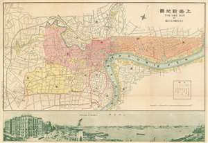
New Map of Shangahi. / 上海新地圖
sold
- Digital Map Information
- Suitable for large format printing
- File Size: 38.8 MB
- File Type: ZIP / TIFF
- ICC color profile embedded
- Delivered instantly via download link
An extremely rare bi-lingual Chinese/English map of Shanghai, China, here in its first edition, issued by the Shanghai-Japanese cartographer Sugie Fusazō (杉江房造) in May of 1927, or Showa 2. This map was produced in the wake of the pro-Nationalist anti-Communist Shanghai Massacre of April 1927, considered the beginning of the Chinese Civil War (國共內戰; 1927 - 1945). This is also the first of Sugie Fusazō's maps to include a panorama of the city (more specifically the Bund), a convention that would be followed in some later editions of the map. The map focuses on the extraterritorial Foreign Concessions huddled around the confluence of the Hunagpu River (Whangpoo) and Soochow Creek (Suzhou). The Japanese area is highlighted in orange, the British in red, the American in Pink, and the large separate French Concession in Yellow. The map extends westward along the Extraterritorial Roads, also administered by the Concessions, as far as the Jessfield Road (Zhongshan) Toyoda Factory, precursor of the modern conglomerate Toyota. (more details)
One of the first and most comprehensive public tram networks in Asia.
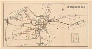
Shanghai Tram Line Map. / 上海電車線務圖
sold
- Digital Map Information
- Suitable for large format printing
- File Size: 3 MB
- File Type: ZIP / TIFF
- ICC color profile embedded
- Delivered instantly via download link
An uncommon 1927 Sugie Fusazo map of Shanghai, China, illustrating transportation networks. The map focuses on Shanghai's developing electric tram line - which is here highlighted in yellow. Shanghai's tram network, one of the first in Asia, offered comprehensive public transport through the Foreign Concessions. (more details)
Shanghai's pre-war Golden Age.
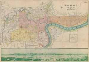
New Map of Shangahi. / 上海新地圖
sold
- Digital Map Information
- Suitable for large format printing
- File Size: 39.14 MB
- File Type: ZIP / TIFF
- ICC color profile embedded
- Delivered instantly via download link
An extremely rare bi-lingual Chinese/English map of Shanghai, China, here in its second edition, issued by the Shanghai-Japanese cartographer Sugie Fusazō (杉江房造) in March of 1930, or Showa 5. This is the second of Sugie Fusazō's maps to include a panorama of the city (more specifically, the Bund). It was the first to depict the Bund from across the Huangpu River, a convention copied on the 1932 Cross House map (Shanghai-crosshouse-1932) and one that would be followed in many later editions of the map. (more details)
Shanghai at the moment of the Shanghai Ceasefire Agreement in which the city became a demilitarized zone.
New Map of Shangahi. / 上海新地圖
sold
- Digital Map Information
- Suitable for large format printing
- File Size: 36.6 MB
- File Type: ZIP / TIFF
- ICC color profile embedded
- Delivered instantly via download link
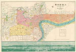
An extremely rare bi-lingual Chinese/English map of Shanghai, China, here in its second edition, issued by the Shanghai-Japanese cartographer Sugie Fusazō (杉江房造) in February of 1932, or Showa 7. The map follows the January 28 Incident, also known as the Shanghai Incident (January 28 - March 3, 1932), a conflict in the Shanghai International Settlement between the Republic of China and the Empire of Japan. This is also the second of Sugie Fusazō's maps to include a panorama of the city (more specifically the Bund), and the first to depict the bund from across the Huangpu River, a convention coped from the 1932 Cross House map (Shanghai-crosshouse-1932) of Shanghai, and one that would be followed in many later editions of the map. The map focus is on the extraterritorial Foreign Concessions huddled around the confluence of the Hunagpu River (Whangpoo) and Soochow Creek (Suzhou). The Japanese area is highlighted in orange, the British in red, the American in Pink, and the large separate French Concession in Yellow. The map extends westward along the Extraterritorial Roads, also administered by the Concessions, as far as the Jessfield Road (Zhongshan) Toyoda Factory, precursor of the modern conglomerate Toyota. (more details)
Scarce map of Shanghai with view of the Bund.
The New Map of Shanghai. /上海最新地圖 / Shànghǎi zuìxīn dìtú.
sold
- Digital Map Information
- Suitable for large format printing
- File Size: 17.73 MB
- File Type: ZIP / TIFF
- ICC color profile embedded
- Delivered instantly via download link
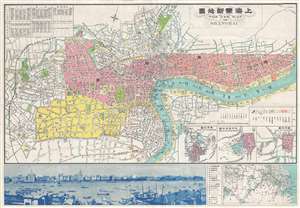
This is a rare and beautiful bilingual 1933 Fusazō Sugie city plan or map of Shanghai, China. Published only two years after the Second Sino-Japanese War began, the map depicts cebtrak Shanghai including the Chinese Quarter, the French Concession, the International Settlement, and the English Quarter (along the Bund), among many other sites. Shanghai's cosmopolitan International Settlement is highlighted in orange (USA), pink (Great Britain), and yellow (France). Nineteen important buildings along the Bund are carefully noted and can be referenced via a table to the right of the view. These include the first HSBC Bank, the British Club, the Peace Hotel, and the Customs House. A lovely vintage panoramic photograph of the Bund adorns the map's bottom border. Of note, a large inset in the lower right corner illustrates the greater Shanghai area and three smaller insets detail Nanking (Nanjing) Hanchow Shiwoo (Hangzhou), and Soochow (Suzhou). (more details)
Scarce map of Shanghai at the beginning of the Second Sino-Japanese War.
The New Map of Shanghai. /上海最新地圖 / Shànghǎi zuìxīn dìtú.
sold
- Digital Map Information
- Suitable for large format printing
- File Size: 37.87 MB
- File Type: ZIP / TIFF
- ICC color profile embedded
- Delivered instantly via download link
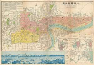
This is a rare and beautiful bilingual 1933 Fusazō Sugie city plan or map of Shanghai, China. Published only two years after the Second Sino-Japanese War began, the map depicts cebtrak Shanghai including the Chinese Quarter, the French Concession, the International Settlement, and the English Quarter (along the Bund), among many other sites. Shanghai's cosmopolitan International Settlement is highlighted in orange (USA), pink (Great Britain), and yellow (France). Nineteen important buildings along the Bund are carefully noted and can be referenced via a table to the right of the view. These include the first HSBC Bank, the British Club, the Peace Hotel, and the Customs House. A lovely vintage panoramic photograph of the Bund adorns the map's bottom border. Of note, a large inset in the lower right corner illustrates the greater Shanghai area and three smaller insets detail Nanking (Nanjing) Hanchow Shiwoo (Hangzhou), and Soochow (Suzhou). (more details)
Shanghai at the beginning of the Second Sino-Japanese War.
The New Map of Shanghai. /上海最新地圖 / Shànghǎi zuìxīn dìtú.
sold
- Digital Map Information
- Suitable for large format printing
- File Size: 99.71 MB
- File Type: ZIP / TIFF
- ICC color profile embedded
- Delivered instantly via download link
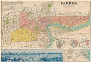
This is a rare and beautiful bilingual 1933 Fusazō Sugie city plan or map of Shanghai, China. Published only two years after the Second Sino-Japanese War began, the map depicts central Shanghai including the Chinese Quarter, the French Concession, the International Settlement, and the English Quarter (along the Bund), among many other sites. Shanghai's cosmopolitan International Settlement is highlighted in orange (USA), pink (Great Britain), and yellow (France). Nineteen important buildings along the Bund are carefully noted and can be referenced via a table to the right of the view. These include the first HSBC Bank, the British Club, the Peace Hotel, and the Customs House. A lovely vintage panoramic photograph of the Bund adorns the map's bottom border. Of note, a large inset in the lower right corner illustrates the greater Shanghai area and three smaller insets detail Nanking (Nanjing) Hanchow Shiwoo (Hangzhou), and Soochow (Suzhou). (more details)
Rare map of Shanghai with text in both English and Chinese.
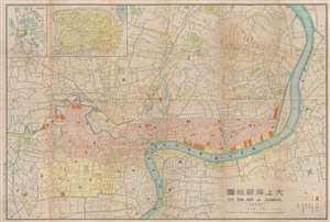
大上海新地圖 / The New Map of Shanghai. / Dai Shanhai shinchizu.
sold
- Digital Map Information
- Suitable for large format printing
- File Size: 24.22 MB
- File Type: ZIP / TIFF
- ICC color profile embedded
- Delivered instantly via download link
This is a very scarce Fusazō Sugie (杉江房造) map of Shanghai, China, issued in 1936 (Showa 11) with manuscript annotations ... (more details)
Scarce map of Shanghai with view of the Bund.
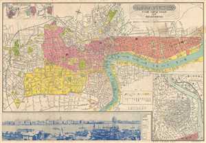
The New Map of Shanghai. /上海最新地圖 / Shànghǎi zuìxīn dìtú.
sold
- Digital Map Information
- Suitable for large format printing
- File Size: 23.45 MB
- File Type: ZIP / TIFF
- ICC color profile embedded
- Delivered instantly via download link
This is a scarce 1930s World War II era Japanese bi-lingual map of Shanghai, China. Centered on the Whangpoo River, it covers ... (more details)
Scarce map of Shanghai with view of the Bund.
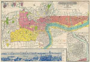
The New Map of Shanghai. /上海最新地圖 / Shànghǎi zuìxīn dìtú.
sold
- Digital Map Information
- Suitable for large format printing
- File Size: 24.78 MB
- File Type: ZIP / TIFF
- ICC color profile embedded
- Delivered instantly via download link
This is a rare and attractive bilingual 1937 map of Shanghai, China. It was made around the start of the Second Sino-Japanese war and World War II. Printed by the Japanese in the 12th year of Hirohito's reign, it depicts central Shanghai including the Chinese Quarter, the French Concession, the English Quarter (along the Bund) etc. Shanghai's cosmopolitan International Settlement is highlighted in Orange (USA), Pink (Great Britain), and Yellow (France). Nineteen important buildings along the Bund are carefully noted and can be referenced via a table to the right of the view. These include the first HSBC Bank, the British Club, the Peace Hotel and the Customs House. There is also a lovely vintage panoramic photo of the Bund along the bottom of the map. Of note, the map includes a large inset in the lower right corner illustrating the development of 'Greater Shanghai'. (more details)
Scarce map of Shanghai with view of the Bund.

The New Map of Shanghai. /上海最新地圖 / Shànghǎi zuìxīn dìtú.
sold
- Digital Map Information
- Suitable for large format printing
- File Size: 46.64 MB
- File Type: ZIP / TIFF
- ICC color profile embedded
- Delivered instantly via download link
This is a rare and attractive bilingual 1937 map of Shanghai, China. It was made around the start of the Second Sino-Japanese war and World War II. Printed by the Japanese in the 12th year of Hirohito's reign, it depicts central Shanghai including the Chinese Quarter, the French Concession, the English Quarter (along the Bund) etc. Shanghai's cosmopolitan International Settlement is highlighted in Orange (USA), Pink (Great Britain), and Yellow (France). Nineteen important buildings along the Bund are carefully noted and can be referenced via a table to the right of the view. These include the first HSBC Bank, the British Club, the Peace Hotel and the Customs House. There is also a lovely vintage panoramic photo of the Bund along the bottom of the map. Of note, the map includes a large inset in the lower right corner illustrating the development of 'Greater Shanghai'. (more details)
Rare map of Shanghai with manuscript annotations relating to foreign concessions and the Battle of Shanghai.
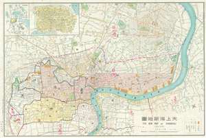
大上海新地圖 / The New Map of Shanghai. / Dai Shanhai shinchizu.
sold
- Digital Map Information
- Suitable for large format printing
- File Size: 20.33 MB
- File Type: ZIP / TIFF
- ICC color profile embedded
- Delivered instantly via download link
This is a very scarce Sugie, Fusazō (杉江房造) map of Shanghai, China, issued on August 30 of 1937 (Showa 12) with ... (more details)
Exceptional World War II map printed in the International Settlement following the Japanese invasion of Shanghai, but before the occupiation of the Concessions - an ephemeral oasis of peace and prosperity in a war-torn city.
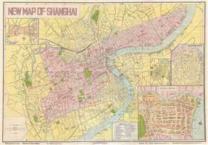
New Map of Shanghai.
sold
- Digital Map Information
- Suitable for large format printing
- File Size: 13.39 MB
- File Type: ZIP / TIFF
- ICC color profile embedded
- Delivered instantly via download link
This is an incredibly rare 1940 Shao Cheng city plan of the concessions in Shanghai, China during the Japanese ... (more details)
Rare map of Shanghai illustrating early development of Yangpu District.
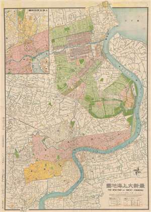
最新大上海地圖 / The New Map of Great Shanghai. / Saishin dai Shanhai chizu.
sold
- Digital Map Information
- Suitable for large format printing
- File Size: 44.54 MB
- File Type: ZIP / TIFF
- ICC color profile embedded
- Delivered instantly via download link
This is a scarce 1940 Shōwa 15 Fusazō Sugie Japanese issue map of Shanghai, China. The map follows the ... (more details)
Rare map of Shanghai illustrating early development of Yangpu District.
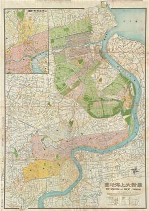
最新大上海地圖 / The New Map of Great Shanghai. / Saishin dai Shanhai chizu.
sold
- Digital Map Information
- Suitable for large format printing
- File Size: 31.12 MB
- File Type: ZIP / TIFF
- ICC color profile embedded
- Delivered instantly via download link
This is a scarce 1940 Shōwa 15 Fusazō Sugie Japanese issue map of Shanghai, China. The map follows the ... (more details)