
Hondius, Henricus II (sold)

Henricus Hondius II (1597 – August 16, 1651) was a Dutch engraver, cartographer and publisher. The son of the cartographer Jodocus Hondius, Henricus took over the business after father died in 1612, co-ran the business with his brother Jodocus II. In 1628 Henricus partnered with Jan Janssonius and together they continued the business, with Jansson’s name appearing on the Atlasas co-publisher after 1633. Eventually, about 50 editions of the Atlas were released in the main European languages. In the Islamic world, the atlas was partially translated by the Turkish scholar Katip Çelebi. The series is sometimes called the 'Mercator/Hondius/Jansson' series because of Jansson's later contributions.
Central Asia at the Dawn of Tsarist Russia
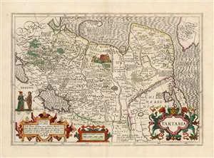
Tartaria
sold
- Digital Map Information
- Suitable for large format printing
- Full resolution TIFF file
- ICC color profile embedded
- Delivered instantly via download link
This is a beautiful, original-color example of Jodocus Hondius' 1606 map of Tartary: Northern Asia, extending from Muscovy and the Black Sea in the west, to the Strait of Anian, China, Korea and the Pacific Ocean in the east. At the furthest extreme of the map is part of North America. The map reaches from the Arctic, as far south as 30 degrees above the equator, embracing the Caspian Sea. (more details)
Classic World Map of the Dutch Golden Age.
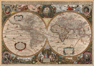
Nova Totius Terrarum Orbis Gerographica ac Hydrographica Tabula. Auct. Henr: Hondio.
sold
- Digital Map Information
- Suitable for large format printing
- Full resolution TIFF file
- ICC color profile embedded
- Delivered instantly via download link
This is Henry Hondius' 1630 map of the world, in its 1646 Jansson edition (the second state, dated 1641), wiht striking old color. With its wealth of decorative flourishes, this map epitomizes Dutch Golden Age cartography. (more details)
First Dutch Atlas Map of North America.
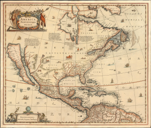
America Septentrionalis.
sold
- Digital Map Information
- Suitable for large format printing
- File Size: 25.59 MB
- File Type: ZIP / TIFF
- ICC color profile embedded
- Delivered instantly via download link
This is Jan Jansson's 1636 map of North America, the first Dutch folio map to focus on North America, featuring abundant cartographic firsts. It is the first general Dutch map of North America to depict a Great Lake connected to the St. Lawrence, and the first obtainable Dutch atlas map of North America to embrace the theory of Insular California. Map historian Carl Wheat considered the many accurate depictions of America's fauna on the map to 'represent its most authentic information, so far as what is now the western United States is concerned'. (more details)
A Richly Detailed Map of the Grand Duchy of Lithuania
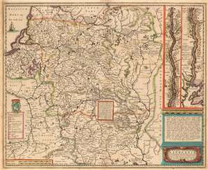
Magni Dvcatvs Lithvaniae caeterarumq ; regionum illi adjacentium exacta descrip./ Illss.mi ac Excell.mi Principis ac Dñi D. Nicolai Christophori Radziwil D.G. Olycae ac in Nieswies Ducis, S. Rom. Imp. Principis in Szylowiec ac Mir comitis, et S. Sepulchri Hirosolimitani Militis etc. opera et cura in lucem edita
sold
- Digital Map Information
- Suitable for large format printing
- DPI: 600
- File Size: 24.13 MB
- File Type: ZIP / TIFF
- ICC color profile embedded
- Delivered instantly via download link
This is Henry Hondius' 1636 map of the Grand Duchy of Lithuania, with inset maps of the course of the Dniepr River. The map encompasses Riga and Smolensk to the north, and Krakow to Kiev in the south. As such it includes parts of modern day Latvia, Lithuania, Poland, Belarus, Ukraine and Russia. The Dniepr insets continue mapping the river from Cherkasy to the river's opening in the Black Sea. The map is based on Willem Blaeu's 1613 wall map of the same title, derived from the 'Radvilas' map of the Grand Duchy of Lithuania. In 1586, the Lithuanian Prince Michael Radziwill commissioned the Polish royal cartographer Maciej Strubicz to produce a map which improved on his earlier map of Poland, Lithuania and Livonia; the resulting map would form the basis of most seventeenth century mapping of this part of the world. Using keys both in the main map and the insets, the cities are marked to indicate their religious (and hence their political) affiliations. The Dniepr maps indicate those forts and cities held by Christians and those held by Muslim 'Tatars;' the main map differentiates between cities of the Palatinates, Catholic bishoprics and Greek Orthodox bishoprics. The map reveals its 16th century naissance in its copious historical notes (with accompanying pictorial battle scenes) of important engagements, alliances and victories in the Polish-Lithuanian Commonwealth's 1579-1581 war with Muscovy. (more details)
A most attractive Dutch Map of the Mogul Empire.
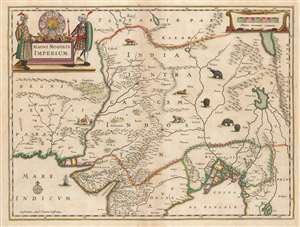
Magni Mogolis Imperium.
sold
- Digital Map Information
- Suitable for large format printing
- DPI: 600
- File Size: 44.94 MB
- File Type: ZIP / TIFF
- ICC color profile embedded
- Delivered instantly via download link
This is an attractive, original color example of Jan Jansson's 1641 map of the Mughal Empire of Northern India. It is the most attractively engraved of the 17th century maps derived from the unacquirable Baffin / Roe map. It features the first accurate mapping of the Indus River, as well as western and central India. At its heart, the map reveals the vital trade routes between the chief cities of Gujarat, Agra, Jaisalmer, and their linkage the Silk Road center of Kabul. (more details)
First Dutch Atlas Map of North America.
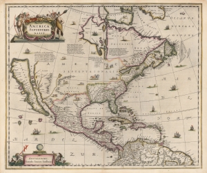
America Septentrionalis.
sold
- Digital Map Information
- Suitable for large format printing
- Full resolution TIFF file
- ICC color profile embedded
- Delivered instantly via download link
This is a beautiful old-color example of Jan Jansson's 1636 map of North America. It is the first folio map to focus on North America specifically after De Jode's 1593 map, and as such features several cartographic primacies. It is the first general Dutch map of North America to depict a Great Lake connected to the St. Lawrence, and the first obtainable Dutch atlas map of North America to embrace the theory of Insular California. Map historian Carl Wheat considered the many accurate depictions of America's fauna on the map to 'represent its most authentic information, so far as what is now western United States is concerned'. (more details)
Hondius Design Genius - two maps, at different scales, superimposed upon one another.
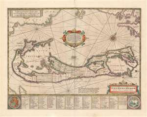
Mappa Aestivarvm Insularum, alias Barmudas.
sold
- Digital Map Information
- Suitable for large format printing
- Full resolution TIFF file
- ICC color profile embedded
- Delivered instantly via download link
This is a classic 17th-century map Dutch of Bermuda, printed by Jan Jansson in 1654 and here in an original color example from the collection of the illustrious map collector, dealer, and scholar Kenneth Nebenzahl. Actually engraved by Jansson's brother-in-law Henricus Hondius, this map was based on Richard Norwood’s chart produced in 1618 for the Bermuda Company. Norwood's chart provides the primary depiction of the island available for that century. Versions of this map were printed by John Speed as well as Hondius' and Jansson's competitor, Willem Blaeu. (more details)