
Menzies, John (sold)

John Menzies (October 27, 1772 - October 16, 1857) was a Scottish engraver active in Edinburgh during the late 18th and early 19th centuries. Menzies mastered engraving as an apprentice to James Rymer. In 1811, he partnered with his younger brother, George Menzies, to found the engraving firm of J. and G. Menzies, which was active until about 1831. Later his son, also named John, joined the firm and they engraved jointly under the imprint of J. Menzies and Son. At its height, the Menzies firm employed three men and three apprentices. Menzies engraved maps for Thomas Brown and John Thomson, among others. After his death, his son, John Menzies II (1819 – 1891), continued the family business until about 1891.
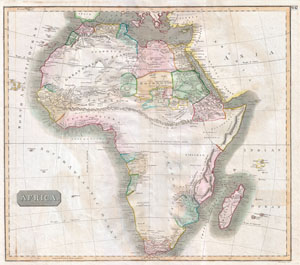
Africa
sold
- Digital Map Information
- Suitable for large format printing
- DPI: 300
- File Size: 15.09 MB
- File Type: ZIP / TIFF
- ICC color profile embedded
- Delivered instantly via download link
This hand colored map is a steel plate engraving, dating to 1813 by the important English mapmaker John Thomson. It is an early and historically important representation of the continent of Africa. Much of the continent is simply labeled 'unknown parts,' but some ... (more details)
Beautifully engraved early 19th century English map of Africa.
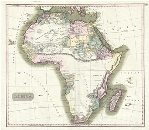
Africa.
sold
- Digital Map Information
- Suitable for large format printing
- DPI: 300
- File Size: 11.05 MB
- File Type: ZIP / TIFF
- ICC color profile embedded
- Delivered instantly via download link
This is John Thomson's fascinating 1814 map of Africa in its first edition. This remarkable map is as engrossing as much for what it doesn't show as for what it does. The great blank interior, here labeled, 'unknown parts' reveals just how little of the 'Dark ... (more details)
On the cusp of great change.
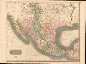
Spanish North America.
sold
- Digital Map Information
- Suitable for large format printing
- Full resolution TIFF file
- ICC color profile embedded
- Delivered instantly via download link
This beautiful 1814 map is most likely the most important large format English atlas map of the American Southwest to be produced in the first quarter of the 19th century. It captures the region on the cusp of great change. At the time of issue Mexico was embroiled in the Mexican War of Independence (1810 - 1821). After the war, the newly independent Mexican Republic, eager to develop its vast northern provinces of Texas and New Mexico, initiated the 'Empressario' system, which opened Texas foreign settlement. The 'Empressario' grants gave rise to a large and industrious Anglo population in Texas and set the stage for the 1836 Texan Revolution and the subsequent Mexican-American War (1846 - 1848). (more details)
Turmoil over slavery.
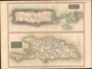
Porto Rico and Virgin Isles. / Haiti, Hispaniola or St. Domingo.
sold
- Digital Map Information
- Suitable for large format printing
- DPI: 600
- File Size: 714.76 MB
- File Type: ZIP / TIFF
- ICC color profile embedded
- Delivered instantly via download link
A beautiful large format 1815 John Thomson map of Porto Rico, the Virgin Islands, and Hispaniola (Haiti / Dominican Republic). When this map was issued, this was a region racked with internal strife and rebellion - mostly revolving around slavery. (more details)
Seeking a Path through the Southern Seas.
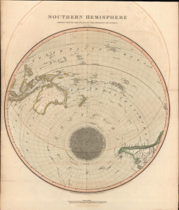
Southern Hemisphere Projected on the Plane of the Horizon of London.
sold
- Digital Map Information
- Suitable for large format printing
- DPI: 600
- File Size: 567.38 MB
- File Type: ZIP / TIFF
- ICC color profile embedded
- Delivered instantly via download link
An unusual offset polar projection map of the Southern Hemisphere, drawn and engraved in 1816 for the 1817 Dublin printing of John Thomson's New General Atlas. Among other features, it highlights the relatively recent voyages of Captain James Cook, including discoveries along the coasts of New Zealand and Australia. (more details)
Issued at the outset of the Third Anglo-Maratha War, which consolited British colonial power in India.
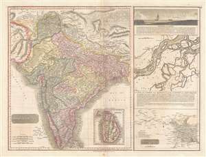
Hindoostan.
sold
- Digital Map Information
- Suitable for large format printing
- DPI: 300
- File Size: 14.11 MB
- File Type: ZIP / TIFF
- ICC color profile embedded
- Delivered instantly via download link
This is the 1817 map of India with inset maps of the Ganges River by Edinburgh cartographer John Thomson. This magnificent map is the rarest of the Thomson India series. It depicts the whole of India from Lahore to the island of Ceylon (Shi Lanka). Numerous ... (more details)
Early mapping of many Gulf states.
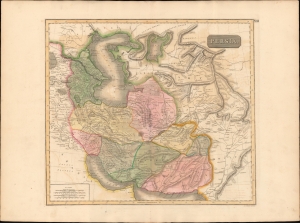
Persia.
sold
- Digital Map Information
- Suitable for large format printing
- DPI: 600
- File Size: 72.44 MB
- File Type: ZIP / TIFF
- ICC color profile embedded
- Delivered instantly via download link
This is an 1817 map of Qujar Persia, including modern-day Afghanistan, by Edinburgh cartographer John Thomson. The map is notable for its naming of multiple emirates and kingdoms on the western shore of the Persian Gulf - including Qatar, Dubai, Kuwait, and Bahrain. (more details)