
Menzies, John

John Menzies (October 27, 1772 - October 16, 1857) was a Scottish engraver active in Edinburgh during the late 18th and early 19th centuries. Menzies mastered engraving as an apprentice to James Rymer. In 1811, he partnered with his younger brother, George Menzies, to found the engraving firm of J. and G. Menzies, which was active until about 1831. Later his son, also named John, joined the firm and they engraved jointly under the imprint of J. Menzies and Son. At its height, the Menzies firm employed three men and three apprentices. Menzies engraved maps for Thomas Brown and John Thomson, among others. After his death, his son, John Menzies II (1819 – 1891), continued the family business until about 1891.
Before the momentous mid-19th century.
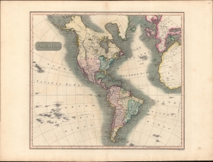
America.
$350.00
Acquire
- Digital Map Information
- Suitable for large format printing
- DPI: 600
- File Size: 709.93 MB
- File Type: ZIP / TIFF
- ICC color profile embedded
- Delivered instantly via download link
A striking example of John Thomson's 1813 map of the Americas. The America presented here predates the momentous events of the mid-19th century: the Mexican American War, the Gold Rush, and the Latin American Wars of Independence. (more details)
Happy Arabia.
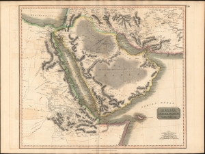
Arabia, Egypt, Abyssinia, Red Sea etc.
$550.00
Acquire
- Digital Map Information
- Suitable for large format printing
- DPI: 600
- File Size: 78.89 MB
- File Type: ZIP / TIFF
- ICC color profile embedded
- Delivered instantly via download link
This is an example of John Thomson's 1814 map of Arabia, Egypt, and Abyssinia. Centered on the Arabian Peninsula, Thomson's map covers from the eastern Mediterranean to the Horn of Africa, and from the Libyan Desert to Persia. The whole of this map is beautifully engraved in the minimalist English style pioneered in the early part of the 19th century. Relief is shown by hachure with towns, caravan routes, cities, and major topographical features identified. (more details)
The Indian Ocean and arteries of trade.
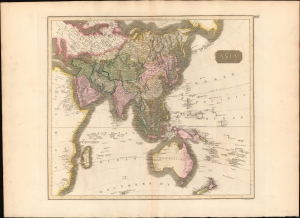
Asia.
$450.00
Acquire
- Digital Map Information
- Suitable for large format printing
- DPI: 600
- File Size: 64.28 MB
- File Type: ZIP / TIFF
- ICC color profile embedded
- Delivered instantly via download link
This is a first edition 1814 John Thomson map of Asia, the Indian Ocean, and Australia. (more details)
The height of the British East India Company.
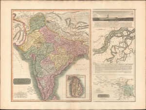
Hindoostan. / A View of the course of the Ganges...
$550.00
Acquire
- Digital Map Information
- Suitable for large format printing
- DPI: 600
- File Size: 77.31 MB
- File Type: ZIP / TIFF
- ICC color profile embedded
- Delivered instantly via download link
This is the 1814 first edition John Thomson map of India with inset maps of the Ganges River. This is the rarest of the Thomson India series, having appeared only in the first edition of his atlas. It is one of the finest atlas maps of India to appear in the early 19th century. (more details)
Mare Britannicum.
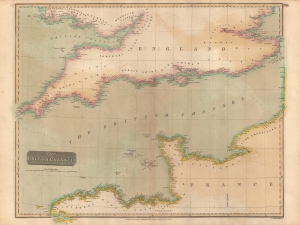
The British Channel.
$250.00
Acquire
- Digital Map Information
- Suitable for large format printing
- Full resolution TIFF file
- ICC color profile embedded
- Delivered instantly via download link
A fine example of John Thomson's 1814 map of the English Channel, published in 1817 in his New General Atlas. (more details)
The Northwest Territory and West Florida.
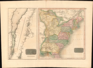
United States of America. / The Course of the River St. Lawrence, from Lake Ontario to Manicouagan Point.
$500.00
Acquire
- Digital Map Information
- Suitable for large format printing
- DPI: 600
- File Size: 66.11 MB
- File Type: ZIP / TIFF
- ICC color profile embedded
- Delivered instantly via download link
This is an example of John Thomson's 1814 map of the United States and the course of the St. Lawrence River. The map offers much of interest, ranging from early state and territorial configurations to rarely seen references to short-lived treaties with American Indians. (more details)
Settling the Borders of Post-Napoleonic Europe.
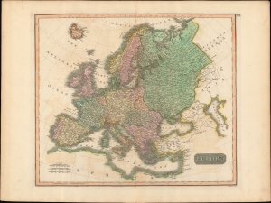
Europe.
$250.00
Acquire
- Digital Map Information
- Suitable for large format printing
- Full resolution TIFF file
- ICC color profile embedded
- Delivered instantly via download link
A lovely example of John Thomson's c. 1815 map of Europe, engraved by John Menzies, for the first edition of Thomson's New General Atlas, published in 1817. Despite the publication date, the map was prepared before the post-Napoleonic order had solidified and reflects a high degree of uncertainty over the borders of Europe emerging from the Congress of Vienna. (more details)
The 'closed' countries of Korea and Japan.
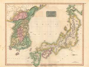
Corea and Japan.
$750.00
Acquire
- Digital Map Information
- Suitable for large format printing
- DPI: 600
- File Size: 84.26 MB
- File Type: ZIP / TIFF
- ICC color profile embedded
- Delivered instantly via download link
This fascinating hand colored 1815 map depicts Joseon Korea and Tokugawa Japan, both of which would be drastically changed by the end of the century. The level of detail attempted here is impressive given the great difficulties faced by foreigners trying to travel to either country at the time. (more details)
¡Viva la resistencia!
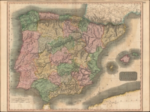
Spain and Portugal.
$300.00
Acquire
- Digital Map Information
- Suitable for large format printing
- Full resolution TIFF file
- ICC color profile embedded
- Delivered instantly via download link
A hand-colored 1815 map of Spain and Portugal by John Thomson, published in his New General Atlas. It depicts the kingdoms at the tail end of the Napoleonic Wars (1803 - 1815), namely the Peninsular War, which was devastating both to Iberia and to both countries' control of their overseas empires. (more details)
Unusal polar projection.
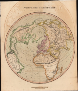
Northern Hemisphere Projected on the Plane of the Horizon of London.
$500.00
Acquire
- Digital Map Information
- Suitable for large format printing
- DPI: 600
- File Size: 581.8 MB
- File Type: ZIP / TIFF
- ICC color profile embedded
- Delivered instantly via download link
A lovely 1816 offset polar projection map of the Northern Hemisphere that appeared in Edinburgh cartographer John Thomson's New General Atlas. (more details)
Unknown Parts.
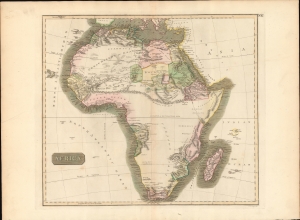
Africa.
$350.00
Acquire
- Digital Map Information
- Suitable for large format printing
- DPI: 600
- File Size: 688.26 MB
- File Type: ZIP / TIFF
- ICC color profile embedded
- Delivered instantly via download link
This is John Thomson's fascinating 1814 map of Africa, here in its first edition. This map is as engrossing as much for what it doesn't show as for what it does. The expansive blank interior, here labeled, 'unknown parts' reveals just how little of the 'Dark Continent' was known in the early 19th century. (more details)