
Ottens, Joachim (sold) (Joshua Ottens, Renier Ottens, I. Ottens)
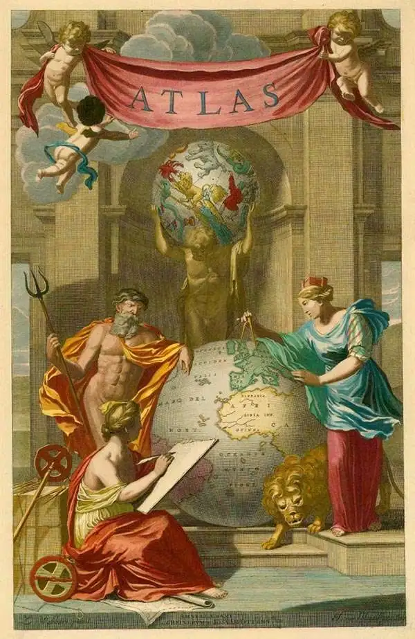
Ottens (fl. c. 1680 - 1785) was a prominent Amsterdam map publishing family active for nearly 100 years. Joachim Ottens (1663 - 1719) was born in Amsterdam to a family of seafarers and educated in Amsterdam's Evangelical Lutheran community. He likely learned copperplate engraving under Frederick de Wit (1629 - 1706), for whom he worked until about 1710. In 1710, he was admitted to the Sint-Lucasgilde (Guild of St. Luke) and, in 1711, Joachim founded his own firm. Although Joachim died only a few years later, in 1719, his widow continued the business, either publishing as either 'I. Ottens', 'Ottens', or 'In de Wereldcaert' [In the World Map]. In 1726, Joachim Otten's sons, Renier (1698 - 1750) and Joshua (1698 - 1750), established a partnership and generally published as 'R. and I. Ottens'. Although they ran separate shops, on Nieuwendijk and Kalverstraat, they worked jointly as a singular business until Renier's death in 1750, at which point Joshua assumed full control. After Joshua's death in 1765, his widow continued the firm with their son, Renier II, changing the imprint to 'Joshua and Reinier Ottens.' Joshua's widow, Johanna de Lindt, held an auction sale of their engraved plates in 1784. Ottens' work stands out in that all of their maps were separate issues, though often found compiled into special, made-to-order multi-volume composite Atlas factice works, such as the Atlas. Some examples of the Atlas include over 800 separately issued maps. Because they were not uniformly issued in standard atlases, Ottens maps are often of the utmost rarity and are notable for their exceptionally rich engraving.
AKA: Joshua Ottens, Renier Ottens, I. Ottens
Centuries of War.
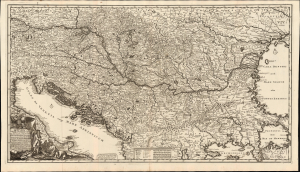
Novissima tabula regni Hungariae et regionum quondam ei unitarum ut Transilvaniae, Valachiae, Moldaviae, Serviae, Romaniae, Bulgariae, Bessarabiae, Croatiae, Bosniae, Dalmatiae, Slavoniae, Morlachiae et reipublicae Ragusanae...
sold
- Digital Map Information
- Suitable for large format printing
- File Size: 44.02 MB
- File Type: ZIP / TIFF
- ICC color profile embedded
- Delivered instantly via download link
Joachim Ottens' rare, large, and beautifully engraved c. 1700 map of the lands about the Danube captures the region in the wake of the 1699 Treaty of Karlowitz, which brought the Great Turkish War (1683 - 1699) to a close. Ottens' map encompasses the theatre of that war and records key battles in that region, stretching back to the 14th century. (more details)
One of the most beautiful cartographic representations of Southeast Asia ever printed.
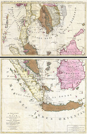
Le Royaume de Siam avec Les Royaumes Qui Luy sont Tributaries & c. / La Royaume de Siam avec les royaumes qui luy sont Tributaires, et les Isles de Sumatra, Andemaon, etc. Et les Isles Voisine Aven les Observations des Six Peres Jesuites Envojez par le Roy en Qualite de Ses Mathe : maticiens dans les Indes, et a laChine ou est aussi Tracee. La Route Qu'ils ont teniie par le Destroit de la Sonde Jusqu a Siam.
sold
- Digital Map Information
- Suitable for large format printing
- DPI: 300
- File Size: 31.05 MB
- File Type: ZIP / TIFF
- ICC color profile embedded
- Delivered instantly via download link
A fine example of Joachim Ottens' magnificent two part c. 1710 map of the Kingdom of Siam and its tributaries. Covers much of Southeast Asia and the East Indies including modern day Thailand, southern Vietnam, Cambodia, Malaysia, Singapore, Borneo, Sumatra and ... (more details)
The first map of the Balearic Islands based on firsthand knowledge.
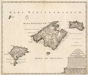
Baleares seu Gymnesiae et Pityusae insulae dictae Maiorca, Minorca et Yvica.
sold
- Digital Map Information
- Suitable for large format printing
- DPI: 600
- File Size: 55.98 MB
- File Type: ZIP / TIFF
- ICC color profile embedded
- Delivered instantly via download link
This is a superbly detailed map of the Balearic Islands by Renard and Josua Ottens, in what appears to be a scarce early state, as early as 1720. The map is oriented to the north, and includes the major islands of Mallorca, Menorca, Ibiza, and Formentera as well as the smaller Cabrera, Dragonera, and Monte Colibre. Mallorca and Menorca, in particular, are superbly detailed. All the major islands' terrain is richly and expertly engraved, illustrating topography, forests, and cultivated areas pictorially. Roads, cities, salt flats, and fortifications are depicted. Anchorages are indicated, in several cases with depth soundings. The elegant, spare cartouche features a brief history of the rulers of the islands, up to the English capture and occupation of Menorca in 1708. (more details)
First map of the Balearic Islands based on firsthand knowledge.
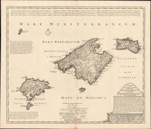
Baleares seu Gymnesiae et Pityusae insulae dictae Maiorca, Minorca et Yvica.
sold
- Digital Map Information
- Suitable for large format printing
- Full resolution TIFF file
- ICC color profile embedded
- Delivered instantly via download link
This is a superbly detailed c. 1725 map of the Balearic Islands by Renard and Josua Ottens. It draws on earlier maps by Johannes van Keulen and the local scholar Vicente Mut i Armengol, while adding notes on the islands' history and quotes from classical texts, providing a comprehensive overview. (more details)
Dominant map of Persia and Afghanistan at the beginning of the 18th century
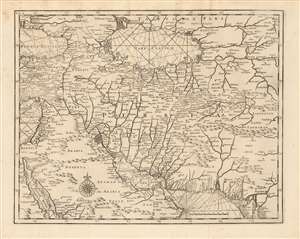
[Persia]
sold
- Digital Map Information
- Suitable for large format printing
- Full resolution TIFF file
- ICC color profile embedded
- Delivered instantly via download link
This is a rare 1726 map of Persia by Francois Valentijn. It covers from the Gulf of Suez eastward to Ahmedabad (Amadabad) in modern-day western India. This map, centered on Persia, includes the Caspian Sea and part of the Arabian Peninsula. The map is highly detailed, noting numerous rivers, towns, islands and mountains. Stippling along the coastlines indicates shallows. The detail of this elegant and scarce map, alas, reflects the cartography of the previous centuries: place names are largely consistent with those found on the 16th century maps of Giacomo Gastaldi, which were largely passed along wholesale to Blaeu, whose labors this map's maker appears to have mined. (more details)
Strahlenberg's stolen 1715 map of Asiatic Russia and the Tatar Empire.
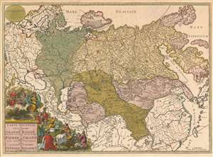
Carte nouvelle de tout l'Empire de la Grande Russie dans l'estat ou il s'est trouvé à la mort de Pierre le Grand. Dressée sur des observations toutes nouvelles et dedoée à l'immortelle memoire de ce Grand Monarque Avec Privilege à Amsterdam.
sold
- Digital Map Information
- Suitable for large format printing
- Full resolution TIFF file
- ICC color profile embedded
- Delivered instantly via download link
This rare, separately issued map of the Russian Empire was printed by Renier and Josua Ottens c. 1730, but the map is based on the work of Philipp Johann von Strahlenberg. It is that mapmaker's first map of Russia and Siberia, stolen from him in 1715. Strahlenberg (1677 - 1747) would rebound to produce his superb 1730 Tattariae Magnae, one of the largest, most groundbreaking, and unique maps of Russia to appear in the first half of the 18th century. This beautiful engraving represents the first complete expression of Strahlenberg's efforts at his seminal mapping of Siberia and the Russian Arctic. (more details)
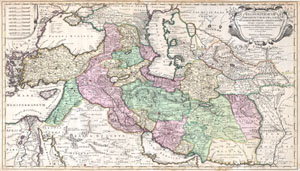
Regnum Persicum Imperium Turcicum in Asia Russorum Provinciae and Mare Caspium.
sold
- Digital Map Information
- Suitable for large format printing
- DPI: 300
- File Size: 15.73 MB
- File Type: ZIP / TIFF
- ICC color profile embedded
- Delivered instantly via download link
A scarce and altogether spectacular c. 1730 map of southwestern Asia, specifically focusing on Persia, by Reiner and Joshua Ottens. Covers from Egypt and Greece eastward to include Turkey, the northern part of the Arabian Peninsula, the Black and Caspian Seas, ... (more details)
St. Eustatius was key to the American victory during the American Revolutionary War.
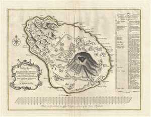
Nieuwe Kaart van het Eyland St. Eustatius in derzelver Ligging en Plantagien met de Naamen der Besitteren, Op Order van de Generaale Geoctroojeerde West-Indische Compagnie.
sold
- Digital Map Information
- Suitable for large format printing
- DPI: 300
- File Size: 9.73 MB
- File Type: ZIP / TIFF
- ICC color profile embedded
- Delivered instantly via download link
This is a rare 1775 Reinier Ottens map of Saint Eustatius, an island in the Caribbean. The map depicts the entirety of the island, from Buccaneer's Bay to Venus Bay and from to Company Bay. Ordered by the Dutch West India Company, 76 different locations (most ... (more details)