
Quad, Matthias (sold)

Matthias Quad (1557 - October 29, 1613) was Dutch engraver active in Cologne during the late 16th and early 17th centuries. Quad was born in the Netherlands and studied engraving under Johannes van Deutecum (fl. 1552 - 1606) of Deventer and Hendrick Goltzius (1558-1616) of Haarlem. Around 1580 he relocated to Heidelberg or Cologne where he primarily engraved geographical texts in conjunction with fellow publisher Johann Bussemacher. In 1608 he published an atlas, Fasciculus Geographicus, with Bussemacher in Cologne. In 1609, another major work, his Teutscher Nation Herligkeit, a historico-cultural regional study of Germany, was published by Wilhelm Lutzenkirchen .
Couching modern geography in a Christian context.
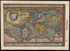
Typus Orbis Terrarum, ad Imitationem Universalis Gerhardi Mercatoris.
sold
- Digital Map Information
- Suitable for large format printing
- File Size: 8.18 MB
- File Type: ZIP / TIFF
- ICC color profile embedded
- Delivered instantly via download link
This is an attractive example of Matthias Quad's 1596 map of the world, modeled on Mercator's 1569 wall map. Quad's reduction is one of the first maps to use the projection bearing Mercator's name, and of these, it is the one that does so the most precisely. In addition, Quad's map relates to Abraham Ortelius' world map by using at the bottom the Latin quotation from Cicero, similarly decorating Ortelius' work: 'For what can seem important in human affairs to someone who is aware of all eternity and the size of the whole world?' Quad has also added the image of Christ in a medallion in the upper left quadrant of the map, bearing the Latin legend 'Our Lord Jesus Christ the founder, redeemer and future judge of the whole world'. (more details)
Curious map with tantalizing hints of Australia.
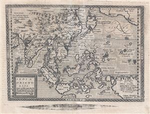
India Orientalis. cuius nobilior pars sunt duo ista quasi ingentia totius Asiæ promontaria in Oceanum versus Meridiem projecta, cum suis insulis.
sold
- Digital Map Information
- Suitable for large format printing
- DPI: 300
- File Size: 5.24 MB
- File Type: ZIP / TIFF
- ICC color profile embedded
- Delivered instantly via download link
An attractive and scarce 1600 map of the East Indies by Johann Bussemacher and Matthias Quad. Cartographically derived from Ortelius' slightly earlier map of the same region, this map covers from Arabia east to the Americas and New Guinea and from northern China ... (more details)
Capturing the Geography of the Virtually Unobtainable First State Mercator Arctic.
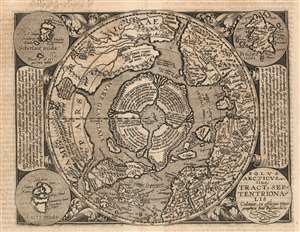
Polus Arcticus sive Tractus Septentrionalis.
sold
- Digital Map Information
- Suitable for large format printing
- DPI: 600
- File Size: 19.18 MB
- File Type: ZIP / TIFF
- ICC color profile embedded
- Delivered instantly via download link
This is a scarce 1600 Matthias Quad map of the Arctic, a beautifully engraved reduction of Gerard Mercator's seminal 1595 Septentrionalium Terrarum descriptio. The timing of the engraving is of great importance: Quad's model was not the relatively ubiquitous 1606 edited version of Mercator's map, but the extremely rare 1595 first state. Although the smaller size of Quad's copperplate necessitated the excision of some place names in Greenland, Norway and Russia, the central Arctic details of the map are very faithfully preserved from the Mercator original - thus making a virtually unobtainable map's cartography available to the more casual collector. Despite the flaws of many of Mercator's sources, his map (and Quad's faithful rendition of it here) presents a fascinating portrait of the best 16th century European conceptualization of the north parts of the world. (more details)
An important map of North America from the Great Age of Exploraiton and one of the first to incorporate the cartography of John White and Jacques le Moyne.
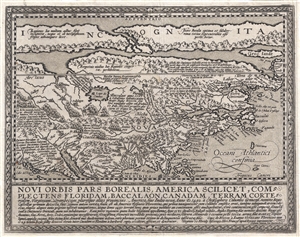
Novi Orbis Pars Borealis, America Scilicet, Complectens Floridam, Baccalaon, Canadam, Terram Corte . . . 1585.
sold
- Digital Map Information
- Suitable for large format printing
- DPI: 300
- File Size: 4.37 MB
- File Type: ZIP / TIFF
- ICC color profile embedded
- Delivered instantly via download link
A beautifully engraved, rare, and important 1600 map of North America by Mattias Quad. Derived from Cornelis de Jode's 1593 Americae Pars Borealis , Quad's map covers all of North America from the unknown arctic to the Gulf of Mexico and from the Pacific to the ... (more details)
Exceptional map of the apocryphal Southern Continent of Terre Australis with text some believe suggest pre-discovery knowledge of the continent.
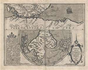
Chica Sive Patagonica et Australis Terra.
sold
- Digital Map Information
- Suitable for large format printing
- DPI: 300
- File Size: 4.33 MB
- File Type: ZIP / TIFF
- ICC color profile embedded
- Delivered instantly via download link
A scarce and interesting 1600 map of the Straits of Magellan and the southern polar regions, including the Great Southern Continent or Terre Australis, a kind of speculative precursor to the discovery of Antarctica. The map is divided into two segments. The ... (more details)
Strait of Magellan, and the imagined lands to the south.
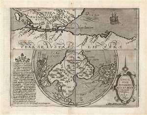
Chica Sive Patagonica et Australis Terra. MDC.
sold
- Digital Map Information
- Suitable for large format printing
- DPI: 600
- File Size: 19.86 MB
- File Type: ZIP / TIFF
- ICC color profile embedded
- Delivered instantly via download link
This scarce and fascinating map is Matthias Quad's 1600 depiction of the Straits of Magellan and the southern polar regions, including Terre Australis - the massive continent believed by many sixteenth and seventeenth century geographers to cover the south part of the world. It is closely derived from a 1597 map by Cornelis Wytfliet, but is much scarcer than the earlier work. (more details)
Stunning map of Sicily from the Cologne School.
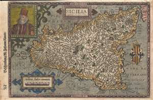
Sicilia.
sold
- Digital Map Information
- Suitable for large format printing
- DPI: 300
- File Size: 3.62 MB
- File Type: ZIP / TIFF
- ICC color profile embedded
- Delivered instantly via download link
A rare 1600 map of Sicily, Italy, by Matthias Quad and Johann Bussemacher. There is an engraved portrait of Phillip II of Spain, who, among his other titles, was also King of Sicily. I the upper left corner. Published in Cologne. Quad's imprint appears as ... (more details)
Stunning Atlas, Old Color, Distinguished Provenance.

Fasciculus geographicus complectens praecipuarum totius orbis regionum tabulas circiter centum, unà cum earundem enarrationibus.
sold
This is Matthias Quad's geographical atlas in its expanded 1608 edition, with 87 maps in superb original color and a distinguished provenance connecting it to the Lord Wardington Collection. Quad's atlas provided, in a small folio, a compilation of the most state-of-the-art maps of his era - some engraved by Quad himself, the bulk having been engraved by publisher Johan Bussemacher. The richly-colored atlas is beautifully bound in contemporary vellum and is the finest example of this work known. (more details)