
Stoopendaal, Daniel (sold)

Daniel Stoopendaal (1672-1726) was a Dutch engraver and mapmaker active in Amsterdam during the early part of the17th century. Stoopendaal is best known for his garden and landscape prints. Cartographically D. Stoopendaal's most notable work is his re-engravings of Visscher maps of the Holy Land for inclusion in the Keur Bible. Daniel Stoopendaal is often confused with Bastiaan Stoopendaal, an engraver associated the Visscher firm, with whom he frequently work but was most likely not related.
Magnificent decorative map of the Holy Land showing the Exodus.
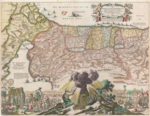
Perigrinatie ofte Veertich-Iarige Reyse der Kinderen Israels
sold
- Digital Map Information
- Suitable for large format printing
- Full resolution TIFF file
- ICC color profile embedded
- Delivered instantly via download link
An absolutely stunning 1682 first state of Keur and Stoopendaal's map of the Holy Land, Israel, or Palestine. This map, from Keur's important Dutch Bible of 1687, is oriented to west and covers from the Nile Delta, Cairo and Memphis, egypt, across the Red Sea and ... (more details)
Early 18th century world map with decorative borders showing an insular California.
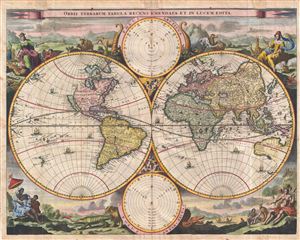
Orbis Terrarum Tabula Recens Emendata et in Lucem Edita.
sold
- Digital Map Information
- Suitable for large format printing
- DPI: 300
- File Size: 11.78 MB
- File Type: ZIP / TIFF
- ICC color profile embedded
- Delivered instantly via download link
A fine 1702 world map was drawn by Daniel Stoopendaal for publication in the Keur Bible. Based on Visscher's very similar map of 1663, this map depicts the world on a hemisphere projection surrounded by stunning allegorical cartouche work. The cartouche work ... (more details)
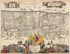
Het Beloofde Landt Canaan door wandelt van onsen Salichmaecker Iesu Christo nessens syne Apostelen.
sold
- Digital Map Information
- Suitable for large format printing
- DPI: 300
- File Size: 10.65 MB
- File Type: ZIP / TIFF
- ICC color profile embedded
- Delivered instantly via download link
This is a splendid early example of Bastiaan Stoopendaal and Jacob Keur's c. 1702 map of Canaan (Israel or Palestine). Oriented to the west, this map covers the Holy Land from the Mediteranean to just beyond the Jordan River. This map purports to illustrate ... (more details)
Magnificent decorative map of the Holy Land showing the Exodus.
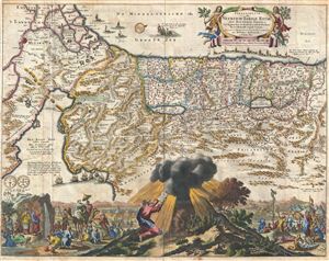
Perigrinatie ofte Veertich-Iarige Reyse der Kinderen Israels.
sold
- Digital Map Information
- Suitable for large format printing
- DPI: 300
- File Size: 11.33 MB
- File Type: ZIP / TIFF
- ICC color profile embedded
- Delivered instantly via download link
An absolutely stunning 1702 map of the Holy Land, Israel, or Palestine by N. Visscher and D. Stoopendaal. This map, from Keur's important Dutch Bible of 1702, is oriented to west and covers from the Nile Delta, Cairo and Memphis, Egypt, across the Red Sea ... (more details)
An fascinating fictional plan of Jerusalem.
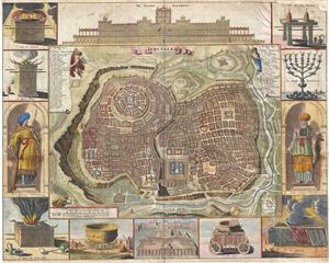
Ierusalem.
sold
- Digital Map Information
- Suitable for large format printing
- Full resolution TIFF file
- ICC color profile embedded
- Delivered instantly via download link
A remarkable imaginary 1702 plan of Jerusalem drawn by Daniel Stoopendaal but based upon an early work by Juan Bautista Villalpando. Villalpando's popular fictive view of Jerusalem first appeared in a 1604 commentary on Ezekiel co-written by Villalpando ... (more details)
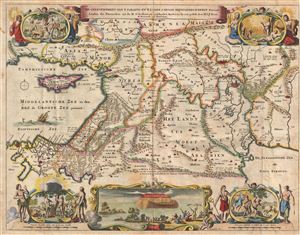
De Gelegentheyt van 't Paradys ende 't Land Canaan mitsgaders de eerste bewoonde landen Der Patriarchen, uyt de H. schrifture en verscheyden Auctoren bij een gestelt door
sold
- Digital Map Information
- Suitable for large format printing
- DPI: 300
- File Size: 10.54 MB
- File Type: ZIP / TIFF
- ICC color profile embedded
- Delivered instantly via download link
This is a splendid early example of Daniel Stoopendaal and Jacob Keur's 1702 map of the Holy Land, or as it is titled (in rough translation) 'Paradise, or the Garden of Eden, with the countries adjacent as inhabited by the Patriarchs.' Covers the region ... (more details)
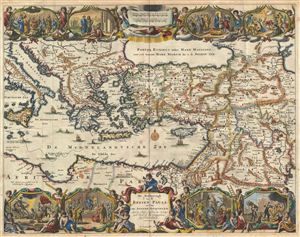
De Beschryvingh van de Reysen Pauli, en van de Andere Apostelen.
sold
- Digital Map Information
- Suitable for large format printing
- DPI: 300
- File Size: 11.32 MB
- File Type: ZIP / TIFF
- ICC color profile embedded
- Delivered instantly via download link
This is a splendid early example of Daniel Stoopendaal and Jacob Keur's 1702 map of the travels of the Apostle Paul. The map covers the eastern Mediterranean from Sicily to the Holy Land and inland as far as the Persian Gulf and the Caspian Sea, ... (more details)
Magnificent decorative map of the Holy Land showing the Exodus.

Perigrinatie ofte Veertich-Iarige Reyse der Kinderen Israels
sold
- Digital Map Information
- Suitable for large format printing
- DPI: 300
- File Size: 10.35 MB
- File Type: ZIP / TIFF
- ICC color profile embedded
- Delivered instantly via download link
An absolutely stunning 1702 map of the Holy Land, Israel, or Palestine by N. Visscher and D. Stoopendaal. This map, from Keur's important Dutch Bible of 1702, is oriented to west and covers from the Nile Delta, Cairo and Memphis, egypt, across ... (more details)
Magnificent decorative map of the Holy Land showing the Exodus.
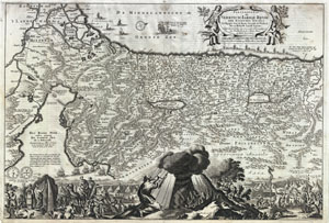
Perigrinatie ofte Veertich-Iarige Reyse der Kinderen Israels
sold
- Digital Map Information
- Suitable for large format printing
- DPI: 300
- File Size: 10.9 MB
- File Type: ZIP / TIFF
- ICC color profile embedded
- Delivered instantly via download link
An absolutely stunning 1702 map of the Holy Land, Israel, or Palestine by N. Visscher and D. Stoopendaal. This map, from Keur's important Dutch Bible of 1702, is oriented to west and covers from the Nile Delta, Cairo and Memphis, Egypt, across ... (more details)
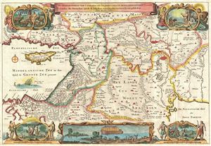
De Gelegentheyt van 't Paradys ende 't Land Canaan mitsgaders de eerste bewoonde landen Der Patriarchen, uyt de H. schrifture en verscheyden Auctoren bij een gestelt door
sold
- Digital Map Information
- Suitable for large format printing
- DPI: 300
- File Size: 8.96 MB
- File Type: ZIP / TIFF
- ICC color profile embedded
- Delivered instantly via download link
This is a splendid early example of Daniel Stoopendaal and Jacob Keur's c. 1730 map of the Holy Land, or as it is titled (in rough translation) 'Paradise, or the Garden of Eden, with the countries adjacent as inhabited by the Patriarchs.' ... (more details)
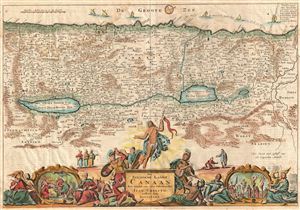
Het Beloofde Landt Canaan door wandelt van onsen Salichmaecker Iesu Christo nessens syne Apostelen.
sold
- Digital Map Information
- Suitable for large format printing
- DPI: 300
- File Size: 9.1 MB
- File Type: ZIP / TIFF
- ICC color profile embedded
- Delivered instantly via download link
This is a splendid early example of Bastiaan Stoopendaal and Jacob Keur's c. 1730 map of Canaan (Israel or Palestine). Oriented to the west, this map covers the Holy Land from the Mediteranean to just beyond the Jordan River. This map ... (more details)
An fascinating fictional plan of Jerusalem.
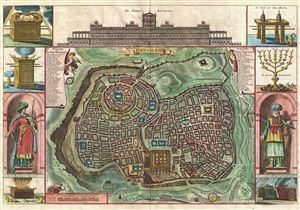
Ierusalem.
sold
- Digital Map Information
- Suitable for large format printing
- DPI: 300
- File Size: 11.21 MB
- File Type: ZIP / TIFF
- ICC color profile embedded
- Delivered instantly via download link
A remarkable imaginary c. 1730 plan of Jerusalem drawn by Daniel Stoopendaal but based upon an early work by Juan Bautista Villalpando. Villalpando's popular fictive view of Jerusalem first appeared in a 1604 commentary on Ezekiel ... (more details)
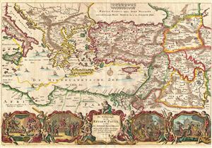
De Beschryvingh van de Reysen Pauli, en van de Andere Apostelen.
sold
- Digital Map Information
- Suitable for large format printing
- Full resolution TIFF file
- ICC color profile embedded
- Delivered instantly via download link
This is a splendid early example of Daniel Stoopendaal and Jacob Keur's c. 1730 map of the travels of the Apostle Paul. Covers the eastern Mediterranean from Sicily to the Holy Land and inland as far as the Persian Gulf and the ... (more details)
Early 18th century world map with decorative borders showing an insular California.
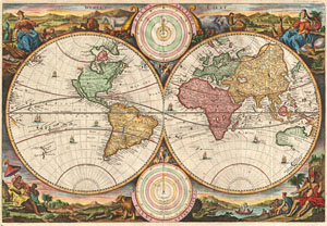
Werelt Caert.
sold
- Digital Map Information
- Suitable for large format printing
- Full resolution TIFF file
- ICC color profile embedded
- Delivered instantly via download link
A fine 1730 world map was drawn by Daniel Stoopendaal for publication in the Keur Bible. Based on Visscher's very similar map of 1663, this map depicts the world on a hemisphere projection surrounded by stunning allegorical ... (more details)