
Tallis, John (sold)

John Tallis (November 7, 1817 - June 3, 1876) was an English map publisher and bookseller. Born in Stourbridge, Worcestershire, he worked in his father's Birmingham agency from 1836 to 1842. Around 1838, Tallis published a collection of London Street Views and entered into a partnership with his brother Frederick Tallis from 1842 to 1849. Tallis and Company also published the Illustrated Atlas of the World (1849). Also in 1849, Tallis traveled to New York City, where he established agencies in 6 American cities. After returning from New York, Tallis paid his brother £10,000 for his share of the business and subsequently operated as John Tallis and Company until 1854. By 1853, John Tallis and Company had agencies in 26 cities in the United Kingdom, the United States, and Canada and employed over 500 people. On February 24, 1854, Tallis brought on a new partner, Ephraim Tipton Brain (1791 - 1876), forming the London Printing and Publishing Company. After a series of setbacks, however, Tallis had to sell his estate and by 1861 was declared bankrupt. Friends and former employees kept him afloat, but none of his 'various ambitious projects' proved lucrative. Tallis married Jane Ball on December 6, 1836, in Birmingham, and they lived together until she died in 1862. Tallis remarried on June 27, 1863, to Mary Stephens, with whom he had two children.
After the embarrassing British defeat in Afghanistan.
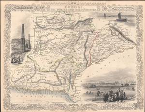
Cabool, the Punjab and Beloochistan.
sold
- Digital Map Information
- Suitable for large format printing
- Full resolution TIFF file
- ICC color profile embedded
- Delivered instantly via download link
This is a rare 1851 John Tallis map of present-day Afghanistan and Pakistan drawn and engraved by John Rapkin for Tallis's Illustrated Atlas and Modern History of the World. A contemporary audience, particularly a British audience, would have viewed this map through the prism of the First Anglo-Afghan War (1839 - 1842), an abject disaster for the British, and the wider context of 'Great Game' imperial competition with Russia. (more details)
Asia in the era of imperial competition.
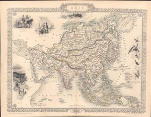
Asia.
sold
- Digital Map Information
- Suitable for large format printing
- Full resolution TIFF file
- ICC color profile embedded
- Delivered instantly via download link
This is a rare and beautifully illustrated 1851 map of Asia by John Rapkin that appeared in Tallis's Illustrated Atlas and Modern History of the World. It shows Asia on the eve of rapid European imperial expansion, which would soon bring much of the territory shown here under direct or indirect control. (more details)
Britain and Russia squabbling over imperial control in Central Asia.
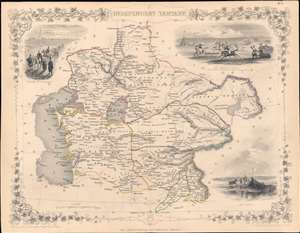
Independent Tartary.
sold
- Digital Map Information
- Suitable for large format printing
- Full resolution TIFF file
- ICC color profile embedded
- Delivered instantly via download link
This is a highly decorative 1851 map of Central Asia drawn by John Rapkin and published by John Tallis, with hand-drawn colored borders between polities (the Emirate of Bukhara, the Khanate of Khiva, the Khanate of Kokand, and 'Tartaria,' roughly equivalent to today's Kazakhstan, Kunduz, and Badakhshan). (more details)
Traveling from London to India.
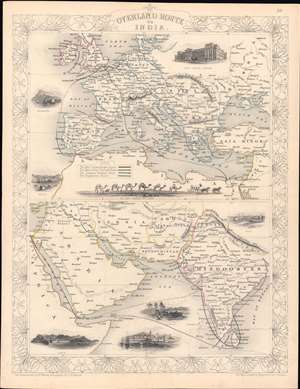
Overland Route to India.
sold
- Digital Map Information
- Suitable for large format printing
- Full resolution TIFF file
- ICC color profile embedded
- Delivered instantly via download link
This is a rare 1851 John Rapkin / John Tallis map of the Near East, Middle East, and India, with hand-coloring of the overland routes to India and of national borders. The top portion shows the European section of four routes between London and India, while the bottom half shows the routes continuing through the Near and Middle East. (more details)
The not-so-Chinese Chinese Empire.
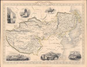
Thibet, Mongolia, and Mandchouria.
sold
- Digital Map Information
- Suitable for large format printing
- Full resolution TIFF file
- ICC color profile embedded
- Delivered instantly via download link
This is an 1851 map of Tibet, Mongolia, Manchuria, and neighboring regions belonging to the Qing Empire that appeared in the Tallis's Illustrated Atlas and Modern History of the World. It shows the immensity of territory under Qing rule, or at least Qing suzerainty, and how much of the 'Chinese Empire' was in fact outside of China. (more details)
Features a curious configuration of Texas presaging the 1850 Compromise following the proposals of Senator Henry Clay.
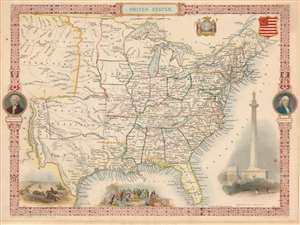
United States.
sold
- Digital Map Information
- Suitable for large format printing
- DPI: 600
- File Size: 7.88 MB
- File Type: ZIP / TIFF
- ICC color profile embedded
- Delivered instantly via download link
This exceptional 1851 John Tallis map of the United States features an incredible configuration of the geography of the western U.S. The map depicts the region from an unusually large Missouri Territory and New Mexico to the Atlantic and from the Canadian border to Mexico. The states in the eastern portion of the country are all illustrated as would be expected. All are labeled, and myriad cities and towns are identified. A handful of railroads are also included, although none are labeled. George Washington and Benjamin Franklin medallions decorate the right and left borders. Several decorative vignettes drawn by J. Marchant and engraved by J. Rogers adorn the work and depict a Native American Buffalo Hunt, William Penn's Treaty with the Indians, and the Washington Monument. (more details)
An attractive 19th century map of the West Indies.
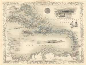
West India Islands.
sold
- Digital Map Information
- Suitable for large format printing
- DPI: 300
- File Size: 4.06 MB
- File Type: ZIP / TIFF
- ICC color profile embedded
- Delivered instantly via download link
This is an 1851 John Tallis map of the Caribbean or West Indies. The map depicts the region from Cuba and the Caribbean coast of Central America to Barbados and from southern Florida to Colombia and the mouth of the Orinoco River. Each of the islands of the Greater ... (more details)