
Valk, Gerard

Gerard Valk (September 30, 1652 - October 21, 1726) (aka. Valck, Walck, Valcke), was a Dutch engraver, globe maker, and map publisher active in Amsterdam in the latter half of the 17th century and early 18th century. Valk was born in Amsterdam where his father, Leendert Gerritsz, was a silversmith. He studied mathematics, navigation, and cartography under Pieter Maasz Smit. Valk and moved to London in 1673, where he studied engraving under Abraham Blooteling (or Bloteling) (1634 - 1690), whose sister he married, and later worked for the map sellers Christopher Browne and David Loggan. Valke and Blooteling returned to Amsterdam in 1680 and applied for a 15-year privilege, a kind of early copyright, from the States General, which was granted in 1684. In 1687, he established his own firm in Amsterdam in partnership with Petrus (Pieter) Schenk, who had just married his sister, Agata. They published under the imprint of Valk and Schenk. Also, curiously in the same year Valk acquired the home of Jochem Bormeester, also engraver and son-in-law of art dealer Clement De Jonghe. Initially Valk and Schenk focused on maps and atlases, acquiring the map plates of Jodocus Hondius and Jan Jansson in 1694. Later, in 1701 they moved into the former Hendrick Hondius (the younger) offices where they began producing globes. Valk and Schenk soon acquired the reputation of producing the finest globes in the Netherlands, a business on which they held a near monopoly for nearly 50 years. In 1702, Valk joined the Bookseller's Guild of which he was promptly elected head. Around the same time, Gerard introduced his son, Leonard, who was married to Maria Schenk, to the business. Leonard spearheaded the acquisition of the map plates of Frederick de Wit in 1709. Nonetheless, Leonard was nowhere near as sophisticated a cartographer or businessman as his father and ultimately, through neglect, lost much the firm's prestige. After his death, the firm was taken over by his widow Maria.
The dominant 17th century depiction of the American Southeast.
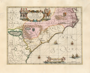
Virginiae Partis australis, et Floridae partis orientalis, interjacentiumque regionum Nova Descriptio.
$1,800.00
Acquire
- Digital Map Information
- Suitable for large format printing
- Full resolution TIFF file
- ICC color profile embedded
- Delivered instantly via download link
This is Jan Jansson's beautiful map of Virginia and Florida, engraved in 1639, appearing here in an attractive example of its c. 1694 restrike under the imprint of Gerard Valk and Peter Schenk. This classic Dutch map, encompassing the Carolinas and what would become Georgia and part of Florida, was derived from that of Willem Blaeu, which has been called 'the most correct map of this area yet to appear' (Cumming). Blaeu's map was sufficiently authoritative for Jansson to make an extremely faithful copy. Both cartographers' maps would have a long print life. (more details)
Earliest Acquirable Map showing the True Source of the Blue Nile.
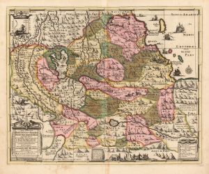
Jobi Ludolfi Habessinia Seu Abassia Presbyteri Johannis Regio perperam dicta...
$950.00
Acquire
- Digital Map Information
- Suitable for large format printing
- DPI: 600
- File Size: 66.6 MB
- File Type: ZIP / TIFF
- ICC color profile embedded
- Delivered instantly via download link
This is Job Ludolf's 1683 map of Ethiopia, the first generally acquirable map focusing on the headwaters of the Blue Nile, as well as the most influential - being copied by De Fer, Coronelli, and others well into the eighteenth century. The present example is the Valk and Schenk edition, in handsome original color. (more details)
Classic Dutch World, updated French Cartography.
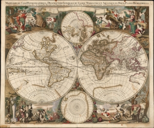
Mappe-Monde Geo-Hydrographique, ou Description Generale Du Globe Terrestre et Aquatique En Deux-Plans-Hemispheres
$6,500.00
Acquire
- Digital Map Information
- Suitable for large format printing
- File Size: 28.15 MB
- File Type: ZIP / TIFF
- ICC color profile embedded
- Delivered instantly via download link
This is a striking, original color example of Gerard Valk's classic 1686 double hemisphere map of the world. The map combines the aesthetics of the Dutch Golden Age with the superior French cartography of Nicolas Sanson. (more details)
An incredible map of Peru clearly showing the unknown of the Amazon region.
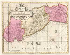
Peru.
$400.00
Acquire
- Digital Map Information
- Suitable for large format printing
- DPI: 300
- File Size: 8.73 MB
- File Type: ZIP / TIFF
- ICC color profile embedded
- Delivered instantly via download link
This is a c. 1700 Pieter Schenk and Gerard Valk map of Peru. The map, oriented towards the east, depicts the region from Los Pastos to Val Xuxuy and from an area east of Peru along the Omapalchas River and home to the Marquires and Cheriabonas Indians to the ... (more details)
A beautiful, original color example of this fine map of Eastern France's wine region.
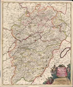
Superior Burgundiae comitatus; vulgo la Franche Comté complectens praefecturas Amontii, Dolae, Avalli quibus adjectus comitatus Montis Belligardi.
$350.00
Acquire
- Digital Map Information
- Suitable for large format printing
- Full resolution TIFF file
- ICC color profile embedded
- Delivered instantly via download link
This is a beautiful example of Gerard Valk's 1702 map of the upper Burgundy region of eastern France. The map is centered on the Saone and the Doubs river valleys, and on the city of Besançon. the region was the County of Burgundy until the region and the neighboring Duchy of Burgundy were abolished during the French Revolution. (more details)
Rare edition of Valk's map of southern Italy.
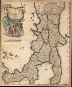
Italiae Pars Meridionalis; Quae Nunc Sceptri Hispanici Regnum Neapolitanum: in XII Provincias divisum.
$850.00
Acquire
- Digital Map Information
- Suitable for large format printing
- DPI: 600
- File Size: 38.33 MB
- File Type: ZIP / TIFF
- ICC color profile embedded
- Delivered instantly via download link
A rare c. 1704 Gerard Valk (Valck) map of southern Italy. The map captures Italy during a period of cultural development and relative peace - if under the domineering control of Spanish Habsburgs - that led to a consolidated Italian identity. (more details)
Frontier of Europe and the Ottoman Empire.
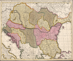
Hungaria Generalis, divisa in proprie dictam Hungariam, Principatum Transylvaniam, Regiones Dalmatiae, Sclavoniae, Moldaviae, Valachiae, Bulgariae, Croatiae, Bosniae, Serviae, Romaniae et Bessarabiae.
$750.00
Acquire
- Digital Map Information
- Suitable for large format printing
- File Size: 24.44 MB
- File Type: ZIP / TIFF
- ICC color profile embedded
- Delivered instantly via download link
This is a beautiful, contemporary-color example of Gerard and Leonard Valk's c. 1705 map of the lands surrounding the course of the Danube, extending from Vienna to the Black Sea. The map encompasses the perennial seat of war between Christian European powers and the Turkish Empire. (more details)
Copernicus Centers the Sun.
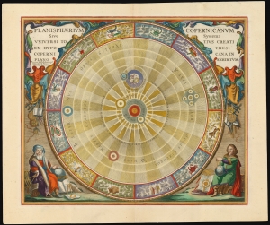
Planisphaerium Copernicanum Sive Systema Universi Totius Creati Ex Hypothesi Copernicana in Plano Exhibitum.
$4,500.00
Acquire
- Digital Map Information
- Suitable for large format printing
- File Size: 27.24 MB
- File Type: ZIP / TIFF
- ICC color profile embedded
- Delivered instantly via download link
This beautiful work is Andreas Cellarius' celestial chart, in its 1708 Valk and Schenk edition, illustrating the solar system theorized by Nicolaus Copernicus in the 16th century. It is among the most vivid and unambiguous depictions of the heliocentric solar system produced in the 17th century. (more details)
Visualizing the Celestial Sphere.

Situs Terrae Circulis Coelestibus Circundatae.
$1,800.00
Acquire
- Digital Map Information
- Suitable for large format printing
- DPI: 600
- File Size: 62.91 MB
- File Type: ZIP / TIFF
- ICC color profile embedded
- Delivered instantly via download link
This beautiful work is Andreas Cellarius' celestial chart, in its 1708 Valk and Schenk edition, illustrating the position of the Earth within the celestial sphere divided into its circles. Its lush, baroque presentation - filled with clouds, putti, and muses - frames a useful visual glossary illustrating terminology important both to the astronomer and to the geographer. (more details)
A beautiful early 18th century map of Asia Minor.
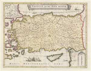
Natolia, quae olim Asia Minor.
$550.00
Acquire
- Digital Map Information
- Suitable for large format printing
- DPI: 300
- File Size: 10.72 MB
- File Type: ZIP / TIFF
- ICC color profile embedded
- Delivered instantly via download link
This is an attractive c. 1708 map of Turkey or Asia Minor. Issued by Petrus Schenk and Gerard Valk, it was engraved in 1636 by Henry Hondius, based on the 1634 map by Johannes Blaeu. The map depicts the region from the Aegean Sea and some of the Aegean ... (more details)
Trading centers on Borneo.
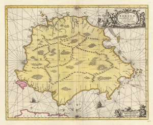
Insula BORNEO et occidentalis pars CELEBIS cum adjacentibus Infulis.
$1,300.00
Acquire
- Digital Map Information
- Suitable for large format printing
- DPI: 300
- File Size: 9.53 MB
- File Type: ZIP / TIFF
- ICC color profile embedded
- Delivered instantly via download link
A stunning full-color c. 1710 map of Borneo by Gerard Valk and Petrus Schenk under the imprint of Valk and Schenk. The map reflects tenuous knowledge of the island in the early days of VOC activity in the region. (more details)
Dutch interest in Sumatra and Malaya.
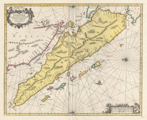
Sumatrae et Insularum Locorum que Nonnull Orum Circumiacentium Tabula Noua.
$1,300.00
Acquire
- Digital Map Information
- Suitable for large format printing
- DPI: 300
- File Size: 9.55 MB
- File Type: ZIP / TIFF
- ICC color profile embedded
- Delivered instantly via download link
A stunning full-color c. 1710 map of Sumatra, Malay, the straits of Malacca, and Singapore by Gerard Valk and Petrus Schenk under the imprint of Valk and Schenk. (more details)
An extremely rare 18th century map of England and Wales.

Regnum Angliae, sive pars Australis Magnae Britanniae, divisa in Regna Northumbriae, Marciae, Ostangliae, Westsexiae, Suthsexiae, Essexiae, et Cantium; quorum singula iterum divisa in Ducatus, Comitatus, Insulas Monam, Monaviam, et Vectam.
$1,200.00
Acquire
- Digital Map Information
- Suitable for large format printing
- DPI: 600
- File Size: 31.12 MB
- File Type: ZIP / TIFF
- ICC color profile embedded
- Delivered instantly via download link
This is a 1724 Gerard and Leonard Valk map of England and Wales. The map depicts the region from eastern Ireland to the North Sea and from Scotland to the English Channel, northern France (Pas de Calais and Nord departments), and Belgium. Highly detailed, myriad cities, towns, and villages are labeled throughout the entire region, not just in England and Wales. Some of the identified cities include London, Southampton, Cambridge, Newcastle, and Cardiff (Caerdyf), along with Belfast in Ireland, and Calais and Dunkirk in France. Seven geographical regions within England are shaded different colors to allow for easy differentiation, including East Anglia, Northumbria, Essex, and Sussex. Wales is also differentiated by color. The Isle of Man is depicted in the Irish Sea between England and Ireland. (more details)