
Valk, Gerard (sold)

Gerard Valk (September 30, 1652 - October 21, 1726) (aka. Valck, Walck, Valcke), was a Dutch engraver, globe maker, and map publisher active in Amsterdam in the latter half of the 17th century and early 18th century. Valk was born in Amsterdam where his father, Leendert Gerritsz, was a silversmith. He studied mathematics, navigation, and cartography under Pieter Maasz Smit. Valk and moved to London in 1673, where he studied engraving under Abraham Blooteling (or Bloteling) (1634 - 1690), whose sister he married, and later worked for the map sellers Christopher Browne and David Loggan. Valke and Blooteling returned to Amsterdam in 1680 and applied for a 15-year privilege, a kind of early copyright, from the States General, which was granted in 1684. In 1687, he established his own firm in Amsterdam in partnership with Petrus (Pieter) Schenk, who had just married his sister, Agata. They published under the imprint of Valk and Schenk. Also, curiously in the same year Valk acquired the home of Jochem Bormeester, also engraver and son-in-law of art dealer Clement De Jonghe. Initially Valk and Schenk focused on maps and atlases, acquiring the map plates of Jodocus Hondius and Jan Jansson in 1694. Later, in 1701 they moved into the former Hendrick Hondius (the younger) offices where they began producing globes. Valk and Schenk soon acquired the reputation of producing the finest globes in the Netherlands, a business on which they held a near monopoly for nearly 50 years. In 1702, Valk joined the Bookseller's Guild of which he was promptly elected head. Around the same time, Gerard introduced his son, Leonard, who was married to Maria Schenk, to the business. Leonard spearheaded the acquisition of the map plates of Frederick de Wit in 1709. Nonetheless, Leonard was nowhere near as sophisticated a cartographer or businessman as his father and ultimately, through neglect, lost much the firm's prestige. After his death, the firm was taken over by his widow Maria.
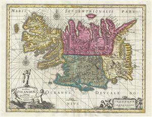
Novissima Islandiae Tabula.
sold
- Digital Map Information
- Suitable for large format printing
- Full resolution TIFF file
- ICC color profile embedded
- Delivered instantly via download link
This is a beautiful c.1680 map of Iceland by Gerard Valk and Pieter Schenk. It covers the entire north Atlantic Island of Iceland and notes the four primary provinces in color. Iceland had been fairly well mapped since the late 16th century. This map notes ... (more details)
A beautiful and some would say underappreciated map of central Mexico.
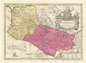
Nova Hispania et Nova Galicia.
sold
- Digital Map Information
- Suitable for large format printing
- DPI: 300
- File Size: 8.78 MB
- File Type: ZIP / TIFF
- ICC color profile embedded
- Delivered instantly via download link
This is a scarce and often underappreciated c. 1690 Petrus Schenk and Gerard Valk map of Mexico or New Spain. Depicting the viceroyalty granted to Hernan Cortez following his conquest of the Aztec Empire, this map details, roughly, from Mexico City westward ... (more details)
The scarce last derivative of Smith's map of Virginia.
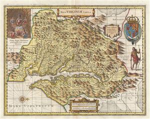
Nova Virginiae Tabula.
sold
- Digital Map Information
- Suitable for large format printing
- DPI: 300
- File Size: 13.81 MB
- File Type: ZIP / TIFF
- ICC color profile embedded
- Delivered instantly via download link
A fine example of the scarce c. 1694 Schenk and Valk map of Virginia and the Chesapeake Bay. Oriented to the west, this map covers from Cape Henry to the Susquehanna River and inland as far as the Appalachian Mountains. The Chesapeake Bay is shown in full ... (more details)
France's Alpine Frontier with Italy.
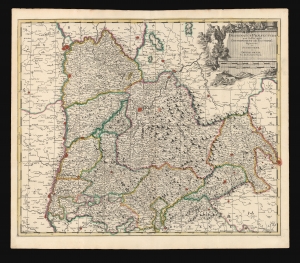
Delphinatus Praefectura quae Gallis audit Gouvernement de Dauphine.
sold
- Digital Map Information
- Suitable for large format printing
- DPI: 600
- File Size: 66.15 MB
- File Type: ZIP / TIFF
- ICC color profile embedded
- Delivered instantly via download link
This is a beautiful c. 1700 map of the Dauphiné region of France, by Dutch cartographer Gerard Valk. (more details)
Gorgeous map of the Lesser Antilles that labels St. Lucia, Barbados, and Puerto Rico.
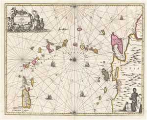
Insula S. Juan de Puerto Rico Caribes; Vel Canibasum Insulae.
sold
- Digital Map Information
- Suitable for large format printing
- DPI: 300
- File Size: 8.88 MB
- File Type: ZIP / TIFF
- ICC color profile embedded
- Delivered instantly via download link
This is an attractive c. 1700 map of the Lesser Antilles by Petrus Schenk and Gerard Valk based on a 1650 map by Jan Jansson. Oriented toward the east, the map depicts the region from Puerto Rico to Venezuela and from the Atlantic Ocean and Barbados to ... (more details)
Presenting the obsolete, geocentric, model of the universe
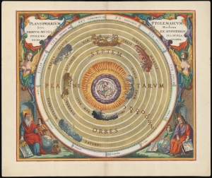
Planisphaerium Ptolemaicum, sive Machina Orbium Mundi Ex Hypothesi Ptolemaica in Plano Disposita.
sold
- Digital Map Information
- Suitable for large format printing
- File Size: 28.06 MB
- File Type: ZIP / TIFF
- ICC color profile embedded
- Delivered instantly via download link
This beautiful work is Andreas Cellarius' celestial chart, in its 1708 Valk and Schenk edition, illustrating the geocentric solar system imagined by Claudius Ptolemy in the 2nd century, and which remained the standard model of the universe until the 16th century and the discoveries of Nicolas Copernicus. It is among the most beautiful depictions of the Earth-centered solar system produced in the 17th century. (more details)
Ptolemy's Earth-Centered Universe.
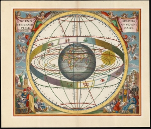
Scenographia Systematis Mundani Ptolemaici.
sold
- Digital Map Information
- Suitable for large format printing
- File Size: 22.18 MB
- File Type: ZIP / TIFF
- ICC color profile embedded
- Delivered instantly via download link
This beautiful work is Andreas Cellarius' celestial chart, in its 1708 Valk and Schenk edition, illustrating the geocentric solar system theorized by the 2nd-century astronomer Claudius Ptolemy. One of Cellarius' most visually engaging celestial charts, it centers on a beautifully engraved hemisphere and depicts the orbits around it of the Moon, Mercury, Venus, the Sun, Mars, Jupiter, and Saturn. Surrounding the orbiting planets is the celestial sphere, divided into circles. Cellarius' lush, baroque presentation frames the chart with a sky filled with putti while on the ground, scholars, astronomers, and their students measure the sky and confer over books and globes. (more details)
Lavishly illustrated celestial chart.
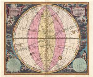
Haemisphaeria Sphaerarum Rectae Et Obliquae Utriusque Motus Et Longitudines Tam Coelestes Quam Terrestres Ac Stellarum Affectiones Monstrantia.
sold
- Digital Map Information
- Suitable for large format printing
- DPI: 300
- File Size: 10 MB
- File Type: ZIP / TIFF
- ICC color profile embedded
- Delivered instantly via download link
A fine 1708 Andreas Cellarius celestial chart illustrating the motions of the upright (the Equatorial Coordinate System) and oblique spheres (the Ecliptic Coordinate System), the Celestial and Terrestrial Longitudes, and the influence of the stars. The surround is lavishly decorated with finely engraved and colored images of clouds, putti, and two sub-diagrams. It is of note that this is a beautifully colored example with giltwork incorporated into the color. (more details)
The lunar theories of Claudius Ptolemy in stunning old color.
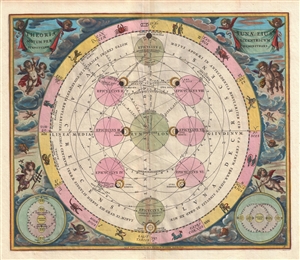
Theoria Lunae, eius Motum per Eccentricum et Epicyclum Demonstrans.
sold
- Digital Map Information
- Suitable for large format printing
- DPI: 300
- File Size: 9.22 MB
- File Type: ZIP / TIFF
- ICC color profile embedded
- Delivered instantly via download link
A fine 1708 Andreas Cellarius celestial chart illustrating the Claudius Ptolemy model of lunar motion. The chart illustrates the lunar epicycles as the moon revolves along various orbits. The central chart is bordered zodiacal iconography. The ... (more details)