
Wellge, Henry (sold)

Henry Wellge (1850 – 1923) was an American panoramic bird's-eye view publisher, artist, and cartographer active in Milwaukee in the late 19th and early 20th century. Wellge was born in Germany in 1850. His first view, in 1878, was of Chilton Wisconsin, but most of his early work is in association with J. J. Stoner, another prolific view maker. Eventually established his own firm Henry Wellge and Company. Later his published and Norris, Wellge and Company. Ultimately though, most of his work appears under the imprint of the American Publishing Company. He continued to publish views until about 1910 with about 152 views bearing his imprint. Wellge is known for large dramatic views illustrated with emphasis on the horizontal dimension.
Florida Citrus Boom.
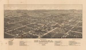
Bird's Eye View of De Land, Fla. Volusia County 1884.
sold
- Digital Map Information
- Suitable for large format printing
- File Size: 44.57 MB
- File Type: ZIP / TIFF
- ICC color profile embedded
- Delivered instantly via download link
A very rare 1884 Stoner / Wellge bird's-eye view of DeLand Florida at the height of the first Florida Citrus Boom and the Second Florida Land Boom - which centered around DeLand.The view looks northeast on Deland. Thirty-eight business, offices, hotels, and civic buildings rea named, as well as seven churches. Orange grows are evident throughout, underscoring DeLand's significance as a center of the Citrus Boom. (more details)
America's first spa resort and National Park.
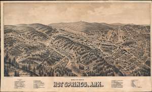
Hot Springs, Ark.
sold
- Digital Map Information
- Suitable for large format printing
- File Size: 31.72 MB
- File Type: ZIP / TIFF
- ICC color profile embedded
- Delivered instantly via download link
An exceptionally rare 1888 two-color chromolithograph bird's-eye view map of Hot Springs, Arkansas - arguably American's first national park and spa city. The view looks east on Hot Springs, possibly from a high point on nearby Sugarloaf Mountain - now part of Hot Springs National Park. Central Avenue, with its bath houses and grand hotels, cuts laterally across the page. Eleven bath houses are noted and keyed alphabetically in the lower right - curiously, they are lettered A-M, but 'I' and 'J' have been omitted. In addition, some 33 other locations, ranging from hotels to stationers and jewelers, are noted and keyed numerically. In the background, the wooden observation tower built in 1877 on top of Hot Springs Mountain by local mill owner Enoch Woolman is identifiable - this was replaced by the current metal tower in 1906. (more details)
Rare and dramatic Bird's-Eye View of Helena, Montana.
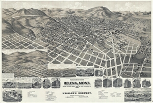
Perspective map of the city of Helena, Mont. Capital of State, county seat of Lewis & Clarke Co.
sold
- Digital Map Information
- Suitable for large format printing
- Full resolution TIFF file
- ICC color profile embedded
- Delivered instantly via download link
A dramatic bird's-eye view of Helena, Montana, issued by the Henry Wellge and the American Publishing Company in 1890. This impressive view is a fine example of Wellge's work, which is known for monumental size and emphasis of the horizontal dimension. The view ... (more details)
Laredo's urbanization.
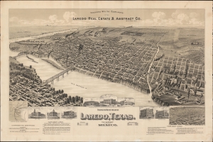
Perspective Map of the City of Laredo, Texas. The Gateway to and from Mexico.
sold
- Digital Map Information
- Suitable for large format printing
- File Size: 1068.57 MB
- File Type: ZIP / TIFF
- ICC color profile embedded
- Delivered instantly via download link
A very rare broadside bird's-eye view map of Laredo, Texas. The map was issued on Laredo's quadranscentennial, and so reflects a 25-year period of breakneck growth and prosperity, from which Laredo emerged as the most prosperous and connected border city in south Texas. (more details)
A view of New York highlighting the ever-increasing industral might of the city.
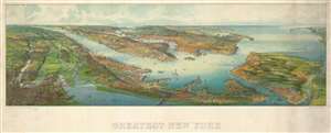
Greatest New York.
sold
- Digital Map Information
- Suitable for large format printing
- File Size: 26.91 MB
- File Type: ZIP / TIFF
- ICC color profile embedded
- Delivered instantly via download link
This is a 1911 Henry Wellge bird's-eye view of New York City and environs. The view depicts the region from Newark and Passaic, New Jersey to Long Island and the Atlantic Ocean and from the Harlem River to Staten Island. Beautifully illustrated, myriad buildings throughout the region are rendered. Although individual buildings are not labeled, some landmarks, particularly the bridges over the East River and the Statue of Liberty are easily recognizable. Central and Riverside Park are shockingly open spaces in the otherwise cramped borough of Manhattan. Ships and boats of all sizes ply the waters of the East and Hudson Rivers and the Upper Bay. The docks in Red Hook, Gravesend Bay, Coney Island, and Jamaica Bay are identifiable in Brooklyn. The factories in Bayonne and other parts of New Jersey are easily noticed, highlighted by the large plumes of smoke rising from their smokestacks. The region's railroads are also illustrated, some of which are labeled. (more details)
Copper Boom on the Keweenaw! Wellge's last work!
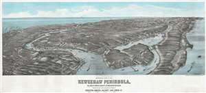
Panoramic View of the Keweenaw Peninsula, The Great Copper Country of Northern Michigan Population near 100,000, including the towns of Houghton, Hancock, Calumet, Lake Linden, Etc.
sold
- Digital Map Information
- Suitable for large format printing
- File Size: 41.33 MB
- File Type: ZIP / TIFF
- ICC color profile embedded
- Delivered instantly via download link
One of only 3 surviving examples of the rare Henry Wellge 1913 bird's-eye view of the Keweenaw Peninsula, Upper Peninsula, Michigan, at the height of the early 20th century copper mining boom. The view looks northeast along the peninsula from a fictive highpoint above Houghton and Portage Lake. Towns are labeled and important buildings noted, including the industrial smelting operations along Torch Lake and Bay. This view was issued by Albert Kennedy Houghton, a bookshop owner in Houghton, shortly before he left town for Minneapolis. (more details)
A promotional piece published by the First American National Bank of Nashville.
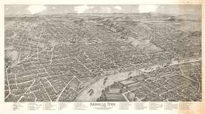
This is a 1958 First American National Bank of Nashville bird's-eye view map of Nashville, Tennessee, originally published by Henry Wellge in 1888. Looking west over the city from a point above the modern-day neighborhoods of Historic Edgefield and Shelby Hills, the Tennessee State Capitol is laid down among the low-profile houses and apartment buildings. Nashville's important railroads and factories are prominently illustrated, with factory smokestacks across the city emitting large plumes of black smoke - indicative of industrial prosperity. Riverboats travel up and down the Cumberland Rive.r Many streets are labeled, and eighty-nine locations throughout the city are numerically identified, including numerous businesses, churches, and schools (such as Vanderbilt University), and correspond with a reference along the bottom border. (more details)