
Wyld (James Wyld I, James Wyld II)

Wyld (1823 - 1893) was a British publishing firm active throughout the 19th century. It was operated by James Wyld I (1790 - 1836) and his son James Wyld II (November 20, 1812 - 1887) were the principles of an English mapmaking dynasty active in London during much of the 19th century. The elder Wyld was a map publisher under William Faden (1749 - 1836) and did considerable work on the Ordinance Survey. On Faden's retirement in 1823, Wyld took over Faden's workshop, acquiring many of his plates. Wyld's work can often be distinguished from his son's maps through his imprint, which he signed as 'Successor to Faden'. Following in his father's footsteps, the younger Wyld joined the Royal Geographical Society in 1830 at the tender age of 18. When his father died in 1836, James Wyld II was prepared to fully take over and expand his father's considerable cartographic enterprise. Like his father and Faden, Wyld II held the title of official Geographer to the Crown, in this case, Queen Victoria. In 1852, he moved operations from William Faden's old office at Charing Cross East (1837 - 1852) to a new, larger space at 475 Strand. Wyld II also chose to remove Faden's name from all of his updated map plates. Wyld II continued to update and republish both his father's work and the work of William Faden well into the late 1880s. One of Wyld's most eccentric and notable achievements is his 1851 construction of a globe 19 meters (60 feet) in diameter in the heart of Leicester Square, London. In the 1840s, Wyld also embarked upon a political career, being elected to parliament in 1847 and again in 1857. He died in 1887 following a prolific and distinguished career. After Wyld II's death, the family business was briefly taken over by James John Cooper Wyld (1844 - 1907), his son, who ran it from 1887 to 1893 before selling the business to Edward Stanford. All three Wylds are notable for producing, in addition to their atlas maps, short-run maps expounding upon important historical events - illustrating history as it was happening - among them are maps related to the California Gold Rush, the New South Wales Gold Rush, the Scramble for Africa, the Oregon Question, and more.
AKA: James Wyld I, James Wyld II
Map of North America that predates the Louisiana Purchase.
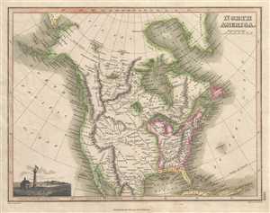
North America.
$275.00
Acquire
- Digital Map Information
- Suitable for large format printing
- DPI: 300
- File Size: 4.02 MB
- File Type: ZIP / TIFF
- ICC color profile embedded
- Delivered instantly via download link
This 1819 Thomson map of North America depicts the entire continent from north of the Arctic Circle to northern Mexico and Baja California. The United States is labeled in detail, including the Western Territory, New England, and the states of Pennsylvania, New ... (more details)
Striking semi-manuscript school-girl map of Africa.
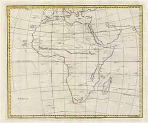
Africa.
$500.00
Acquire
- Digital Map Information
- Suitable for large format printing
- DPI: 300
- File Size: 8.99 MB
- File Type: ZIP / TIFF
- ICC color profile embedded
- Delivered instantly via download link
An unusual and beautiful semi-manuscript map of the Africa dating to 1823. The printed portions of this map follow the cartography of James Wyld and include the basic outlines of the countries, latitude and longitude lines, the Tropic of Capricorn, the ... (more details)
Striking 19th century manuscript school-girl map of England under the Roman Empire.
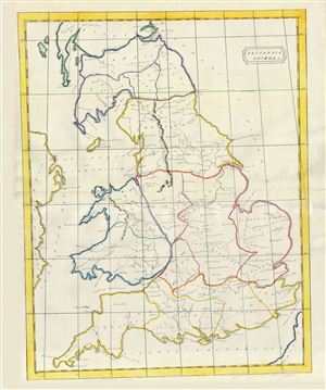
Brittania Antiqua.
$500.00
Acquire
- Digital Map Information
- Suitable for large format printing
- DPI: 300
- File Size: 10.84 MB
- File Type: ZIP / TIFF
- ICC color profile embedded
- Delivered instantly via download link
An unusual and beautiful 1823 manuscript map of england during Roman times. The map generally follows the historical atlas work of the english cartographer James Wyld however is a fully independent and unique hand rendered production. The manuscript ... (more details)
Striking semi-manuscript school-girl map of Europe.
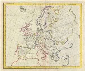
Europe.
$400.00
Acquire
- Digital Map Information
- Suitable for large format printing
- DPI: 300
- File Size: 9.29 MB
- File Type: ZIP / TIFF
- ICC color profile embedded
- Delivered instantly via download link
An unusual and beautiful semi-manuscript map of the europe dating to 1823. The printed portion of this map follows the cartography of James Wyld and includes the basic outlines of the countries, latitude and longitude lines, the Arctic circle and ... (more details)
Striking 19th century manuscript school-girl map of Italy.
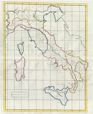
Italia Antiqua.
$500.00
Acquire
- Digital Map Information
- Suitable for large format printing
- DPI: 300
- File Size: 9.53 MB
- File Type: ZIP / TIFF
- ICC color profile embedded
- Delivered instantly via download link
An unusual and beautiful 1823 manuscript map of Italy in antiquity. The map generally follows the historical atlas work of the english cartographer James Wyld however is a fully independent and unique hand drawn production. The manuscript ... (more details)
Striking 19th century manuscript school-girl map of Israel, Palestine, or the Holy Land.
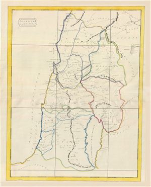
Palestina Antiqua.
$500.00
Acquire
- Digital Map Information
- Suitable for large format printing
- DPI: 300
- File Size: 8.76 MB
- File Type: ZIP / TIFF
- ICC color profile embedded
- Delivered instantly via download link
An unusual and beautiful 1823 manuscript map of the Palestine, Israel, or the Holy Land in Biblical times. The map generally follows the historical atlas work of the english cartographer James Wyld however is a fully independent and ... (more details)
Striking 19th century manuscript school-girl map of Persia.
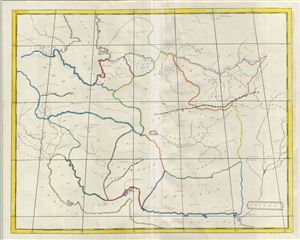
Oriens.
$500.00
Acquire
- Digital Map Information
- Suitable for large format printing
- DPI: 300
- File Size: 9.81 MB
- File Type: ZIP / TIFF
- ICC color profile embedded
- Delivered instantly via download link
An unusual and beautiful 1823 manuscript map of Persia and Afghanistan (Iran) in antiquity. The map generally follows the historical atlas work of the english cartographer James Wyld however is a fully independent and unique hand ... (more details)
Striking 19th century manuscript school-girl map of the Ancient World.
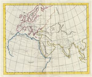
[World as known to the Ancients] Untitled.
$500.00
Acquire
- Digital Map Information
- Suitable for large format printing
- DPI: 300
- File Size: 8.49 MB
- File Type: ZIP / TIFF
- ICC color profile embedded
- Delivered instantly via download link
An unusual and beautiful 1823 manuscript map of The Ancient World, including Asia, europe and Africa. The map generally follows the historical atlas work of the english cartographer James Wyld however is a fully independent and ... (more details)
Striking semi-manuscript school-girl map of the British Isles.
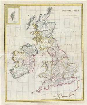
British Isles.
$500.00
Acquire
- Digital Map Information
- Suitable for large format printing
- DPI: 300
- File Size: 10.76 MB
- File Type: ZIP / TIFF
- ICC color profile embedded
- Delivered instantly via download link
An unusual and beautiful 1823 semi-manuscript map of the england, Wales, Scotland and Ireland, with an inset map of the Shetland Islands in the upper left quadrant. The printed portions of this map follow the cartography of ... (more details)
Most important Canadian immigration and settlement initiative.
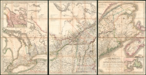
To His Most Excellent Majesty King William IVth This Map of the Provinces of Lower and Upper Canada, Nova Scotia, New Brunswick, Newfoundland and Prince Edwards Island, with a Large Section of the United States...
$19,500.00
Acquire
- Digital Map Information
- Suitable for large format printing
- Full resolution TIFF file
- ICC color profile embedded
- Delivered instantly via download link
This is Joseph-Francis Bouchette's rare large-scale 1831 map of Canada - a seminal map relating to Canadian development, immigration, and land usage. The map details the provinces of Upper and Lower Canada (Ontario and Quebec), which were established in 1791. Most significantly, the map focuses on lands, towns, roads, and districts designated to the Canada Company - the most important immigration and settlement initiative in Canadian history. The Canada Company’s copious settlements are indicated on the map by an asterisk or a cross next to each name. Bouchette notes land disputes between the United States and British North America in Maine and Oregon, but predictably advocates exclusively for British positions. (more details)
News of the First Opium War.
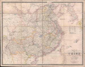
Map of China Compiled from original Surveys and Sketches.
$1,500.00
Acquire
- Digital Map Information
- Suitable for large format printing
- Full resolution TIFF file
- ICC color profile embedded
- Delivered instantly via download link
A beautiful example of the scarce 1841 edition of James Wyld's First Opium War Era map of China, with Hong Kong identified here as 'Heong Kong'. This is essentially an early 'newsmap' offering up to date information on the fast-paced war to the invested British public. (more details)
The West Indies as slavery was being abolished.
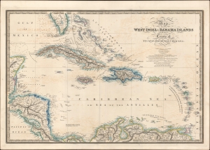
Map of the West India and Bahama Islands with the adjacent Coasts of Yucatan, Honduras, Caracas etc.
$800.00
Acquire
- Digital Map Information
- Suitable for large format printing
- DPI: 600
- File Size: 75.65 MB
- File Type: ZIP / TIFF
- ICC color profile embedded
- Delivered instantly via download link
A beautifully engraved 1843 map and nautical chart of the West Indies or Caribbean by James Wyld, 'Geographer to the Queen.' It captures the region in a moment of transition, as plantation slavery in the British colonies began to be dismantled and revolution and rebellion destabilized island economics. (more details)
Unrecorded but novel map of London.
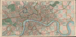
The Post Office Plan of London.
$2,000.00
Acquire
- Digital Map Information
- Suitable for large format printing
- File Size: 74.43 MB
- File Type: ZIP / TIFF
- ICC color profile embedded
- Delivered instantly via download link
This is a rare 1843 James Wyld Map of London featuring a unique infographic pink-and-blue grid designed to facilitate fast calculation of Cabriolet and Hackney Coach fares. It captures the sprawling metropolis at the height of the early Victorian Era and in a year immortalized by Charles Dickens' A Christmas Carol. This map does reappear later (1848) in the Wyld canon, but the present edition is unrecorded. (more details)
Best map of southeastern Australia during the 1851 Australian Gold Rush.
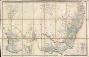
Map of South Australia, New South Wales, Van Diemens Land, and Settled parts of Australia.
$900.00
Acquire
- Digital Map Information
- Suitable for large format printing
- File Size: 45.77 MB
- File Type: ZIP / TIFF
- ICC color profile embedded
- Delivered instantly via download link
An exceptional c. 1851 James Wyld map of southeastern Australia, Tasmania (Van Diemen's Land), New South Wales, and Western Australia, issued to capitalize on the 1851 Australian Gold Rush. Probably the finest map of Australia then extant, the map draws heavily on the explorations of Sir Thomas Livingstone Mitchell (June 15, 1792 - October 5, 1855), an influential surveyor and explorer to whom the map is also dedicated. Mitchell led a series of expeditions throughout south-eastern Australia between 1830 and 1836. (more details)
The Crimean War.
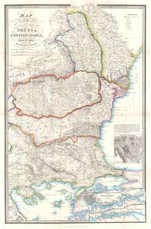
Map of the Country between Odessa and Constantinople, embracing the Present Seat of War between the Russians and Turks.
$850.00
Acquire
- Digital Map Information
- Suitable for large format printing
- File Size: 32.15 MB
- File Type: ZIP / TIFF
- ICC color profile embedded
- Delivered instantly via download link
This is an 1854 James Wyld map of the eastern Balkans and the Black Sea coast during the Crimean War. The map depicts the region from Salonica to Odessa, and from the Dnister (Dniester) River to the island of Lesbos (I. Mytilini) in the Aegean Sea. Published in the middle of the conflict, Wyld presents the theater of war, highlighting the two regions first occupied by the Russian Empire (Wallachia and Moldavia) and allowing his viewers a better understanding of the news they were receiving from their armies in the Balkans. (more details)
One of an incredibly important series of maps of Australia detailing its colonization.
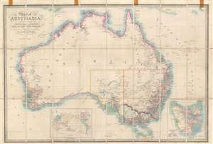
Map of Australia Compiled from the Nautical Surveys, Made by Order of The Admiralty, And other Authentic Documents, By James Wyld Geographer to the Queen.
$1,000.00
Acquire
- Digital Map Information
- Suitable for large format printing
- File Size: 29.49 MB
- File Type: ZIP / TIFF
- ICC color profile embedded
- Delivered instantly via download link
This is a c. 1858 James Wyld map of Australia during the Australian Gold Rush. Depicting the entire continent as well as Tasmania, Wyld illustrates Australia as is being transformed by aggressive colonization and mineral exploitation. (more details)
Capitalizing on British interest in the American Civil War.
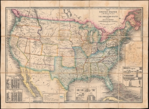
The United States and Relative Position of the Northern States and the Southern Confederated States.
$3,200.00
Acquire
- Digital Map Information
- Suitable for large format printing
- Full resolution TIFF file
- ICC color profile embedded
- Delivered instantly via download link
This is an 1861 James Wyld map of the United States depicting the Union and Confederacy at the outset of the American Civil War (1861 - 1865). It was published in Great Britain to capitalize on British interest in the conflict, which threatened their booming textile industry and thus national economic stability. The 'Southern Confederated States' are shaded blue. Keeping current to the fast-paced events, Wyld remarkably includes the ephemeral Confederate state of Arizona. (more details)
Rare Military Staff Map of the Nile Expedition.
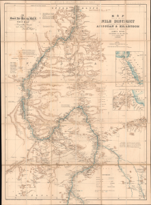
Wyld's Military Staff Map. / Map of the Nile District between Assouan and Khartoum. / Wyld's Egyptian Series No. 13.
$1,400.00
Acquire
- Digital Map Information
- Suitable for large format printing
- Full resolution TIFF file
- ICC color profile embedded
- Delivered instantly via download link
This is James Wyld's c. 1885 large-format folding map of the Nile River between Aswan and Khartoum - essentially southern Egypt and Sudan. Produced during the early stages of the Mahdist War (1881 - 1899) and in the wake of the Nile Expedition, it is dedicated by Wyld to Lord General Garnet Wolseley, the leader of the expedition and one of the most decorated British military officers of the era. (more details)