

Carte De L'Empire De La Chine
sold
- Digital Map Information
- Suitable for large format printing
- DPI: 300
- File Size: 4.59 MB
- File Type: ZIP / TIFF
- ICC color profile embedded
- Delivered instantly via download link
A fine example of Rigobert Bonne and G. Raynal's 1780 map of China, Japan, and Korea. Extends from Tartary (Mongolia) south as far as the Philippines, roughly corresponds to modern day countries Vietnam, North Korea, South Korea, China, Japan and the Philippines. ... (more details)
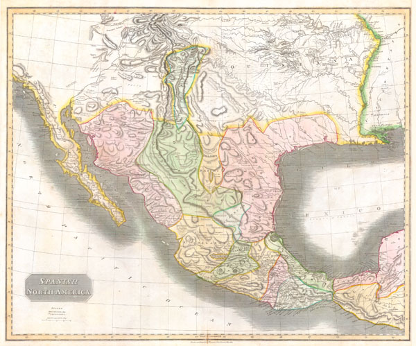
Spanish North America.
sold
- Digital Map Information
- Suitable for large format printing
- Full resolution TIFF file
- ICC color profile embedded
- Delivered instantly via download link
This hand colored map, along with Pinkerton's similar map, is most likely the most important large format English map of the American Southwest to be produced in the 19th century. Depicts Mexico from the Yucatan north to what would become the Republic of Texas, ... (more details)
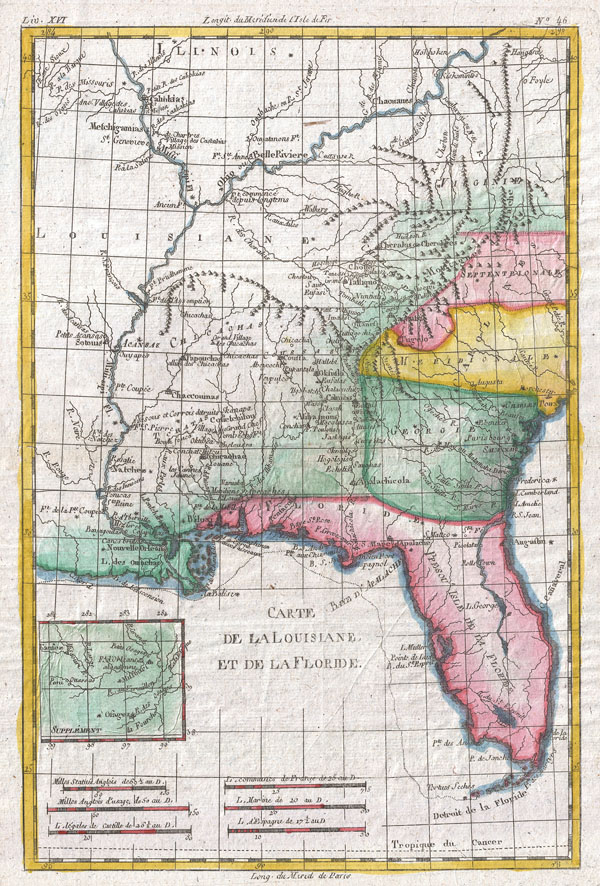
Carte De Louisiane Et De La Floride
sold
- Digital Map Information
- Suitable for large format printing
- DPI: 300
- File Size: 4.69 MB
- File Type: ZIP / TIFF
- ICC color profile embedded
- Delivered instantly via download link
A fine example of Rigobert Bonne and G. Raynal's 1780 map of Louisiana and Florida. Map corresponds to modern day Florida, Georgia, Alabama, Arkansas, Kentucky, Tennessee, North Carolina, South Carolina, Virginia and Louisiana. Offers considerable detail of ... (more details)
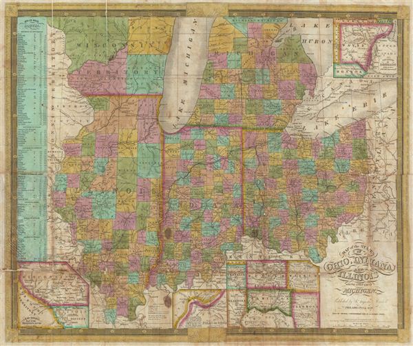
Map of the States of Ohio, Indiana, and Illinois with the settled par of Michigan.
sold
- Digital Map Information
- Suitable for large format printing
- DPI: 300
- File Size: 17.67 MB
- File Type: ZIP / TIFF
- ICC color profile embedded
- Delivered instantly via download link
A scarce 1839 S. A. Mitchell pocket map depicting the states of Ohio, Indiana, Illinois, and Michigan. Insets include, 'Vicinity of Detroit,' 'Vicinity of Cincinnati,' 'Falls of Ohio,' 'Lead Region East of the Mississippi.' A chart on the left-hand side of the ... (more details)

Carte De La Partie Meridionale De Bresil
sold
- Digital Map Information
- Suitable for large format printing
- DPI: 300
- File Size: 4.64 MB
- File Type: ZIP / TIFF
- ICC color profile embedded
- Delivered instantly via download link
A fine example of Rigobert Bonne and G. Raynal's 1780 map of southern Brazil, Uruguay, and northern Argentina, including Rio de Janeiro, Montevideo, and Buenos Aires. This map generally corresponds to modern day Minas Gerais, Sao Paulo, Parana, Santa ... (more details)
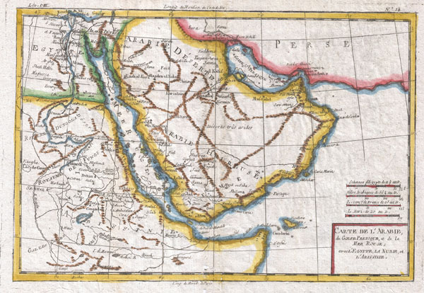
Carte De L'Arabie
sold
- Digital Map Information
- Suitable for large format printing
- DPI: 300
- File Size: 4.94 MB
- File Type: ZIP / TIFF
- ICC color profile embedded
- Delivered instantly via download link
A fine example of Rigobert Bonne and G. Raynal's 1780 map of the Arabia and Abyssinia (Ethiopia). Covers from the Nile Delta south as far as the Horn of Africa and West to Persia, inclusive of the modern day countries of Ethiopia, Egypt, Saudi Arabia, ... (more details)
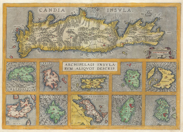
Candia Insula / Archipelagi Insularum Aliquot Descrip.
sold
- Digital Map Information
- Suitable for large format printing
- DPI: 300
- File Size: 8.68 MB
- File Type: ZIP / TIFF
- ICC color profile embedded
- Delivered instantly via download link
A rare and beautiful 1584 Abraham Ortelius map of Crete and ten other Greek islands: Metellino (Mitiline, Lesbos), Cerigo, Scarpanto (Karpathos), Nicsia (Naxos), Santorini, Milo, Stalimene (Limnos), Negroponte (Euboea), Rodus (Rhodes, home of the ... (more details)

Carte Des Isles Canaries
sold
- Digital Map Information
- Suitable for large format printing
- DPI: 300
- File Size: 3.11 MB
- File Type: ZIP / TIFF
- ICC color profile embedded
- Delivered instantly via download link
A fine example of Rigobert Bonne and G. Raynal's 1780 map of the Canary Islands. Shows entire chain along with the Madeira and Porto Santo Islands in the North. Offers relatively good detail, showing towns, rivers, some topographical features, ... (more details)
One of the most beautiful representations of upper Manhattan ever printed.
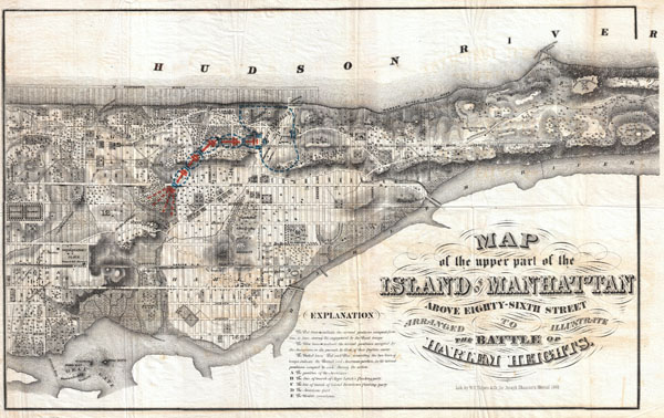
Map of the upper part of the Island of Manhattan above eighty-sixth street arranged to illustrate the Battle of Harlem Heights.
sold
- Digital Map Information
- Suitable for large format printing
- File Size: 15.14 MB
- File Type: ZIP / TIFF
- ICC color profile embedded
- Delivered instantly via download link
A stunning and rare 1868 Map of the northern part of the island of Manhattan, New York city by W. C. Rogers. Map covers the upper part of Manhattan, above 86th street (including Morningside Heights, Manhattan Valley, Harlem, Inwood, the Upper ... (more details)

Afrique
sold
- Digital Map Information
- Suitable for large format printing
- DPI: 300
- File Size: 4.77 MB
- File Type: ZIP / TIFF
- ICC color profile embedded
- Delivered instantly via download link
A fine example of Rigobert Bonne and G. Raynal's 1780 map of Africa. Highly detailed, showing towns, rivers, some topographical features, ocean currents, ports and political boundaries. Drawn by R. Bonne for G. Raynal's Atlas de Toutes les ... (more details)
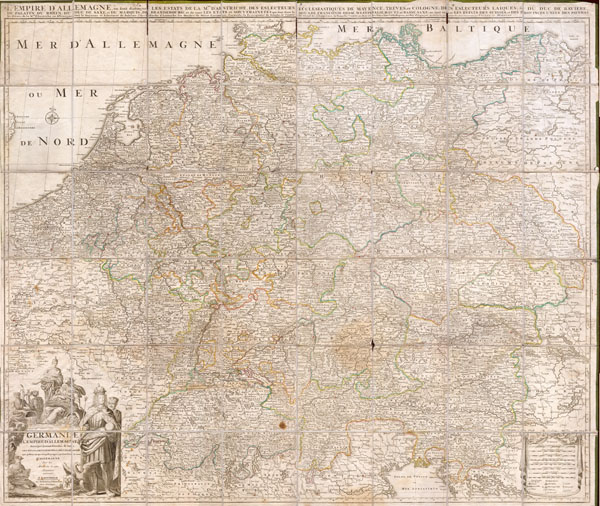
Germaniae L’Empire D’ Allemagne distingue suivant l’etendue tous les etats, principautes et souveradnettes qui passent ou qui ont passé jusque a present sous la nome D’Allemagne sur les Memoires les plus Nouveaux.
sold
- Digital Map Information
- Suitable for large format printing
- File Size: 13.05 MB
- File Type: ZIP / TIFF
- ICC color profile embedded
- Delivered instantly via download link
This is an extraordinary and gigantic c. 1730 map of Germany and the surrounding nations. Map is presented in case or pocket format on 48 linen backed panels. Covers most of what is today central Europe from eastern France and the ... (more details)

Partie Occidentale De L'Ancien Continent
sold
- Digital Map Information
- Suitable for large format printing
- DPI: 300
- File Size: 4.36 MB
- File Type: ZIP / TIFF
- ICC color profile embedded
- Delivered instantly via download link
A fine example of Rigobert Bonne and G. Raynal's 1780 map of Western Africa. This area corresponds to modern day Morocco, Western Sahara, Mauritania, and Algeria. Includes the Canary Islands, Madeira Island, and Cape Verde ... (more details)

Dominia Anglorum in America Septentrionali.
sold
- Digital Map Information
- Suitable for large format printing
- Full resolution TIFF file
- ICC color profile embedded
- Delivered instantly via download link
This 1730 Homann map of British Territories in North America depicts, in four separate maps, much of the Eastern Coast of North America. This large page is divided into four separate maps: Nova Scotia & Newfoundland, New ... (more details)
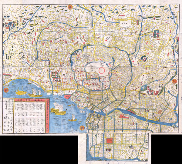
Edo.
sold
- Digital Map Information
- Suitable for large format printing
- File Size: 14.28 MB
- File Type: ZIP / TIFF
- ICC color profile embedded
- Delivered instantly via download link
This extraordinary item is a hand colored Edo Period woodcut map of Edo, or Tokyo, Japan. Impressive size and detail. Produced in the mid 19th century Japanese woodcut style, this map is a rare combination of practical ... (more details)
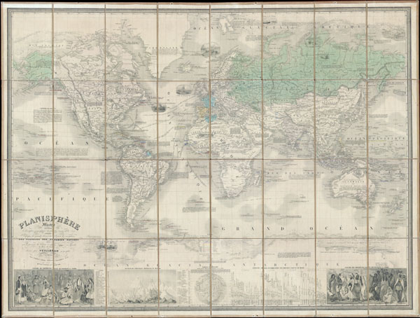
Planisphere Illustre presentant la description geographique des parties connues de la Terre. Indiquant l’epoque des grandes decouverts et le nom des navigateurs. Les Colonies des diverses nations ainsi que la parcours des bateaux a vapeur, l’ epoque des departes la duree du trajet & c. dresse par Vuillemin geographe. (Famous World Map presenting the geographical description of the known parts of the Earth. Indicating the time of great discoveries and the name of the navigators. The Colonies of the various nations as well as the course of steamers, the times departure and the duration of the journies, etc. Drafted by Vuillemin Geographer.)
sold
- Digital Map Information
- Suitable for large format printing
- File Size: 32.32 MB
- File Type: ZIP / TIFF
- ICC color profile embedded
- Delivered instantly via download link
This is a rare and magnificent 1857 case map of the world on Mercator's projection by French cartographer Alexandre Vuillemin. Depicts the world in extraordinary detail with numerous decorative embellishments and ... (more details)

Johnson’s Hindostan or British India.
sold
- Digital Map Information
- Suitable for large format printing
- File Size: 4.29 MB
- File Type: ZIP / TIFF
- ICC color profile embedded
- Delivered instantly via download link
A very nice example of A. J. Johnson's 1865 map of India and Southeast Asia. Covers from the Indus River eastward to include all of India, Burma, Siam (Thailand), Laos, Cambodia, Malaysia (Malacca) and Vietnam ... (more details)
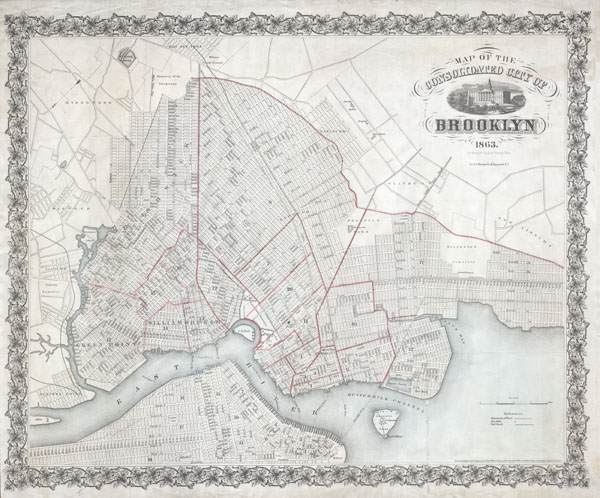
Map of the Consolidated City of Brooklyn.
sold
- Digital Map Information
- Suitable for large format printing
- File Size: 9.63 MB
- File Type: ZIP / TIFF
- ICC color profile embedded
- Delivered instantly via download link
An extremely rare first edition of Henry McCloskey's 1863 pocket map of the city of Brooklyn, New York. In the mid 19th century, fueled by the advent of the steam ferry, which made crossing the East River ... (more details)
Possibly the finest map of southern India to appear in the 19th century.
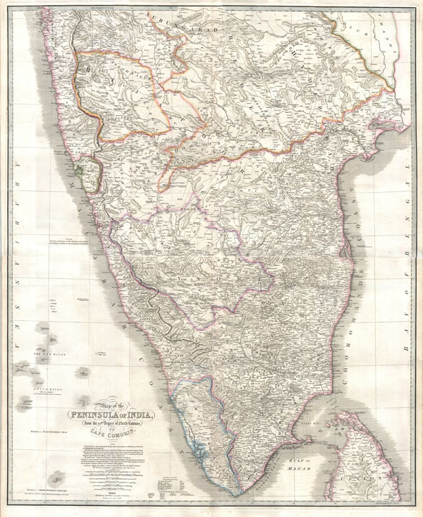
Map of the Peninsula of India, from the 19th. Degree of North Latitude, to Cape Cormorin.
sold
- Digital Map Information
- Suitable for large format printing
- DPI: 300
- File Size: 43.85 MB
- File Type: ZIP / TIFF
- ICC color profile embedded
- Delivered instantly via download link
This stunning wall map of India, dating to 1838 is James Wyld's reissued of William Faden's important c. 1799 map of the same region. This is one of the largest and most impressive maps of India to emerge ... (more details)
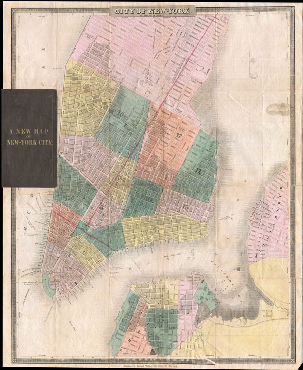
Map of New-York
sold
- Digital Map Information
- Suitable for large format printing
- DPI: 300
- File Size: 8.23 MB
- File Type: ZIP / TIFF
- ICC color profile embedded
- Delivered instantly via download link
This is the c. 1834-1836 edition of David H. Burr and Edward Walker's important pocket map of the City of New York. Covers New York City south of 26th street on the west side and south of 40th street on ... (more details)

County Map of Pennsylvania, New Jersey, Maryland, and Delaware.
sold
- Digital Map Information
- Suitable for large format printing
- File Size: 7.03 MB
- File Type: ZIP / TIFF
- ICC color profile embedded
- Delivered instantly via download link
A beautiful example of S. A. Mitchell Jr.'s 1863 map of Pennsylvania, New Jersey, Delaware and Maryland. Detailed to the county level with special attention both political and geographic elements. ... (more details)