
Covens and Mortier

Covens and Mortier (1721 - c. 1862) was an Amsterdam publishing firm, the successor to the extensive publishing empire built by Pierre Mortier (1661 - 1711). Covens and Mortier maps are often criticized as derivative - but this is not fully the case. Pierre Mortier lived in Paris from 1681 to 1685. There he established close relationships the the greatest French cartographers of the era, including De L'Isle and D'Anville. His business model was based upon leveraging Dutch printing technology and sophistication to co-publish state of the art French cartography. Upon Mortier's death in 1711 his firm was taken over by his son, Cornelius Mortier (1699 - 1783). Cornelius married the sister of Johannes Covens (1697 - 1774) in 1721 and, partnering with his brother in law, established the Covens and Mortier firm. Under the Covens and Mortier imprint, Cornelius and Johannes continued in Pierre's model of publishing the most up-to-date French works with permission. They quickly became one of the largest and most prolific Dutch publishing concerns of the 18th century. The firm and its successors published thousands of maps over a 120 year period from 1721 to the mid-1800s. During their long lifespan the Covens and Mortier firm published as Covens and Mortier (1721 - 1778), J. Covens and Son (1778 - 94) and Mortier, Covens and Son (1794 - c. 1862).
De l'Isle's British Isles.
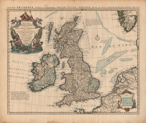
Les Isles Britanniques ou sont le Rme d'Angleterre tiré de Sped, celuy d'Ecosse tiré de Th. Pont, etc. et celuy d'Irlande tiré de Petti. Le tout rectifié par diverses Observations.
$500.00
Acquire
- Digital Map Information
- Suitable for large format printing
- Full resolution TIFF file
- ICC color profile embedded
- Delivered instantly via download link
A c. 1718 example of Covens and Mortier's issue of De l'Isle's map of the British Isles. Combining terrestrial and maritime information in splendid detail, this example is also distinguished by old color, refreshed, and heightened with gold. (more details)
The largest bay in Brazil and the second largest bay in the world.
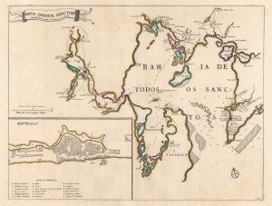
Sinus Omnium Sanctorum.
$1,400.00
Acquire
- Digital Map Information
- Suitable for large format printing
- DPI: 600
- File Size: 37.67 MB
- File Type: ZIP / TIFF
- ICC color profile embedded
- Delivered instantly via download link
This is a c. 1721 Covens and Mortier map of All Saints Bay or the Baía de Todo os Santos, and the city of Salvador, the 18th-century economic and political center of Portuguese Brazil. (more details)
Attractive map of the Flemish regions of Belgium.
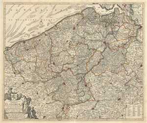
Novissima et Accuratissima Comitatus Flandriae Tabula, in qua Novae Lineae, et omnes Urbes, cum suis veris Munitionibus quae Gallis, Hispanis, Batavisqe parent.
$900.00
Acquire
- Digital Map Information
- Suitable for large format printing
- Full resolution TIFF file
- ICC color profile embedded
- Delivered instantly via download link
This is an attractive c.1721 map of Flanders by Frederik De Wit. The map depicts western portions of modern day Belgium and northern France along with parts of Holland, a region commonly known as Flanders at the time. Extends from Zeeland south to Arras in France ... (more details)
Beautiful early map depicting the Nile Delta in Egypt.
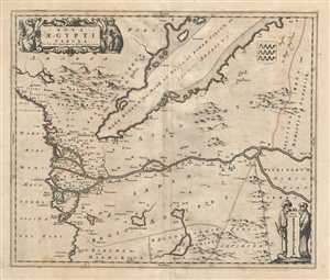
Nova Aegypti Tabula.
$400.00
Acquire
- Digital Map Information
- Suitable for large format printing
- Full resolution TIFF file
- ICC color profile embedded
- Delivered instantly via download link
This is a beautiful map of northern Egypt and the Red Sea by Frederik De Wit. Centered on the Nile River, the map is oriented with east on top and covers the Nile delta in northern regions of the Egypt. The entire map is depicted in extraordinary detail, ... (more details)
Beautiful map featuring the division of the Crown of Castile.
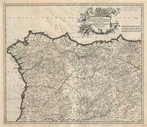
Regnorum Castellae Veteris, Legionis, et Gallaeciae principatuumq Biscaiae, et Asturiarum Accuratissima Descriptio.
$400.00
Acquire
- Digital Map Information
- Suitable for large format printing
- Full resolution TIFF file
- ICC color profile embedded
- Delivered instantly via download link
This is a scarce c.1721 map of northwest Spain by Frederik De Wit. The map depicts the northern divisions under the Crown of Castile, including the part of the Kingdom of Leon, the Kingdom of Castile, the Principality of Asturias, the Kingdom of Galicia ... (more details)
Map of the historic region of Pomerania in Germany and Poland.
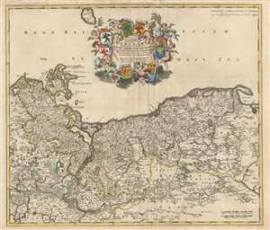
Ducatus Pomeraiae Tabula Generalis, in qua sunt Ducatus Pomeraniae, Stettinensis, Cassubiae, Vandaliae et Bardensis, Principatus Rugiae ac Insulae Comitatus Guskoviensis, et Dominia Louwenburgense, Wolgastense et Butoviense.
$1,000.00
Acquire
- Digital Map Information
- Suitable for large format printing
- Full resolution TIFF file
- ICC color profile embedded
- Delivered instantly via download link
This is a scarce c.1721 map of Pomerania in modern day Germany and Poland by Frederik De Wit. It covers from Stralsund in Germany east as far as Gdansk in Poland and south to Berlin. Bornhom Island is also included. Important cities of Berlin, Szczecin ... (more details)
Beautiful Covens and Mortier edition of the De Wit map of Brabant.
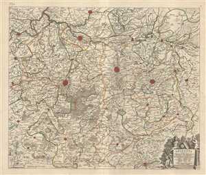
Pars Meridionalis Brabantiae continens Dominium Merchliniense Ducatum Arschotanum.
$300.00
Acquire
- Digital Map Information
- Suitable for large format printing
- Full resolution TIFF file
- ICC color profile embedded
- Delivered instantly via download link
This is an attractive c.1721 map of the southern part of the Duchy of Brabant by Frederik De Wit. The map depicts part of modern day Belgium, which was at the time this map was made, part of the Duchy of Brabant. It covers the vicinity of Brussels and ... (more details)
Map of the historic County of Namur.
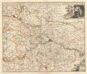
Comitatus Namurci Tabula in Lucem.
$200.00
Acquire
- Digital Map Information
- Suitable for large format printing
- Full resolution TIFF file
- ICC color profile embedded
- Delivered instantly via download link
This is an attractive c.1721 map of the County of Namur by Frederik De Wit. Centered on the fortified city of Namur, the map extends from Fortaine (Fortaine-l’Eveque) to Huy and from Gembloux to Florennes. The entire region is depicted in ... (more details)
'A towering landmark along the path of Western cartographic development' - Wheat
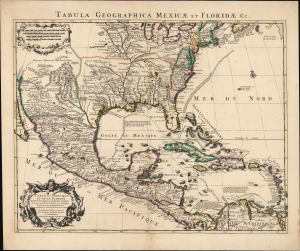
Carte du Mexique et de la Floride des Terres Angloises et des Isles Antilles... / Tabula Geographica Mexicae et Floridae etc.
$1,500.00
Acquire
- Digital Map Information
- Suitable for large format printing
- Full resolution TIFF file
- ICC color profile embedded
- Delivered instantly via download link
This is the 1722 Covens and Mortier issue of Guillaume de L'Isle's groundbreaking map of North America, focusing on Mexico, the Mississippi watershed, and the West Indies. De L'Isle first published this map in 1703, at which point it was the most sophisticated map of the region obtainable: the first map to accurately denote the course of the Mississippi River, the first to accurately place the Great Lakes, and the first appearance on a map of updates from La Salle, Bienville, and D'Iberville. (more details)
Glorious Revolution.
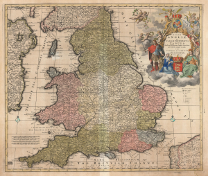
Regni Angliae et Walliae Principatus Tabula, divisa in LII Regiones, Anglice Shire dictas, prae coeteris correcta et edita per I. Covens et C. Mortier Amstelo-Batavum.
$650.00
Acquire
- Digital Map Information
- Suitable for large format printing
- DPI: 600
- File Size: 68.76 MB
- File Type: ZIP / TIFF
- ICC color profile embedded
- Delivered instantly via download link
This is Carel Allard's 1697 map of England and Wales, in its 1725 Covens and Mortier edition. Between the superb engraving of the map and its ornate cartouches, it is one of the most richly decorative maps of England produced in that era. (more details)
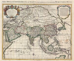
L' Asie divisee en ses principales regions, et ou se peuvent voir l'estendue des empires, monarchies, royaumes, et estats qui partagent presentement L'Asie / Asia divisa in imperia, regna & status in quae distributur.
$950.00
Acquire
- Digital Map Information
- Suitable for large format printing
- Full resolution TIFF file
- ICC color profile embedded
- Delivered instantly via download link
An attractive and large map of Asia issued by the Dutch firm of Covens and Mortier c. 1730. Covens and Mortier based this map upon an earlier map by Guillaume Delisle, which was in turn based upon the Sanson-Jaillot model of 1692. ... (more details)
El Dorado, Maelstroms, and a Growing Understanding of American Geography.
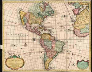
Carte d'Amerique Dressee pour l'Usage du Roy.
$900.00
Acquire
- Digital Map Information
- Suitable for large format printing
- File Size: 24.79 MB
- File Type: ZIP / TIFF
- ICC color profile embedded
- Delivered instantly via download link
This is an attractive example of Guillaume De l'Isle's map of America in its first Amsterdam issue. De l'Isle, as Geographer to the King, was considered authoritative throughout Europe, and his maps found an eager audience in Amsterdam and beyond throughout the 18th century. (more details)
Sea of the West, El Dorado, a Maelstrom, and more.
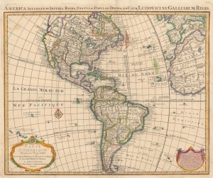
America Accurate in Imperia, Regna, Status and Populos Divisa, ad Usum Ludovici XV, Galliarum Regis. / Carte d'Amerique Dressee pour l'Usage du Roy.
$1,400.00
Acquire
- Digital Map Information
- Suitable for large format printing
- DPI: 600
- File Size: 27.87 MB
- File Type: ZIP / TIFF
- ICC color profile embedded
- Delivered instantly via download link
An uncommon 1755 variant on Guillaume Delisle's map of America. The map offers much of interest, including theories regarding the Sea of the West, cities of gold in North America, El Dorado, and a magnificent whirlpool in the South Atlantic. (more details)
Magnificent, updated plan of Amsterdam.
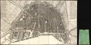
[Plan de la Grande et Fameuse Ville Marchande d'Amsterdam. / Plan van de Wyd Vermaarde en Beroemde Koop Stad Amsterdam.]
$2,000.00
Acquire
- Digital Map Information
- Suitable for large format printing
- Full resolution TIFF file
- ICC color profile embedded
- Delivered instantly via download link
This is the final 1814 Covens and Mortier issue of this large, beautifully engraved Nicolas Visscher II map of Amsterdam. It was originally entitled Plan de la Grande et Fameuse Ville Marchande d'Amsterdam / Plan van de Wyd Vermaarde en Beroemde Koop Stad Amsterdam, but in this state of the plan, the increasingly unfashionable cartouche has been removed, along with the title the plan had borne for a near a century. Architect Daniel Stalpaert initially compiled the plan. It was printed by Nicolas Visscher and was notable as one of the earliest depictions of the iconic ring canals, which were added to the city in the first half of the seventeenth century. The plan is oriented to the south-southwest to display the vibrant port, teeming with ships. It is a magnificently detailed work, with nearly three hundred streets named and numbered. Particularly famous or important structures are illustrated pictorially, as are the windmills built around the city to operate the canal system. (more details)