
Extremely scarce Spanish nautical chart of Cuba.
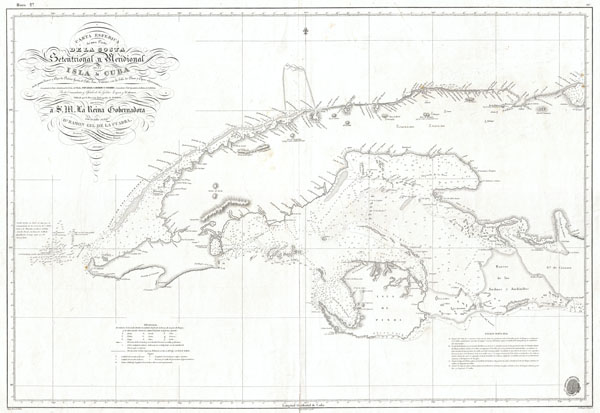
Carta Esferica de una Parte de la Costa Setentrional y Meridional de la Isla de Cuba … 1834.
sold
- Digital Map Information
- Suitable for large format printing
- DPI: 300
- File Size: 18.88 MB
- File Type: ZIP / TIFF
- ICC color profile embedded
- Delivered instantly via download link
This is a dramatic and exceptionally rare 1854 nautical chart or map of the western part of Cuba by the Spanish mapping agency, Direccion Hidrografica . Covers the West India island from Cape San Antonio eastward as far as the Gulf of Cazones. Includes the Isla ... (more details)

United States Military Academy West Point New York.
sold
- Digital Map Information
- Suitable for large format printing
- File Size: 11.91 MB
- File Type: ZIP / TIFF
- ICC color profile embedded
- Delivered instantly via download link
This is an uncommon view or map of the United States Military Academy at West Point, New York. It was drawn in 1944 by Jim Cumberpatch. Identifies various campus buildings and monuments. Also includes part of the Hudson River, the West Shore Railroad, and the ... (more details)

Northern Italy.
sold
- Digital Map Information
- Suitable for large format printing
- File Size: 9.09 MB
- File Type: ZIP / TIFF
- ICC color profile embedded
- Delivered instantly via download link
A beautiful 1855 first edition example of Colton's map of northern Italy. Covers from Switzerland to the Gulf of Gaeta, including the island of Corsica. Includes Milan, Genoa, Parma, Tuscany, Venice, Lombardy, and the Papal States. Throughout, Colton ... (more details)

Southern Italy Kingdom of Naples, I. Sardinia & Malta.
sold
- Digital Map Information
- Suitable for large format printing
- File Size: 7.7 MB
- File Type: ZIP / TIFF
- ICC color profile embedded
- Delivered instantly via download link
A beautiful 1855 first edition example of Colton's map of Southern Italy. Covers the southern part of the Italian peninsula from Abruzzo to Melito, inclusive of the Kingdom of Naples. Also includes the islands of Sicily and Sardinia. An inset map in ... (more details)
Rare first edition of Colton's important Australia series.

Australia.
sold
- Digital Map Information
- Suitable for large format printing
- File Size: 6.84 MB
- File Type: ZIP / TIFF
- ICC color profile embedded
- Delivered instantly via download link
A beautiful 1855 first edition example of Colton's map of Australia. Covers the entire continent including Tasmania or Van Diemen's Land. Colton's mappings of Australia, updated annually through the 1860s, offer a comprehensive overview of the ... (more details)
An extremely uncommon chart of the South Carolina Coastlands.

Coast Chart No. 53 Coast of South Carolina from Long Island to Hunting Island Including Charleston Charbor and St. Helena Sound.
sold
- Digital Map Information
- Suitable for large format printing
- File Size: 36.27 MB
- File Type: ZIP / TIFF
- ICC color profile embedded
- Delivered instantly via download link
This is a highly unusual and rarely seen 1866 U.S. Coast Survey chart or map of the South Carolina coastline. Covers from St. Helena Bay to Charleston Harbor. Includes the North Edisto River, South Edisto River, Kiwah River, Stono River, ... (more details)
One of the most uncommon U.S. Coast Survey charts.

Coast Chart No. 92 Mississippi Sound Western Part From Round I. to St. Jospeh's I.
sold
- Digital Map Information
- Suitable for large format printing
- File Size: 48.35 MB
- File Type: ZIP / TIFF
- ICC color profile embedded
- Delivered instantly via download link
This is a highly unusual and rarely seen 1860 U.S. Coast Survey chart or map of the western part of the Mississippi Sound. Covers the coast of Mississippi roughly from St. Joseph Island (today's Grand Island) and St. Louis Bay eastward as ... (more details)

Colton's Map of The World on Mercator's Projection.
sold
- Digital Map Information
- Suitable for large format printing
- File Size: 19.72 MB
- File Type: ZIP / TIFF
- ICC color profile embedded
- Delivered instantly via download link
A beautiful 1855 first edition example of Colton's map of the World on a Mercator Projection. Centered on the continent of America, this map of the world is hand colored in pink, green, yellow and blue pastels. This map is a reduction ... (more details)
“Scientific cartography of the Territory of Utah may be said to date from the appearance of this map”-C. I. Wheat

Map of the Great Salt Lake and Adjacent Country in the Territory of Utah.
sold
- Digital Map Information
- Suitable for large format printing
- Full resolution TIFF file
- ICC color profile embedded
- Delivered instantly via download link
It had been a daring feat of exploration, succeeding where the mountain men had all failed, and by means of his map of the western portion of the lake, Stansbury had painted at least one more bold stroke into the unfinished portrait of ... (more details)

Palestine.
sold
- Digital Map Information
- Suitable for large format printing
- File Size: 7.22 MB
- File Type: ZIP / TIFF
- ICC color profile embedded
- Delivered instantly via download link
A beautiful 1855 first edition example of Colton's map of Palestine, Israel or the Holy Land. Includes the modern day nations of Israel, Palestine and Lebanon with parts of adjacent Syria and Jordan. Notes both ancient and ... (more details)

Turkey in Asia and the Caucasian Provinces of Russia.
sold
- Digital Map Information
- Suitable for large format printing
- File Size: 8.41 MB
- File Type: ZIP / TIFF
- ICC color profile embedded
- Delivered instantly via download link
A beautiful 1855 first edition example of Colton's map of Turkey in Asia and the Caucuses. Covers from the Crimea south to the Nile Delta, west as far as the Aegean, and east to the Caspian Sea and the Persian Gulf. ... (more details)

New Jersey.
sold
- Digital Map Information
- Suitable for large format printing
- File Size: 7.86 MB
- File Type: ZIP / TIFF
- ICC color profile embedded
- Delivered instantly via download link
A beautiful example of Colton's 1857 map of New Jersey. Covers New Jersey in full as well as parts of adjacent states. Like most of Colton's state maps, this map is largely derived from an earlier wall map of North ... (more details)

New Jersey.
sold
- Digital Map Information
- Suitable for large format printing
- File Size: 8.28 MB
- File Type: ZIP / TIFF
- ICC color profile embedded
- Delivered instantly via download link
A beautiful 1855 first edition example of Colton's map of New Jersey. Covers New Jersey in full as well as parts of adjacent states. Like most of Colton's state maps, this map is largely derived from an earlier ... (more details)

Persia, Arabia & Co.
sold
- Digital Map Information
- Suitable for large format printing
- File Size: 7.45 MB
- File Type: ZIP / TIFF
- ICC color profile embedded
- Delivered instantly via download link
A beautiful 1855 first edition example of Colton's map of Persia, Arabia and Afghanistan. Covers from the Mediterranean east to India and south to include all of Arabia to the entrance to the Red Sea. Includes ... (more details)

Preliminary Chart No. 3 of the Sea Coast of the United States from Cape Small Point Maine to Cape Cod Mass.
sold
- Digital Map Information
- Suitable for large format printing
- File Size: 32.66 MB
- File Type: ZIP / TIFF
- ICC color profile embedded
- Delivered instantly via download link
An impressive and striking example of the U.S Coast Survey's Map of the New England Coast. Extends from Cape Small Point, Maine, south to Cape Cod, Massachusetts. Includes Boston City and Harbor, Salem, ... (more details)
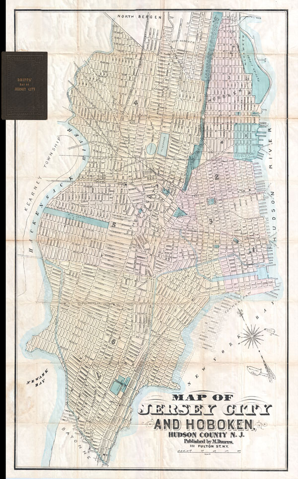
Map of Jersey City and Hoboken Hudson County N. J.
sold
- Digital Map Information
- Suitable for large format printing
- File Size: 6.34 MB
- File Type: ZIP / TIFF
- ICC color profile embedded
- Delivered instantly via download link
A map of exceeding rarity. This is the only known example of Matthew Dripps' pocket map of Jersey City and Hoboken. While this map is undated, the combination of the map's attribution, printing style, ... (more details)
One of the first American maps to detail Singapore.

East Indies.
sold
- Digital Map Information
- Suitable for large format printing
- File Size: 9.28 MB
- File Type: ZIP / TIFF
- ICC color profile embedded
- Delivered instantly via download link
A beautiful 1855 first edition example of Colton's map of the East Indies. Covers from Burma in the extreme northwest to New Guinea and East Timor in the southeast. Includes of Burma, Pegu, Siam ... (more details)

Hawaiian Group or Sandwich Islands. New Zealand. Viti Group or Feejee Islands. Society Islands. Marquesas or Washington Is. Galapagos Islands. Samoan or Navigators Is.
sold
- Digital Map Information
- Suitable for large format printing
- File Size: 7.19 MB
- File Type: ZIP / TIFF
- ICC color profile embedded
- Delivered instantly via download link
A beautiful 1855 first edition example of Colton's map of Hawaii and other Polynesian island groups. Sheet contains seven separate maps. The top map, occupying the upper half of the sheet, ... (more details)

East Hampton, Town of East Hampton, Suffolk Co. Amagansett, Town of East Hampton, Suffolk Co. Bridgehampton, Town of Southampton, Suffolk Co.
sold
- Digital Map Information
- Suitable for large format printing
- File Size: 4.85 MB
- File Type: ZIP / TIFF
- ICC color profile embedded
- Delivered instantly via download link
A rare example of Fredrick W. Beers' Map of the towns of East Hampton, Amagansett, and Bridgehampton. Published in 1873, this is actually three maps on one sheet. The top map details East ... (more details)

East Hampton Suffolk Co. L.I.
sold
- Digital Map Information
- Suitable for large format printing
- File Size: 5.72 MB
- File Type: ZIP / TIFF
- ICC color profile embedded
- Delivered instantly via download link
A rare example of Fredrick W. Beers' Map of East Hampton, Long Island, New York. Published in 1873, this magnificent map covers the south fork of Long Island from Sag Harbor toe Napeague ... (more details)