

Asia.
sold
- Digital Map Information
- Suitable for large format printing
- DPI: 300
- File Size: 10.52 MB
- File Type: ZIP / TIFF
- ICC color profile embedded
- Delivered instantly via download link
An extremely attractive example of S. A. Mitchell Sr.'s 1853 map of Asia and Australia. Covers the entirety of Asia as well as the East Indies and Australia. Color coded according to region. An inset map in the lower left quadrant details Australia. Surrounded ... (more details)
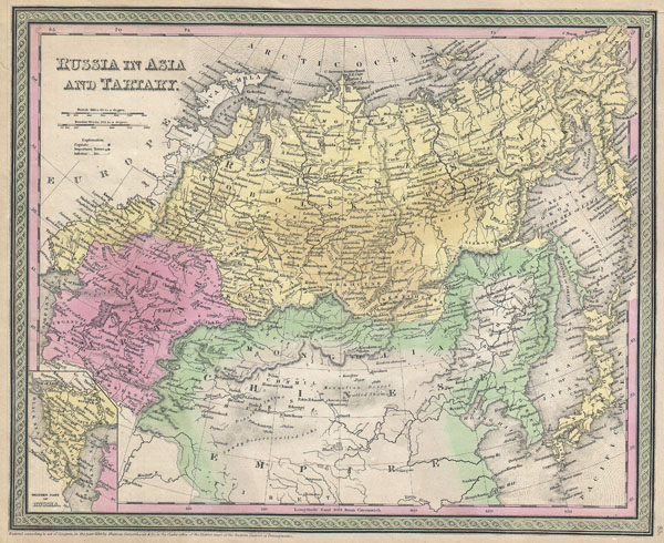
Russia in Asia and Tartary.
$150.00
Acquire
- Digital Map Information
- Suitable for large format printing
- DPI: 300
- File Size: 11.16 MB
- File Type: ZIP / TIFF
- ICC color profile embedded
- Delivered instantly via download link
An extremely attractive example of S. A. Mitchell Sr.'s 1853 map of Russia in Asia. Extends from the Ural Mountains and the Caspian Sea eastward as far as Siberia, Kamtschatka and Japan. Extends south to include Korea, Mongolia, and much of northern China. An ... (more details)

Hindoostan.
sold
- Digital Map Information
- Suitable for large format printing
- DPI: 300
- File Size: 10.81 MB
- File Type: ZIP / TIFF
- ICC color profile embedded
- Delivered instantly via download link
An extremely attractive example of S. A. Mitchell Sr.'s 1853 map of India. Covers the subcontinent in considerable detail. Princely states and British possessions are color coded. An inset in the lower right hand quadrant details the Delta of the Ganges ... (more details)

China.
sold
- Digital Map Information
- Suitable for large format printing
- Full resolution TIFF file
- ICC color profile embedded
- Delivered instantly via download link
An extremely attractive example of S. A. Mitchell Sr.'s 1853 map of China. Covers from Chinese Tartary south to Hainan and east to Korea and Formosa. Chinese provinces are color coded and numbered. Surrounded by the green border common to Mitchell maps ... (more details)
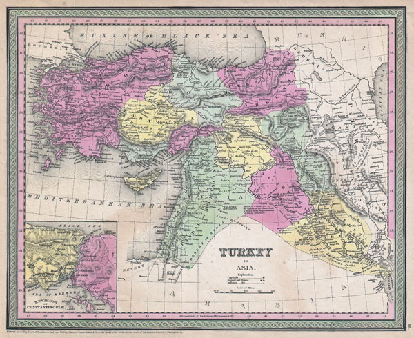
Turkey in Asia.
sold
- Digital Map Information
- Suitable for large format printing
- DPI: 300
- File Size: 10.41 MB
- File Type: ZIP / TIFF
- ICC color profile embedded
- Delivered instantly via download link
An extremely attractive example of S. A. Mitchell Sr.'s 1853 map of Turkey in Asia. This map, made when the Ottoman Empire controlled much of the Middle East, covers what is today Turkey, Cyprus, Iraq, Israel, Palestine, Jordan, Lebanon, and Syria. ... (more details)
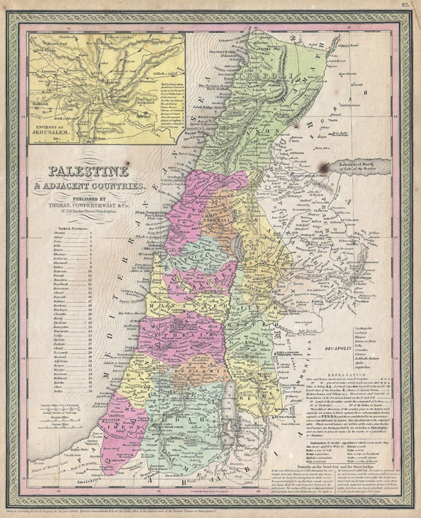
Palestine & Adjacent Countries.
sold
- Digital Map Information
- Suitable for large format printing
- DPI: 300
- File Size: 11.62 MB
- File Type: ZIP / TIFF
- ICC color profile embedded
- Delivered instantly via download link
An extremely attractive example of S. A. Mitchell Sr.'s 1853 map of Palestine, Israel or the Holy Land. Depicts the entire region in considerable detail. When this map was made Palestine or Israel was under the control of the Ottoman Empire. ... (more details)

A New Map of Arkansas with its Canals, Roads & Distances.
sold
- Digital Map Information
- Suitable for large format printing
- DPI: 300
- File Size: 7.98 MB
- File Type: ZIP / TIFF
- ICC color profile embedded
- Delivered instantly via download link
An extremely attractive example of S. A. Mitchell Sr.'s 1853 map of Arkansas. Depicts the entire state color coded according to individual counties. Shows canals and roads with notations regarding steamboat and overland mileage. Surrounded ... (more details)

A New Map of Louisiana with its Canals, Roads & Distances from placeto place, along the Stage & Steam Boat Routes..
sold
- Digital Map Information
- Suitable for large format printing
- DPI: 300
- File Size: 8.91 MB
- File Type: ZIP / TIFF
- ICC color profile embedded
- Delivered instantly via download link
An extremely attractive example of S. A. Mitchell Sr.'s 1853 map of Louisiana. Depicts the entire state color coded according to individual counties. Shows canals and roads with notations regarding steamboat and overland mileage. A large ... (more details)
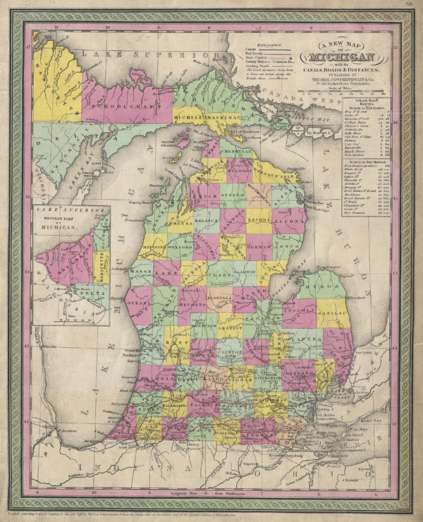
A New Map of Michigan with its Canals, Roads & Distances.
sold
- Digital Map Information
- Suitable for large format printing
- DPI: 300
- File Size: 9.01 MB
- File Type: ZIP / TIFF
- ICC color profile embedded
- Delivered instantly via download link
An extremely attractive example of S. A. Mitchell Sr.'s 1853 map of Michigan. Depicts the entire state color coded according to individual counties. An inset on the right hand side of the map details the western part of the Upper ... (more details)
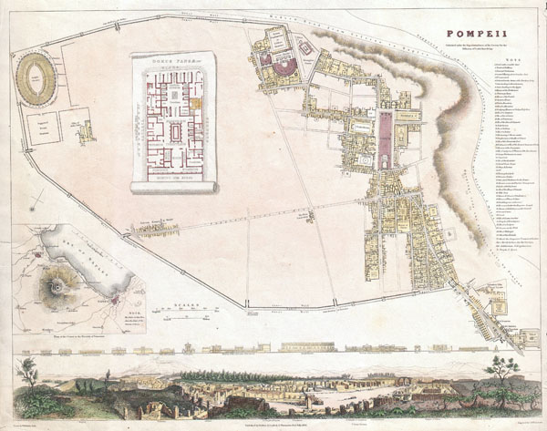
Pompeii.
sold
- Digital Map Information
- Suitable for large format printing
- Full resolution TIFF file
- ICC color profile embedded
- Delivered instantly via download link
A beautiful example of the 1832 S.D.U.K. map of Pompeii, Italy. Pompeii was destroyed by the eruption of the volcano Vesuvius, in A.D. 79 and remained buried under ash until its rediscovery in 1748. Though excavations had been in ... (more details)
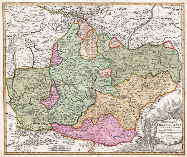
Principatus Transilvaniae in quinque Nationes earum'que Regiones es comitatus cum finitimis vicinorum Statuum Provinciis accuraté divisus.
sold
- Digital Map Information
- Suitable for large format printing
- DPI: 300
- File Size: 20.96 MB
- File Type: ZIP / TIFF
- ICC color profile embedded
- Delivered instantly via download link
A striking example of J. B. Homann's c. 1716 map of Transylvania. Covers what is today the northern part of Romania from the Bereton River eastward as far as Castle Boza. Color coded according to district with superb detail ... (more details)

Colton's Map of the World on Mercator's Projection. / Printed for J. & H. Miller, Columbus, Ohio.
sold
- Digital Map Information
- Suitable for large format printing
- DPI: 300
- File Size: 31.26 MB
- File Type: ZIP / TIFF
- ICC color profile embedded
- Delivered instantly via download link
A rare and extremely attractive folding map of the world by J. H. Colton. This map, comprising the entire world, was prepared by Colton in 1852 for issue in J. & H. Miller publication in the 1855 edition of Blake's Volume ... (more details)
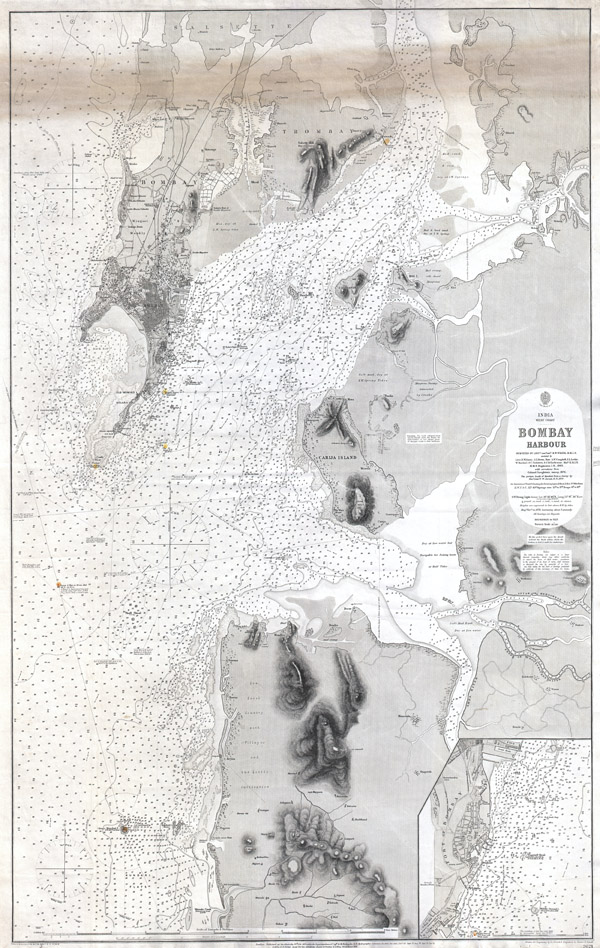
Bombay Harbour
sold
- Digital Map Information
- Suitable for large format printing
- File Size: 47.84 MB
- File Type: ZIP / TIFF
- ICC color profile embedded
- Delivered instantly via download link
A rare and extraordinary 1879 nautical chart or map of Bombay (Mumbai) Harbor, India prepared by the British Admiralty. Offers extraordinary detail of Bombay harbor from Salsette in the north to Warsole Creek and Veshvee ... (more details)
A masterpiece by an mysterious unknown cartographer.
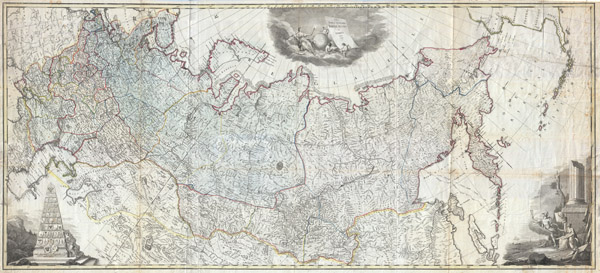
Nova Tabula Geographica Imperii Russici in Gubernia Divisi Edita 1787
sold
- Digital Map Information
- Suitable for large format printing
- DPI: 300
- File Size: 129.69 MB
- File Type: ZIP / TIFF
- ICC color profile embedded
- Delivered instantly via download link
A scarce and spectacular monumentally proportioned 1787 Map of Russia by an unknown yet masterful cartographer. Renders the full sprawling extant of the Russian Empire from the Black Sea to the northwestern parts of the ... (more details)
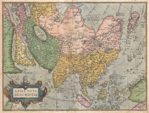
Asiae Nova Descriptio
sold
- Digital Map Information
- Suitable for large format printing
- DPI: 300
- File Size: 19.89 MB
- File Type: ZIP / TIFF
- ICC color profile embedded
- Delivered instantly via download link
A scarce and stunning first edition example of Abraham Ortelius' important 1572 map of Asia. Covers from Europe and Africa eastward to include all of Asia, the East Indies, Japan, and parts of New Guinea and Australia. ... (more details)

L'Asia Nuovamente Corretta, et Accresiuta, Secondo le Relationi piu Moderne du Guglielmo Sansone…
sold
- Digital Map Information
- Suitable for large format printing
- DPI: 300
- File Size: 20.58 MB
- File Type: ZIP / TIFF
- ICC color profile embedded
- Delivered instantly via download link
A spectacular 1687 map of Asia by the important Italian cartographer Giovanni Giacomo De Rossi. Depicts the entire continent as well as parts of Europe, Africa, and the East Indies. In drawing this map Rossi drew ... (more details)
First edition of Colton's influential map of New York City.

Map of New York and the Adjacent Cities.
sold
- Digital Map Information
- Suitable for large format printing
- File Size: 16.74 MB
- File Type: ZIP / TIFF
- ICC color profile embedded
- Delivered instantly via download link
A rare and beautiful example of J. H. Colton map of New York City and vicinity, including Manhattan as well as parts of Brooklyn, Jersey City, Hoboken, and Queens. This is the first edition, first state, of the ... (more details)

A New Map of the Circle of Upper Saxony; with the Duchy of Silesia and Lusatia, from the Latest Authorities.
sold
- Digital Map Information
- Suitable for large format printing
- DPI: 300
- File Size: 20.04 MB
- File Type: ZIP / TIFF
- ICC color profile embedded
- Delivered instantly via download link
An attractive example of John Cary's 1801 map of Upper Saxony, Germany. Covers from the Baltic Sea south to Franconia, Bavaria, Bohemia and Moravia. Extends eastward as far as Poland. Includes the Duchy of ... (more details)

A New Map of the Circles of the Upper and Lower from the Latest Authorities.
sold
- Digital Map Information
- Suitable for large format printing
- DPI: 300
- File Size: 19.21 MB
- File Type: ZIP / TIFF
- ICC color profile embedded
- Delivered instantly via download link
An extremely attractive example of John Cary's 1799 map of the Upper and Lower Rhine, Germany. Covers Westphalia south to France and Swabia. Bordered on the west by the Netherlands and on the east by ... (more details)

A New Map of the Circle of Franconia, from the Latest Authorities.
sold
- Digital Map Information
- Suitable for large format printing
- DPI: 300
- File Size: 16.5 MB
- File Type: ZIP / TIFF
- ICC color profile embedded
- Delivered instantly via download link
An extremely attractive example of John Cary's 1799 map of Franconia, Germany. Covers from Upper Saxony south to Swabia, west to the Lower Rhine and west to the Bavaria. Includes the important ... (more details)