

Bocage's Map of Messenia in Ancient Greece.
sold
- Digital Map Information
- Suitable for large format printing
- Full resolution TIFF file
- ICC color profile embedded
- Delivered instantly via download link
This lovely little map of Messenia, in the southeast of Ancient Greece, was prepared by M. Barbie de Bocage in 1786 for the 'Travels of Anarcharsis.' Follows the earlier D' Anville map. This peninsula and gulf just south of Arcadia and west of Laconia, was ... (more details)

Angleterre 1833.
sold
- Digital Map Information
- Suitable for large format printing
- Full resolution TIFF file
- ICC color profile embedded
- Delivered instantly via download link
This is a beautiful 1833 hand colored map of England. All text is in ... (more details)

Map of Europe, showing its Gt. Political Divisions
sold
- Digital Map Information
- Suitable for large format printing
- File Size: 3.85 MB
- File Type: ZIP / TIFF
- ICC color profile embedded
- Delivered instantly via download link
This hand colored map is a copper plate engraving, dating to 1860 by ... (more details)

Geographie Du Moyen Age Principalement au IXe Siecle.
sold
- Digital Map Information
- Suitable for large format printing
- Full resolution TIFF file
- ICC color profile embedded
- Delivered instantly via download link
This is a beautiful 1837 hand colored map of Europe and parts of ... (more details)

Johnson’s South America.
sold
- Digital Map Information
- Suitable for large format printing
- File Size: 17.02 MB
- File Type: ZIP / TIFF
- ICC color profile embedded
- Delivered instantly via download link
This is a magnificent 1863 hand colored map of South America. ... (more details)

Johnson’s South America
sold
- Digital Map Information
- Suitable for large format printing
- File Size: 3.3 MB
- File Type: ZIP / TIFF
- ICC color profile embedded
- Delivered instantly via download link
This is a magnificent 1861 hand colored map of South ... (more details)

Patagonia. / South Orkney or Powell’s Group. / Falkland Islands. / South Georgia Island.
sold
- Digital Map Information
- Suitable for large format printing
- File Size: 2.45 MB
- File Type: ZIP / TIFF
- ICC color profile embedded
- Delivered instantly via download link
Rare map of Patagonia (Argentina) with side panel ... (more details)

Sud-Ost-Australien.
sold
- Digital Map Information
- Suitable for large format printing
- File Size: 6.05 MB
- File Type: ZIP / TIFF
- ICC color profile embedded
- Delivered instantly via download link
This fascinating hand colored map depicts ... (more details)

Johnson’s Palestine.
sold
- Digital Map Information
- Suitable for large format printing
- Full resolution TIFF file
- ICC color profile embedded
- Delivered instantly via download link
This is a beautiful hand colored map of ... (more details)
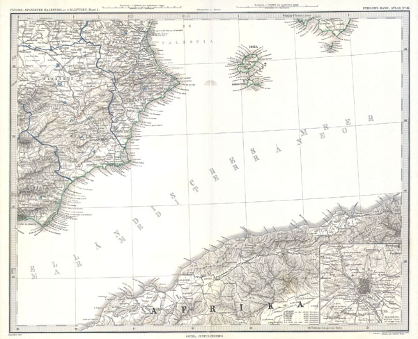
Ibiza and Spanish & African Coasts, Balearic Islands
sold
- Digital Map Information
- Suitable for large format printing
- File Size: 2.06 MB
- File Type: ZIP / TIFF
- ICC color profile embedded
- Delivered instantly via download link
This fascinating hand colored map ... (more details)

Monde Connu des Anciens au 11e Siecle de L’ere Chretienne.
sold
- Digital Map Information
- Suitable for large format printing
- Full resolution TIFF file
- ICC color profile embedded
- Delivered instantly via download link
This beautiful 1837 hand colored ... (more details)

County Map of the State of Pennsylvania
sold
- Digital Map Information
- Suitable for large format printing
- File Size: 3.8 MB
- File Type: ZIP / TIFF
- ICC color profile embedded
- Delivered instantly via download link
This is a hand colored map of ... (more details)

Sketch J Showing the progress of the Survey of the Western Coast 1849-53.
sold
- Digital Map Information
- Suitable for large format printing
- Full resolution TIFF file
- ICC color profile embedded
- Delivered instantly via download link
A rare hand colored 1853 ... (more details)

Johnson’s Map of Australia
sold
- Digital Map Information
- Suitable for large format printing
- File Size: 3.85 MB
- File Type: ZIP / TIFF
- ICC color profile embedded
- Delivered instantly via download link
This magnificent 1865 ... (more details)
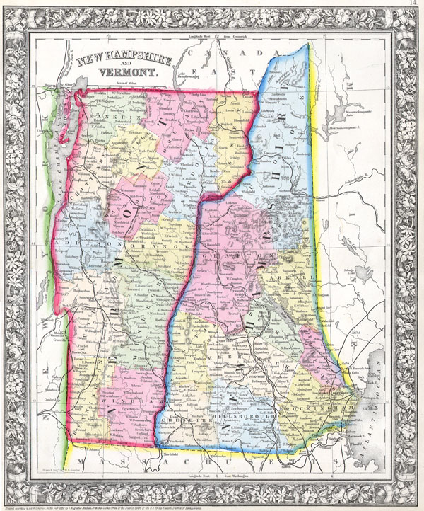
Vermont and New Hampshire.
sold
- Digital Map Information
- Suitable for large format printing
- File Size: 3.45 MB
- File Type: ZIP / TIFF
- ICC color profile embedded
- Delivered instantly via download link
This hand colored ... (more details)

Ubersichtskarte des Mondes.
sold
- Digital Map Information
- Suitable for large format printing
- File Size: 2.11 MB
- File Type: ZIP / TIFF
- ICC color profile embedded
- Delivered instantly via download link
This ... (more details)

Carte du Nouv. Rme. De Grenade, de la noule Andalousie, et de la Guyane, avec les Pays Limitrophes qui en sont au Sud.
sold
- Digital Map Information
- Suitable for large format printing
- Full resolution TIFF file
- ICC color profile embedded
- Delivered instantly via download link
This ... (more details)

Elis and Triphylia for the Travels of Anacharsis
sold
- Digital Map Information
- Suitable for large format printing
- Full resolution TIFF file
- ICC color profile embedded
- Delivered instantly via download link
This ... (more details)

Germania Magna Rhaetia Noricum
sold
- Digital Map Information
- Suitable for large format printing
- File Size: 0.02 MB
- File Type: ZIP / TIFF
- ICC color profile embedded
- Delivered instantly via download link
This ... (more details)

France, Gaul, Gallia in Ancient Times.
sold
- Digital Map Information
- Suitable for large format printing
- File Size: 0.02 MB
- File Type: ZIP / TIFF
- ICC color profile embedded
- Delivered instantly via download link
This ... (more details)