
Take a ride on the Reading!
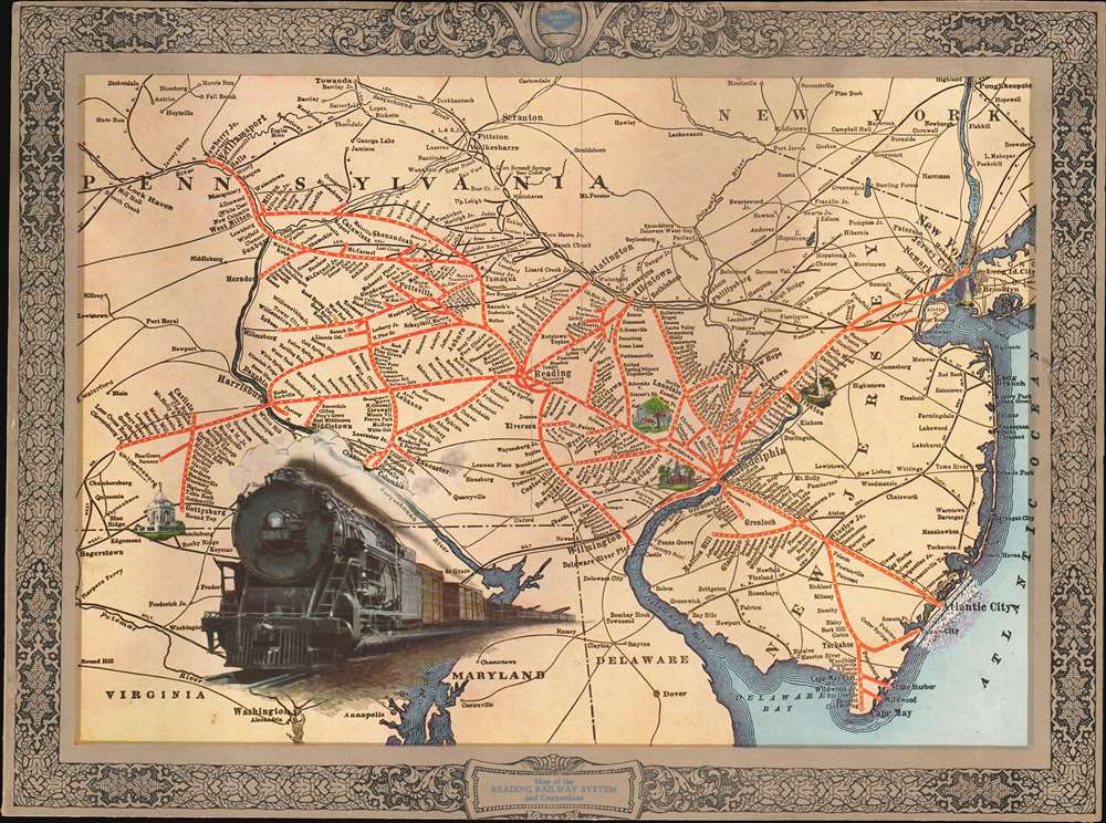
Map of the Reading Railway System and Connections.
sold
- Digital Map Information
- Suitable for large format printing
- File Size: 18.06 MB
- File Type: ZIP / TIFF
- ICC color profile embedded
- Delivered instantly via download link
This is a c. 1925 Reading Railroad promotional tourist map of Pennsylvania and New Jersey highlighting the Reading Railroad's network. The map was issued to promote the Locomotive 2009, then the largest and fastest locomotive ever constructed and key to the Reading Railroad's high-speed service. (more details)
San Francisco's Response to Steinberg.

Inside.
$600.00
Acquire
This is James McCaffry's 1978 large-format pictorial bird's-eye view of the United States (and beyond), viewed from downtown San Francisco. It is a direct response to Saul Steinberg's iconic illustration, 'The World from 9th Avenue,' which appeared on a 1976 cover of The New Yorker. (more details)
One of the most important assets to the Union Army.

Map of United States Military Rail Roads, Showing the Rail Roads operated during the War from 1862-1866 as Military Lines, Under the Direction of Bvt. Brig. Gen. D.C. McCallum Director and General Manager.
sold
- Digital Map Information
- Suitable for large format printing
- File Size: 37.33 MB
- File Type: ZIP / TIFF
- ICC color profile embedded
- Delivered instantly via download link
This is an 1866 Julius Bien map of Union Army military railroads during the American Civil War (1861 - 1865). The map illustrates both the eastern and western theaters of war, highlighting railroads operated by the Union Army. Railroads proved critically important to both sides during the war, and many major battles were fought at railroad junctions or along rail lines. (more details)
Lone Star Secession.

Johnson's New Map of the State of Texas.
sold
- Digital Map Information
- Suitable for large format printing
- Full resolution TIFF file
- ICC color profile embedded
- Delivered instantly via download link
This is Johnson and Ward's 1864 map of Texas. Created during the American Civil War (1861 - 1865), it details the territorial evolution of the state and the development of its road and rail network (including unrealized lines). (more details)
'Japanese Eye View' of the Pacific War.

Jap's Eye View.
$400.00
Acquire
- Digital Map Information
- Suitable for large format printing
- Full resolution TIFF file
- ICC color profile embedded
- Delivered instantly via download link
This is a 1944 Edwin Sundberg map of East Asia, Southeast Asia, and the East Indies, published in the Sunday News in New York City. Sundberg chose to illustrate the region in the opposite orientation from what most of his American audience would have been accustomed to, providingSunday News readers with a new perspective ('the Japanese point of view) on the continued push across the Pacific toward Japan. (more details)
Al Capone's Chicago.
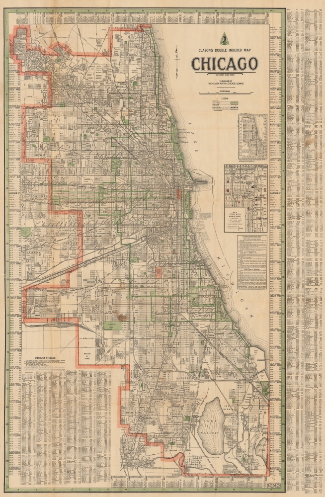
Clason's Double Indexed Map of Chicago. / Clason's Chicago Map.
sold
- Digital Map Information
- Suitable for large format printing
- Full resolution TIFF file
- ICC color profile embedded
- Delivered instantly via download link
This is a c. 1930 Clason city plan or map of Chicago, Illinois. This map details Chicago near the end of notorious gangster Al Capone's time as boss of the Chicago Outfit. (more details)
Travel the South Pacific.

The Travels of [blank] to the Isles of the Pacific from [blank]. A Voyage of [blank] miles [blank] months.
sold
- Digital Map Information
- Suitable for large format printing
- File Size: 51.3 MB
- File Type: ZIP / TIFF
- ICC color profile embedded
- Delivered instantly via download link
This is a 1945 M. S. Bailey pictorial map of the South Pacific. (more details)
Published just days after D-Day.
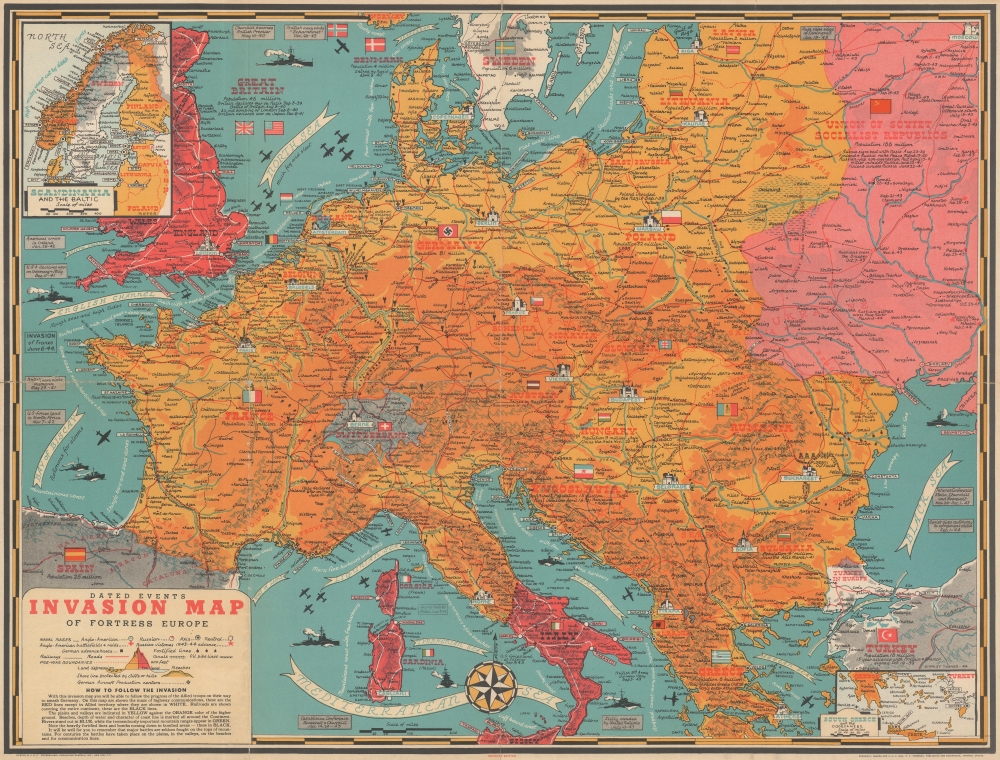
Dated Events Invasion Map of Fortress Europe. Seventh Edition.
sold
- Digital Map Information
- Suitable for large format printing
- Full resolution TIFF file
- ICC color profile embedded
- Delivered instantly via download link
This is a 1944 Stanley Francis Turner pictorial map of Europe just after the D-Day invasion of France. This is the first edition of Turner's 'Dated Events War Map' series to depict the D-Day invasions, published only days after the landings in France. (more details)
Enjoy exploring Jacksonville!
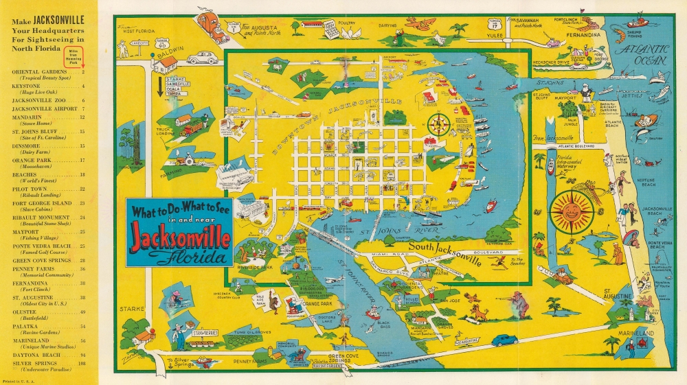
What to Do What to See in and near Jacksonville Florida.
sold
- Digital Map Information
- Suitable for large format printing
- Full resolution TIFF file
- ICC color profile embedded
- Delivered instantly via download link
This is a 1939 first edition 'Zink' pictorial tourist map of Jacksonville, Florida, and its environs. Charming pictorial vignettes fill the sheet and highlight sites within Jacksonville and farther afield, even as far away as St. Augustine. (more details)
First printed English Nautical Chart of the East Coast

Carta Seconda Generale del' America. XXII.
sold
- Digital Map Information
- Suitable for large format printing
- File Size: 10.87 MB
- File Type: ZIP / TIFF
- ICC color profile embedded
- Delivered instantly via download link
This is the 1661 edition of Robert Dudley's general map of the east coast of North America. According to Burden, this is the 'first printed sea chart of North America by an Englishman and the first to record soundings.' It is a great rarity on the market and a keystone map for any collection of early American cartography. (more details)
First printed map to show New York Harbor
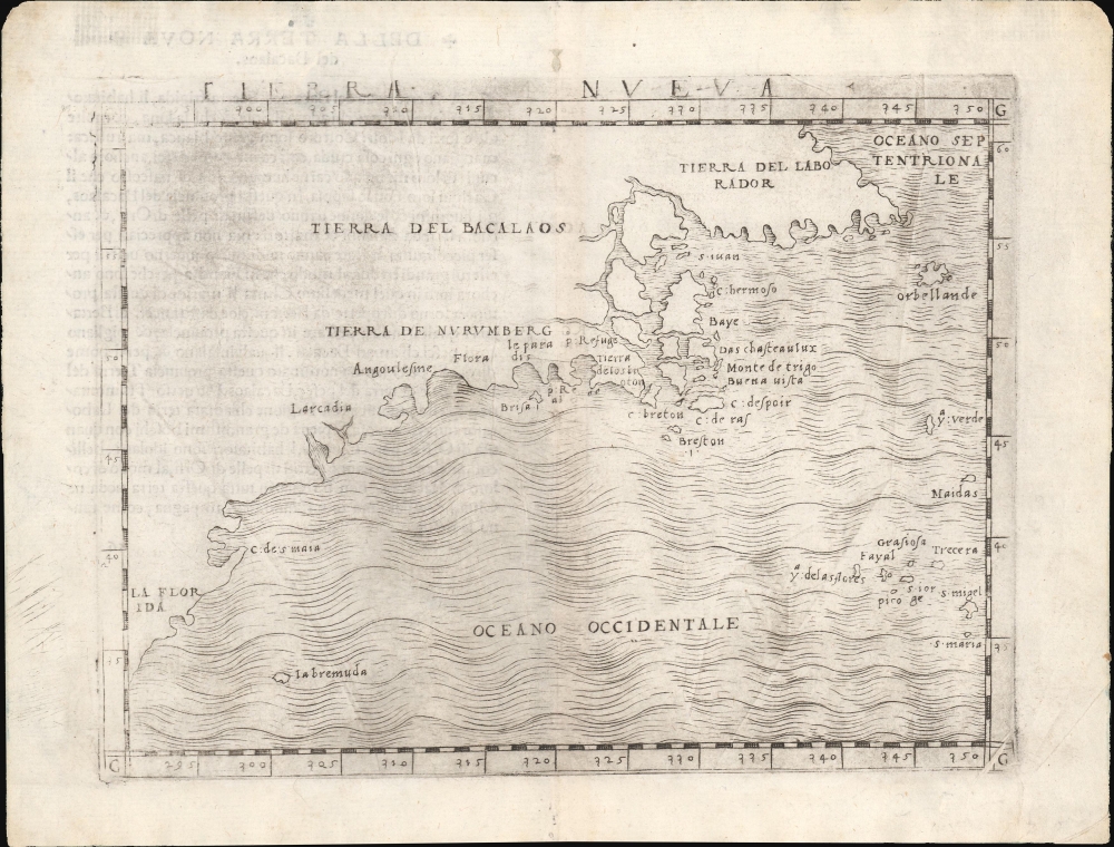
Tierra Nueva.
sold
- Digital Map Information
- Suitable for large format printing
- Full resolution TIFF file
- ICC color profile embedded
- Delivered instantly via download link
This is Giacomo Gastaldi's 1548 map of the eastern coast of North America. It is considered the first printed map specifically of the American eastern coastline and the first obtainable map to illustrate Narragansett Bay, Block Island, New York Harbor, Long Island, the Outer Banks, and Bermuda. (more details)
United Colonies: First printed map devoted to the 13 states.

Le Colonie Unite Dell' America Settentrle. Di Nuova Projezione a S.S.E.E. Li Signori Riformatori Dello Studio Di Padovia.
sold
- Digital Map Information
- Suitable for large format printing
- File Size: 191.68 MB
- File Type: ZIP / TIFF
- ICC color profile embedded
- Delivered instantly via download link
This is a beautiful example of Antonio Zatta's 1778 12-sheet Revolutionary War era wall map of the United States - significant as the first printed map dedicated to the thirteen states, here distinguished from their former status as 'British Colonies' by the new term 'Colonies Unite' or 'United Colonies.' (more details)
Van Keulen maps Quiri Regio.

De Zuyd Zee [The South Seas].
sold
- Digital Map Information
- Suitable for large format printing
- File Size: 19.99 MB
- File Type: ZIP / TIFF
- ICC color profile embedded
- Delivered instantly via download link
A remarkable untitled c. 1720 Gerard van Keulen map of the Pacific and the Americas. The map is rich with fascinating content, reflecting the degree to which the Pacific remained a terra incognita well into the 18th century. Points of interest include California as an Island, a vast landmass named 'Terre de Compagnie' between America and Asia, and the mapping of the discoveries of Álvaro de Mendaña y Neira (Solomon Islands) and Pedro Ferdinand de Quiros (Quiri Regio). (more details)
From lost Russian sources.

Carte des Découvertes des Russes dans la Mer Orientale, et en Amerique Pour Servir à L'essai, Sur le commerce de Russie.
$2,000.00
Acquire
- Digital Map Information
- Suitable for large format printing
- File Size: 378.74 MB
- File Type: ZIP / TIFF
- ICC color profile embedded
- Delivered instantly via download link
This is a rare and unusual 1777 map of the North Pacific in the vicinity of Alaska, the Bering Strait, and northeastern Siberia based upon Russian Promyshlenniki (trader) exploration. It appeared accompanying one of the earliest works on Russian commerce, the M. de Marbault's Essai sur le Commerce de Russie, avec l'Histoire de ses Decouvertes. (more details)
Mainstay of the Chicano Movement.

Cinco de Mayo Celebración.
$1,600.00
Acquire
This is a c. 1979 Rodolfo Cuellar stylized representation of Northern California, produced for a Cinco de Mayo celebration at California State University, Sacramento (Cal State Sacramento or CSUS for short). In the 1970s, the campus became a center of Chicano activism, closely connected with the United Farm Workers (UFW) movement, led by Caesar Chavez. (more details)
Flying Clipper Ships during World War II. By a prominent Mexican-American illustrator.

Routes of the Flying Clipper Ships [As of December 7, 1941. Subsequent Wartime Changes Censored]. Pan American World Airways. 'Wings of Democracy'.
sold
- Digital Map Information
- Suitable for large format printing
- File Size: 42.72 MB
- File Type: ZIP / TIFF
- ICC color profile embedded
- Delivered instantly via download link
This is a striking c. 1941 World War II era pictorial map of the world promoting the 'Flying Clipper Ship' routes of Pan American Airways. It was illustrated by the Mexican-American artist Leon Helguera, who went on to illustrate many widely admired war effort posters. (more details)
Defeating Napoleon's Navy in the War of the First Coalition (1772 - 1797).

Jack's return after Lord Howe's glorious victory...
sold
- Digital Map Information
- Suitable for large format printing
- DPI: 600
- File Size: 24.57 MB
- File Type: ZIP / TIFF
- ICC color profile embedded
- Delivered instantly via download link
A British patriotic broadsheet mezzotint issued in the wake of the Glorious First of June (1794), a decisive British naval victory over Napoleonic France in the War of the First Coalition (1772 - 1797). It depicts a street scene at the wharf where victorious sailors are disembarking. (more details)
Important satirical map of Europe.

Karte Von Europa im Jahre 1870 nach einem französischen Holzschnitte./Carte drôlatique d'Europe pour 1870.
sold
- Digital Map Information
- Suitable for large format printing
- File Size: 4.73 MB
- File Type: ZIP / TIFF
- ICC color profile embedded
- Delivered instantly via download link
A rare example of the 1870 / 1914 German edition of Paul Hadol's satirical map of Europe on the cusp of the Franco-Prussian War. (more details)
Evolution of the East Bay.

Map of Oakland and Vicinity / Map of Oakland and Vicinity showing Real Estate and Electric Railways of Realty Sundicate in Red.
sold
- Digital Map Information
- Suitable for large format printing
- File Size: 40.89 MB
- File Type: ZIP / TIFF
- ICC color profile embedded
- Delivered instantly via download link
This is a 1903 Woodward, Watson, and Co. real estate map of Oakland, Berkeley, Alameda, and nearby cities in the East Bay region of the San Francisco Bay Area. It demonstrates the rapid growth of the East Bay at the turn of the 20th century, a development that would be turbocharged several years later following the devastating 1906 earthquake. (more details)
Italian wine!

Vini d'Italia.
sold
This is a 1976 Yanez Oski pictorial wine map of Italy. The map celebrates Italy's rich viticultural tradition. (more details)