
Spreading the Faith in Southeast Asia.
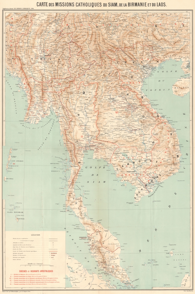
Carte des Missions Catholiques du Siam, de la Birmanie et du Laos.
$650.00
Acquire
- Digital Map Information
- Suitable for large format printing
- File Size: 47.59 MB
- File Type: ZIP / TIFF
- ICC color profile embedded
- Delivered instantly via download link
A colorful, large-format chromolithographed 1904 map of mainland Southeast Asia engraved by Rémy Hausermann and printed by Jean Noël Monrocq as a supplement to the missionary periodical Les Missions Catholiques. While also an excellent topographic map, its main focus is on the Catholic missionary territories (vicariats apostoliques) of the Missions Etrangères de Paris (MEP) in the region. (more details)
Jacksonville - Healthcare, Banking, Beach Life.

Jacksonville.
sold
This is a 1979 Archar Inc. 'City Character Print' pictorial map of Jacksonville, Florida, playfully promoting the city's history, identity, and businesses - particularly banking and healthcare. This is among the rarest Archar views, with no other cataloged examples known. (more details)
Florida Land Grants and its first railroad.

Florida.
sold
- Digital Map Information
- Suitable for large format printing
- File Size: 8.2 MB
- File Type: ZIP / TIFF
- ICC color profile embedded
- Delivered instantly via download link
This is an 1846 Thomas Bradford map of Florida two years after statehood. It illustrates early land grants, Florida's first railroad, and the remnants of the Second Seminole War (1835 - 1842). (more details)
Preserving Alaska's wilderness.

Alaska.
sold
- Digital Map Information
- Suitable for large format printing
- File Size: 83.79 MB
- File Type: ZIP / TIFF
- ICC color profile embedded
- Delivered instantly via download link
This is a 1917 I. P. Berthrong and General Land Office map of Alaska. It highlights wildlife reservations, emphasizing the U.S. government's conservation efforts. (more details)
Michigan's first railroad and an ambitious unrealized Canal.

Michigan.
sold
- Digital Map Information
- Suitable for large format printing
- File Size: 9.19 MB
- File Type: ZIP / TIFF
- ICC color profile embedded
- Delivered instantly via download link
This is an 1846 Thomas G. Bradford map of Michigan. It illustrates the state's first railroad and the proposed Ionia and Saginaw Canal. (more details)
Signed Example of Chase's popular World War II World Map.
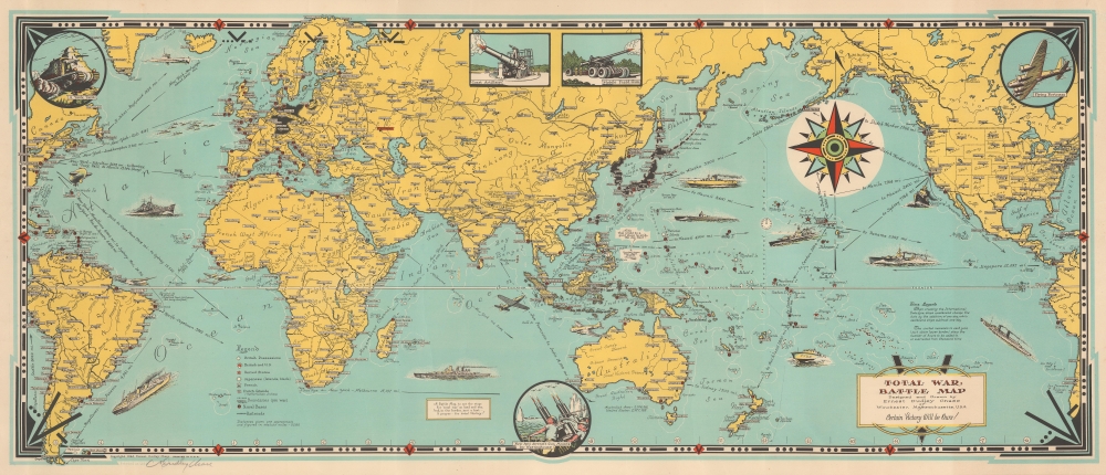
Total War Battle Map.
sold
- Digital Map Information
- Suitable for large format printing
- File Size: 22.69 MB
- File Type: ZIP / TIFF
- ICC color profile embedded
- Delivered instantly via download link
This is a 1942 Ernest Dudley Chase pictorial map of the world during World War II (1939 - 1945). It is one of a series of maps Chase produced to illustrate the war as it developed. (more details)
Republic of Texas, United Provinces of Central America, Independent Yucatán.

The United States of Mexico. / Guatemala or the United Provinces of Central America.
sold
- Digital Map Information
- Suitable for large format printing
- File Size: 7.69 MB
- File Type: ZIP / TIFF
- ICC color profile embedded
- Delivered instantly via download link
This is Jeremiah Greenleaf's 1842 map of Mexico and Central America. The map reflects the original boundaries of the Republic of Texas, the short-lived United Provinces of Central America (Guatemala), and the Yucatán Federalist Movement. (more details)
An Imperiled Capital.

Environs de Washington et du Bull Run.
sold
- Digital Map Information
- Suitable for large format printing
- File Size: 21.94 MB
- File Type: ZIP / TIFF
- ICC color profile embedded
- Delivered instantly via download link
This is an 1890 Dumas Vorzet map of Washington, D.C., and its environs in eastern Virginia, the scene for multiple important battles during the American Civil War (1861 - 1865), issued as part of the scarce atlas volume of the French edition of Philippe d'Orléans' Histoire de la Guerre Civile en Amérique. (more details)
Striking comparative chart.

Lengths of the Principal Rivers in the World. Heights of the Principal Mountains in the World.
sold
- Digital Map Information
- Suitable for large format printing
- File Size: 11.91 MB
- File Type: ZIP / TIFF
- ICC color profile embedded
- Delivered instantly via download link
This is the scarce 1846 Samuel Augustus Mitchell edition of H. S. Tanner's comparative mountains and rivers chart. This stunning center-weighted chart is a stylistic advance over earlier American comparative charts in that it incorporates both mountains and rivers on a single sheet. (more details)
World - from the American Perspective.
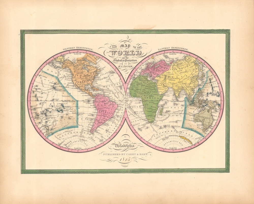
A New Map of the World in the Globular Projection.
sold
- Digital Map Information
- Suitable for large format printing
- File Size: 9.29 MB
- File Type: ZIP / TIFF
- ICC color profile embedded
- Delivered instantly via download link
This is the 1846 first edition of S. Augustus Mitchell's double-hemisphere world map. (more details)
Jimmy Buffett Highway, before he Picked Up a Guitar.

Travel mat Scenic Hi-Way US 1.
sold
This is a 1960 Travelmats Corporation of America pictorial 'Travel mat' illustrating the Scenic Highway U.S. 1, running from Key West to Jacksonville, Florida. It also depicts State Road A1A, now known as the Jimmy Buffett Memorial Highway. (more details)
New Mexico's history, culture, and recreational opportunities.
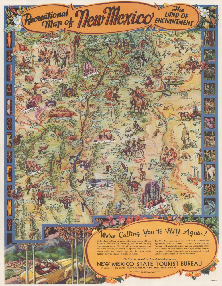
Recreational Map of New Mexico. The Land of Enchantment.
sold
- Digital Map Information
- Suitable for large format printing
- Full resolution TIFF file
- ICC color profile embedded
- Delivered instantly via download link
This is a 1946 first-edition Wilfred Stedman pictorial recreational map of New Mexico. The map celebrates New Mexico's culture and the many cultural and outdoor activities one can enjoy when visiting 'the Land of Enchantment.' (more details)
Archetypal Mid-Century Pictorial Map of the Gulf Coast,

Scenic and Pictorial Map Recreational and Resort Areas of the Mississippi Gulf Coast / Mississippi Gulf Coast Pictorial Map Hotels and Motor Courts.
sold
- Digital Map Information
- Suitable for large format printing
- Full resolution TIFF file
- ICC color profile embedded
- Delivered instantly via download link
This quaint c. 1950 mid-century pictorial tourist map of the Mississippi Gulf Coast was produced by Mendle Printing to highlight accommodations along the coast. (more details)
Stunning map of Philadelphia.

Philadelphia.
sold
- Digital Map Information
- Suitable for large format printing
- File Size: 13.18 MB
- File Type: ZIP / TIFF
- ICC color profile embedded
- Delivered instantly via download link
This is a detailed 1846 city map of Philadelphia, Pennsylvania, by Samuel Augustus Mitchell after H.S. Tanner. (more details)
Tornado insurance.
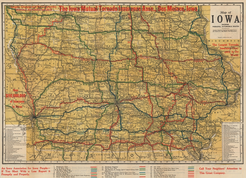
Map of Iowa Showing Principal Automobile Roads.
sold
- Digital Map Information
- Suitable for large format printing
- Full resolution TIFF file
- ICC color profile embedded
- Delivered instantly via download link
This is a 1914 Kenyon Company road map of Iowa issued with overprinting to promote the Iowa Mutual Tornado Insurance Association. (more details)
Pictorial View of Paradise.

California and Nevada.
sold
A 1993 pictorial view of California and Nevada, highlighting the region's topography, including the Sierra Nevada and the Great Basin, prepared by the Canadian firm Unique Media. (more details)
Charming View of Cascadia.

Pacific Northwest.
sold
A colorful 1995 first-edition pictorial view of the Pacific Northwest and British Columbia, produced by the Canadian firm Unique Media. (more details)
Discover Florida on Highway 27!

Complete Map Florida Traveling Featuring U.S. 27.
sold
This is a c. 1964 Highway 27 Association of Florida double-sided pictorial tourist map of Florida. This highway booster map promotes hotels, restaurants, and other businesses found along the famous route. (more details)
Traces the coast of the United States from Doboy Sound, Georgia past Jekyll Island to Amelia Island, Florida.

Coast Chart No. 57 From Sapelo Island Georgia to Amelia Island Florida.
sold
- Digital Map Information
- Suitable for large format printing
- File Size: 50.89 MB
- File Type: ZIP / TIFF
- ICC color profile embedded
- Delivered instantly via download link
This is an 1878 U.S. Coast and Geodetic Survey nautical map of the coast of Georgia and Florida. This is the best and most detailed chart of the Georgia coast to appear until the early 20th century. (more details)
Iconic view of New York with Spectacular Chromolithograph Color.

The City of New York.
sold
- Digital Map Information
- Suitable for large format printing
- File Size: 48.95 MB
- File Type: ZIP / TIFF
- ICC color profile embedded
- Delivered instantly via download link
This is a beautiful example of the iconic 1870 Currier and Ives chromolithograph view of New York City, specifically Manhattan. It is the first edition of this famous view to include the Brooklyn Bridge, in the year construction on the wonder began, but 13 years before it opened! This example also has the richest original chromolithograph color we have seen in any example. (more details)